River Walk In Fort Benton Brings History to Life
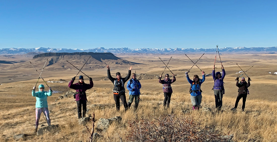
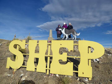 Instead of our own River's Edge Trails, the GiG headed downstream to Fort Benton, home of Montana's first settlement as well as the bloodiest block in the West. We left Great Falls at 8:30 a.m., stopped at the overlook to look down on the town and the horseshoe bend in the river before parking at the Grand Union Hotel and walking a half mile to the Missouri Breaks Interpretive Center. There, we were greeted by Allison, who had agreed to open the center for us to have a private tour as the center is closed in the winter. Allison started the half hour video that gives a brief history of the town, how the old paddlewheel steamboats could make it to Fort Benton but no farther due to the shallow depth of the Missouri beyond, not to mention waterfalls. The film also highlighted the white cliffs that some of the gals had kayaked a few years ago. Carol had seen the video too many times, so she took another mile walk. After, we all walked around, looking at the exhibits. Then Allison rolled up some free posters for us and some of us took home brochures. KuntZ spotted some Leave-No-Trace cards that she thought would be good to hand out to new members. Then we backtracked along the river to our cars, where we took a quick drink and grabbed a snack before continuing on the trail that hugs the shore. First off, we stopped to see the memorial to Shep, the ever-faithful sheepdog. Shep appeared at the Great Northern Railway station one day in 1936 and watched as his deceased master's casket was loaded onto the train. The dog remained at the station, waiting for his master to return for the next five and a half years until he was killed by an incoming train in 1942. HIs grave lies on a hill above the town. Then we walked across the old bridge, now just used for walking. We marveled at the beauty of the bluffs in this area of the river. On the far side, we saw several deer down below us, enjoying the tall grasses under the cottonwoods. Then it was back to the trail, where we stopped to read the interpretive signs along the way that explain everything from the bloodiest block in the West and how Thomas Meagher, the man for whom the county is named. He was the territorial governor of Montana and died in suspicious circumstances: he either fell off, jumped or was pushed off a steamboat. Several researchers suspect political rivals pushed him over. His body has never been found. We continued walking, past the reconstructed fort, past the senior living center, past the new houses that we admired to the dirt loop end of the official trail. We circled around and walked back. We decided to sit on the porch of the Grand Union Hotel (they had kindly said we could use their restrooms) to get out of the wind to eat our lunch. During lunch, Katie had an alert on her phone. She told the others that protestors had stormed the Capitol, where the legislature was meeting to count the electoral college votes affirming Joe Biden as the next president. We were all shocked at this contentious development threatening the process. It is interesting to note that Thomas Meagher was convicted in Ireland of sedition for creating an uprising. He was sent to Australia, escaped and made his way to the United States. After lunch and our distressing news about our country, we were getting ready to drive home when KuntZ said we should visit Shep's grave, so she led us along the highway, past the golf course where we parked and walked. (Note: KuntZ took us the long way--Carol and Katie were wondering where we were going. But of course, KuntZ would know how to navigate from golf courses! We had a nice quarter-mile hike to the grave site, marked with a cut out of Shep and his name in large metal letters. Then we drove home, arriving by 2 p.m., awaiting news of what was going on with our government. Who went: Jo Ann, Gail, KuntZ, Carol, Anita, Katie |
 RSS Feed