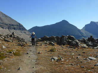
Silver Crest, Dec. 21, 2016: Winter Solstice Celebrated Snowshoeing at Silver Crest
Mimi's birthday yesterday gave way to a gorgeous day for a snowshoe on the winter solstice under bright blue sunny skies, with a bit of wind. It was perfect for her first day trying a new sport. Mimi brought along her sister-in-law from Whitefish, who joined June and Katie for a trek through some deep powdery, fluffy white stuff.
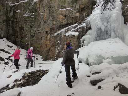
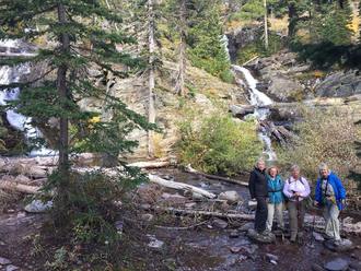
We left Great Falls at 8:30 a.m. and were on trail by 10:15. The powder was pretty but kept us busy breaking trail, a bit of chore; we all took turns, so it wasn't too bad overall. One bad thing was that no one had been on the trail yet this year, so the base wasn't set up; occasionally we hit a tree or rock udner the powder, which tried to buck us off our snowshoes; luckily, we mostly stayed upright. We followed the new Chaser trail, going the two-mile loop with a stop for a snack at the Silver Dyke warming hut, followed by a bit of confusion finding the trail from that point on. We arrived back at the cars in less than two hours, so we felt pretty good about our time with breaking trail and it being the first time out this year for everyone. After this jaunt, we decided to hike to Memorial Falls, always pretty in winter. We had noticed on the way in that the turnout was actually plowed this year so we didn't have to hike the highway. The falls was nicely iced over, but we could faintly see and hear the falls behind the crystallized water, which formed what looked like stalactites from the rocks above. After a few pictures of this fairyland-type creek-carved canyon, we climbed in the car for our trip home. We forewent a stop at Bob's to head back early, arriving at 4Bs by 2:30. Who went: Mimi, June, Trish, Katie |
Beaver Basin to Willow Creek, Nov. 30, 2016: Where Are They? Where Are We? A Day of Lost Ways
The GiG went with the guys on our first midweek adventure that we planned during the school year. We met the group at Lippi's kitchen to head out for probably the last hike of the year before we get out the skis and snowshoes. We did bring gaiters and yaktrax in case we encountered some snow.
After a quick decision to do a key exchange instead of taking the time to shuttle cars, the question of the day became "Where are they?" on both sides of the exchange.
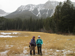
The day started at 8 a.m. as we headed toward Augusta for a hike along the Rocky Mountain Front. The day was hovering around 10 degrees with wind, so we did battle keeping warm all day, with wind chills at zero degrees.
Nora went with the group that started on the Willow Creek side while Katie, June and Jaye headed up the trail from Beaver Basin. The Beaver Basin group discovered the road closed two miles from the trail head, so they knew that hike would be at least 8 miles instead of the anticipated six. They had a chuckle thinking the other group wasn't going to know about the extra two miles until the end of the hike, and the hike would be all uphill that direction on tired feet.
The Beaver Basin group hiked uphill most of the way after the road, stopping briefly to take a picture of Hidden Lake with Fairview Mountain in the backround; however, the wind kept the group moving to keep warm. The trails seemed marked well, but the direction seemed off and we didn't see the other group by noon, which made us wonder if we were on the same trail. Both groups kept hiking until 1 p.m., both having to route-find as the trails were not obvious among the outfitter- and cattle-made trails. At this point, the Beaver Basin group decided to turn around, not knowing if they were on the right trail. Two of the Willow Creek group turned around, knowing that they had the key to the car on that end.
After much worry about what happened to each other, all turned out. The four in the Beaver group left messages in the snow on their backtrack to the car and finally heard voices behind them to discover the two Willow group members who had soldiered on.
So six walked the last two miles to the car for a total of nine miles on the day. On hte way out, we saw a variety of tracks including grizzlie, coyote, possibly wolf and a small cat. We expected the two others to have driven the car around but we found just the one car. So we piled six into a Subaru Outback with Jaye being game to ride in the back, sitting on poles and crammed up against backpacks. The rest of us took some gear in our laps as we headed to the Willow creek parking area.
Just before we reached the parking area, we came across Nora driving toward us. She and her hiking partner had gotten lost on the way out and he had fallen on the ice covering a stream and hurt his elbow.
All in all, no one was seriously injured and we all did the right thing. Nora said going in her direction was very, very windy and she got chilled. Katie, June and Jaye were glad to have turned around, not having to face a stiff wind in the face.
We arrived home around 6 p.m. The next day, those with a GPS uploaded the routes. We discovered we were only a few hundred feet apart when we decided to turn around. Both groups were yodeling and calling out, the wind too strong to hear it.
After a quick decision to do a key exchange instead of taking the time to shuttle cars, the question of the day became "Where are they?" on both sides of the exchange.
The day started at 8 a.m. as we headed toward Augusta for a hike along the Rocky Mountain Front. The day was hovering around 10 degrees with wind, so we did battle keeping warm all day, with wind chills at zero degrees.
Nora went with the group that started on the Willow Creek side while Katie, June and Jaye headed up the trail from Beaver Basin. The Beaver Basin group discovered the road closed two miles from the trail head, so they knew that hike would be at least 8 miles instead of the anticipated six. They had a chuckle thinking the other group wasn't going to know about the extra two miles until the end of the hike, and the hike would be all uphill that direction on tired feet.
The Beaver Basin group hiked uphill most of the way after the road, stopping briefly to take a picture of Hidden Lake with Fairview Mountain in the backround; however, the wind kept the group moving to keep warm. The trails seemed marked well, but the direction seemed off and we didn't see the other group by noon, which made us wonder if we were on the same trail. Both groups kept hiking until 1 p.m., both having to route-find as the trails were not obvious among the outfitter- and cattle-made trails. At this point, the Beaver Basin group decided to turn around, not knowing if they were on the right trail. Two of the Willow Creek group turned around, knowing that they had the key to the car on that end.
After much worry about what happened to each other, all turned out. The four in the Beaver group left messages in the snow on their backtrack to the car and finally heard voices behind them to discover the two Willow group members who had soldiered on.
So six walked the last two miles to the car for a total of nine miles on the day. On hte way out, we saw a variety of tracks including grizzlie, coyote, possibly wolf and a small cat. We expected the two others to have driven the car around but we found just the one car. So we piled six into a Subaru Outback with Jaye being game to ride in the back, sitting on poles and crammed up against backpacks. The rest of us took some gear in our laps as we headed to the Willow creek parking area.
Just before we reached the parking area, we came across Nora driving toward us. She and her hiking partner had gotten lost on the way out and he had fallen on the ice covering a stream and hurt his elbow.
All in all, no one was seriously injured and we all did the right thing. Nora said going in her direction was very, very windy and she got chilled. Katie, June and Jaye were glad to have turned around, not having to face a stiff wind in the face.
We arrived home around 6 p.m. The next day, those with a GPS uploaded the routes. We discovered we were only a few hundred feet apart when we decided to turn around. Both groups were yodeling and calling out, the wind too strong to hear it.
Rock City, November 12, 2016: Rock City Hoodoos Haunt Gals as They Stroll Along the Two Med River
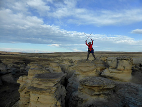
Rock City sits along the edge of the Two Medicine River, right at the confluence of it and Birch Creek, before it becomes the Marias. Years ago, the river receded, leaving sandstone that wind and rain are slowly eating away. The strange-looking rock formations, hoodoos, look like aliens, with their elongated heads and stick bodies.
We left Great Falls at 7 a.m., and arrived in Valier by 8:15 to meet Marta from Essex. Along the way, we saw deer, a fox and a hawk in the middle of the road. The weather was gorgeous and the promised 30-mph winds had not whipped up yet. The road wasn't too bad and had recently been gravelled, so that was a blessing. We had a great time jumping up on, climbing up, walking around,and squeezing through the formations as we worked our way down to the river. Unfortunately, the river bank was lined with spotted knapweed, the one disappointment of the day besides a bit of graffiti. Everyone was amazed at the large number of hoodoos, all amassed in one place. We all took way too many photos. Everywhere we looked, we saw another interesting rock or hole in the wall or bend in the river. For our backdrop, we had the northern end of the Rocky Mountain Front, the Badger Two Medicine and Glacier mountains looming above the plains. We spent about two hours climbing around and then headed up to a high point to view the confluence and the golden eagle nests sitting on ledges in the high bluffs. We all plan to come back in spring, provided the road isn't gumbo, to see the eagles mothering their chicks. Thankfully, we didn't see the grizzlies that reportedly had been hanging around the river bottoms. The forest service even helped the townspeople of Valier set up a phone tree to report grizzly sightings, since so many have been spotted this year. At 11:15 a.m., we headed back to the cars and had lunch at the Panther Cafe, under new ownership. Tracy was very friendly and accommodating to us, having let us use the bathrooms on the way in. As we exited the cafe, we were confronted with a huge gust of wind and felt lucky to have gone early enough to miss it or else we would have had sand blowing into our eyes. We said goodbye to Marta as she headed back to the Essex area. We were home by 2 p.m. Who went: Marta, Nancy, Jean, Sue, Katie, KuntZ, Gail, Mary N, Chrissie, June |
Scalplock, October 29, 2016: Day of Golden Larch Ablaze; Glistening Snow, Misty Valleys
A fun overnight at the Izaak Walton Inn in Essex set the stage for a fantastic fall climb of Scalplock mountain in the south part of Glacier Park.
We left Great Falls at just after 4 p.m. Friday after a day of school for most, and arrived in Essex in time for a 7 p.m. dinner at the Inn. After meals of coconut shrimp, chicken marsala and ratatouille, we checked in and then played a few games in the downstairs lounge: foosball, pool and shuffleboard, an early night for most to get prepared for the long climb tomorrow. Then we were up for coffee at 7 a.m., quick breakfast and check out, which saw us on trail by 8:30 a.m. on a foggy morning. Eight of us hiked up the 18 switchbacks, crossing Ole Creek on a hanging bridge, walking through the clouds with sunbeams shining upon us, trudging through snow at the very top to arrive at the lookout tower bathed in sun at 12:30, lunch time. The golden larches, turning orange and dropping their needles on our path, colored the day as did the bright blue skies, which accented the snow-capped mountains as they poked from the clouds. The climb of 3,100 feet was a challenge for some of us who hadn't done much hiking since Sperry, two months ago. Sitting on the lookout tower ledge, we had a lovely lunch overlooking the Middle Fork of the Flathead and the Nyack Creek valleys, filled with fog and surrounded by towering peaks, glittering with fresh snow. Some of us wished to come back to see the valleys without the fog and clouds, to see the rivers and the greenery below. But we will have to wait for another time. The low-lying clouds did make it look like we were gazing out of an airplane window, so high above the billows. The trip down Scalplock took us just under three hours and we were on the road home by 4:30 p.m., in time so that the drivers wouldn't have to face dark on two-land roads. After a dinner at the Rex in Conrad, we returned home by 8:30 p.m. Who went: Kuntz, Kathy M., Bonnie, Sara, Susan, Sue, Anita and Katie |
Cataract and Piegan Pass, Sept. 29, 2016: Canadian Friends Invite GiG on Fabulous Fall Trip |
It’s usually an early start with a day trip to Glacier and this day was no different: 5:30 a.m. but the dark of the shorter fall days made it seem worse somehow for the two who made this hike.
But as soon as we hit St. Mary, the glory of Glacier came into view and woke us up, with a mist softly covering the lake, which was surrounded by the golds and reds of fall. Since the two GiG members, Katie and Doris, made it to St. Mary a half hour in front of the Canadian gals, they decided to take it slowly up Going to the Sun road, stopping at Wild Goose Island overlook and Sunrift Gorge as well as other pull-outs for photo opps.
The we met our Canadian friends, led by LaVerne, at Siyeh Bend and were on trail to Piegan Pass by 9:30, all 11 of us, which included a grandmother and her granddaughter.
The hike up was fairly uneventful, passing streams, what remained of the wildflowers (hawkweed, showy asters, yarrow, hairbells, cinquefoil/potetilla), stromatolites, and friendly, all-local hikers this time of year. Just before the pass, we could see the top of Cataract Peak, the destination for some of us after lunch.
We crested the pass, the Garden Wall in our face, and sat just on the other side; we faced Many Glacier, gazing into the Cataract Creek valley, with its glacier-fed aqua ponds and cascades streaming toward Lake Grinnell. We were surprised by the lack of marmots and other pesky little critters that usually beg for a handout and attack unattended daypacks.
From our vantage point, we could see Heavens Peak, Mount Jackson with Jackson and Blackfoot glaciers, Piegan peak and its glacier, Mount Gould, the Garden Wall, and big daddy Mount Siyeh, one of the famed 10,000-footers in the park. We also got to watch a barefoot hiker go over Piegan, hiking the opposite way.
Those climbing, had a quick lunch and headed up, while a group of four decided to head to the cars to get back early for other evening plans. One stayed at the pass to rest and watch as the other five ascended. On the way up, we saw a lone gal also climbing, a gal who had passed us on the trail earlier. We marveled at how quickly she climbed, without even the use of poles. Youth allows such things.
In the end, only two made it all of the way, but we all got our fill of climbing over talus, balancing on the uneven and unsteady rock piles, using our hands and butts as needed.
Doris and Katie headed back (reaching the car at 4:50) before the five Canadians as they had to await the last of their group who had made the summit. The hike back was gorgeous as the golden colored undergrowth really stood out against the dusky sky.
A few raindrops fell on the way home, fulfilling the prediction of 30 percent chance of rain or thunderstorms in the late afternoon. After a stop at the Lighthouse for dinner, Katie and Doris arrived back in Great Falls at 8:45 p.m. after a wonderful day with new and old friends.
Upper Two Medicine, Sept. 25, 2016: Wind, Colors Moose Highlight Gorgeous Fall Day
The blustery day started at 5:30 a.m. with meeting Marta from Essex at the trailhead, located inside the Two Medicine campground.
The group was on trail by 8:45. After crossing the bridge, the group of five made a quick trip, probably in record time for the GiG (finished around 2:30), to Twin Falls and Upper Two-Medicine Lake. Although windy, it wasn't too cold, although a few said the chill did keep the group moving along without many stops. The wind a the lake was particularly strong, making it not too nice for a lunch stop. On the return trip, the gals happened upon some hikers who said three moose, a mama, baby and yearling, lay ahead. And the gals did see one moose, the yearling. This guy decided to parallel hike next to us, making it a bit uncomfortably close at times. But it was hard to know what to do as the moose seemed to keep the same pace we did, faster or slower. The group at at the Alpenglow in East Glacier. This restaurant hasn't been the best in the past but is under new management and a new name. After our hike, we said goodbye to Marta, who headed back to Essex. She reported seeing a bear on the road home. We arrived home by 6:30 p.m. Who went: Marta, Susan, Bonnie, Kuntzie and Chrissie Thanks to Marta, Chrissie and Bonnie for the pictures. |
|
Sperry Chalet, Aug. 23-26, 2016: 'We Are Sperry Tough!"
|
 100th Anniversary of the NPS
We had been working up to it all year, getting in shape, but more than that, getting “Sperry tough,” as Susan would say. Our Sperry Chalet trip was as much mental as physical, believing that we could hike three days in a row with the first day being one of the biggest hikes the GiG has tackled: 13.5 miles and 3410 elevation gain, with the bulk of the gain coming at the end of the hike. But it was all so worth it!
The trip started on a Wednesday morning at 8 a.m. We had to drop two cars off at McDonald Lake Lodge before heading to Rising Sun Cabins and Motor Inn for our first night. Bonnie, Gail, Kathy and Mary drove. After dropping off Mary and Bonnie’s cars and piling ourselves and our gear into the other two, we drove a few more miles down the road to take a quick stretch break along McDonald Creek to eat our lunch on the banks of this gorgeous, turquoise-colored stream and the Sacred Dancing Waters section of the rapids.
Then it was up and over Logan Pass for us, with another quick stop, this time to the Visitor Center and walking path behind it (we saw two bighorn rams) before we arrived at our final destination for the night: Rising Sun Motor Inn and Cabins. It took three rooms and one cabin to fit all 10 of us, with those sleeping on the cots saying they were a bit lumpy, but one said she slept like a lamb despite the mattress. Others didn’t sleep even in a queen or double bed, due to the excitement and a little apprehension about the major hike planned for the next day.
After dinner at the Two Dog Flats Café, some took a walk down to the boat dock to watch the clouds roll in, giving an ominous outlook for the next day with a 40-percent chance of rain in the afternoon.
The next morning, we arose early, ate a hurried breakfast of instant oatmeal and bananas or whatever else we hauled along since the restaurant didn’t open until after our go-time. After sending a quick message from the lodge wifi to let Nancy and Chrissie, our car shuttlers know that we were sticking to original plans as the sky looked clear, we headed out, saying a temporary goodbye to Gail, who would be heading over the pass to ride a horse to the chalet. We would meet back up at dinner time.
Then it was time to hit the trail. We parked Kathy’s car at the Jackson-Glacier Overlook lot and geared up and got on trail at 6:30 a.m., a few minutes before daybreak. The trail was posted for a bear frequenting the area along the first two miles as it drops to Reynold’s Creek and Deadwood Falls, so Katie was extra cautious leading while still keeping a fast pace on the downhill and flat in preparations for a slow-go on the uphill sections. Luckily, we didn’t run into a bear in the early-morning light. But we did run into two hikers coming out of Reynold’s Creek campground (the place where last year’s fire stated) who said they had not seen any bears, which reassured us a bit.
No bears, but we did run into a mama moose! Right before we entered the willow-filled St. Mary River basin of Gunsight Lake, we spotted a moose; she was walking down the trail right at us but wandered to the right-hand side when she saw us. Then we heard a rustling to our left and realized she had a baby hidden among the willows. She was distracting us to the right side of the trail, away from her baby. After a few photo opps with bear spray out, we continued on to the gorgeous clear-aqua Gunsight Lake for our first rest and snack break, filling our bottles and sterilizing the water, before we started the major uphill pull to the pass. We did see a lone loon in the lake.
At the lake, we came across our first fellow-hikers of the day: travelers who had stayed at the lake, but they took off toward the pass ahead of us. At this point, we started seeing goats on the trail; some did not want to yield the trail and had to be shooed away. This section of trail is most beautiful as it becomes very alpine. The views of Blackfoot and Jackson Glacier stun the eyes; and the rock ledges and narrow trail provide a different kind of thrill, not to mention the thrill of looking down on glacial-till filled Gunsight Lake.
At the top of the pass, we immediately saw down into the Lake Ellen Wilson valley and had more eye candy upon which to gaze. We took a few pictures of the hikers’ shelter but decided the wind wasn’t bad enough to warrant resting inside. Then we encountered a group of young men eating lunch, so we joined them. We were all glad that Kuntzie was married or we may have lost her to the Lake Ellen Wilson campground where these men were staying.
After a very short “teacher’s lunch,” Katie kept the group going, as the threat of afternoon thunderstorms coupled with the thought of missing a hot meal for dinner had her anxious. This next section of the trail is down, down, down to just above the lake and then up, up, up. The hucks were numerous and particularly tasty, which seemed to explain all of the bear scat we saw on the trail. At this point, we also passed a couple (it’s a rarity that we pass anyone), but we noticed that the gal of the pair was dragging her leg. The man said she had injured herself earlier. We asked if they needed anything or any help; when they said no and didn’t seem too talkative, we said we would tell the chalet they might be late for dinner, but they said they would make dinner, which was 6 p.m. (and they did).
Goat sightings became more frequent and less of a novelty as we approached our next pass: Lincoln pass. This one seemed a bit steeper than Gunsight but it may have been our tired legs. The last 2.3 miles from the Lake Ellen Wilson campground to the chalet seemed never ending.
Many of the gals kept asking “how much longer” and “will there be any more uphill?” Katie didn’t think so, but after a half mile of flat on top of the pass, there was one more low-angle switchback to get over before dropping down to the chalet. At the chalet, the kitchen staff greeted us with a pitcher of cold lemonade, which we quickly drank and then drank another. We had made it in time for dinner with 45 minutes to spare, so we could freshen up a bit and organize in our rooms. And everyone had made it without being too exhausted; every gal carried her own pack the whole way!
On top of that, we found out no one had to share a bed as one room had four singles, while two rooms had a double and two singles. We had drawn names earlier and Gail and Kuntzie were expecting to have to share. We were all happy to meet back up with Gail, who said her horse ride was great; she wasn’t very sore either.
Our dinner was Thanksgiving with a cucumber salad, turkey, mashed potatoes and gravy, veggies, cranberries, and apple-spice cake for dessert. Katie had a delicious chickpea stirfry, being the vegetarian of the bunch. At dinner, the staff introduced themselves, read an inspirational passage and then had us all introduce ourselves. They gave us tips about breakfast, avoiding mice in the rooms, hanging our items so they wouldn’t get chewed up by the goats and marmots and quiet hour. They also explained that social hour was at 8:30 with games, non-alcoholic drinks and maybe popcorn. Only Katie, Bonnie and Kuntzie took them up on social hour. We played dominoes with an extreme hiker who was doing Mount Brown the next day. Nobody could really remember the rules, but we had fun anyway.
The next day we met at 7:30 a.m. for breakfast, which was made to order (choice of eggs, pancakes, oatmeal, bacon, toast, orange juice), and planned to hike immediately afterward until the staff said a pack train was coming between 9 and 10 a.m. The gals wanted to see the pack train, even if it would leave us short on time at the glacier due to afternoon thunderstorms and getting back in time for dinner, so we did. The train came in at 9:30 a.m.; the gals took many pictures with Kuntzie and Gail recognizing the wranglers from their trip to Granite Park the week before. We al felt appreciation for these wonderful animals that make our stay at the Chalet possible, hauling our laundry and bringing food and full propane bottles.
At just before 10 a.m., we headed to Sperry Glacier, via the 58 gravelly,narrow, and steep stone steps of Comeau pass. The trail is gorgeous, passing many waterfalls and alpine tarns (glacially carved lakes). At the top, the views are stunning. This hike is a must-do in the park. At the pass, the trail becomes decidedly more challenging, requiring rock scrambling and crossing slippery snowfields. We scrambled across several of these obstacles before stopping for lunch at 1 p.m. At this point, Katie had been timing the clouds coming in and estimated we had another hour before lighting might strike in the area in addition to rain making the steep stone steps slippery and dangerous, so she said we had to hustle if we hoped to get to the glacier. Bonnie and Susan decided not to continue and instead turn back to take their time down the steps.
Kuntzie took over lead from Katie, negotiating a different route back. She said she loved the scrambling best of all and kept us at a great pace, getting us to the stairs before any rain fell. We soon caught up to Bonnie and Susan and finished our hike around 4:15, ten minutes before the rain started. Luckily, no thunder or lightning accompanied it and it let up in about an hour or so.
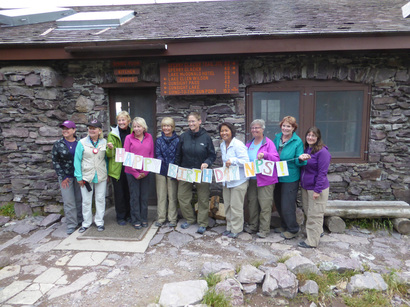
Dinner this night was roast beef, scalloped potatoes and veggies with the yummy home-baked salty-crust bread and chocolate-cherry cake for dessert. Katie had a vegetarian meatloaf, that again was delish. The staff again read an inspirational passage, this time about the origin of the park, in honor of the 100th anniversary of the National Park Service(NPS). The employees had made a “happy birthday” sign; everyone, staff and guest alike, went outside for a group photo on this very special day.
Also at dinner, Katie asked if anyone wanted to get up and climb Lincoln peak in the morning. they all thought her a bit on the crazy side as only Beth agreed to get up early, hike fast uphill and be back by check-out time of 10 a.m.
All of the gals showed up for social hour this night, since we didn’t need to get an early start the next day (except Katie and Beth). Mary had hauled up Left, Right, Center and we found some poker chips in the chalet’s game box, so we played two rounds with Kuntzie’s stories about melon balls and not being invited to join the gourmet club, which Susan warned us not to believe, kept us entertained.
The next morning, Katie and Beth did go up Lincoln pass and scramble up the peak, enjoying the fantastic views into Lake Ellen Wilson (one last view), Lincoln Lake and Beaver Chief Falls as well as Lake McDonald and beyond; they made it down by 9:30 a.m. They met the other gals in the lodge and packed their items. This time, Gail would be hiking with us, so all 10 would be together on the home stretch. After pictures in front of the lodge, we left at 10:30 a.m. for our trip down the mountain to Lake McDonald Lodge, where Nancy and Chrissie would be awaiting our arrival after shuttling Kathy’s car from Jackson-Glacier Overlook.
The trail seemed long on tired legs. We enjoyed looking back up at the lodge as we wound our way down, but the 6.5 miles of downhill took its toll. Just before then end, a man with wild red hair and beard came flying past us. Katie shouted—“Hey, you took our picture on Peigan pass a week ago”; he turned around and acknowledged her and Sue, who had also been there, smiling and saying he had started at 8 am. from Jackson-Glacier overlook. We were shocked at how fast he was going, but then again, he climbed Piegan Peak, Cataract Peak and Siyeh Bend and passed us by on the way up twice before finishing with Siyeh Bend. He basically completed four hikes in one day.
Everyone was hot and tired by the time we arrived at the lodge parking area at 2:30 p.m. Most of the gals put their packs in the cars before going inside while those who road with Kathy took their items into the lounge, where we all enjoyed a cook drink. Nancy and Chrissie had not arrived, so Sue checked at the desk to see if they left a message. Then 10 minutes later they came in. We enjoyed some laughs with them and said our goodbyes. Sue went with them to go camp at Kintla Lake and say goodbye to Ranger Lyle, the 96-year-old, who had worked at Kintla for years, but not before Sue got an $8 shower at Glacier Raft Company.
On our way home, we stopped at the Glacier Conservancy store to pick up books about the chalets (Kuntzie got a copy of Night of the Grizzlies DVD) and called ahead for reservations at the fun restaurant the Lighthouse in Valier, our final stop.
After a great dinner, we arrived home around 8:30 p.m., tired and wanting a shower from a trip we will never wash away from our memories.
On a side note, most of us felt we tested ourselves, going beyond what we thought we could do just a few short years ago. We did have a few mishaps on the trail but nothing major, thank goodness: Katie was the first to fall, scouting for bears on the very first section of our trail on day one; Kuntzie followed on the same section. Mary took a tumble and Bonnie had the worst: she fell while crossing below a waterfall on a wet rock, which bent her glasses out of whack so that they wouldn’t stay on her face unless she put sunglasses over them. Bonnie kept her sense of humor, saying, “Not many people can say they fell in a waterfall.”
Who went: Katie, Gail, Susan, Bonnie, Catherine, Kuntzie, Beth, Sue, Kathy M and Mary N
The trip started on a Wednesday morning at 8 a.m. We had to drop two cars off at McDonald Lake Lodge before heading to Rising Sun Cabins and Motor Inn for our first night. Bonnie, Gail, Kathy and Mary drove. After dropping off Mary and Bonnie’s cars and piling ourselves and our gear into the other two, we drove a few more miles down the road to take a quick stretch break along McDonald Creek to eat our lunch on the banks of this gorgeous, turquoise-colored stream and the Sacred Dancing Waters section of the rapids.
Then it was up and over Logan Pass for us, with another quick stop, this time to the Visitor Center and walking path behind it (we saw two bighorn rams) before we arrived at our final destination for the night: Rising Sun Motor Inn and Cabins. It took three rooms and one cabin to fit all 10 of us, with those sleeping on the cots saying they were a bit lumpy, but one said she slept like a lamb despite the mattress. Others didn’t sleep even in a queen or double bed, due to the excitement and a little apprehension about the major hike planned for the next day.
After dinner at the Two Dog Flats Café, some took a walk down to the boat dock to watch the clouds roll in, giving an ominous outlook for the next day with a 40-percent chance of rain in the afternoon.
The next morning, we arose early, ate a hurried breakfast of instant oatmeal and bananas or whatever else we hauled along since the restaurant didn’t open until after our go-time. After sending a quick message from the lodge wifi to let Nancy and Chrissie, our car shuttlers know that we were sticking to original plans as the sky looked clear, we headed out, saying a temporary goodbye to Gail, who would be heading over the pass to ride a horse to the chalet. We would meet back up at dinner time.
Then it was time to hit the trail. We parked Kathy’s car at the Jackson-Glacier Overlook lot and geared up and got on trail at 6:30 a.m., a few minutes before daybreak. The trail was posted for a bear frequenting the area along the first two miles as it drops to Reynold’s Creek and Deadwood Falls, so Katie was extra cautious leading while still keeping a fast pace on the downhill and flat in preparations for a slow-go on the uphill sections. Luckily, we didn’t run into a bear in the early-morning light. But we did run into two hikers coming out of Reynold’s Creek campground (the place where last year’s fire stated) who said they had not seen any bears, which reassured us a bit.
No bears, but we did run into a mama moose! Right before we entered the willow-filled St. Mary River basin of Gunsight Lake, we spotted a moose; she was walking down the trail right at us but wandered to the right-hand side when she saw us. Then we heard a rustling to our left and realized she had a baby hidden among the willows. She was distracting us to the right side of the trail, away from her baby. After a few photo opps with bear spray out, we continued on to the gorgeous clear-aqua Gunsight Lake for our first rest and snack break, filling our bottles and sterilizing the water, before we started the major uphill pull to the pass. We did see a lone loon in the lake.
At the lake, we came across our first fellow-hikers of the day: travelers who had stayed at the lake, but they took off toward the pass ahead of us. At this point, we started seeing goats on the trail; some did not want to yield the trail and had to be shooed away. This section of trail is most beautiful as it becomes very alpine. The views of Blackfoot and Jackson Glacier stun the eyes; and the rock ledges and narrow trail provide a different kind of thrill, not to mention the thrill of looking down on glacial-till filled Gunsight Lake.
At the top of the pass, we immediately saw down into the Lake Ellen Wilson valley and had more eye candy upon which to gaze. We took a few pictures of the hikers’ shelter but decided the wind wasn’t bad enough to warrant resting inside. Then we encountered a group of young men eating lunch, so we joined them. We were all glad that Kuntzie was married or we may have lost her to the Lake Ellen Wilson campground where these men were staying.
After a very short “teacher’s lunch,” Katie kept the group going, as the threat of afternoon thunderstorms coupled with the thought of missing a hot meal for dinner had her anxious. This next section of the trail is down, down, down to just above the lake and then up, up, up. The hucks were numerous and particularly tasty, which seemed to explain all of the bear scat we saw on the trail. At this point, we also passed a couple (it’s a rarity that we pass anyone), but we noticed that the gal of the pair was dragging her leg. The man said she had injured herself earlier. We asked if they needed anything or any help; when they said no and didn’t seem too talkative, we said we would tell the chalet they might be late for dinner, but they said they would make dinner, which was 6 p.m. (and they did).
Goat sightings became more frequent and less of a novelty as we approached our next pass: Lincoln pass. This one seemed a bit steeper than Gunsight but it may have been our tired legs. The last 2.3 miles from the Lake Ellen Wilson campground to the chalet seemed never ending.
Many of the gals kept asking “how much longer” and “will there be any more uphill?” Katie didn’t think so, but after a half mile of flat on top of the pass, there was one more low-angle switchback to get over before dropping down to the chalet. At the chalet, the kitchen staff greeted us with a pitcher of cold lemonade, which we quickly drank and then drank another. We had made it in time for dinner with 45 minutes to spare, so we could freshen up a bit and organize in our rooms. And everyone had made it without being too exhausted; every gal carried her own pack the whole way!
On top of that, we found out no one had to share a bed as one room had four singles, while two rooms had a double and two singles. We had drawn names earlier and Gail and Kuntzie were expecting to have to share. We were all happy to meet back up with Gail, who said her horse ride was great; she wasn’t very sore either.
Our dinner was Thanksgiving with a cucumber salad, turkey, mashed potatoes and gravy, veggies, cranberries, and apple-spice cake for dessert. Katie had a delicious chickpea stirfry, being the vegetarian of the bunch. At dinner, the staff introduced themselves, read an inspirational passage and then had us all introduce ourselves. They gave us tips about breakfast, avoiding mice in the rooms, hanging our items so they wouldn’t get chewed up by the goats and marmots and quiet hour. They also explained that social hour was at 8:30 with games, non-alcoholic drinks and maybe popcorn. Only Katie, Bonnie and Kuntzie took them up on social hour. We played dominoes with an extreme hiker who was doing Mount Brown the next day. Nobody could really remember the rules, but we had fun anyway.
The next day we met at 7:30 a.m. for breakfast, which was made to order (choice of eggs, pancakes, oatmeal, bacon, toast, orange juice), and planned to hike immediately afterward until the staff said a pack train was coming between 9 and 10 a.m. The gals wanted to see the pack train, even if it would leave us short on time at the glacier due to afternoon thunderstorms and getting back in time for dinner, so we did. The train came in at 9:30 a.m.; the gals took many pictures with Kuntzie and Gail recognizing the wranglers from their trip to Granite Park the week before. We al felt appreciation for these wonderful animals that make our stay at the Chalet possible, hauling our laundry and bringing food and full propane bottles.
At just before 10 a.m., we headed to Sperry Glacier, via the 58 gravelly,narrow, and steep stone steps of Comeau pass. The trail is gorgeous, passing many waterfalls and alpine tarns (glacially carved lakes). At the top, the views are stunning. This hike is a must-do in the park. At the pass, the trail becomes decidedly more challenging, requiring rock scrambling and crossing slippery snowfields. We scrambled across several of these obstacles before stopping for lunch at 1 p.m. At this point, Katie had been timing the clouds coming in and estimated we had another hour before lighting might strike in the area in addition to rain making the steep stone steps slippery and dangerous, so she said we had to hustle if we hoped to get to the glacier. Bonnie and Susan decided not to continue and instead turn back to take their time down the steps.
Kuntzie took over lead from Katie, negotiating a different route back. She said she loved the scrambling best of all and kept us at a great pace, getting us to the stairs before any rain fell. We soon caught up to Bonnie and Susan and finished our hike around 4:15, ten minutes before the rain started. Luckily, no thunder or lightning accompanied it and it let up in about an hour or so.
Dinner this night was roast beef, scalloped potatoes and veggies with the yummy home-baked salty-crust bread and chocolate-cherry cake for dessert. Katie had a vegetarian meatloaf, that again was delish. The staff again read an inspirational passage, this time about the origin of the park, in honor of the 100th anniversary of the National Park Service(NPS). The employees had made a “happy birthday” sign; everyone, staff and guest alike, went outside for a group photo on this very special day.
Also at dinner, Katie asked if anyone wanted to get up and climb Lincoln peak in the morning. they all thought her a bit on the crazy side as only Beth agreed to get up early, hike fast uphill and be back by check-out time of 10 a.m.
All of the gals showed up for social hour this night, since we didn’t need to get an early start the next day (except Katie and Beth). Mary had hauled up Left, Right, Center and we found some poker chips in the chalet’s game box, so we played two rounds with Kuntzie’s stories about melon balls and not being invited to join the gourmet club, which Susan warned us not to believe, kept us entertained.
The next morning, Katie and Beth did go up Lincoln pass and scramble up the peak, enjoying the fantastic views into Lake Ellen Wilson (one last view), Lincoln Lake and Beaver Chief Falls as well as Lake McDonald and beyond; they made it down by 9:30 a.m. They met the other gals in the lodge and packed their items. This time, Gail would be hiking with us, so all 10 would be together on the home stretch. After pictures in front of the lodge, we left at 10:30 a.m. for our trip down the mountain to Lake McDonald Lodge, where Nancy and Chrissie would be awaiting our arrival after shuttling Kathy’s car from Jackson-Glacier Overlook.
The trail seemed long on tired legs. We enjoyed looking back up at the lodge as we wound our way down, but the 6.5 miles of downhill took its toll. Just before then end, a man with wild red hair and beard came flying past us. Katie shouted—“Hey, you took our picture on Peigan pass a week ago”; he turned around and acknowledged her and Sue, who had also been there, smiling and saying he had started at 8 am. from Jackson-Glacier overlook. We were shocked at how fast he was going, but then again, he climbed Piegan Peak, Cataract Peak and Siyeh Bend and passed us by on the way up twice before finishing with Siyeh Bend. He basically completed four hikes in one day.
Everyone was hot and tired by the time we arrived at the lodge parking area at 2:30 p.m. Most of the gals put their packs in the cars before going inside while those who road with Kathy took their items into the lounge, where we all enjoyed a cook drink. Nancy and Chrissie had not arrived, so Sue checked at the desk to see if they left a message. Then 10 minutes later they came in. We enjoyed some laughs with them and said our goodbyes. Sue went with them to go camp at Kintla Lake and say goodbye to Ranger Lyle, the 96-year-old, who had worked at Kintla for years, but not before Sue got an $8 shower at Glacier Raft Company.
On our way home, we stopped at the Glacier Conservancy store to pick up books about the chalets (Kuntzie got a copy of Night of the Grizzlies DVD) and called ahead for reservations at the fun restaurant the Lighthouse in Valier, our final stop.
After a great dinner, we arrived home around 8:30 p.m., tired and wanting a shower from a trip we will never wash away from our memories.
On a side note, most of us felt we tested ourselves, going beyond what we thought we could do just a few short years ago. We did have a few mishaps on the trail but nothing major, thank goodness: Katie was the first to fall, scouting for bears on the very first section of our trail on day one; Kuntzie followed on the same section. Mary took a tumble and Bonnie had the worst: she fell while crossing below a waterfall on a wet rock, which bent her glasses out of whack so that they wouldn’t stay on her face unless she put sunglasses over them. Bonnie kept her sense of humor, saying, “Not many people can say they fell in a waterfall.”
Who went: Katie, Gail, Susan, Bonnie, Catherine, Kuntzie, Beth, Sue, Kathy M and Mary N
Piegan Pass to Many Glacier, Aug. 17, 2016: Outstanding Views; Bull Moose Highlight Long Hike Over Piegan Pass |
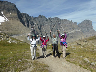 The back side of the Garden Wall behind the GiG.
Whoosh! It sounded like a tsunami hit the creek that lay in front of us. A flash flood? What could it be? And then we saw him, water flowing from his back, his enormous rack still barely in the velvet: a huge bull moose, standing face-to-face with us.
This incident took place toward the end of the hike, but the whole of the day contained more excitement: outstanding vistas, animal visits, chance meetings and tired feet and backs as we hike the section of the CDT (Continental Divide Trail) that leads from Siyeh Bend on Going-to-the-Sun Road over Piegan Pass and into the Many Glacier valley..
It all started at 4:30 a.m., when we started from the Paris Gibson Square parking lot with Jaye driving. Jaye had on hot coffee as well as muffins to sustain us on our drive to St. Mary. And she drove in record time without a stop in Browning. We had just missed the 7 a.m. bus, so we had plenty of time to visit the restrooms and gear up for the day. We had hoped for a 7:30 or 7:40 bus like last year; however, the next shuttle didn’t arrive for a full 60 minutes. And the driver was chatty, delaying us at every stop, so we didn’t get on trail until 8:40.
At the trailhead, we happened upon a young gal named Shelly, who wanted someone to hike Siyeh Bend to Sunrift Gorge with her. Since no one else was going that way, she decided to hook up with us as we offered her a shuttle back to her car since Carol was unable to join us last minute. We told her she would have to travel at an old lady’s pace, but she was happy not to travel alone.
So we set out on a bright blue day that was promising thunderstorms in the afternoon.
Although the flowers were fading at this time in the summer, we still enjoyed may late bloomers, especially grounsel, rosy crown sedum, asters, blue explorer’s gentian and beard tongue penstemon.
As we climbed the trail, an older couple overtook us as well as some younger hikers. We passed an elderly gentleman with a Santa beard, slowly determined to make the pass one last time. We were impressed with his determination despite a hitch in his gait.
After quite a bit of gain and two miles, we arrived at Preston Park, where the trail splits and where Shelly had to decide if she were to continue on with us or hike solo to Siyeh Pass; however, serendipitously, a group of hikers came upon us. They were going over Siyeh Pass! So we said our goodbyes to Shelly and parted ways, her going to the right and we taking the left-hand path. Check out her blog Living on the Dirt.
From this juncture, the trail starts the outstanding alpine section with views in all directions. We slowed our pace significantly as we took numerous pictures and enjoyed the vistas and wildflowers. Chrissie spotted two rams crossing a snow field, so we watched them for a while as well. Then we gained the pass.
As we crested the top, we saw more people, groups enjoying lunch as well as many climbing Cataract mountain. We had to save that climb for another day due to the lateness in the day and a storm abrewing on the horizon. The pass had more people than Katie had ever seen on the Piegan trail, a surprise especially for a Wednesday. Another surprise was that several parties had come up from the Many Glacier side, which includes much more uphill.Here we had our lunch from noon until 12:30, joined by a marmot mama and her two young. She especially liked Sue.
After a lunch with outstanding views overlooking the valley on the Many Glacier side, we reluctantly started our descent, following Cataract Creek to the bottom of the valley floor. We knew we had to get going as the thunderheads were starting to amass over the tops of the mountains. The descent is a bit grueling with many switchbacks and large rock steps that take a toll on the knees, but we broke it up with huckleberry stops as they were out in profusion. But then Katie mentioned that we were travelling at 1 mph and we wouldn’t get in until 8 p.m. at that pace, so we gave up the berries for faster walking, especially in light of the impending storm.
Along the way, we passed Morning Eagle Falls, still gushing strongly, and Feather Plume falls, which had hardly any water. The rock on the creek bottom was decorated in bright turquoise, maroon and reds.
As we hit the bottom and got set to cross Cataract Creek, we heard a loud “whoosh” of water rushing, as if a flash flood were imminent. We didn’t have to look long for the cause of this noise as a very large bull moose arose from the creek just in front of us. We had disturbed his afternoon soak! His rise was one of the more thrilling things we had ever seen; however, he was a bit too close for our comfort and did not yield the trail, continuing to stand right in front of us, so we got out our bear spray and waited. After a minute, he wandered a bit farther away and decided to start eating some willows and ignore us, so we slowly took to the trail again, being ever mindful of just how big and just how close he was. We were all a bit relieved to get around him yet hesitant to take our eyes away from this awe-inspiring sight.
Then it was on down the last set of switchbacks to Grinnell Lake. We thought of stopping to rest our feet and soak them in the water, but decided to continue on to Josephine lake as it was only another mile and had the boat dock, Oaster shelter and bathrooms.
As we arrived at Josephine, the boat was blowing its whistle, indicating it was going to leave soon. The captain asked if we were riding back. It was tempting, but no one had brought money and we wanted to hike the last two miles anyway, to complete our 14-mile trek. Chrissie, Katie and Jaye took their boots off and went in the water, which wasn’t as cold as expected and felt oh, so good. Chrissie was feeling the heat and struggled a bit with her back the last mile.
The weather finally blew in, so we raced down the trail to the Many Glacier Hotel in hopes of beating the storm. Jaye raced ahead, having put on tennis shoes at the lake. Katie and Sue encouraged Chrissie to keep going as the thunder intensified and the first raindrops fell. But we reached the hotel—and food--without getting wet at 5:40. Chrissie found her aunt—our ride—and we took our packs off and settled into the makeshift lounge for dinner (The hotel lobby is under construction, so the lounge is acting as the gift store).
After a nice dinner at the lodge (lentil burgers, cobb salad, bison chili with huckleberry cobbler for dessert), we crammed ourselves and our gear along with Chrissie and her aunt’s camping gear, into a Rav 4 (five plus gear), while Chrissie’s aunt shuttled us back to our car at St. Mary. Along the way, we were in for one more final treat: a bear grazing on berries on the side of the road. We arrive back home around 10:30 p.m., a wonderful end to a very long day.
Who went: Katie, Chrissie, Sue, Jaye
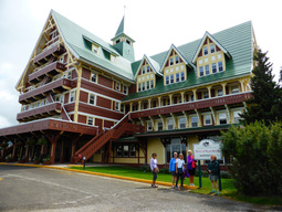
Waterton Weekend, August 12-14, 2016: Wonderful Waterton Weekend Features Carthew-Alderson Traverse; Bear's Hump, 'Beauty and the Beast"; Petroglyphs at Provincial Park
“I thought it was a black German shepherd.” So said Susan when she ran into a black bear sow and her cub. And this incident was just one of the super adventures the GiG had on our Waterton Weekend trip.
It all started at 7 a.m. on a cloudy Friday. After a border crossing that almost turned eventful when the agent cross-examined Catherine in a not-too-friendly voice about whether she normally has a gun in her console, we arrived in Waterton at 11:30 a.m. A quick stop at the Visitor Center to ask about trail conditions of our preferred hike, the Carthew-Alderson traverse (they didn’t know but would find out) and we were off for our hike up the Bear’s Hump. This hike is a “hump” up a steep hill; but, thankfully, it is a short climb (1.8 miles round trip with 750 feet of gain). At the top, we ate our lunch with spectacular views of the Waterton townsite, Prince of Wales Hotel and the big daddy Mount Cleveland, the largest peak in the International Peace park (it is on the Glacier side) as well as Cameron, Vimy and Blackiston peaks in Waterton. We did get a bit of rain, but the kind that stops the minute you put on your poncho. After our lunch hike, we again stopped into the Visitor Center to see if there were any updates on the trail. Katie was pretty petrified of taking the gals over scree with death drop offs if the trail wasn’t in perfect shape. If anyone at all said the trail was iffy, we would have cancelled our shuttle tickets and instead purchased boat tickets and gone on the Crypt Lake hike. But everyone we met said the trail was good now, that the trail crew had repaired all of the washed-out areas after the torrential rains earlier in the week, so we decided to stick to our original plans. So then it was off to the Prince of Wales Hotel. Katie and Catherine has visited before, but the others had their first taste of the first-class lodge, sitting atop a bluff on the edge of Waterton Lake. The inside is lovely with plate glass windows overlooking the lake and mountains. We decided to make a reservation and eat there that night. Meanwhile, our Canadian friends invited us to dinner with them, but when we did the logistics of getting to the play and checking in at our lodgings, it just didn’t work out. We were sorry about missing a visit with them. So we left the hotel, glancing in the berry bushes where the bears have been hanging out, hoping to catch a glimpse of one from the safety of Catherine’s van, but no luck this time. We hung around the downtown, doing a bit of shopping until dinner time when we returned for a fabulous early dinner, so we could then head to Cardston (after a brief check-in at our bed and breakfast, the Mountain View Inn) for the local production of the musical Beauty and the Beast, which was performed with a minimalist set of just two staircases that the stage crew and actors kept moving around to indicate the different places of the play. The voices were great, but the sound system blasted us since our seats were on the left side by the speakers. Then back to the Mountain View Inn. We met another guest of the inn who had hiked Carthew-Alderson that very day who said the trail was good, so Katie was resting her mind a bit at this good news and not sweating the narrow scree trail as much. Then it was off to sleep a few hours before the biggie hike. We awoke early, around 5 a.m. to pack our lunches, get dressed, eat a hurried breakfast (we were afraid we wouldn’t get any since the gal at the inn wasn’t the one with whom Katie had been communicating, but she showed up with yogurt, fruit and muffins just before we left), and head to Waterton. We had a little snafu when we got to the park gate as it was unattended and no envelopes were left. We were worried about getting a ticket for not having a pass, so we drove to the Visitor Center as well as the campground in hopes of finding one—nothing! So we took our chances and parked at the fire hall where the shuttle was to pick us up. More worries: no one else was at the shuttle stop at 7:20, the time we were to be there, since the buses were all booked. Katie panicked again and sent Catherine to the Tamarack Inn, where the usual shuttle stop is. They told her the shuttle was coming. And it did. We were the first on and then the bus stopped at the Tamarack to gather more hikers. The ride to the trailhead was uneventful and quicker than expected putting us on trail by 8:10 a.m. Katie was a bit confused as the bus let us off at a different place from the usual trailhead by Cameron Lake. The driver said the trail was rerouted, so we had to start at a different place. Katie kept questioning the bus driver about how to find the main trail. She said it was easy, so we went on our way and sure enough, this new trail ends at Cameron lake where it joins the main path. The lake was gorgeous and had a lone loon pair cutting the still water that was creating perfect reflections of the surrounding mountains on the glass-like surface. Then it was up, up, up to Summit lake, the halfway point of the four-mile uphill section of our 13-mile day, where we stopped for a quick snack to face the steeper climb to come. On this next section, Katie was still very worried about the last switchback of trail, which is very sketchy at times, very narrow with steep drop offs. She instructed the gals to pick up their poles on this part so as to prevent a landslide. However, when we arrived at the scary part, Katie decided we should take the shortcut straight up the mountain. It was nice and wide and two gals who passed us gave us the thumbs up as they ascended saying it was good all of the way up. Katie knew that going up and looking up is easier than side-hilling and seeing the steep drop-offs out of the corner of the eye, which makes some get dizzy. And it was easy, albeit steep, steep, steep. But short! We arrived at the saddle before others who had passed us earlier. At the pass, the wind picked up tremendously, so Katie asked if everyone were okay with continuing to the top of the peak, since it was bound to be windier there and actually adds a half mile to the trip. Everyone wanted to go for it; we found little wind surprisingly, so we had our lunch and visited with the others on top. Catherine even had a chance to use her native tongue, Tagalog, when a group of Filipinos joined us. (Later, Chrissie would be able to use her German, conversing with tourists visiting from Bayern). The rest of the day was a very long stroll of downhill, passing the gorgeous string of the three Carthew lakes, connected via cascading creeks and waterfalls, and finally Lake Alderson where we rested and cooled our feet in the clear turquoise water. This tarn marked 7 km left to our hike, but it was a very long 7 km on tired legs going down, down, down. The vistas were huge, however, with rock wall faces staring us down, and sheep playing and sleeping on the mountainsides. We had to be aware of stinging nettles along this section of the trail as it was very overgrown with vegetation, and the trail was quite muddy. So between dodging mud holes, avoiding pricklies, Susan fell but was not hurt badly. We did have to clean her elbow wound which was bleeding and full of dirt. Then Susan had an almost-mishap with a bear. As it approached her on the trail, she thought it was a black German shepherd (Waterton, unlike Glacier, allows dogs on the trail; we had seen a small black dog earlier in the hike). So instead of getting out her spray, she froze, turned around and said, “There’s a bear.” Then she saw the bear was really a mama with a cub. Katie saw that Susan didn’t have her spray out, so Katie got out her spray and moved to the front of the group, calling to the bear “Hey bear, we are here,” over and over and asked the others to get out their spray and take the safety off. A mother bear, black or grizz, is nothing to mess with. This happened about a mile from the end of the trail. Some of us realized that we need practice not just on using the spray, but also on getting if off our packs and releasing the safety. Chrissie’s wouldn’t come off her carabiner so it was stuck to her pack. Others struggled with the safety. Mary was able to back Katie up. More practice is needed for sure. Another lesson learned. Fortunately, we didn’t need to use the spray; the sow and cub meandered down the side of the mountain, so we kept on our way, talking loudly. We arrived at Cameron Falls in Waterton at just before 6 p.m. We were starved and had a fun meal at Zum’s, buying a wild berry pie to eat later at the Inn after a fight for the one shower we had to share among our six ladies. Flowers and berries we saw: fireweed (both regular and alpine), blue explorer’s gentian, beard-tongue penstemon, groundsel, buckwheat, cushion buckwheat, showy asters, baneberry, huckleberry, black currants, mountain ash, twisted stalk, red twinberry The next morning, we were in no rush, so we got up leisurely and enjoyed the luxury breakfast fixed by the family: sausage and egg strata; fresh-cut fruit; muffins, blackberries, strawberries, blueberries and raspberries; pancakes with berry compote and whipped cream; seven-grain porridge; fried potatoes; berry, apple and orange juices; tea and coffee. We ate large as we would be having a late lunch after our adventure to Writing-on-Stone Provincial Park. The drive is very rural and very interesting. We saw some fields cut differently than in the States as well as many animals: deer, coyote and pup, badger, hawks, At the park, we walked the 2.5-mile Hoodoo trail, enjoyed the fantastically varied Milk River Breaks country, marveled at the pictographs and petroglyphs, but stopped short of the entire trail due to the intense sun and heat. We were all sweating on this short hike. Then it was back to Milk River for lunch at Yummy’s Chinese restaurant. The waitress/cook invited us to get the dinner for five so we could try many different items. All dishes were indeed “yummy.” After our late lunch, our trip across the border was uneventful, the border agent uncharacteristically pleasant. A quick stop in Shelby for gas (we didn’t dare fill up in Canada at over $4 per gallon—we are lucky to have our prices!), saw us home by 6:30. What a very full, fun-filled Waterton weekend! Who went: Susan, Mary N, Chrissie, Sara, Catherine, Katie. Catherine did an excellent job driving us! |
Granite Park Chalet, August 10-13, 2016: Thoughts on Staying at Chalet; Group Dynamics
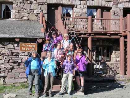
aWHAT did a group of nine ladies whose average age was 64 accomplish between August 11 to 13, 2016? All of us made it to GRANITE PARK CHALET, a destination that was built in 1913 (which is older than any of us).
One person alone could not have accomplished this hike without the other eight ladies. This hike was a true example of why Together Everyone Accomplishes More = TEAM works which equals GIG teamwork! Read on! "Super views, great people, fun for all! Nice to have such a good group of people." -- Gail "'Everything I learned in Kindergarten... 'I have been reminded of in GIG -- share -- share your food, your water, moleskin, arnica, etc. Be Kind to others -- help carry their pack if it is too heavy, let them go ahead of things if needed. Listen to your leader -- she knows alot about the length of the trip, elevation gain, where to catch the shuttle, etc." -- Jeanne "Granite Park brings a whole new meaning to 'Breathtaking Views.' My biggest takeaway was: 'No hike is so hard that the view won't be worth it. Heat, rain, steep elevation gains all disappear when you see the view from the top." -- Brenda "I never cease to be amazed about how GIG brings together intelligent women who can do more together than of us individually. Each hike builds deeper friendships." -- Mary "Remember the feeling of seeing and holding your baby for the first time after birth? The same feeling occurs when walking over the top and seeing Grinnell Glacier or Swift Current Overlook -- Beautiful! The GIG Girls are the Best!" -- Cathy K "This was such a wonderful adventure. I loved it. Spending time with these wonderful, caring women made it even more special! My favorite hike was to Grinnell Glacier Overlook. I'm crossing this hike to Granite Park Chalet off my bucket list!" -- Randi "Our trip to Granite Park Chalet had perfect weather; fog, sunshine, clouds, rain, all at the perfect times! Beautiful scenery, great food and fabulous companionship! 'Be quiet and breath!' Super leader!" -- Bonnie "Giggers are GREAT in Glorious GLACIER!" -- Patty "Col-LABOR-ation in working together. Wisdom from life's experiences and sharing of knowledge. Caring for each other was the most significant!!!! If I could choose eight siblings I would choose each and every one of you. I had no siblings as a child. -- Kathy D P.S. Each one of us was a "LEADER at one time or another during this hike. Pat yourself on the back for stepping up when needed. It is deeply appreciated by each and everyone of us! How Our Trip Unfolded: WHAT did a group of nine ladies whose average age was 64 accomplish between August 11 to 13, 2016? All of us made it to GRANITE PARK CHALET, a destination that was built in 1913 (which is older than any of us). One person alone could not have accomplished this hike without the other eight ladies. This hike was a true example of why Together Everyone Accomplishes More = TEAM works which equals GIG teamwork! Read on! "Super views, great people, fun for all! Nice to have such a good group of people." -- Gail "'Everything I learned in Kindergarten... 'I have been reminded of in GIG -- share -- share your food, your water, moleskin, arnica, etc. Be Kind to others -- help carry their pack if it is too heavy, let them go ahead of things if needed. Listen to your leader -- she knows alot about the length of the trip, elevation gain, where to catch the shuttle, etc." -- Jeanne "Granite Park brings a whole new meaning to 'Breathtaking Views.' My biggest takeaway was: 'No hike is so hard that the view won't be worth it. Heat, rain, steep elevation gains all disappear when you see the view from the top." -- Brenda "I never cease to be amazed about how GIG brings together intelligent women who can do more together than of us individually. Each hike builds deeper friendships." -- Mary "Remember the feeling of seeing and holding your baby for the first time after birth? The same feeling occurs when walking over the top and seeing Grinnell Glacier or Swift Current Overlook -- Beautiful! The GIG Girls are the Best!" -- Cathy K "This was such a wonderful adventure. I loved it. Spending time with these wonderful, caring women made it even more special! My favorite hike was to Grinnell Glacier Overlook. I'm crossing this hike to Granite Park Chalet off my bucket list!" -- Randi "Our trip to Granite Park Chalet had perfect weather; fog, sunshine, clouds, rain, all at the perfect times! Beautiful scenery, great food and fabulous companionship! 'Be quiet and breath!' Super leader!" -- Bonnie "Giggers are GREAT in Glorious GLACIER!" -- Patty "Col-LABOR-ation in working together. Wisdom from life's experiences and sharing of knowledge. Caring for each other was the most significant!!!! If I could choose eight siblings I would choose each and every one of you. I had no siblings as a child. -- Kathy D P.S. Each one of us was a "LEADER at one time or another during this hike. Pat yourself on the back for stepping up when needed. It is deeply appreciated by each and everyone of us! How Our Trip Unfolded:The weather did not want to cooperate as we started our four day adventure to Granite Park Chalet. The night before it rained three inches in an hour in Great Falls and flooded one of our ladies basement, not once but twice. Bonnie did not think she would be able to go but her family took over the task of dealing with the water. We were to hike around Sunrift Gorge, St Mary and Baring Falls but with 90% chance of rain, wind and thunderstorms, we decided to cancel that hike. The trip started later in the day and we headed to St. Mary and stopped at the Visitors Center and watched a short movie about the Park. A few miles down the road we turned into Rising Sun and had an ample dinner before we settled into are rooms. Cathy K had just come to our room and asked if anyone wanted to go for a walk when she turned and looked out the window to see a very large beautiful shiny black bear eating berries. Everyone shouted bear, bear and cameras were retrieved quickly to capture the moment. Someone in the parking lot set off their car alarm and spooked the bear so no pictures were to be had. Cathy K decided that she did not want to hike after all, especially because the bear was on the trail. Morning arrived and we headed to Logan Pass to start our adventure. With a few quick pictures we were on the Highline Trail. The weather was quite foggy and a young couple asked if it would lift or should they do another trail, we convinced them that it would lift so they stayed with us for about half of the trip. I think the fog was helpful to some of the ladies because of their trepidation of the distant down along the first part of the trail. Along the way there was a huge marmot and her two little ones laying on the rocks. As we proceeded the fog slowly began to lift, it had been covering the views but now they were beginning to show. We were treated to many flowers and lush plants and at Haystack Pass it was time for a lunch break. As we proceeded along the trail we spotted goats and came across a lone ram that was enjoying his lunch also. The scenery was changing and the view were ever expanding and the sun had decided to emerge and illuminated the huge mountains. A deer was spotted chose to the trail and there were many photo opportunities to enjoy. We arrived at the Granite Park Chalet in the afternoon and most were happy to put down their twenty pound pack and get settled in the bunk quarters after the seven and a half mile hike. The staff showed us the kitchen, food storage and we picked a time to use the kitchen to cook dinner. Some hikers hiked the trail to get water for dinner or drinking which is located one fourth of a mile on the trail to the campground. The group was ready to check out the chalet and dispose of our packs in our balcony rooms that had a super view of the mountains. We prepared dinner and for some in our group it was the first time that they experienced a freeze dried meal. The evening program was presented by the four young people that worked at the chalet and they were superb speakers. As we enjoyed the program we were treated to coffee, tea, spiced tea or coco. Quiet time was at 10:00 and we were glad to rest. A few of our group ventured out with our headlamps and bear spray to look at the Perseid Meteor Shower. We did see a few but were a little disappointed in the display. On our return trip by the chalet a large buck decided he wanted a look at what we were doing and with only a picnic table between us we slowly walked past each other in the night. We awoke to another beautiful day of and a perfect day to hike Grinnell Glacier Overlook. Eight women packed only water, cameras and bear spray the take the taxing hike to the top. It is about a four mile round trip but a very steep climb to the top to look down at Grinnell Glacier. Before the group headed on their hike, the Granite staff informed us of the mule train arrival that traveled up from the Loop Trail twice a week to bring supplies to the chalet. The wrangler rode his horse and had a string of four mules with him and he removed large plastic containers that carried food, fresh bedding and other supplies. The gas tanks used to supply the fuel for cooking weighed one hundred pounds apiece. I was amazed at how well the animals behaved and I was struck by the glimpse of our rich western heritage of dedicated animals shaping the park. Everyone was back for lunch from the Grinnell Overlook hike and with a short rest, a group of five decided to attempt the Swift Current Overlook. A ranger informed the group that it might rain and rain it did. On the groups return they were excited to see such awesome views and did not seem to mind the rain. Another night of cooking our dinner in a bag. We were getting pretty good a measuring, boiling water and adding it to our freeze dried meals. Before we turned in we again took part in the evening program. Our last day we headed down the Loop Trail, a decent of 2200 feet in four miles. The trail was better than anticipated and we were treated to magnificent views and many flowers. The huckleberries and thimble berries were just right for the picking and that is what we decided to do. We arrived at the loop on Going to the Sun and then took the free shuttle to Logan Pass. Our last stop before heading home was at Rising Sun and we proceeded to have an early dinner. The four days went quickly but what we took away in experiences and friendships won’t be soon forgotten. |
Dawson Pass and No Name Lake, Aug. 6, 2016 : Cool Dip in Lake Helps Shake off Heat of Beau-Coup Elevation Gain |
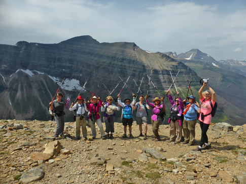
It was long. It was hard. It was 14 miles with 2,800 feet of elevation gain with "relentless up, up up," as one website describes the hike, and a great precursor for our hike to Sperry Chalet over Gunsight Pass. Most of us considered this a get-in-shape hike to see if we were ready for our big one later in August.
The day started by leaving Great Falls around 5:30 a.m. and getting on-trail by 8:30. We met Carol in the Pray Lake parking area of the Two-Med campground. She had about the same amount of driving from Condon that we did from Great Falls: 2.5 hours.
Ten of us hit the trail, enjoying the flowers from the get-go with fireweed and goldenrod providing a great foreground for our views of Sinopah mountain. As we started out along the northshore trail around Two Medicine Lake, we didn't see a soul, which surprised us, until after the turn for the pass, at which time some who had taken the boat overtook us. But Mary N and her family were not among them, so we wondered if she had thought better of the weather since there was a 50 percent chance of showers in the afternoon.
We continued on, making good time on the first four miles of the hike, which has little elevation gain.
But then, Mary and family did catch us, right at the turn for No Name Lake, as we were resting after a bit of uphill. We chatted a bit, admired her grandbaby and then headed up the trail behind Mary, her daughter/son-in law, granddaughter and husband, saving the half-mile spur to the lake for the way back.
At this point, the pitch of the path takes a decidedly steeper turn, so we mustered our energy for an uphill climb. Some of us struggled on the way, but the views just got better and better while the alpine flowers put on a show: blue explorer's gentian, Indian paintbrush, St. John's Wort, asters, pink monkey flowers, sulphur buckwheat, pearly everlasting, western tobacco root (valerian), and ocean spray.
As we approached Big Horn Basin, a rocky area where the sheep bed down, we hoped to catch a glimpse of the majestic animals, but no luck there. Some of the hikers who were now headed back down told us two were on top, so we still hoped to see a few.
When we finally arrived at the top, we were overcome with the views of the other side: two glaciers (Blackfoot and Jackson) and the remnants of the former Lupfer glacier as well as Mount Stimpson, 8888 and St. Nick looming in the background. It was now 1 p.m., a bit later than we had hoped, but we were very happy to enjoy our lunch with such spectacular scenery along with a few pesky critters (Colombian and golden-mantled ground squirrels) hoping for a handout.
Another interesting thing to see was the remnants of last year's Thompson fire. It has burned the whole Nyack area that use to be such a gorgeous emerald green that it shocked the eyes. Now the green is only on one small part that avoided the fire somehow. A gentleman and his partner offered to take our photo as long as we posted it with the hashtag #montanamoment when we got home, so we handed over a variety of phones and cameras. He said he worked for the department of commerce in Helena.
At 2 p.m., we had to scurry off the top as storm clouds started brewing in the west. Katie reminded everyone that we needed to be off the top by 2 p.m. as this is the time when electrical storms start. Therefore, we couldn't go up the extra 500 feet to the edge of Flinsch peak, so we didn't get in a full 3200 feet that we had hoped to attain, nor the extra mile. So Katie decided that we would for sure hike around No Name lake to get in one more mile and cool our feet.
So we descended as quickly as we could to get into the trees just in case of lightning, which we did. We came across many other parties passing us now, asking about the last boat time and how to get to the dock. The biggest surprise hikers were Katie's husband Tom and his hiking partner Gordon. They had hiked Pitamakan Dawson,but we had thought they were hiking the other way, not expecting to see them. We were all impressed that they had hiked almost six more miles than we did and they caught us! Of course, they didn't swim in the lake or relax at the pass.
Tom and Gordon told us they saw a young bull moose in the velvet on the way out. Kuntz and Susan saw something big wander through the bushes in about the same spot but weren't sure what it was.
When we reached No Name Lake, we were happy to take a bit of a break, soak and rest our feet. Carol decided to swim and tried to encourage others too as well. So Beth stripped down and joined her. They both said it wasn't too chilly and they felt like they could do Dawson Pass again they were so refreshed. It didn't convince anyone else to swim though. When we were done, Chrissie looked up and spotted a goat by a snow field right by the lake! What a treat.
The rest of the way back along the north shore of Two Med lake was uneventful except for the threatening thunder that kept crashing above us. We kept our poles down low and hoped for the best. The storm hardly produced a sprinkle though, so we didn't get wet.
During this part of the hike, Catherine and Beth started getting serious about huckleberry picking, lagging behind but then catching up and repeating until the end of the hike. They only managed to collect about a cup of berries each, so Beth supplemented hers with service berries (Saskatoon to our Canadian friends). Beth planned to make some wild berry muffins while Catherine had a hankering for a huckleberry margarita.
After this long hike, we earned our meal at the Glacier Park Lodge, where the lounge host actually allowed us to sit in the dining room yet order off the lounge menu. Last time we tried this tactic, we were scowled at and scolded by the waiter. This time our waitress was quite friendly, and some of us ordered off the dining menu anyway. And we had another surprise as we entered the lodge: Gail, who had led a hike to Upper Two Medicine Lake, was just exiting with her hikers. They had had a fantastic day. And we also ran into Rich from the Tribune, so Kuntz got after him about an article she had written and the reaction to it.
Even though the clouds rolled in, no real rain or hail materialized, so the drive home was dark but, thankfully, not in a storm. We arrived back at the school district offices at 10:30 p.m. Carol said she took a power nap and arrived back in Condon about an hour later than we.
Who went: Catherine, Sara, Kuntz, Kathy M, Chrissie, Sue, Susan, Beth, Katie, Carol
Upper Two-Med Lake, August 6, 2016 Nice Boat Ride Concludes Fun Hike to Twin Falls, Upper Two-Med Lake |
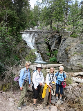
On Saturday, August 6th, Gail, Doris, Suzie, Jeanne & Randi hiked from Two Medicine Lake to Twin Falls & Upper Two Medicine Lake. It was a wonderful, gentle hike of 7 plus miles and only 200 to 300 feet of elevation. We loved it. The trail provided a nice variety of views--starting with Two Medicine Lake, some fabulous mountain peaks, such as Sinopah Mountain, which dominated the landscape,and high rocky ridges.
The shady stretches felt cool. Great patches of huckleberries and thimble berries nourished us along the way. At Twin Falls, where we stopped for lunch, we talked to a couple, who had encountered a moose on the trail from the boat dock. They showed us pictures and video; that's as close as we came to seeing any wild life except for chipmunks and a large, black insect with huge antennas that perched on Jeannie's shoulder.
About this time, a large ranger-led group joined us at the falls. We leap-frogged with them on the trail to the upper lake. Whenever they stopped to listen to the ranger, we passed them, and then they would catch up to us. The flowers were not quite as glorious as the ones on the way to Iceberg Lake the previous Saturday, but the weather was cooler and more comfortable for hiking.
At Upper Two Medicine the shore of the lake was covered with washed-up logs that provided good seats for enjoying the view of the lake and the mountains behind it. Several fishermen were also enjoying the site. We saw fish jumping, but didn't see any being caught. About this time, the weather was beginning to look rather ominous so we decided to head to the boat dock. We got there shortly before 4, when the boat came to pick up the ranger-led group. If there was room, we could ride back on the boat; however, there was only room for three more people by the time we got to the boat so we let another group of three go and we five waited for the boat to come back for us.
The boat ride back was the perfect, relaxing way to finish our hike. After returning to the car, we headed to East Glacier Lodge for an excellent dinner. Just as we arrived, the rain got serious!! But it conveniently ended just about the time we finished eating. On our way back to the car, the group that had gone to Dawson Pass arrived for dinner. They were tired, but so excited that they had accomplished another tough hike. They will definitely be ready for their hike to Sperry Chalet at the end of the month! And we are ready for Granite Park Chalet as we head there on Thursday!
Iceberg Lake, July 30, 2016: Busy Trail; Meeting Visitors; Wading to, Standing on Icebergs Offer Highlights of Day |
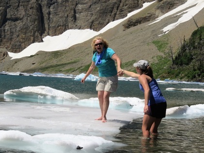
On Saturday, July 30, Gail Holzheimer, Chrissie Jackson and Randi Graves hiked to Iceberg Lake. It was a beautiful sunny day with lots of people on the trail. A short distance up the trail a man told us that a mama grizzly and her two cubs had been seen on the hillside above us. Chrissie, hoping to see them, checked the hillside frequently. Some of the hikers ahead of us loudly announced their presence to warn the bears if they were near. All along the trail, people were friendly; they offered to take pictures of our group, shared information about animals they'd seen, and cheered us on as we got closer to the lake.
About 3 miles up the trail, near the waterfall, we had our first chance to sit down and rest. It is a welcoming spot alongside the river where people can sit and cool their feet. We took time to have a snack here and enjoy the people watching. Moving on, we could see that we'd made significant progress. The huge cirque that holds the lake seemed much closer.
On this next segment of the hike, the swaths of wild flowers were incredible; they were so lush and colorful. We wished Katie was with us to identify them. We recognized thimble berries, Indian paint brush, bear grass and blue bells, but there were soooo many more!! It seemed that the higher up we got, the fresher the flowers were. Also on this section of the hike, Chrissie spotted a herd of mountain goats grazing in a patch of green just below a big snow bank. Goats, but no bears! Further up the trail, hikers coming down told us about two moose enjoying the coolness of a pond down in a meadow on the left side of the trail. Also, in the valley on our left, we could see the river that flows out of Iceberg Lake make its way and drop over two or three falls. Just a short distance before Iceberg Lake, there was a "pre-lake" as Gail called it, with another wonderful array of wildflowers leading up to it!
Finally, we made it to the lake. It was so worth it! The water is deep aqua, which makes the perfect background for the icebergs. There must have been 50-75 people on the beach. They were loving it. People walked out to the icebergs, climbed up, lay down and made snow angels, yelled with delight, and either walked back, or dived in and swam back. We sat next to a fun family of five from Wisconsin, which included three teen daughters. The daughters and their mom all climbed the bergs. Then Chrissie decided she had to do it too. After that Gail thought she must also venture out (it might be her last chance), which she did with the help of borrowed sandals & one of the daughters. Randi had no desire to go, but she succumbed to peer pressure from the "mom" and Chrissie and Gail. She also borrowed sandals and an arm from a daughter and made it to the nearest iceberg, about 6 feet from shore. What fun!! After several more people scaled our iceberg, it could not endure it any more and split apart. The Wisconsin family was not only enjoying Glacier, but they were using their hikes to prepare for hiking the John Muir trail next year. Impressive!
We finished our lunch and decided to head back because it was already after 2 pm; Katie says you need to head back by two.
On the way back, we were tired, but clouds and breezes and stops at the little streams to dip our scarves in the cold water helped us back down the mountain. We refreshed ourselves at the lodge and then headed over to Many Glacier Lodge for a delicious dinner. The Ptarmigan hikers were already there. Gail and Randi didn't see them when they came in, but Chrissie did. She heard about their hike and Kathy's fall at the end of their hike. Sorry, Kathy. We made it back to Great Falls about 10:30. What a fabulous day. None of us were sure we could do the 10 miles, but we did.
Ptarmigan Tunnel and Iceberg Lake, July 30, 2016: First Real Mishap on Trail Doesn't Dampen Day of Tunnel Fun; Kathy M Earns 500 Miles of Hiking with the GiG
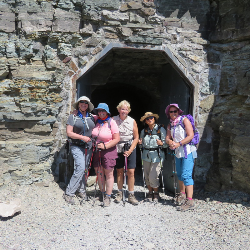
On a beautiful summer morning, Mary, Susan, Catherine, Anita, and Kathy M ventured out for another trip to Glacier, this time to Ptarmigan Tunnel. But this hike was like no other as the one of the gals faced an unexpected mishap at the end of the hike. Without Katie, fearless leader, Mary and Susan took charge, made the arrangements, and were the leaders for the day.
The gals met bright and early at 6 a.m. and were on the trail by 9:15 a. m. Shortly after being on the trail, a woman hiking solo informed them that there was a grizzly sow and her cubs in the area. The ladies thanked her for the information and continued on the trail. Knowing that the weather would be hot, the gals moved quickly and kept a steady pace as they made the ascent to the tunnel. Ptarmigan Falls was a perfect place to stop for a quick snack to replenish their energy before moving on Ptarmigan Lake. After a short lunch the ladies decided not to dally for too long, and they ventured out to make the final steep ascent to the tunnel. The blazing hot sun proved to test their determination to reach the top, but fortunately the breezy wind brought some relief to the gals. The four-hour trek and the stupendous views from the tunnel turned out to be everything they expected and more. Looking back at the steep switchback trail from Ptarmigan Lake to the tunnel, the ladies were proud of their accomplishments. For Catherine and Anita, this was their first time to reach Ptarmigan Tunnel. Once inside the cool 240 foot long tunnel, the gals received a bit of respite from the heat. In spite of the cool temperatures inside, the "light at the end of the tunnel" spurred them to move quickly to the other side only to find nothing but astounding views of the Belly River country, Old Sun Glacier, and the unique stratified layers of red and white rock. After taking a lot of photos, the gals determined to get back on the trail lined with a riot of wildflowers of every kind imaginable, and in a snowfield near Ptarmigan Lake a large herd of bighorn sheep entertained them with their playful antics. An oncoming hiker informed the ladies that there was a bull moose on a hillside about 1/4 mile away. Because of this, the ladies kept their eyes peeled for any sighting of the moose, but he must have wandered far into the brush and trees. The ladies moved quickly down the trail motivated by the fact that the sun was hot and the temperatures were rising. Getting closer to the trailhead, the gals anticipated removing their hot boots and to get relief from the heat. As the gals made the final descent to get to the trailhead, Kathy suddenly tripped and found herself sprawled out on the trail bleeding from abrasions on her hand, arm, and split lip. Not only that, but Kathy found that she broke two of her front teeth and her sunglasses broken into several pieces. The rest of the gals came to her aid along with quite a number of other hikers who offered band-aids, ointment, and other first aid items. All Kathy wanted to do was get off the trail and wash her wounds before applying any ointment or bandaids. Once the pieces of teeth and sunglasses were gathered, the ladies quickly moved on to Swiftcurrent Inn to get cleaned up, remove their boots, and to get something to eat at Many Glacier Hotel. Kathy, not wanting to attract any more attention, went to the shower house behind Swiftcurrent Inn to get cleaned up and somewhat presentable for a nice dinner at the hotel. After dinner, the gals all had a lively conversation and a few laughs (at Kathy's expense) all the way home, as any great group of friends would, and truly enjoyed each other's company. Kathy was in good spirits in spite of her mishap and made light of her predicament. The ladies arrived back to town by 10:00 p.m. and welcomed a good nights sleep, and Kathy to wake up to a smile broken by 2 missing teeth, a nice shiner, and a fat lip~ enough to make her look like she had been in a back alley fight. Ha ha! |
White Cliffs Kayak, July 23-25, 2016: A Little Hiking, a Little Climbing and a Lotta Padding on the Mighty Mo
Gail H, Chrissie J, Sue M, Cathy and Brittany K, Mary N, Mary and Michael S embarked from Coal Banks Landing Saturday morning. Day 1, Slightly overcast skies helped us endure 15 miles of paddling to our first night camp at Eagle Creek.
After setting up our camp, tents, cots, kitchen and dinner setting, we took off for our first adventure, hike through Neat Coulee. Starting off in a cow pasture, that turned into the most amazing slot canyon, with narrow walls, and wind-eroded formations. In a couple places, fallen rocks blocked our paths, but with team work, determination and lots of laughs, we climbed our way through, over, under and on to further amazing views of incredible formations. It was hard to believe that the landscape could change so dramatically from the river and meadow land we had started from to this almost “alien” land forms. Breathtaking views and wonders awaited us almost at every turn, until we reached the “top” of the plateau. Posing for a group picture, we than made our way back down to our camp. That night’s dinner of grilled steaks, corn on the cob, salad and cheesecake was a delightful end of a very full day. There was “no daylight left on the table” as we finished the dishes by headlamps. After a few S’mores around the campfire, our cots and sleeping bags welcomed us for a great night’s sleep under a beautiful moon that reflected off the river and the white cliffs opposite the shore of our camp. Day 2, breakfast of pancakes, bacon and eggs, blueberries and cantaloupe was the beginning of another long day of paddling and hiking. Our first seven miles took us past the Citadel, and National Historic Landmark, just before The Hole-in-the-Wall. This is literally an 8 ft hole in the side of an igneous rock extrusion, about 300 ft above the river. “Climbing up to the Hole-in-the-Wall is not for the inexperience hiker. The trail is steep and the drop from the edge is precipitous.” (BLM map description). With determination, high spirits and “Jay with a rope” we climbed the rocky trail, using the rope and supporting each other, we reached the HOLE! Pictures of all of us, huddled precariously inside the Hole were taken and the journey back down was just as adventurous as the climb up. We became adept at “rock repelling with a rope” as we made our way back to the boats. We had sure worked up an appetite for our lunch waiting for us under a large cottonwood tree. The afternoon proved to be quite challenging with clear skies, (no cloud cover) over 90degrees on a lazy, slow river that required us to paddle consistently for thirteen more miles. In this section of the river, we enjoyed the most amazing rock formations, wind erosions, hoodoos along the river banks; Seven Sisters, Dark Butte, Archangel, Steamboat Rock to name a few. Twenty total miles of paddling under a very hot sun brought us to a welcome campsite at Slaughter River. Grilled chicken marinara with steamed green beans and raspberry shortcake was a delicious end of a great day as the sun set. Day 3, breakfast of French toast, warm peaches and sausages began our last day on the Wild and Scenic portion of the Missouri River. We found a little faster water on our final 11 miles to Judith Landing. We had a 2 hour drive back to Great Falls to reminisce our 3 days, incredible hikes that pushed our limits, and paddling 46 river miles. |
Crown Mountain Trail, July 22, 2016: Quick Trip Has Us Back Home for Beer and Gear Expo
 Scapegoat Wilderness Scapegoat Wilderness
.Crown Butte it's not. Instead of a flat-topped lacolith, Crown Mountain is a major peak in the Rocky Mountain Front, one that looks similar to Sawtooth but just a little tipped. It resembles a king's crown from a coloring book.
At 6:30 a.m., four of us set off to Augusta, had a brief stop at the mercantile before heading down the Benchmark gravel road that leads to some of the best wilderness in the world. Spardha drove for her first time in the Front and did an excellent job--she wasn't a bit afraid of the gravel. Before we got to the trailhead, we took a side trip to Double Falls, enjoying the smaller cascade, spilling into the larger one. Spardha actually climbed to the upper falls, while the rest of us stayed back. Then it was off for the last mile to the Crown Mountain trailhead. We were on trail around 9 a.m.and immediately started uphill, getting in our 1500 feet of elevation gain for the day. The day was hot, but luckily most of the trail was in the shade. Along the uphill climb, we enjoyed many wildflowers, in particular the lady slippers and blue explorer's gentian. We also saw two kinds of lousewort: fern-leafed and parrot-beak. Of course, there were many others. Also on the way up we came across the avalanche chute that had taken out the trail this year, spilling rocks over it. This section was a bit hard to navigate over the piled-up scree, but not too bad. After this part, the trail breaks out into the open, revealing the rocky cliffs of the mountain. Since it was so hot and all of us wanted to get back to the Beer and Gear Expo, we decided to stop short of the saddle by a half mile and enjoy an early lunch. Then it was back down and back to Augusta, with a quick stop for coffee and a look around Latigo and Lace, since both Bonnie and Spardha had never seen this cute boutique. In the store, we noticed several Great Falls' artists and enjoyed all of the hand-crafted items. Nobody bought anything other than a latte though. Then it was on home by 3:30 p.m., just in time to wash up and get to the Gear Expo at 5 p.m. Who went: Spardha, Bonnie, Randi and Katie |
Samsara Welcomes Us to Lookout; Views Galore; Marmot Madness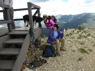
The thought of reaching the fire lookout to visit with friend Samsara kept us going all day, a day that started at 5:15 a.m. with us getting on trail by 7:35 a.m. We wanted to go uphill before the heat of the day and we did. We welcomed Jaye, a new member, to our group. She picked a tough first hike, but had been going on trips with MWA all summer.
It was a very chilly 31 degrees, so we raced over the first 2.25 miles of mostly flat to keep ourselves warm. Many of us pulled out the mittens and warm hats/hoods on this stretch of our journey. Then it was time to don our sandals and crocs to cross Straight Creek, a cold 30-yard dash that had some of us howling in pain as our feet numbed in the freezing water. But our coolness didn't last long as the climb starts the minute we put our boots back on. So we started the punishing uphill and kept a steady pace. Along the way, Catherine spotted a huckleberry patch, which was fortuitous since Raye had wanted to see and taste them for the first time. We reached honeymoon basin around 11:30 for a break and a snack before the final ascent of another brutal mile to the top of Patrol mountain.The basin had a wonderful display of flowers, particularly Indian paintbrush and various vetches. As Catherine ate an energy bar, a holly blue butterfly landed on it and then moved to her hand. On the last mile, we could see the lookout most of the way, giving us hope and keeping us going even though it was deceptively still far away. Just before we reached the structure, we faced the narrow saddle, with steep drop-offs on either side, but this section didn't intimidate anyone this year, unlike prior groups. About a half mile away, we heard marmots and a pika calling as well as Rye, Samsara's blue-healer cross, barking at us. Rye greeted us as we approached the porch and settled down, licking those who offered their faces. She also gladly took a bit of our lunches, with Sam's blessing. After we dropped our packs, had a quick bite and Sam oriented us, we went inside as it was getting windier, and it was still chilly, only 48 degrees, according to Samsara. Inside, Sam told us about her work, how she scans the hills every hour for 15 minutes, unless it is raining or very wet, how she calls in fires, uses her Osborne firefinder and informed us about the fires she has already seen, including one on a ridge next to her where we could still see the fire retardant orange between the trees. The gals all had questions, especially about her safety being alone in a lookout. Sam said she has only once in 20 years of manning the lookout felt uncomfortable with a visitor, a man who kept violating her personal space. She also explained how she could contact the other lookouts for a safety check. She also said she doesn't have a gun or feel comfortable with one but she does have bear spray and a pulaskii. And her dog, Rye. The forest service allows one dog, so she can't bring her other one. Rye is 15 and showing her age, so Sam can't do as much hiking on her days off as she used to. She has Mondays and Tuesdays off and occasionally goes into Augusta, making the long trek down the mountain and back. She also told us about her resupply, how she can call in what she needs and her packer purchases it for her and brings it up. She is busy making a sweater for her husband, but two years ago knitted one for her packer. Her husband visits occasionally (he is a smoke jumper) and this past trip brought her some flowers and makings for pizza, something they love to make together on her wood stove. Her other visitors are hikers like us and animals. She has seen several weasels and even a wolverine, a black bear with twin cubs, and her friendly marmots, who were eating all of her pretty purple penstemons. Before we left, Jaye brought out a dark chocolate bar and passed it around but left the majority of it for Sam. It was bittersweet to leave Samsara and the glorious views, but we did need to get down the mountain as clouds were rolling in, and T-storms were predicted for late afternoon. The downhill was uneventful, except for the high-pitched whistle of the marmots, the gorgeous stroll through honeymoon basin with all of the flowers and our recrossing of chilly Straight Creek, which felt good on our tired feet this time across. It took us nine hours and nine minutes to complete our 12-mile hike, a full hour and a half faster than two years ago. Then it was on to Augusta for dinner after a quick stop at Lattigo and Lace, a boutique with handcrafted and other items. The owner informed us that the Lazy B cafe had a malfunctioning exhaust fan and could only serve pizza, so we opted to go to the Buckhorn bar instead for a bite to eat. However, even though the food was good for bar food, it took over an hour to get our grub, and we were starved! The wait was perhaps the most painful part of the day. On a side note, we ran into June at the Buckhorn. She had just come out of a five day, four night trip into the Bob. She visited Samsara's father on Prairie Reef. After dinner, an hour's drive saw us back in Great Falls by 9 p.m., an hour earlier than expected. All in all, a super day and a fantastic hike and visit with Samsara. Who went: Catherine, Roni, Deb, Jaye, Brenda and Katie |
|
Seeley/Jewel Basin, July 6-8, 2016: Three Days with Two Hikes; Susan Earns 500-Mile Mark
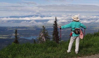 Photo by Madelon Photo by Madelon
Mary N did it again: provided us with a fabulous vacation at her cabin in Seeley that gave us a great home-away-from-home feel while serving as a take-off point for adventure.
We left Great Falls on a cloudy, thurnderstorm-threatening Wednesday at 6 a.m. and arrived in Seeley around 9 a.m. after many mishaps that included a broken bottle of wine, difficulty locking and getting the keys out of the car topper, and Sue M getting a flat tire on her way to meet us. Despite the rainy weather, we did get in a hike, but not the Hemlock Lake that Mary had in mind, due to mud and much uphill that might have sent us sliding. Instead, we opted for the shorter and flatter Morrell Falls. We were able to throw in upper Morrell, even though it was a steep climb, and enjoyed looking down on the falls from above. This hike earned Susan her 500-miles with the GiG! She was the first person to do so and will get a gorgeous framed King Kuka print of Indian paintbrush flowers with mountains in the background. We returned to Seeley in time to fit in some shopping. Kuntz bought a pink cowboy hat and some Polish pottery for her mother, Katie some jewelry for her daughters and daughter-in-law and the others shirts and souvenirs. Then we headed to purchase Mega Millions lotto tickets as the pot was up to 49 million. Too bad we didn't win. We also tried our hand at shake-a-day at the Chicken Coop. Katie and Susan won free drinks but we left the big money on the table. Then we enjoyed a nice dinner at the Double Arrow Lodge. We had hoped for a six-o-clock seating, but we couldn't get in until 7:30 p.m., which actually worked out better since Sue, who came up on her own, had to get a flat tire fixed on her way (in Vaughn) and didn't arrive until 7:45. The late time meant she was able to join us for dinner. It's hard to believe, but by the time we arrived back at Mary's cabin, we were all too tired to play games, given our 5:30 a.m. wake-up call the next morning, so some enjoyed the deck for a few minutes but then climbed into bed. The next day, it was up early and out the door at 6:30 a.m. to head to Jewel Basin to hike to Crater Lake via Birch Lake. On the way, we picked up Madelon from Eureka, who met us at the school district building at the Echo Lake turn, so nine of us arrived at Camp Misery around 9 a.m. We discovered that the last mile and half of road to the trailheads was closed, so we had an extra bit of uphill hiking. The first part of the hike is boring and switchbacked, but as soon as you leave the old road, the trail is fabulous, providing endless views of the Flathead valley and all of the surrounding towns and lakes, including Flathead lake, the largest by surface area lake west of the Mississippi in the contiguous United States (Tahoe is larger by volume). Three miles into the hike, we arrived at Birch Lake (we viewed emerald-green Martha lake on the way, but it is a bushwack to get to). At Birch, we rested, had a snack, and took a potty break at the "outhouse" with a view, as there is no "house" to it, just a seat in the outdoors. Then eight of us continued on to Crater, leaving Gail to enjoy the peacefulness of the little gem in the Jewel. This next section of the hike hadn't been traveled much as the snow was still clinging to the trail in places, and much fall-down from the winter avalanches gave us an obstacle course. But the early spring flowers were in abundance, especially the glacier lilies--fields and fields of them. On the trail, we came across a group of young backpackers who had stayed at the lake and Joan, from the Glacier Gals Kayakers group. She was as shocked as we were to just happen upon each other. But at Crater Lake itself, we didn't see a soul; we had it to ourselves and enjoyed a very short lunch as Katie allowed only 20 minutes so we could make our dinner reservations. On the hike back out, we enjoyed even better views of the valley, and several of the flowers, such as pink spiraea, had blossomed during the day. We picked up Gail at Birch lake and hiked out, getting out a half hour earlier than expected. We said our goodbyes to Madelon, who drove out first for her trip home to Eureka, while we stopped by the Laughing Horse Lodge in Swan Lake for a gourmet dinner. No one except Katie had been there before, so the new experience and the food were both treats. The food turned out well, despite the seafood special not being cooked to begin with. But the fresh huckleberry/peach pie that Chef Kathryn (Kate) comped for everyone who ordered the special more than made up for it. The beet salad with chevre several commented that it was the best they had ever had, and the seafood gumbo soup without gumbo was very tasty too. Then it was on to shake-a-day again and a game night of Catch Phrase since we could sleep in the next morning. Still, most didn't stay up too late except rumors have it that Kuntz and Anita chatted into the wee hours. The next day, Mary fixed a fabulous meal, despite telling everyone she doesn't cook much. Her baked egg and cheese dish and sticky buns were to die for, served with berries and melon. Yum! Then it was off for a boat ride with Captain Mary, the lady willing to share her gifts and talents and ideas with us. Sue M wanted to get home early to support her friend Sue O, and fellow GiG member, who had just lost her husband. Katie went back with her to keep her company and also rest a while before a big hike she and her husband were going on the next day. The rest took a long ride to the other end of the lake to look for the eagle's nest which was hard to spot but it was unoccupied. We were hoping to witness an eaglet or parent but they weren't home. On our way back to the cabin we saw a sit-down hydrofoil skier that was fun to watch. He was preforming tricks such as flips that looked like you needed skills to complete. Everyone had a good time on the boat and then sat on the deck until we left Seeley. The ride home put the gals back in Great Falls around 6 p.m. A big thank you and shout out to Mary for her hospitality! She had so much laundry and cleaning to do and prep work on breakfast and snacks. She made it all look so easy, but we know better. We so appreciate it! What an awesome time with good friends. Who went: Sue M, Susan, Gail, Anita, Kuntz, Bonnie, Mary, Sue M, Katie and Madelon joined us for one day |
Mary's RecipesCheese egg casserole
Nine slices of bread, crest removed and cubed 1/4 pound melted margarine 3/4 pound grated sharp cheddar cheese Three eggs separated 2 cups milk 1/2 teaspoon dry mustard 1/3 teaspoon cayenne pepper 1/2 teaspoon of salt Remove crusts from Bread and cut into 1/2 inch cubes. Soak Bread in melted margarine. Add cheese and mix. Add milk. Beat egg whites to Peak and fold in gently. Place in buttered 9 x 9" pan. Cover with foil and chill overnight or 12 hours. Bake for 45 minutes at 325 degrees. Let set five minutes before cutting to serve Serves 6 to 8 Double for an 9 x 13 pan and cook 55 to 60 minutes or more. Let it set for five minutes before cutting to serve. This will serve about 12 or more Chicken spread 1/2 cup sour cream 1/2 cup mayonnaise Two cans of canned chicken or one large can (can use real chicken also) One fourth of a cup of chopped walnuts 2 ounces of pimento, sliced and drained 1/4 teaspoon of curry powder Mix all together serve with crackers or plain Tostitos Best if it sits a little while in the refrigerator Overnight butterscotch sticky buns Service 18 to 20 18 to 20 frozen roll balls 4 tablespoons dry butterscotch pudding mix, not instant 1/2 cup melted butter 2 tablespoons cinnamon 1/2 cup brown sugar Chopped nuts if desired. I did not use nuts Place frozen dough in a buttered Bundt pan. Sprinkle with 4 tablespoons dry butterscotch pudding mix. Mix melted butter, cinnamon, brown sugar and nuts and pour butter mixture over rolls. Cover with foil and let sit overnight. Do not refrigerate. In the morning, bake at 350° for 30 minutes. Remove from the oven and invert to a plate or at 13 x 9 pan You don't want to know the calorie count on these |
Cracker Lake, July1, 2016: Challenging Hike Gives Way to Views, Moose, Milky Aqua Lake
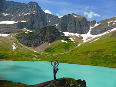
Any time you have a 13-miler near the beginning of hiking season, you are pushing the limits. As we age, it takes longer to get in shape as the weather warms, so this hike did challenge a few of us; but it was so worth the extra effort.
The day started early at 5:15, and after our traditional stop for a stretch and a bite in Browning, we arrived in Many Glacier to meet Madelon at 8:25. It did take us clear until 9:05 a.m. to take care of business and gear up, but then nine of the GiG hit the trail. The first part of the hike is on the trail-ride loop, so we were following the morning horse tour, and two other horsemen passed us on the trail. This section, then, is not too pleasant unless you like the smell of road apples and the bite of horse flies. Still, we enjoyed the views of Sherburne Lake and Mount Altyn. At the three-mile mark, we thankfully left the horse loop and started our ascent to the top of a narrow ridge, formed by a creek on either side: Canyon and Allen creeks. After crossing both streams and climbing out of the creek bottoms, the trail comes out into the open, revealing the Cracker Lake cirque, flanked by Mount Siyeh, Cataract Mountain and Mount Allen. The other gorgeous sites were the many and varied wildflowers, from lupine-full fields on the drive in to the beard-tongue penstemon, many-flowered stickseed, yellow, waxy buttercups, and blue explorer's gentian; the flowers put on quite a show, different in each zone. As the sun was hot, we were grateful for the streams that crossed our path, providing a place to cool down. And the first four miles are in the shade, another lucky break on a warm day. None of the sites, however, can prepare one for the first site of Cracker Lake, with its milky aqua color, unlike other glacier-fed lakes in the park that exhibit more of a deep turquoise hue. The lake provided another treat: a bull moose lying down cooling his feet in the water on the opposite shore. He was oblivious to the hikers passing by and those of us who were lucky enough to spot him to stop and take photos. Some of us took our lunch break at the near-end of the lake while some continued on to the campground site and a large rock, perfect for enjoying a bite and viewing the head of the lake. From the rock, one can see the old mine tailings and equipment left behind from the days before this area was a national park. After a half-hour break, we started back down the trail for the long 6.5 miles back. About half-way back, Madelon decided to move more quickly and hitched up with a young couple to hike back with so she could get on the road to Eureka. The rest of us slowly made our way and ended our hike just before 6 p.m. and enjoyed a delicious dinner at the Many Glacier Hotel lounge along with a cool drink. Then it was home; ironically, we followed a horse trailer, so all day, we were trailing equine. After a stretch break in Browning, we arrived home at just after 10 p.m. Who went: Cathy, Roni, Gail, Susan, Sara, Bonnie, Katie, Catherine, Madelon |
|
Two-Med Waterfalls, June 18, 2016: Two New Hikers Join Two from Eureka for Clouds, Winds, Rain, Moose |
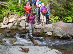
,The GiG welcomed Spardha and Emily ffrom Great Falls and Pat from Eureka for their first hike with GiG. And it was good to see Madelon, also from Eureka, for the first time this season.
The weather had been predicted to be up and down all week, but with a 20 percent chance of rain in the morning and a 70 percent in the afternoon of T-storms, we followed the adage of "always go to the trailhead." We left Great Falls at 5:30, and after a longer stop in Browning and a quick stop in East Glacier to pick up the Eureka gals, plus time to shuttle vehicles to the campground, we got on trail just before 9 a.m. The boat dock was just opening as we hit the south-shore trail, probably the first hikers on this section for the day, which turned out to be great, since we saw a moose in the pond about a mile down the trail. She showed off a bit for us but then disappeared into the bushes, probably to seek out a hidden little one. The flowers also put on a show with buckwheat, Sego lilies (Mariposa), buiscuitroot . woods forget-me-nots and the wild anise very prolific. The bear grass was just starting, and we saw just a few fading spring beauties and glacier lilies in a shaded area. There were many other flowers too, including berries: elderberry, fool's huckleberry, thimbleberry, mountain ash, strawberry, and service/saskatoon berry flowers. We didn't see another soul on the trail and had both Aster falls and Rockwell falls to ourselves, but on the way out of Rockwell, we ran into two rangers. (An interesting note about the hanging bridge over Paradise Creek: Pat said if she had known about it, she would still be in Eureka). At this point, eight of the gals went ahead to attempt the full 13-miles to include Upper Two-Med lake, while three wanted to take their time encircling the main lake and bypassing the upper lake. The gals who wanted a slower hike ended up going back they way they came and visiting the camp store, while the others hustled to fit in a long hike as it was already 11:30 with 9 miles to go. The day had been cool and cloudy, actually a nice temperature all day but started to darken as the gals hit Twin Falls, which meant 8 miles to go. When the thunder started, they decided to skip the upper lake to shave off three miles and just go for the 10. Twice it sprnkled as the gals put on and then took of their raingear, but about a mile and a half from the cars, it stated raining for real. As the droplets descended, so the did the clouds, covering the view of the lake and most everything else. Our boots and pant legs got pretty wet from the soaking brush, but a half mile from the cars, the sky cleared into a beautiful sunny day. Because we hustled down the trail in the rain and skipped the upper lake, we finished at 2:30 p.m. instead of 5 p.m. And the other gals had already shuttled the other car from the parking lot and met us at the trail's end. We decided to make the falls count for the day go from three to four by stopping at Running Eagle (Trick) Falls on the way out, Many of the gals hadn't visited this double falls before, including Madelon and Pat from Eureka, so it was fun to see the rushing water coming over the top of the gushing cave. Then it was time to say goodbye to our Eureka friends while we headed to the Whistlestop cafe in East Glacier for a bit to eat. Then it was on to Great Falls. The drive was eventful with lots of rain at time, buckets of moisture on the road and even a rainbow, but it was sunny when we arrived in Great Falls at 7:30. It was nice to get home early even if we did skip the upper lake. Who went: Spardha, Emily, Sue, Gail, Mary N, Toni, Roni, Catherine, Madelon, Pat and Katie |
|
St. Mary Waterfalls, June 16th, 2016: Six Falls Spill Over on Gals as They Hike Reynolds Burn Area |
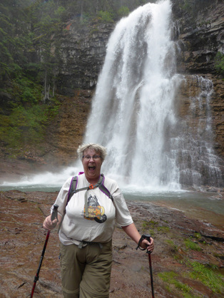
We wanted to see the burn and we did. Beside the falls spilling over with spring run off, we were able to see the effects of last year's Reynolds fire and enjoy the benefits of fire as well as the devastation.
Our day started at 6 a.m. and we arrived at Sunrift Gorge parking lot and got on trail at 9:30 a.m. After a quick trip to view the gorge, we headed down the Baring Falls trail and diverted to Sun Point, which is officially closed due to construction. Along this portion of the trail, we were keenly aware of the blackened trees and soil but also shocked to see all of the bright green of new growth and popping colors of the wildflowers, particularly the Mariposa/Sego lilies, the state flower of Utah. Penstemon, alumroot, Indian paintbrush and lupine were also abundant. We didn't stay at Sun Point long, due to high winds that blew us off our feet, so we were back on the trail, retracing our steps until we arrived at Baring Falls, where the Reynolds fire destroyed a historic ranger's cabin. Still the fire opened up the views, so we could see St. Mary lake as well as distant falls, such as Virginia, which we visited up close, and Florence Falls, which we didn't. Then it was on to St. Mary Falls, where the burned areas were most apparent, revealing the cascades much sooner than we could ever see them before, but also exposing us to more sun than we were used to in this normally very shady area. After our admiring the falls, we headed up the trail toward Virginia Falls, but not before stopping for lunch at an unnamed falls that trammeled down over solid rock that made a great resting ;place. After eating, we continued past two more unnamed cataracts before making it to Virginia Falls, the grand daddy of all of them, spilling and spewing mist for many meters. The gals, and their camera lenses, were soaked by even a brief stroll near the cascading water. After we were drenched, we moved on to the bridge over the creek, which is fed by the spilling water, and enjoyed the falls from a safer vantage point. From there, we retraced our steps to the cars, to complete an 8.5-mile circle. On the way out of the park, we got a surprise: a black bear eating by the side of the road. After many pictures and creating a bit of a bear jam, we stopped briefly at the St. Mary Visitor Center to buy souvenirs, Nature Conservancy maps and then visit the bathrooms. Before getting home around 9 p.m. we stopped for a fun and satisfying dinner at a GiG favorite: Buffalo Joe's in Dupuyer. Surprisingly, the construction by Choteau hadn't started yet, so the drive was better than expected along this stretch of the road. Who went: Gail, Susan, Mary, Denise, Sue, Brenda, Toni, Nancy, Anita, Katie |
|
Scalplock Lookout, June 10, 2016: Snake, Robin's Egg, Views Highlight Scalplock Lookout Climb
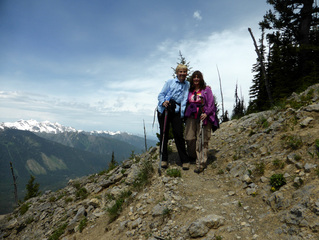
Carol made a hike! After several failed attempts, we finally were able to meet Carol from the west-side Glacier group, so we have now added her to the list of Marta, Madelon, Jackie, Kate, Tracy and Joan who have joined the GiG for a hike!
Our day started with meeting Carol at the back-country parking lot at the Walton Ranger Station outside Essex. (we left Great Falls at 5:40 a.m. and arrived at 8:35). We traveled with Tom, Katie's husband and his climbing partner Mark, who decided to go up Running Rabbit on an off-trail excursion. The three ladies got on trail about 9 a.m. and made the 3,200-feet, 4.5-mile ascent through lovely wildflowers, especially roses, Indian paintbrush, lupine, arnica, and ballhead waterleaf, in 3.5 hours. On the way up, we encountered a handful of sprinkles before the sky cleared for good. The ascent isn't too bad, due to 20 switchbacks, except the last third of a mile from the saddle to the lookout turns decidedly steeper. We enjoyed the fantastic views on top as we savored our lunch while sitting on the deck of the lookout. At 1:30 p.m., Katie scurried everyone off the mountain as we could see clouds brewing in the western skies, and we wanted to be off the top and out of the exposed area back into the trees in case lightning hit.The walk down was gorgeous the first mile, with 360-degree views, but we must admit,the last few miles grew a bit tedious with so many trees and switchbacks. We did enjoy the flowers in spots again as many had opened up since the morning. Also on the way down, we found a perfect blue robin's egg, which Carol decided to incubate in her bra to take home to try to hatch. It lay right off the trail and would have been smashed for sure had she left it. Another interesting find was a small snake which appeared to be a western terrestrial garter snake. We arrive back at the car at 4 p.m. and had beaten the men down. After leaving a note for the guys, Carol graciously gave us a ride to the Izaak Walton Inn, where we had a cold drink while awaiting their return. We read the paper and had a refill before the men made it back, about an hour after us. Then we headed to Serrano's for one of their famous dinners. Unfortunately, it took us over an hour just to get our food, so we were late getting home: 9:30 p.m. |
|
Rogers Pass/Rodgers Peak, May 31, 2016: Two Hikes, One Night Feature Forget-Me-Nots, Expansive Views, Ticks
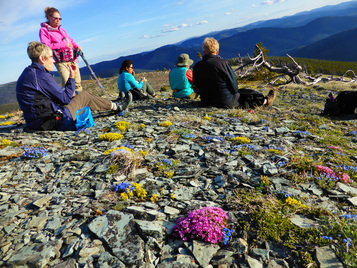
The perfect temperature and no wind--we couldn't have asked for a more perfect evening for our hike up Rodgers Peak and Rogers Pass. We headed out from the school district office at 4:15 and were on trail about 5:40, meeting Mary N at the parking lot.
Our hike stated with beautiful meadow flowers: glacier lilies, valerian/western tobacco root, anica, huckleberries, strawberries, ballhead waterleaf, blue-eyed Marys, holly or Oregon grape, chickweed, and larkspur, but turned to the alpine flowers as we approached the timber line: douglasia and then forget-me-nots, yellowstone draba, twinpod, Lyall's rock cress, shooting star, bluebells and pasque flowers. The colors were amazing, accented against the dusky evening sky of clouds and patches of blue. And the sweet hint of jasmine wafting from the forget-me-nots delighted our noses. On top, we had expansive views into the Rockies and back side of the Swans. We could see Holter lake and where the mountains meet the plains, with the buttes in the background. On top of the peak, the cairn revealed mounds of lady bugs when we disturbed the rocks. But of course, we saw a few other not-so-friendly critters: ticks, in fact, seven of them, two on Mary, one on Catherine, one on Katie and three on Cathy. Ick! After a 15-minute snack break on top, we wove our way down, scaring up a herd of 8-9 elk, which thundered up the trail toward Flesher pass, another wonderful sight for our eyes. The way down is almost as glorious as the sight of the flowers as you have views in all directions. We were back at the new CDT (Continental Divide Trail) sign by the cars at just after 9 p.m. and arrived in Great Falls at 10:15 p.m. Who went: Peak: Mary N., Cathy, Katie, Randi, Anita, Catherine; Pass: Kathy M, Gail, Allison |
May 16, 2016 :Gorgeous Views, Lighting Highlight Dinner in the Highwoods
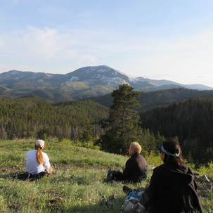
On a beautiful spring late afternoon the gals met in the 4B's parking lot anxious to get away from work and get on the trail. We were ready to forget the stress of the day and to enjoy each other's company and the lush spring-green mountain meadows outside our "backyard." The girls left Great Falls around 4:30 and arrived around 5:30 pm at the trailhead to Windy Peak at the Thain Creek campground near Highwood. Once we arrived, we found that the gate to the campground was closed so we trekked over cattle guards, rocks, and a water-filled roadway to get to the first point of interest....the outhouse for a quick stop before heading up the trail to Windy Peak.
Once on the trail, we faced numerous stream crossings along the trail due to the recent snowmelt and runoff from the latest spring storm that blasted central Montana a few days before. With trepidation, the gals crossed the streams balancing on logs, hopping from rock to rock, or making the leap of faith from one side to the other. As we hiked along the trail, the bright green meadows and aspen trees glowed with the afternoon setting sun. We expected to see a wild array of wildflowers, but were disappointed when we only saw a few Bluebells, a couple of Larkspur, some Oregon Grape, Prairie Smoke, Violets, Pussy Toes, Biscuit Root, a hillside of Arrow Leaf Balsamroot, and a few "spent" Shooting Stars. The evening was warm and a bit humid, and the ascent was bit slow due to the many stream crossings. At one point when the mountainside became a bit too steep, Gail and Denise turned around and went back to the campground to hike around the campground. The rest of us continued on to Windy Point, and by that time it was 7:30 pm when we stopped to eat our dinner and relished the beautiful views surrounding us. Not even a top 5 Star restaurant could compare with our million dollar views for our simple dinner! ! Knowing that we needed to get back to the parking lot before dark, we quickly finished our meal and met Denise and Gail at the trail head. We arrived home around 10:15 pm. Who went: Cathy K, Allison, Randi, Mary N., Denise, Gail, Catherine, Susan, Beth, and Kathy M. |
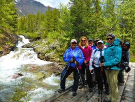
Despite a weather prediction of 50 percent chance of scattered rain and snow and a high of 47 degrees, the gals headed out to Many Glacier for a moderately easy day of hiking to three waterfalls. On this day, we welcomed Denise for her first Glacier hike with us. She had gone on Windy Point previously but she hadn't hiked Glacier yet.
The first falls we hiked was Apikuni, about 600 feet of elevation gain in less than a mile, so it is uphill, a great spring warm up to the hiking season. On the way we encountered rain and then graupel, necessitating rain gear. We saw much sign of moose but they didn't show themselves; however, we did see goats high on the hills. Those who braved the rock-climbing section of the trail found the falls were really rushing and spraying, adding to our already damp day. After this falls, we drove to the Swiftcurrent parking lot and enjoyed a lunch on a picnic table in the camp ground before heading up the trail to Red Rock Falls. The falls were gorgeous with mountains of water spilling over the maroon-colored rocks. Some of the gals, led by Kuntzie, did a bit of rock climbing, despite the wet, slippery rocks and were rewarded with awe-inspiring views over the top of the falls. We also went to the nice pool with a cascade just above the falls. We thought about continuing on to Bullhead lake, but the weather was taking a turn for the worse and the sky really getting socked in, so we decided to pass. With the low-lying clouds, we couldn't really see anything anyway, so we ended the day at 3 p.m., a whole hour early than expected. So we headed down the road, thinking we would eat at the Keg in Conrad only to find it closed for the holiday weekend. Roni asked some locals for advice on where to eat and they recommended the bowling alley, saying it had the same owners at the Keg and all of the food homemade. So we took a chance and it was good choice. The menu included interesting taco choices as well as many variations on a burger, fajitas and burritos. Note: the California burrito said it came with fries--we discovered the fries are actually part of the burrito. Another interesting aside: Toni and Anita's boss was there: Brad B, principal at North Middle School. Some of us just couldn't get away from work! Who went: Cathy, Katie, Denise, Randi, Anita, Toni, Catherine, Roni, Bonnie |
|
Many Glacier Lakes, April 24, 2016: Glacier is our Pot of Gold at End of Rainbow
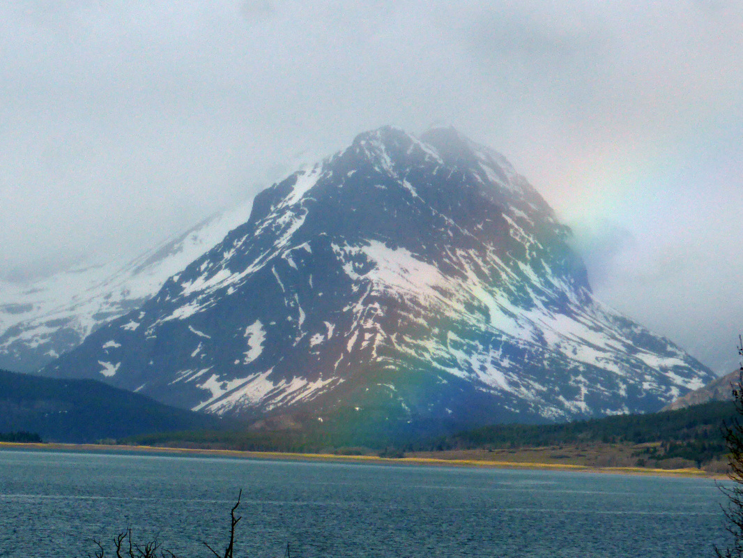
It rained all the way to Browning. Duck Lake Road was thick with fog and mist; but when we turned at Babb to make the drive to Many Glacier, the sun came out. By the time we reached the shores of Sherburne Lake, a beautiful rainbow arched over Grinnell Point ending on the road, showing us the Glacier is our pot of gold.
And the day only got better as we enjoyed our hike around Swiftcurrent and Josephine Lakes. The glacier lilies as well as the spring beauties are opening and lined our path. We also so a few other flowers such as yellowstone draba and strawberries. For animals, we saw sheep, moose, goats; for birds, bald eagle, mergansers, golden eye, varied thrush, spruce grouse, so we saw all of the biggies except a bear. In fact, we didn't even see tracks. The weather was in the 40s-50s with just a light drizzle, which fizzled out as the day wore on, so many of the gals didn't even put on rain gear. But we were glad to have waterproof boots and gaiters as we were walking on snow about half of the way, which involved some post-holing at times in very wet snow. At least it wasn't very icy. We didn't make it to Grinnell lake, stopping a third of a mile short due to the stream crossing being a bit deeper and swifter than normal. We did find a decent place to cross where the bridge normally is; however, on the other side was a steep snow bank that wouldn't have been fun crossing, especially in water shoes or sandals. Instead, we ate our lunch by the creek with Hidden Falls tumbling behind us. After lunch, we climbed to the top of Hidden Falls, marveling at the canyon it carved, almost like Avalanche Gorge. As for animals, the goats and sheep, especially, put on quite a show. They were very active around the side of Josephine Lake, jumping up and down the rocks and skidding across snow fields. We even saw a herd of sheep come up and over Grinnell Point to join some others further down. The sheep all appeared to be rams; most likely the ewes are preparing to give birth and sticking to lower elevations; yet we didn't see any around the lodge, like we usually do. Instead of encircling both lakes, we backtracked around Josephine, due to much fall down and deep snow on the south-east side of the lake. Then some of us retraced around Swiftcurrent Lake, while others encircled Switfcurrent to end up at the Many Glacier Hotel, at which point the ladies climbed up to the viewing area, despite their legs being a bit worn out from hiking on snow. |
April 10, 2014: Gals Throw Down Poles: Use Hands, Butts to Handle Class III Climbing
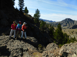
Tower Rock State Park can be a simple hike up a trail or it can be a technical climb to the top of the actual Tower Rock, requiring--or at least recommended-- rope. Five of the GiG did something in between, mastering Class III climbing as we went off trail and scrambled up the rocks, having to use our hands and feet much of the way.
Kuntzie took lead on the climbing section, finding the best routes, while also being the brave one going first down the scary parts. We only had one slight fall--and on the trail--not the climbing area. Often the trail seemed worse than the climbing as it is steep and covered with small pebbles that act like ball bearings, making it quite slippery. After getting to the top and admiring the views, we headed across the top rocks to make a loop before leaving. Kuntzie navigated over the rocks, which were precipitous at times, to lead us to the next set of boulders, which all required hands, dropping our poles and sliding with footholds, only to do the same again on the next set of rocks. We met at 10 a.m. for the 30-minute drive to the park, and got on trail quickly in the cool air. We soon warmed on the very vertical climb to the base of Tower Rock. Along the way, we saw several types of wild flowers: wild alyssum, biscuit root, arrow-leaf balsam root, fritillary (yellow bell), sumac, pasque flower, early buttercups and one shooting star. On top, we saw phlox and cut-leaf daisy. And the views of the Missouri River Valley were gorgeous in both directions. The trip was a very good one to get us in shape, with our quads and calves as well as lungs getting a good work out going up/down the trail and our balance and route-finding skills warming up on the off-trail, climbing sections. We didn't see the resident mule deer herd, which was a bit of a disappointment, but we did see their sign, so they are still around, just probably feeding in the fields for the day. We arrived back in town by 1:30. And best of all--no ticks. |
Neihart Mining District, March 31, 2016: Snow Flurries, the Word 'Surfactant' Crop Up All Day
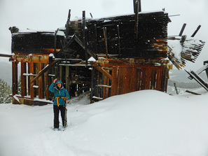
With newbie Patty along, we learned a few things about her life and another use for the word "surfactant" as she told her story about her daughter being born a premie but having enough of the substance needed to have strong lungs. The word cropped up again as Jasmine, our leader, told us about the surfactants used in the mining process. For those who don't know, "surfactant" is a lubricant that reduces the surface tension in liquid.
Anyway, our day started out at 8 a.m. with rain coming down in Great Falls. The roads were a bit of a worry as it was already snowing in Neihart, according to the weather report, with rocks and possibly ice on the road, but we headed out anyway, letting Jasmine know we might be a bit late getting to the Inconvenient Store, our meeting place. We arrived around 9:30 and wondered if Randi's front-wheel-drive vehicle would make it up the road as it had snowed about six inches and no one plows the Carpenter Creek road. But we decided to give it a shot. Jasimine loaded up Tip, the dog, and we followed her to the turn off point, which we quickly discovered would not be a good idea to go farther in Randi's car. So we all hopped into Jasmine's Honda CRV, five gals and a dog, for the wild road trip of three miles. Jasmine handed the car well, and the car, in turn, handled the deep snow well. We hit the trail about 10:15 as the snow really started to come down, but the wind wasn't bad, thwarting the prediction of gusts up to 40 mph. We had a lovely climb to the top of the mining area with Jasmine doing the majority of the trail breaking in the new fluffy stuff. We all though it looked like Christmas, rather than late March, with the trees laden with snow and near blizzard conditions. On the climb, we came across several mining structures, all collapsed, and we could glimpse the mill far up on the hill off and on through the trees. Jasmine led us to the Glory Hole, a huge mining pit from the silver boom days. She said it was visible from space; and the hole has a protective fence all around it as the ledge was steep. In the hole, we spied a huge nest in a side cave. It would either be a big bird/raptor or perhaps a porcupine, which like to find alcoves and caves. At the hole, Tip the dog got afraid. She put her trail between her legs and slinked off. We wondered if she sensed the danger of the drop off or if there were magnetism or if perhaps the contaminating chemicals affected her. We didn't stay long as the wind started to pick up and we didn't want to catch cold. So we headed downhill, with a few route finding efforts on Jasmine's part, to the actual mill. It was in quite good shape and still had the gears and machinery inside the structure, remnants of an earlier time. The rest of the trip was a quick downhill descent to the car. Jasmine had a note on her car from a neighbor, asking her to drop in. While we took off our gear and loaded the car, she went to his shop to see his latest wood-crafted items. We said goodbye to Jasmine at the highway and got back into Randi's car. We were surprised that even though it had snowed most of the day, the road was just wet, not snowy or icy, so we traveled back to Neihart to have hot chocolate, coffee and sweet potato fries at Bob's Bar. We sure hope Patty wasn't scare away by the weather or climb. We hope to see her on the trail again soon. Who went: Susan, Randi, Patty, Katie, Jasmine |
|
Lack of Snow Doesn't Hinder Izaak Walton Weekend
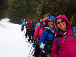
Rain, bad snow, and a cold hot tub didn’t hinder the GiG from having a fun-filled weekend escape at the Izaak Walton Inn in Essex. Fifteen of us headed out on an early Friday morning for three solid days of hiking and companionship.
We arrived in West Glacier at Lake McDonald Lodge by 10:45 and hit the trail at 11, after a trip to the outhouses, for a hike along McDonald Creek and John’s Lake Loop. We decided to ditch the snowshoes for Yaktraks since the snow was packed, very thin and even non-existent under the trees. Our choice turned out perfectly as we never post-holed at all. The day was cloudy and threatened rain early on but turned into a very sunny day. As we hiked along the snow-covered Going to the Sun Road, four deer appeared off and on, seemingly not afraid of us. McDonald Creek charmed us with it riffles and falls over stunning rock slabs; the snow held out on this part of the hike. We ate our lunch just before the bridge on a rocky outcropping along the edge of the creek, enjoying the breathtaking views of Mount Cannon and Edwards. After lunch, we crossed the bridge, climbed to the road and continued onto John’s Lake. This part of the hike quickly turned to a muddy trail, making some of us wish we had stayed on the road. However, it was nice to view the lake with its icy covering. We didn’t see any moose or signs of them either, unfortunately, even though this area is known for the critters. After our five-mile hike, we headed into Apgar to visit the gift shop and get a view of Lake McDonald with the surrounding mountains before we went to Belton Chalet for dinner, where we met up with Shelley from Kalispell. Our dinners were mixed, with most thinking the food much too spicy. One gal had a pile of peppers and not much of a sandwich left after removing them. The soup was spicy; the tofu dish was very hot. The gals who ordered the strip steak said their meal was fantastic; the bread was fabulous and the drinks inexpensive. Then we left to check into the Izaak Walton. We had a few surprises with futons not made up, not enough towels and a missing key for one of the rooms. Then those who tried the hot tub found it much too cold and got our right away, so after a few games of Left, Right, Center, most of us retired early. It was fun to have Marta join us for a round before she left with her husband. Then it was up early the next morning to find no coffee made at 7 as promised. In fact, no one showed up until 7:50. We finally got coffee at 8, and breakfast ran late, causing us not to get on the snowshoe trail until 9:30, a half hour later than expected. The five who wanted to ski got their rentals all set for the afternoon with the help of Gumby; we planned to ski when the snow wouldn’t be so icy after a night of rain. It was still drizzling when we hit the Essex Creek trail, but it quickly turned to sunshine. Ten of us continued onto the Towering Pines and Pileated trail, while four returned to the lodge. We all met up for lunch, at which time it started pouring, so we didn’t head out for our ski and/or second snowshoe at 1:30 as predicted. But an hour later, it once again cleared. The skiers found their gear all put away and had to have another person re-outfit them. But by this time, three decided not to ski after all. However, Cathy got to try cross-country skiing for the first time with Sara, Mary, Kathy and Katie, while seven others snowshoed the Essex Creek Road and Dickey trails. The skiers beat the snowshoers into the lodge and some had an early dinner to save money by eating off the lunch menu. Most enjoyed their meals, while some thought the soup had too much salt. Those who had the flourless chocolate torte said it was amazing. The late dinner crowd had some interesting entertainment when Cathy replaced the cream in the pitchers with Bailey’s Irish Cream. When the waitress went to refill the half-full creamers, Cathy quickly grabbed a pitcher and poured the “cream” into her coffee, while Michele did likewise with the one near her. The waitress didn’t know why everyone was laughing hysterically. That night, Cathy organized “game night” by having us all play shuffle board, pool, Shut the Box, and foosball in teams of two or three. Then she handed out “prizes” pilfered from her and Anita’s overnight bags, such as Scope, sewing kits and trial-sized lotions. Luckily for those wanting libations, the gals had brought plenty of wine as no one manned the bar at the Inn. The next morning, we were pleased that Kate from the Flathead hiking group met us for breakfast and joined us on the morning hike to the river, led by Marta, who filled us in about how the fires had transpired last summer, pointing out the burns. The hike of 3.5 miles led downhill to the Middle Fork of the Flathead, which provided a nice uphill exercise for the day. Then, at noon, we packed up and hit the road for home. The gals opted out of any more hiking for the day, so we didn’t stop at Marias Pass, instead driving back via Choteau in order to catch the Tundra swans and snow geese on Freezeout lake. We did see some swans on the east side of the highway, but not many geese were in Freezeout, which was a bit disappointing. We added two more members to the 100-Miler Club: Anita and Cathy! We arrived back in Great Falls around 5 p.m., two hours ahead of prediction. |
Kathy's Quinoa RecipesMexican Quinoa Salad
1 cup quinoa 2 cups water 1/4 cup extra virgin olive oil 2 limes, juiced 2 tsp. cumin red pepper flakes 1 tsp. salt 1 1 /2 cups halved grape tomatoes 1 15 oz can black beans, drained & rinsed 3 green onions, finely chopped 1/4 cup cilantro, chopped Directions: 1. Bring quinoa & water to boil in saucepan. Reduce heat to medium low, cover, and simmer until quinoa is tender and water has been absorbed (10-15 minutes). Set aside to cool. 2. Whisk olive oil, lime juice, cumin, 1 tsp. salt, & red pepper flakes together. 3. Combine quinoa, tomatoes, black beans, & green onions together in a bowl. Pour dressing over quinoa mixture; toss to coat. Stir in cilantro, season w salt & pepper. Serve immediately or keep chilled in the fridge. Curried Quinoa Salad 1 cup dry quinoa 2 cups water 1 Tablespoon curry powder 1 tsp. cumin 1/2 tsp. crushed red pepper flakes pinch salt 1. Bring above ingredients to a boil in medium saucepan. Reduce heat to medium-low, cover, and simmer until quinoa is tender and water has been absorbed, 10-15 miutes. Set aside to cool. In a large bowl, combine: 2 medium carrots, finely shredded 1 can chick peas (garbanzo beans), drained and rinsed 3 thinly sliced green onions 2 granny smith apples, cored and chopped 1/4 cup toasted pumpkin seeds (2J's) 1/2 cup finely chopped cilantro In separate bowl, mix: 3 T. extra virgin olive oil 1 T. apple cider vinegar 1 tsp lime zest juice of 2 limes Toss dressing mixture w/ quinoa and vegetable/fruit mixture. Refrigerate until cool. Valerie's Quinoa Salad (this is one that my daughter-in-law made up) 1 cup quinoa, (mixed colors of quinoa if desired - red/white) 2 cups chicken stock Directions: 1. Bring quinoa & chicken stock to boil in saucepan. Reduce heat to medium low, cover, and simmer until quinoa is tender and water has been absorbed (10-15 minutes). Set aside to cool. 2. Add bell pepper, mix of colored peppers (good way to use up those mini peppers!) 3. Add Corn (fresh or frozen- sauteed ahead of time in a bit of butter and minced garlic) 3. Add cherry tomatoes, halved 4. Add Cilantro- roughly chopped 5. Add feta cheese, crumbled right before serving. Serve chilled. |
Slushy, Sticky Snow and a Frozen Beer Round out the Day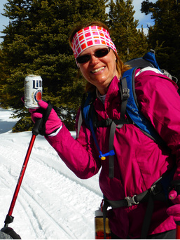
The snow conditions were less than ideal for Jean's first time out on snowshoes, with wet, sticky snow on a very warm day (in the 40s and 50s). In fact, she got a taste of less-than-ideal equipment when her snowshoes acquired 10 pounds of built-up ice around the claws.
Luckily, we had an extra pair of snowshoes in the car, so Katie went back to get them; otherwise, Jean's first day out may have been her last as she would never have been able to make the five miles with the extra tonnage. To make matters a bit worse, most of us were battling left-over coughs from previous colds while Katie's was just starting. Besides that and a bit of a strained muscle and two falls, the trail held few surprises and not too many snowmobiles either, which surprised us as we saw hordes of them when we stopped at Silvercrest for a potty break on the way up. For some reason, they stayed down low and didn't come up to the Kings Hill area, which was fine with us. We didn't have the danger of facing a whizzing sled around any corners. We did find evidence of them, however, when we happened upon a beer can in the snow. But it wasn't a can--it was a full, frozen-solid beer. It really was a gorgeous day, with blue skies and a light breeze. The trail winds uphill for about a mile, then flat and downlhill for three miles, and then back up again for the last mile, in fact, straight up the Powerline. Those of us with televators were happy to have them. After we loaded up our gear, we headed to Bob's Bar for some sweet potato fries (and mushrooms and onion rings). We discovered the first person not to like the sweet potato fries: Jean. It just left more for the rest of us. Who went: Susan, Bonnie, Jean, Anita, Katie |
Two Medicine, Feb. 21, 2016: Four-wheeling down Two Med road to go to Trick Falls, Lake
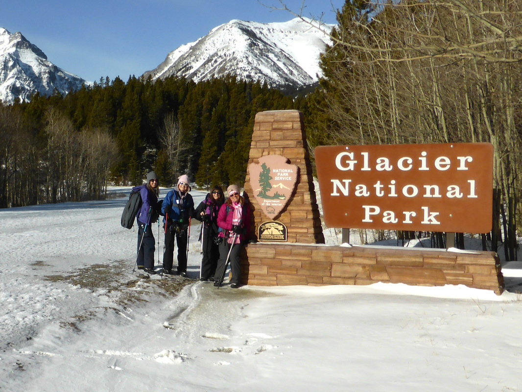
"Yes, let's take bikes; no bikes due to a new skiff of snow; yes, bikes will be better," so went the conversation as to whether we should try to bike down part of the Two Medicine Road instead of hiking the entire way. Katie's friend Terry said we could drive in 1.5 miles with a high-clearance vehicle and then bike almost to Running Eagle/Trick Falls parking lot, but we decided against the idea, which proved to be for the best since it had snowed three inches the day before..
The day started off at 6:30 a.m., with a gorgeous yellow-orange almost-full moon lighting our way to Conrad. The night sky lifted to reveal the Rocky Mountain Front awash in the white of new-fallen snow, so the entire ride was stunning. When we arrived in Browning, we had a text from Marta, saying she was going to meet us at the Two Med Road/Hwy 49 junction and sure enough, she was there when we arrived. The road started out right away with snow drifts; Katie started leading but she wasn't sure how Marta's smaller Subaru was handling, so then Marta took lead and stopped about a half mile down the road in front of a formidable snowbank, less than the 1.5 miles we had anticipated. So we got out and geared up. We did have a time strapping on snowshoes to our packs, adding in yaktrax as well as anticipating what we might need on this trip as the road was intermittent snow mixed with half dry pavement. For about four miles, we enjoyed views of our old mountain friends Rising Wolf and Sinopah while we were able to get by with just our boots, and then a half mile from Trick Falls/Running Eagle Falls, we strapped on the snowshoes. The falls were very pretty with the snow on the surrounding mountains and on banks of the Two Medicine River. We were surprised at two things: no water in the tributary, so we could walk right over to the falls without a bridge and the bathrooms at Trick Falls parking lot were open. We enjoyed a sunny lunch at the falls overlook (it was 11:30 when we arrived) and discussed if we wanted to continue to the lake, which would add four more miles. We all decided to give it a shot, but about a mile from the lake, Katie and Brenda turned around while Marta, Cathy and Anita kept going. Brenda and Katie arrived back at the car at 3 p.m. and noticed another car had plowed through two more snow banks, getting about a third of a mile farther down the road, so they packed up their gear and drove the car gingerly down so that when the others returned, they wouldn't have to walk the last third of a mile uphill. Soon after, Brenda spied three people approaching the car (at 3:45). Katie didn't think there were any way it would be our gals as they hiked two more miles than we did, thinking instead it was three gals we passed on the way in; however, it was the rest of our crew. They had hiked two more miles than Katie and Brenda in only a half hour more AND on snowshoes! The gals who went to the lake reported that it was entirely frozen over still and that they enjoyed a snack at the bench near the shore. All day, we saw tons of moose tracks, both a mama and a yearling, but we never saw a moose. We also saw coyote scat and tracks, along with mice, squirrel and rabbit evidence, but we didn't spy any actual critters at all. The day started a bit cloudy but cleared to a bright blue, mixed with plenty of wind, which was to our face going out and to our backs coming back. We finished the day with dropping in on Katie's friend to say we had made it and to check on his mother Doris, who had fallen and broken an arm. Then we headed down the road to have dinner at the Lighthouse Restaurant in Valier. We arrived back in Great Falls at 8 p.m., worn out. Who went: Cathy, Marta, Anita, Brenda, Katie |
|
Weekday Jaunt up Shorty Creek in Little Belts to Get Out of Wind
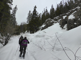
Gail and Katie joined Jasmine and Tip the dog from the Inconvenience Store in Neihart for a quick trip up Shorty Creek. The beautiful canyon lies at the base of the O'Brien Creek trail and is sheltered from the wind, so it was a perfect choice on a 40 mph gusty day.
The Shorty Creek trail can be an eight-mile loop; however,, we went up three miles and retraced our steps for a total of six. A snowmobile had been up the trail a few days before so we really didn't have to break snow. The trail follows the creek on a fairly easy incline. We appreciated Jasmine showing us a new snowshoe area. She said she was trying to get a guiding permit and had us fill out a survey. Good luck to her on her new business showing others the beauty of our wonderful Montana and helping others enjoy the great outdoors. We ended the day with sweet potato fries at Bob's Bar. |
Silvercrest Twice, Feb. 5, 6, 2016 We Felt Like 'Revenant' Extras on Winter Trails Day
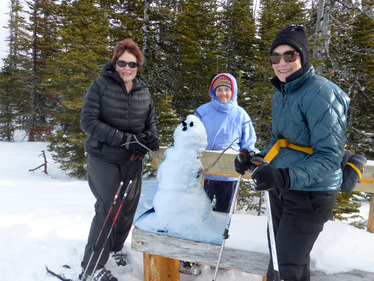
Four of the GiG broke trail at Silvercrest before our volunteer day at National Winters Trail Day at Silvercrest. Both days were breezy, but once we got our of the parking lot and into the trees, it wasn't bad at all. However, the few times we were in the open, the snow kicked up into our faces, making use feel like a scene from the hugely popular Revenant film that is getting all of the Oscar buzz this year. Winter Trails Day started out with us asking ourselves why Katie volunteered us to lead hikes; if we had'n't been counted upon, we probably would have turned around as it was driving rain in Great Falls when we left at 8 a.m., turned to sleet by Armington junction and blowing blizzard by Neihart with whiteout conditions. We just kept thinking that NOAA predicted partly sunny. Well, the saying of always go to the trail head proved true as right before the first hike started, the blue skies poked out as the wind blew the clouds away. But the wind didn't stop but it was tolerable with 40 degree weather and sun. Katie/Toni and Gail/Cathy each led two snowshoe hikes around the trails, with a break in between for a bite to eat: chili dogs, fresh fruit, followed by Great Harvest cookies and Chai tea and hot cocoa and coffee. We ran into many people we knew among them our own Bonnie who brought a friend to try snowshoeing. Overall, the day was fun and great way for us to give back, since we once were the beginners on the trails ourselves. Who went: Friday--Gail, Katie, Randi and Doris; Saturday--Cathy, Gail, Toni and Katie |
Gorgeous Canyons, Sunsets and Garbage Burgers Rule the Day
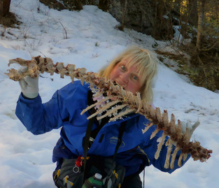
Five of the GiG headed out on an MWA hike the North Fork of the Judith River out of Utica for a snowshoe down the limestone canyon and cliffs overlooking Yogo Creek and the river. We met up with others at the Oxen Yoke before going to the trailhead at 10 a.m. (we had to wait 40 minutes for one person who didn't show up).
After we arrived at the starting place and put on our gear, we headed out toward the pictographs, following the river, enjoying the limestone caves cut into the cliffs on either side of the banks. However, the ice became too precarious to continue, Kathy fell through ice and snow, but luckily she had tall waterproof boots on. Tnen one of our hike leader created a large cracking boom with his footsteps where the canyon narrows, at which point, it was decided to turn around and not continue. So we backtracked and then continued on to Yogo crossing, where motorized and non-motorized paths connect. This nice broad area in the sun provided a nice lunch spot. We then continued down Yogo creek and some decided to continue even further to where the road overlooks the river. Three headed back to the cars, not wanting to hike the extra mile. This extra part had many ups and downs with not much snow, so we ditched our snowshoes for part of it. However, there was one very icy section on a steep up- and then downhill. Those with yaktrax or other ice cleats were happy to have them. Also during this last section, we can across a deer carcass just below a cliff. We surmised that a mountain lion had crouched above and jumped down on the unsuspecting deer as it traveled down the road to the river for water. Cathy had fun pretending it was her dinner. Our real dinner included Garbage Burgers at the Oxen Yoke (the burgers have grilled onions, mushrooms, bacon and cheese plus jalapenos if you like). We were very surprised that such a small establishment could handle our large group of 15 plus the other four full tables and those sitting at the bar. Our food arrived quickly and all at once. Our waitress was able to keep up with our drink orders and "extras" that we requested. On the way back to Great Falls, we were treated to a gorgeous sunset highlighting the Highwood mountains and Square Butte. Who went: Sara, Gail, Cathy, Susan, Katie NOTE: Sara earned her way into the 100-Milers Club on this hike |
|
Memorial Falls, Jefferson Creek, Jan. 10, 2016: Frozen Falls, Crystal Creeks Sparkle under Blue Skies
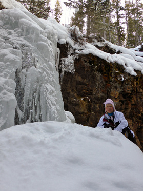
After two days and nights that included below-zero weather, the gals were glad to find some sunshine to highlight the snowy landscape.
Four of us headed to the hills--the Little Belts--for a snowshoe to Memorial Falls, followed by lunch at the car and then a short run up Jefferson Creek, just to where Chamberlain Creek crosses the road.
We were surprised that the pull-out just after Memorial Falls isn't being plowed. In fact, markers have been put up prohibiting plowing altogether, so we had to hike about a half mile and park at the Jefferson Creek parking lot in order to reach the falls.Luckily, we had light traffic, which was also surprising since we expected quite a bit of skiers headed to Showdown on such a nice Sunday.
Memorial Falls never disappoints in the winter as it always looks different. This time, it resembled an elaborate cave formation or off-center wedding cake. After visiting the main falls, we headed up the hill to upper falls and short distance beyond. The lack of snow was evident as branches and fallen logs weren't covered yet. And we really didn't have a base, the powder so fluffy we sank right down to rocks in many places.
After our falls fix, we returned to the car for lunch before heading for our jaunt down Jefferson Creek. On this part of our hike, we met Jane Weber on skis as well as several other snowshoe parties. Unfortunately, there is no sign indicating snowshoe etiquette to stay off the ski tracks, which frustrates the skiers, whose tracks are wrecked by snowshoes. We did try to explain to the other snowshoers whom we encountered to please stay off the ski tracks.
We had a fun hike along the creek, venturing off the main trail at times to keep the water in sight. It had some gorgeous frozen ponds with crystals glinting in the sun. We marveled at all of the animal tracks we saw, mostly large ungulates, possibly both elk and moose along with rabbit tracks.
At the end of a 2.5 mile hike to add to our previous 2.5 miles to the falls, we returned to Great Falls by 2:30.
Powerline Loop, King's Hill, Jan. 6, 2015: Foggy First Snowshoe of 2016 with Killer Hill Doesn't Deter the GiG
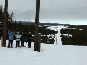 The gals made it to the top of the monster hill. The gals made it to the top of the monster hill.
It was a frosty inversion day with temps in Great Falls at 11 degrees when we headed out at 8:30 a.m., but the temperature slowly rose as we climbed King's Hill to a balmy 22 at 10 a.m. when we hit the trail. By the end of the day, the thermometer would register a tropical 36 but fall to 14 when we arrived in Great Falls at just after 4 p.m.
The drive was interesting with much fog and much smog from wood stoves settling in over the Belt valley. On King's Hill, the day started sunny with absolutely no wind, but a cloud hung over the area producing slight snowfall. We all marveled over the complete silence in the absence of even a breeze. This trail was a first for the gals. It starts on the O'Brien Creek trail, dips down to Silvercrest E-Loop and then has a killer-climb up the Powerline trail back to the parking lot. Once you hit the bottom, the area is multi use, but this being a weekday, we didn't encounter any snowmobiles until the very end of our hike, near the parking lot. However, we did observe one other person on what appeared to be snowshoes, way up the power line ahead of us. We may not have liked the steepness of the incline on the Powerline trail, but we enjoyed using our televators, some of us for the very first time. The televators really do help on vertical slopes. Of course, having the uphill at the end of the hike was a bit of a challenge but everyone made it to the top with relative ease. This trail probably could be dangerous on weekends as many sleds will be whizzing around the power poles. After the 4.5-mile day, we drove to Bob's bar for sandwiches and sweet potato fries. On a side note, this was Doris's first time out after her hand surgery and she did well! She only felt some slight pain in her wrists. And this was the GiG's first trip out for 2016! Happy new year. Who went: Randi, Susan, Doris, Gail and Katie |
|