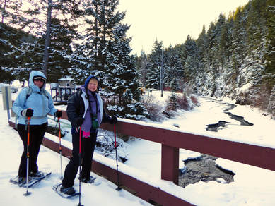
Crawford Creek, Dec. 17, 2017: Three Gals Enjoy Solitude along Crawford Creek
The hike was full, then people started dropping like flies. Too bad they missed this gorgeous hike, out of the wind, on a gorgeous day.
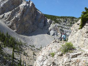
We parked at the Belt Creek Ranger Station for our hike up this beautiful creek. We went about 1.5 mile up the hill before turning around at the last livestock gate, right before we broke into the open area. We decided it wouldn't be very good to get out in the open as we would be exposed to the wind that had been dropping blizzards of snow from the trees at intervals, causing us to cover our faces until it stopped.
Otherwise, the hike was magical, taking us through old growth forest, covered in fresh powder. The snow wasn't deep at all,making us think we could have been fine in ice cleats or yaktrax instead of the heavier, bulkier snowshoes.
Kuntzie did a marvelous job of trail finding since no one else except rabbits, a coyote and a few deer had traveled up this coulee since the snow fell. She complained a bit when the animal tracks occasionally disappeared.
Since we all wanted to get back to town early, we didn't stop to eat. However, we did stop at the Cougar Canyon to drop off a donation in lieu of attending the benefit for the owners. We lamented the demise of the Lazy Doe and the Cabin and hope that this new restaurant that inhabits the old Cub's Den will be able to make it.
We left at 8:30 in the morning and returned to town around 2.
Who went: Jeanne, Kuntzie and Katie
Lighthouse Restaurant, Dec. 13, 2017: Saying Goodbye: Last Dinner at The Lighthouse
We prayed for good roads, not a sure thing in December in Montana, but we got our wish for the final drive to a favorite restaurant, just ahead of a predicted storm.
The Lighthouse was one of our favorite places to eat after a long day hike in beloved Glacier, a great finish to many wonderful days shared with friends.This eating establishment had been for sale for a while, with no takers, so the owner's son purchased it and plans to turn it into living quarters for a summer home. The last day will be New Year's Eve.
So, of course, we had to say goodbye with a final meal, which wasn't an easy thing to do. Katie called in October and already the slots were booked for large groups. Finally, the owner found one day where he could accommodate 10 people: Dec. 13. We had hoped for a weekend so that we could fit in a hike ahead of time, but no such luck. But that didn't deter the gals who had to make it a long day after work.
We did have a half hour wait in the bar, giving us time to visit and look at the few remaining wood carving pieces the owner had left in the showcase--not many at all.
So 10 of us headed up at 4:45 for a laughter-filled dinner of chicken, halibut, walleye, blue-cheese steak, apple walnut salad with salmon and mud pie for dessert. Everything was wonderful, tender and perfectly done. Doris, who is from Valier and Christi, from Conrad, reminisced about the restaurant. Christi remembered how popular it was for prom dates. And Kuntzie snagged a menu as a souvenir.
Then on the way home, we were treated to the Geminid meteor shower, the best of the year, the comets streaking past our front window until we arrived back in Great Falls at around 10 p.m.
Goodbye, old friend, we will miss you after the trail.
Who went: Christi, Mary S, Kuntzie, Maria, Deb, Roni, El, Sue, Doris, and Katie
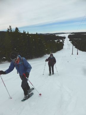
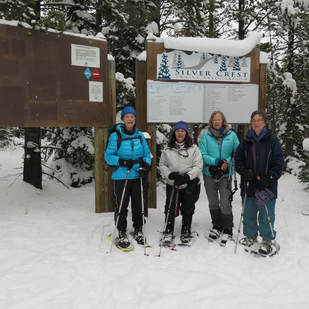
Silver Crest, Dec. 9, 2017: Day so Gorgeous We Wanted to Bask in Sun All Day
aThe wind was howling when we left Great Falls, making us think we might have a cold snowshoe trip despite the sunny day. However, Silver Crest was windless, not even a breeze. We wanted to get out the lawn chairs and read a book it was so lovely. But instead we hit the trail for the almost-three-mile loop on the new trail, stopping to enjoy a quick lunch at the warming hut. Although there isn't much snow, the base kept us from tripping over too many branches.
As we arrived back at our car, we met up with Jasmine, who said she wasn't able to groom as the equipment had broken down. She told us how she was running for the legislature and planned to lead us on another adventure in the Neihart mining district this winter. On the drive up, Katie was a bit tenuous, remembering a few weeks before when she was in the car when Maria's car hit a deer. We did see a few herds in the fields, but not many and not any on the road, thank goodness. An update on Maria's car is that it was totalled, so she will be getting new one. Of course, she didn't get the full amount, but at least everyone was safe. She did give advice on not to take the first offer the insurance gives--dicker for a higher amount when they say it is totalled. Back to the trip: Since we all had to be back early for Christmas parties, we forewent stopping at Bob's for a snack or drink and headed straight home, arriving back in town by 2:30. A glorious days with glorious gals and a big thank you to Carolyn for sharing her pictures. Who went: Carolyn, Cathy, Susan, Sue, Brenda, Jeanne, Katie |
Porphyry Powerline Loop, Nov. 15, 2017: Hitting Deer Almost Ruins Day and Car
It was bound to happen with all of the traveling we do at dawn and dusk and with all of the hunters stirring up the deer, not to mention the bucks in the rut chasing does; yes, we hit a deer or should we say poor Maria's car hit the deer. We all felt so very sad for the white-tailed doe. But we couldn't believe how calmly and logically Maria handled the accident when her brand new Ford Edge was basically ruined.
We were lucky no one was injured. We were lucky we had two cars. We were lucky we had cell service. The accident happened 6.7 miles south of Armington Junction around 8:30 a.m. We were all really paying attention and Maria driving cautiously as we had already seen several deer near the road and herds of them in the fields. However, the doe jumped out of the bushes right in front of us--no time to brake. The whole front end Maria's white car was smashed with liquids leaking all over. The airbags did not deploy, which we thought a bit odd, given the hard impact. In fact, it was so hard that the passenger door wouldn't open due to the front being pushed back into it. But Maria, Katie and Mary N were completely unhurt. Maria kept insisting that we all go on ahead while she handle insurance etc, but all of us wanted to make sure she wasn't left alone on the side of the highway. Suzie called the highway patrol, while Maria dealt with AAA and her insurance. Luckily, a Forest Service truck happened along right away and took care of the deer and dragged her way off the roadway, and then they threw the big chunks of the car off the road as well and cleaned up some of the debris; About 45 minutes later, the highway patrol came and then AAA. As we waited, three more deer, including a large buck, also crossed the road in front of our cars, and at different times, so this area must be a main crossing for animals. Then, after we determined that Maria was safely in the hands of the wrecker, four of us got into Nora's car and decided to go on a modified snowshoe anyway. We got on the road just before 10 a.m. Since we only had one car and couldn't drop one off for a shuttle as was the original plan to hike from Kings Hill to Silvercrest, Katie decided we would do the same hike except loop back around on the PowerLine trail; however, she didn't mention how "uphill" it would be at the end of the hike. And she missed the O'Brien Creek turn so we got in another half mile and lots of of extra cardio going up, up, up. But everyone handled the slightly longer and harder hike just fine. We sure missed Maria and thought of her throughout the day, hoping the wrecker ride back to town turned out okay and that her husband wouldn't be too upset about the new car. But Maria kept repeating that a "car is just a 'thing'" emphasizing she wasn't upset about the damage and that she was glad everyone was okay. Instead, she fretted about the deer as we all did. The day was a gray day, with much wind, but in the 30s, so it was bearable. Overall a nice snowshoe but it could have been a better day. We are thankful that we are all okay. Who went: Nora, Mary N, Suzie, Katie |
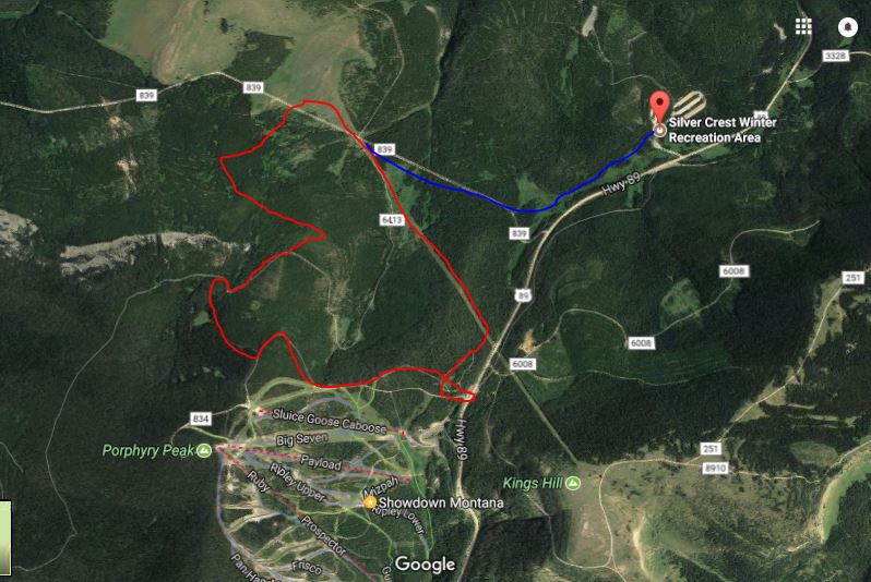
Click to enlarge. Red is our route. Blue what we were supposed to do.
|
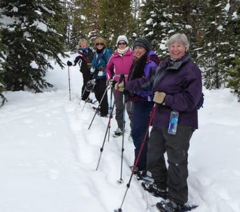
Silver Crest, Nov. 11, 2017: Silver Crest Twice in One Week; Snow is Best in Years
The snow is unbelievable and so much of it for this time of year; Great Divide and Lost Trail have already opened, the earliest in over 50 years. And we found the almost two feet at Silver Crest to be perfectly set up with a base and nice powder on top. So we took the long trail but cut off the last half mile or so, which wasn't broken yet.
With just six of us, we all piled into Katie's traverse at 8:30 a.m, hit the trail around 10 and made it to the warming hut around 11:30 a.m. in time for a snack. We didn't have any wind in the trees and found just a slight breeze out in the open. Overall, it was a warm day, in the 30s, yet the snow didn't get mushy. The trail was already broken by the gals who went on Wednesday. We made it to Bob's Bar for lunch around 12:30 and were back in town by 3 p.m. A perfect first-time out for most of us. Who went: Randi, Bonnie, Sue, Anita, Susan, Katie |
|
Silver Crest, Nov. 9, 2017: Breaking Trail Not Too Bad on a Snowy Day
 Thanks to Carolyn for the photos Thanks to Carolyn for the photos
What a difference a year makes! This year the snow is already setting up nicely in the LIttle Belts unlike last year that never really produced too much white stuff in this area. In fact, the snow was powdery on top but with a good base developing below, so that when we did have to break trail, it wasn't too bad. And part of the trail had been broken already and some of it by elk.
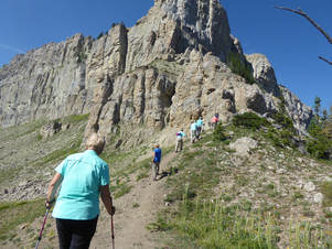
It was Carolyn's first time out, as she got to try her brand new snowshoes and backpack. And she did well on this moderately easy three-mile hike. One challenge was the branches and rocks that weren't quite covered all of the way with snow yet. We got tangled up in slicks and small tree trunks a time or two. After a quick snack in the warming hut, we headed back to the cars for lunch at Bob's Bar in Neihart, which included sweet potato fries, of course. On trail we saw plenty of elk and bunny tracks along with some cat tracks, but we didn't see any animals. It was a gray day, turning to snow in the afternoon with a slight breeze; we were glad to make it home an hour ahead of our predicted 4 p.m. end time. Who went: Carolyn, Maria, June, Janel, Katie. |
|
Seeley Weekend, Oct. 28-29, 2017: Golden Larch Lure Gals to Seeley for Weekend at Mary N's Cabin; Gals Rescue Dog along the Way
Our overnight fall hiking weekend began early Saturday morning as Gail and Jo Ann rode with Cathy while Roni and Paula joined Beth in her car. About five miles out west of Lincoln, we noticed a medium sized black dog scampering along the highway...all alone. There was no sign of hunters or fisherman in the area; the dog sprinted to the car as we pulled off the road and promptly hopped in the back seat of the car. He appeared to be injured as he had a distinct gait, but upon further observations, he only had one hind leg. He was extremely friendly and seemed so happy to see humans. We ended up taking the dog, Boone, whose name was printed on the collar, to Lincoln. The staff at the Hi Country Beef Jerky Store also noticed a phone number on his collar so they called the number and left a message. They offered to keep the dog and reunite the dog with his owner so we went on our way.
We arrived at Mary’s cabin in Seeley Lake around 10:00AM, unloaded our cars, and prepared to head our to our destination of Holland Lake Falls. The beautiful golden color of the larches scattered throughout the hillsides in the Swan Valley on our 20 mile drive to the trailhead was amazing. Some of the larches had begun to lose their needles and we noticed sporadic areas of a carpet like appearance from the needles. On our way up to the water falls, we saw very few people on the trail and the reflections of the trees in the calm water of Holland Lake was stunning. When we arrived at the falls, we ate lunch and some of us ventured on a side trail to the base of the falls to gain a better view. The weather could not have been better with clear skies and temperatures in the upper 60’s. The return trip was just as wonderful and we stopped periodically to enjoy the views and fall colors of the forest and western larch. The round trip distance of the hike was four miles was very much enjoyed by all. So what is a larch tree? The soft larch needles are about one inch long, grow in large clusters from a single part of the branch called a spur shoot in older branches and grow singly on current year branches. The trees grow to be quite tall, as much as 80-100 feet. They are a special kind of tree called a “deciduous conifer” because they form cones and grow needles, while in the fall, their needles change color and fall off the trees. And Montana Fish Wildlife and Parks states that we do not have native tamaracks in northwestern Montana. Before returning to Mary’s cabin, we took a short drive to see the world’s largest Western Larch tree at 153 feet tall, named Gus. Being over 1000 years old and surviving at least 40 fires, the tree is HUGE. It’s circumference is as large as five of us women standing in a large circle with our fingertips barely touching. After walking downtown to visit a couple of the stores in the town of Seeley Lake we enjoyed some daiquiris at Mary’s before eating dinner at the Double Arrow Lodge. Mary made us a delicious breakfast the following morning and then we drove to the pullout north of Seeley at Beaver Creek. We hiked a loop on an old logging road and admired the larches one last time. After hiking we headed back to Great Falls, with one car stopping at the Blackfoot Pathways, Sculpture in the Wild Park on the way home. We did find out that Boone (the dog we found running along the road) was taken to the animal shelter in Great Falls. Who went: Beth, Mary, Kuntzie, Paula, Roni, Gail, Jo Ann |
Roni's Corn Dip Recipe
Microwave one stick butter, one 8 oz cram cheese, one can diced Rotel, one can drained shoe peg corn and one can yellow corn. Stir and serve. Enjoy! Mary's Coconut Cake Recipe Coconut Cake
While you are mixing the cake, toast (325') the remaining ½ c or so of coconut...be careful, it will burn very easily. Check every 3-5 min and move around in pan. This is important; otherwise you will be making another trip to the market. Grease two 9" cake pans; line bottom with parchment paper and grease again. Dust with flour. Bake according to box directions, checking to make sure you don't over bake; set time for at least 10 min less. Cake should begin to pull away from edges. Cool in pans 10-15 min; then turn out and let cool completely. I cover at this point with a light cloth, to keep moist. Drizzle: 1/2 c culinary coconut milk and 2 Tbl. powdered sugar; mix and set aside. Icing
of crumb, go slow, distribute evenly. I try to end up with a top layer .... on top! Press remaining toasted coconut into icing and pat it to make it stay. It helps to set it on a cookie sheet during this process; it's messy. Refrigerate cake. |
Lovely Fall Climb to Top of Mount Ascension in Helena: Chrissie's Sister; Aunt Join Us
Nine of the GiG were joined by Chrissie's sister Carla, bringing our total to 10, for our ascent of Mount Ascension, a moderately easy hike of four miles round trip. We followed up our hike with a visit to Carol's studio to see her pottery sculptures, including her incredible "wedding cake"--see our pictures below.)
The hike was Susan's maiden climb after her ankle injury, so we were all worried about her re-injuring it or having issues, especially on the downhill, but she handled it beautifully. We even finished a half hour early, so Susan wasn't slacking at all. It was the first time that the GiG had done this fun hike that starts right from the edge of town. We all agreed that the views were terrific and that we should come back and do some more trails. Ellen, Chrissie's aunt, joined us for lunch at Benny's Bistro, where Carla works, although she had today off, thank goodness. Then we walked around Last Chance Gulch, purchasing a few things at the Four 'O Six store the wine store, the Base Camp, the Parrot, the Pan Handler and some others. On the way, we traveled the frontage road from Craig to Helena to enjoy the colors, although many of the trees had lost their leaves. Still, both coming and going, the river and colorful ground colors delighted the eyes. |
|
Cataract Peak Eclipse, August, 20-21, 2017: Tough Climb Challenges Gals, But All Make Top for Chilly, Windy Eclipse Viewing |
The GiG has had quite a year: The Chinese Wall, Crypt Lake and now Cataract Peak for the eclipse. Wow.
We decided to make Cataract an overnight. The only place that we could find rooms was in East Glacier, so we made reservations with Katie’s friend Terry Sherburne at the Mountain Pine motel. We left Great Falls at 11 a.m. on Sunday to give us a leisurely start but also provide a little time for a small hike in Two Med before the big day on Monday of the eclipse and our mountain climb.
We arrived at Two Medicine Lake around 2 p.m. and hiked to Aster Falls and then Paradise Point, stopping at the pond both coming and going to view a mama moose. On the way in, she was resting by a tree and then on the way back, she was eating in the pond. We did not see her baby but others had seen the young one before. We figured she had her little one stashed in the willows surrounding the lake. We also enjoyed observing the trees down by –and almost downed by—beavers along with their lodge.
The flowers were mostly dried up, due to no rain since June, but a few showy asters and harebells brightened our path with a splash of purple along with a few yellow groundsel.
After our hike, we headed into East Glacier to queue up at Serrano’s. While a few held our place in line (we were first and got there at 4:35), the others shopped at the Mercantile and the Little Brown Pottery house. The gals bought huckleberry and lupine earrings, unique.
After our dinner, we checked in and got all our gear prepared for an early start the next day.
On Monday morning, we got on the road just before 6 a.m. with the sun just starting to give us some daylight. We had to watch for free-range black angus on the way in addition to wildlife. We stopped at St. Mary Lodge to leave some eclipse glasses at the desk for the Canadian gals to pick up on their way as they would be meeting us at Piegan pass, but not before we climbed the peak. We wanted to make sure they had glasses for viewing the eclipse.
We got on trail at Siyeh Bend at 7:30 a.m. under smoky skies that cast an eerie, but pretty red, light on the lake and surrounding mountains as we drove the Going to the Sun highway.
And we booked it to Piegan pass, with only three parties passing us on the way. One bad thing: Sue Michels didn’t have her expensive ($280) down jacket secured to her lumbar pack. While she was looking for items in her pack, it went tumbling 50 feet down the side of the mountain. We knew we didn’t have time to retrieve it, if anyone dared do so, so we marked the spot to assess the dangers on the way back. And Catherine lost the cover to her bite-valve on her water bladder.
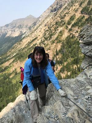
We arrived at the pass in 2.5 hours, took a a quick 10-minute break looking over the pass into the Many Glacier valley and snapped some pictures of ourselves in front of the back side of the Garden Wall before starting our ascent. Another party also decided to climb Cataract, which disappointed Katie a bit as she had thought no one else would think to climb this mountain. However, the other party turned out to be a blessing as one of the men guided us to what he called a “full frontal attack,” which proved to be a better way than what Katie usually does. This is quite a challenging climb as it passes through the Diorite Sill, an igneous intrusion in the Siyeh limestone. The talus is quite large with may loose boulders to navigate and rough rock that can cuts and scrapes hands.
Maddie and Catherine looked like they may give up several times due to the rough rocks, but they kept going, so we all made it to the top!
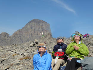
It took us exactly an hour to climb the peak, as we arrived at just after 11 a.m., stopping a few times to pull out the eclipse glasses to view the start of moon covering the sun since it started at 10:35. At the top, Anita realized she had lost her bear spray from the holster somewhere during the climb, making it three items lost so far on this trip. We all sat down (some lay down) and settled in for some eclipse viewing.
On the top, it was windy; and as we approached the height of the 89.9 percent eclipse that we would see, the temperature dropped noticeably. At its height, the sun cast an eerie greenish-colored light with odd shadows, and the wind picked up.
Several of us put on two or more layers. We were grateful that we already had gloves on from the climbing.
In fact, it was so cold, we decided to head back down before the entire eclipse was over but not before having our picture taken by the other party. And we asked them to keep their eyes open for Anita’s bear spray on their descent. On a side note, the other party was using double garbage-bag plastic for viewing the eclipse. We didn’t think this too safe.
It took us a while to navigate the boulders on the way down, so we were very happy to reach the grassy vegetation on stable ground once again. We were also happy to see our Canadian friends waiting for us at the pass. And we were happy that the other party found Anita’s bear spray. We said a quick “hi,” and “goodbye,” to our friends as they headed back down to find out what happened to the rest of their party. They think they accidentally took a wrong turn and ended up at Siyeh instead of Piegan Pass. Unfortunately, they hadn’t given each gal her own glasses, so the “lost gals” didn’t get to view the eclipse.
We took some photos of us pointing to our peak and then found the spot where Sue lost her jacket. It took us a while to locate it and were afraid someone else had retrieved it but then we did see it. Mary S volunteered to climb over the steep side and get the jacket. We all told her not to risk it if she thought the angle too steep, but she was able to get the jacket in its stuff sack and climb back up with the strap over her wrist.
We never did find Catherine’s bite-valve cover, but we felt good to retrieve two out of three lost items.
We arrived back at the cars by 3:30 p.m., a half hour before our anticipated time. We drove to St. Mary lodge for a break, some sodas and coffee as well as for Katie to leave a nice note and tip for Alfred, the desk attendant who had given the package of eclipse glasses to the Canadians. Unfortunately, he had just left for the day so sh couldn’t do it in person.
Being Monday, many small restaurants were closed, but Buffalo Joe’s was open, so we headed back via Dupuyer and Choteau. Our meal was good, finshed off with “Piegan” pie (really “pecan”); the drive back was fun as we were still high from the exciting day we just had.
We got back into Great Falls around 8:15 p.m.
Who went: Sue, Mary S, Mary N, Catherine, Maddie, Anita, Katie
We decided to make Cataract an overnight. The only place that we could find rooms was in East Glacier, so we made reservations with Katie’s friend Terry Sherburne at the Mountain Pine motel. We left Great Falls at 11 a.m. on Sunday to give us a leisurely start but also provide a little time for a small hike in Two Med before the big day on Monday of the eclipse and our mountain climb.
We arrived at Two Medicine Lake around 2 p.m. and hiked to Aster Falls and then Paradise Point, stopping at the pond both coming and going to view a mama moose. On the way in, she was resting by a tree and then on the way back, she was eating in the pond. We did not see her baby but others had seen the young one before. We figured she had her little one stashed in the willows surrounding the lake. We also enjoyed observing the trees down by –and almost downed by—beavers along with their lodge.
The flowers were mostly dried up, due to no rain since June, but a few showy asters and harebells brightened our path with a splash of purple along with a few yellow groundsel.
After our hike, we headed into East Glacier to queue up at Serrano’s. While a few held our place in line (we were first and got there at 4:35), the others shopped at the Mercantile and the Little Brown Pottery house. The gals bought huckleberry and lupine earrings, unique.
After our dinner, we checked in and got all our gear prepared for an early start the next day.
On Monday morning, we got on the road just before 6 a.m. with the sun just starting to give us some daylight. We had to watch for free-range black angus on the way in addition to wildlife. We stopped at St. Mary Lodge to leave some eclipse glasses at the desk for the Canadian gals to pick up on their way as they would be meeting us at Piegan pass, but not before we climbed the peak. We wanted to make sure they had glasses for viewing the eclipse.
We got on trail at Siyeh Bend at 7:30 a.m. under smoky skies that cast an eerie, but pretty red, light on the lake and surrounding mountains as we drove the Going to the Sun highway.
And we booked it to Piegan pass, with only three parties passing us on the way. One bad thing: Sue Michels didn’t have her expensive ($280) down jacket secured to her lumbar pack. While she was looking for items in her pack, it went tumbling 50 feet down the side of the mountain. We knew we didn’t have time to retrieve it, if anyone dared do so, so we marked the spot to assess the dangers on the way back. And Catherine lost the cover to her bite-valve on her water bladder.
We arrived at the pass in 2.5 hours, took a a quick 10-minute break looking over the pass into the Many Glacier valley and snapped some pictures of ourselves in front of the back side of the Garden Wall before starting our ascent. Another party also decided to climb Cataract, which disappointed Katie a bit as she had thought no one else would think to climb this mountain. However, the other party turned out to be a blessing as one of the men guided us to what he called a “full frontal attack,” which proved to be a better way than what Katie usually does. This is quite a challenging climb as it passes through the Diorite Sill, an igneous intrusion in the Siyeh limestone. The talus is quite large with may loose boulders to navigate and rough rock that can cuts and scrapes hands.
Maddie and Catherine looked like they may give up several times due to the rough rocks, but they kept going, so we all made it to the top!
It took us exactly an hour to climb the peak, as we arrived at just after 11 a.m., stopping a few times to pull out the eclipse glasses to view the start of moon covering the sun since it started at 10:35. At the top, Anita realized she had lost her bear spray from the holster somewhere during the climb, making it three items lost so far on this trip. We all sat down (some lay down) and settled in for some eclipse viewing.
On the top, it was windy; and as we approached the height of the 89.9 percent eclipse that we would see, the temperature dropped noticeably. At its height, the sun cast an eerie greenish-colored light with odd shadows, and the wind picked up.
Several of us put on two or more layers. We were grateful that we already had gloves on from the climbing.
In fact, it was so cold, we decided to head back down before the entire eclipse was over but not before having our picture taken by the other party. And we asked them to keep their eyes open for Anita’s bear spray on their descent. On a side note, the other party was using double garbage-bag plastic for viewing the eclipse. We didn’t think this too safe.
It took us a while to navigate the boulders on the way down, so we were very happy to reach the grassy vegetation on stable ground once again. We were also happy to see our Canadian friends waiting for us at the pass. And we were happy that the other party found Anita’s bear spray. We said a quick “hi,” and “goodbye,” to our friends as they headed back down to find out what happened to the rest of their party. They think they accidentally took a wrong turn and ended up at Siyeh instead of Piegan Pass. Unfortunately, they hadn’t given each gal her own glasses, so the “lost gals” didn’t get to view the eclipse.
We took some photos of us pointing to our peak and then found the spot where Sue lost her jacket. It took us a while to locate it and were afraid someone else had retrieved it but then we did see it. Mary S volunteered to climb over the steep side and get the jacket. We all told her not to risk it if she thought the angle too steep, but she was able to get the jacket in its stuff sack and climb back up with the strap over her wrist.
We never did find Catherine’s bite-valve cover, but we felt good to retrieve two out of three lost items.
We arrived back at the cars by 3:30 p.m., a half hour before our anticipated time. We drove to St. Mary lodge for a break, some sodas and coffee as well as for Katie to leave a nice note and tip for Alfred, the desk attendant who had given the package of eclipse glasses to the Canadians. Unfortunately, he had just left for the day so sh couldn’t do it in person.
Being Monday, many small restaurants were closed, but Buffalo Joe’s was open, so we headed back via Dupuyer and Choteau. Our meal was good, finshed off with “Piegan” pie (really “pecan”); the drive back was fun as we were still high from the exciting day we just had.
We got back into Great Falls around 8:15 p.m.
Who went: Sue, Mary S, Mary N, Catherine, Maddie, Anita, Katie
Waterton Weekend: Crypt, Bertha Lakes, Aug. 11-13, 2017: Most Giggers Say They Won't Do Crypt-Lake's Challenging Obstacles Ever Again, so They Bought the T-Shirt
Well, the second leg of the Waterton Triple Crown is complete: We made it to Crypt Lake. The Crypt Lake hike is one of the most unique hikes you'll ever encounter. It was rated as Canada's "Best Hike" in 1981. In 2014 National Geographic rated this hike as one of the World's 20 Most Thrilling Trails.
Here’s our story: On Friday, we left Great Falls at 5:20 a.m. and arrived in Waterton by 9 a.m., in time to get our boat tickets for the tour and for the 8:30 a.m. Crypt Lake shuttle for the next day. Then it was time to go back to the cars and gear up; the rush and worry over the tickets over. We boarded our vessel with tour guide Mike, whom Katie recognized as her guide from years ago. She recognized his distinctively low voice, which didn’t fit his 20-something body at the time, but now he has grown into it. Mike filled us in on everything Waterton, including the popular hikes, names of mountains, the international border, and his favorite things since he grew up in the area. We really enjoyed the one-hour tour on our way to Goat Haunt. We debarked at Goat Haunt, which is in the United States and planned to hike, wo we had to go through customs (twice in one day as we had come into Canada just two hours earlier) and have our passport stamped with the mountain goat, signifying this particular border crossing. We hiked as a group together to Rainbow Falls and had a snack overlooking this small cascade. Then seven of the 10 decided to book it to the Waterton Overlook to cross off two of Jake’s hikes while the other three took a leisurely stroll back to the boat dock. The boat left at 2:25, so it was a push to make the overlook with a smoky view down the length of Waterton Lake and back in time as this hike is up, up, up, although a short two miles roundtrip. After our short hikes and boat ride back, we had about an hour of shopping in Waterton, where we made it a point to visit Lorna’s stores, including Big Scoop Ice Cream Shop, to get some fudge and souvenirs. Luckily, Lorna was so we could say “hi,” however briefly as she was busily making fudge for the long line of people waiting to sample her wares. We also visited her Caribou Clothes shop. Then it was off to Zum’s for dinner at this Waterton staple. After dinner, we had a very rushed check-in and quick freshen-up at the Mountain View Inn “rustic cabin” before we drove to Cardston to see Music Man at the Carriage Theater. The starring role was performed by local talent Ricky Duane, who definitely has the right moves and acting ability. However, the day was long so a few nodded off occasionally. We did get to bed a bit late (around 11 p.m.) for our early morning and big hikes the next day. So it was up early on Saturday at 6 a.m. so we had an easy breakfast of yogurt, fruit, granola and peanut-butter on toast with orange juice before we headed back into Waterton for one of two hikes: the dreaded Crypt Lake or Bertha Falls and Lake, the tamer hike, although both groups faced hikes with elevation gain. The Crypt Lake hike starts with steep switchbacks out of the gate, then has a moderate section followed by steeper switchbacks and then finally the obstacle course of walking a cliff ledge that leads to a ladder that ends at a very low natural tunnel that requires some crawling, followed by climb on the side of the rocky mountainside with an iron cable to cling to. Most of the gals said the scariest part was the top of the ladder that was a few rungs short of reaching the entrance of the tunnel. It required a scary step or two on the rocky edges and using poor handholds on the sides of cave entrance both coming and going. Thankfully, men helped a few of us both directions and Sue helped several on the way back. After the obstacles, it was a short walk to the gorgeous cirque lake, where Katie and Beth decided to take a plunge into the cold water, still fed by some snow fields. Very refreshing. Then it was a reverse of everything with all of the gals letting out a sigh of relief and saying a prayer after the last ledge was completed. The rest was all downhill from there, as they say, except for a thunderstorm that gave us a bit of a scare when a bolt hit close by. Some had questioned whether we needed rain gear. The answer is always "yes"!. We caught the 5:15 p.m. boat back to the dock, where Anita announced that she didn’t care if the t-shirt were $40; she was going to buy it no matter what after surviving. The rest of us headed for the car. When Anita came back, she told us the shirts were on sale for half price. That convinced us all to go buy one. Then we headed to the Prince of Wales hotel to meet with the Bertha Lake group who were going to reserve a table. However, none was available so we sat in the lounge with a beautiful view. But the flies were very annoying and every table had several "fly"-ers on it explaining that since we were in a national park, the hotel staff wasn't allowed to kill the flies and to "let the flies be flies." Some of us wondered if flies were an endangered species or why they couldn't put out humane traps and then let them go outside instead of all over our food. Again, we had a late night, but this time instead of watching a play, we relived our day of hiking by looking at Beth’s cellphone pictures. She really got some nice ones. The next day, we had nice late start and a full breakfast of pancakes with blueberry sauce or real maple syrup with walnuts, bacon, cheesy eggs, orange juice and fruit! Wow. We cooked up a storm and then headed out for leisurely strolls to Blakison Falls and the Red Rock parkway before more shopping in Waterton. Again, the gals got more fudge and bought more clothes at Lorna’s store. In fact, many of us got matching purple and bright green windbreakers that say "Waterton Park Canada" on them. We plan to wear them to the eclipse hike. Anita had a saying we all liked. She said, "My husband asked me why I shop. I asked him why he hunts.". After a quick late lunch at the infamous Wieners of Waterton, we headed home, arriving before 7 p.m., tired but all happy from the great hikes, great laughs and fun comradery of our group. Next year we tackle the third leg: Akimina Ridge. |
|
The Bob and Chinese Wall, July 22-July28, 2017: Six-Day Trip to Prairie Reef, Chinese Wall and Many Adventures
“And into the forest I go, to lose my mind and find my soul.” -John Muir
The WALL: After month's of preparation, two cars with eight gals and tons of gear headed to the Stage Stop Inn in Choteau for our evening of meet, greet and get ready for our six-day trip into the Bob (Bob Marshall Wilderness). We arrived at just after 3 p.m. and met the gals from Dropstone at 4 p.m., whom we followed to their work site, a large outbuilding on one of the gal’s mother’s place just out of town. Here, we were given more details about our tip, including how each day would, hopefully, proceed. We also had our gear weighed and only one of us was overweight and had to remove a few items. We were allowed 20 pounds, which included our tent, pad, sleeping bag, headlamp, toiletries and extra clothing. We carried our lunches and day packs each day along with raingear, jacket, first-aid supplies. We also had to make our lunches for our first day. We were introduced to our hiking guides and packers: Julie and Maggie (co-owner of Dropstone), packing; Nicole, cook and guide; Aubra and Bonnie, guides. Bonnie was the newbie in training for Dropstone. Although she had backcountry experience, it was her first trip to the Chinese Wall. We were all worried about the extreme dry, heat and smoke from wildfires and requested a very early start. So we agreed to meet at 6 a.m. for the drive to Benchmark, where we would start hiking. I don’t think any of us slept well that night. Day One: 11 miles, 1,000 feet of gain, Camp on Reef Creek for two nights “If you are lucky enough to be in the mountains, you are lucky enough.” -Unknown After a very hurried breakfast at the Stage Stop Inn, we headed at 5:45 to Dropstone’s headquarters where we loaded the van, put our overnight gear, cellphones etc., into the their shed so they wouldn’t overheat in our cars. The road to Benchmark was a washboard ride, but we got on trail by 8:15 a.m. We really did well up until lunch time, traveling at over 2 mph, but afterward, the sun beat on us and we started to fade. On the trail, one pack train going in passed us while three were headed out, but really the trail wasn’t too crowded at all. However, it was dusty and very overworn. We enjoyed looking back at Patrol Mountain, remembering our past climbs and visits to see Samsara in the lookout. We eventually separated into two groups, one going a faster pace. This group arrived in camp at 1:30 p.m. while the other got in at 2 p.m., both ahead of our pack train. Nicole went to the river to scout a camp and she got her first choice. To get to it, we had to ford the river, so we were glad we had carried our wading shoes/sandals with us. The cool water felt good on our feet as we made our way to our camping spot. We barely beat the pack train led by Maggie and Julie. We rinsed off in the river (no soap allowed in wilderness), and set up our tents, some with help from the guides, while the cook set up her area (Shared tents: Katie and Mary S, Mary N and Kuntz, Julie and Deb, Roni and Sue) The guides slept in tents by the horses to listen to anything strange at night. Our meal was stew, bread and kale salad with parmesan with a cookie for dessert (Katie had a lentil stew). We had crackers and cheese for an appetizer and a box of wine along with tang laced with electrolytes to drink. Everyone was tired, but Maggie prepped us for the dreaded Prairie Reef climb the next day. Some wanted to get up very early to start climbing before the heat but the earliest the guides said they would get breakfast would be 7 with a trail start around 7:30 a.m. Maggie explained that some could go just to the saddle so they got a view of the wall while others could go all the way to the lookout. Kuntz declared she wasn’t going at all and would hang out in camp. Katie thought she might change her mind. But we had the added worry about both Mary’s having blisters and several others having hotspots. The blisters, along with heat exhaustion, were the number 1 and 2 issues the guides said they dealt with on these trips. Luckily, packer Julie was also a paramedic, so we sought her advice throughout the trip. She checked on the Mary’s while Maggie pulled out the medical supplies. Then Kuntz entertained everyone with her stories incriminating herself, including one story involving Dr. Bergman, not realizing that guide Audra was Dr. Bergman’s sister-in-law. We all howled at that one. She also did a demonstration of her husband’s dancing along with examples of her awful cooking. Maybe she had a bit too much of the boxed wine. Then we washed up, visited the latrine (a hole dug in the ground with a rope around the tree to help us balance over it). Whenever someone went to use the “facilities,” she took the shovel and followed the pink marking tape to the spot. After doing our “business,” we shoveled dirt over it and put the shovel back so that we knew when the “bathroom” was free. What our camps were like: a set area for the “kitchen” with a table; camp chairs around a campfire area where we ate and gathered to hear about the next day (to get out of the chairs is a challenge—Sue said, “Nose over toes” is the way to do it; a drip system of drinking water hanging from a tree; a wash-up station with biodegradable soap that is not near the river for washing face and hands; an electric fenced area away from our camp for the two horses and six mule;, and our tents spread out in an area away from the food area. The bathroom consisted of a hole dug in the ground way away from our living/eating areas, with the way to it marked with pink marking tape. And everyone took a turn doing dishes after dinner. The guides handled them at breakfast for us. Flowers we saw: Fireweed, and more fireweed, showy fleabane daisy, harebells, goldenrod, tall buttercup, potentilla/cinquefoil, Indian paintbrush. Day Two: 12 miles, 3500 feet of gain, Prairie Reef “I’m on the top of the world looking down on creation…” -The Carpenters We rose in time for a 6 a.m. breakfast of cherry almond oatmeal for our big climbing day. Mary N and Kuntz decided to take a down day and just hang out at camp, Mary to rest her blistered feet. The other six headed to conquer the big daddy hike of the trip: a climb of Prairie Reef with 3500 feet of gain over 12 miles. We got a later start to the day as we had to ford the river again, which necessitated those with blisters to doctor their feet after the crossing, which took around 40 minutes to complete. We got on trail around 8 a.m. instead of our hoped-for 7 a.m. However, we made good time and reached the saddle by 10 a.m., despite most of us carrying four liters of water and our guides carrying six, in case anyone ran out as there is no water on this trial aside from a mud wallow. At this point, Sue and Mary S decided to call it quits for the day. Mary’s blisters were really bad by now, affecting most of her toes on both feet. So Deb, Roni, Julie, Katie and guides Bonnie and Maggie headed up the final 1.5 miles to the top while Nicole returned to camp with the other two. Once we left the saddle, a very nice breeze came up, helping us with the heat as we were now in the exposed area above the treeline. Roni and Deb shot out ahead with Bonnie, reaching the top 20 minutes ahead of the others. Then they headed back down, while Julie and Katie explored the lookout, the Osborne Fire Spotter and the “outhouse” with a view to discover how Rick, the lookout, lived. Guide Maggie pointed out the various peaks to us, including Rocky, the highest point in the Bob; Holland, Swan, Twin Peaks, the Flathead Alps, Red Buttes and Silvertip. She also showed us Cliff Mountain, the highest point on the wall, near our climbing spot, as well as where we would be climbing the wall. The 360-degree views, of course, were spectacular, and two of the gals felt this was the best day of the trip. Rick, the new lookout, was very friendly, sitting outside and visiting with our party as well as another that also climbed to the top. He talked about the elk that visited him at the lookout and how the resident marmots had chewed the cork handles on some hikers’ poles while they went inside the lookout, proving you do not want to leave your gear unguarded or the critters will munch on it. Rick also said he hadn’t had any bears on Prairie Reef yet, but that he hears wolves nightly. The way down was hot, hot, hot! And twice Julie lost her hat to a gust of wind, but faithful guide Maggie chased it down both times, even when Julie said to let it go. The heat made us just want to get down as quickly as possible. The first group was down by 3 and the second group by 4 p.m. When we got back to camp, we learned that Audra had to ride back to benchmark with a mule in tow as the gals had forgotten a saddle bag of food. Nicole had discovered it when she was getting items out in preparation for supper. So Audra rode 24 miles on her “off day,” when she was supposed to be on light duty. The predominate flowers we saw were showy fleabane daisies, buckwheat (both Sulphur and white), various paintbrush. Our dinner was black-eyed peas with sausage (fake sausage for Katie), rice, onions, celery, lemon and sun-dried tomatoes with brownies for dessert. And Kuntz entertained us with her usual stories. Many of us rinsed our clothes in the river in preparation for moving camp tomorrow with an early rise of 6:30 a.m. so we can hit the trail by 8. And no one had been sleeping well as one horse camp let their livestock wander at night, their bells keeping us awake. Day Three: Hike to Base of Wall (Cliff Mountain camp), 11 miles, 2500 feet of gain “The mountains are calling and I must go.” -John Muir Mary joined the “Creek Club” today, a club Kuntz dubbed after several had taken a spill in one water hazard or another. Bonnie took a tumble in a waterfall while Susan fell in the Two Med River on other trips. Mary succumbed to one of the nine stream crossings, one that had a log over it. The creeks were Grizzly Bear, White Bear, Black Bear, Grizzly Gulch, No Name, Pine, Red Butte, and the West Fork (really a river) two times. We did hit the trail at 8 a.m. after a breakfast of granola, either hot or cold, on a very pleasant morning temperature-wise. Again, the gals doctored their blistered and mustered on. We ate lunch just past No Name Creek, at a campsite, where someone had irresponsibly dumped about three pounds of dog food. Audra and Nicole carefully scooped it up, put it in a plastic bag and hauled it with us. This dog food would have attracted bears and other creatures to a camp site. The other options besides hauling it out would be to disperse it in the stream, making some fish food of it. Along the way, Katie spotted huckleberries well as grouse whortleberries and strawberries and she and one guide stopped to pick them. Later, the others who were traveling in front noticed the berries too. This prompted Ron it say, “The only thing that Deb stops for is huckleberries, “ as Deb was the speed demon of the group. After a while, it got very HOT! We struggled in it for about three miles until we spied the “wall,” which gave us a second wind. Except for Kuntz, who said, “Where’s the wall? All I see is a big rock!” She actually thought the Chinese Wall was a man-made structure in the middle of the wilderness. Of course, we didn’t point out that she thought we were planning a flight to China when she first signed up for the trip. At this point, Mary N said, “Attention: The Great Wall of China is NOT in the Bob Marshall Wilderness.” We all got a laugh at Kuntz’s expense. But Kuntz got us back: Around the wall, was beautiful bear grass and more bear grass, still in bloom, so we all took many photos, prompting Kuntz to declare her famous, “Keep moving. Bear grass is bear grass.” As we neared our campsite for the next two days, an old cowboy-type packer was standing at the junction in the trail to tell us to turn there, indicating that Maggie, Julie and the mules had gone that direction. It was nice of him to stand there to point the way for us, except he told us we had eight more miles to go! Good thing he was kidding as most of us were ready to be done for the day. Then we saw the pink marking tape. One guide and several gals went ahead but lost the trail. This time, Kuntz regained her standing after her Chinese Wall comments by finding the way for us and leading us to the campsite for a much-needed rest after a long day. The way was very mucky but through a tall-grass meadow with very unusual swamp flowers: White bog orchids and bright pink elephant heads along with showy fleabane daisies, arnica, Lewis monkey flowers, valerian, and Indian paintbrush. The guides created this campsite bathroom up a hill and over several downed logs, presenting quite an obstacle course to reach it. Everyone hoped she wouldn’t have to get up in the middle of the night to use it. Kuntz again revived her reputation as she showed the guides how to “core” the toilet paper so that it rolled easily from their draw-string bag holder. A few of us rinsed off in the nearby creek. However, several of us go the itches from no-see-ums, which lasted a few days, since we didn’t have other water sources to wash off. This small creek had been trampled and fouled by stock, so several gals disinfected their water twice, just to be safe. Dinner was pulled pork with coleslaw. For Katie, Nicole used Jack fruit, which looked like pulled pork, but the texture was different and the flavor sweeter. And tonight, the gals built a campfire; the smoke followed Mary S, no matter how many times she moved to another spot around the campfire, so Katie quit sitting next to her tent partner. Another note to our evenings: Maggie brought along her dog Rosie, a part healer, part collie, very fun dog, who was constantly bringing sticks to each of us to throw. Kuntz was the gullible one, who kept throwing sticks, so she soon became Rosie’s fav. We went to bed dreaming of the Wall and our climb set for tomorrow. Day 4: Climbing the Wall, 7 miles and 1200 feet of gain “It is one thing to decide to climb a mountain. It is quite another to be on top of it.” -Herbert A. Simon Coffee at 7 a.m. and a hot breakfast scramble of eggs, cheese and sausage greeted our day, the day of climbing the Wall, the day we all came for, the day we all hoped everyone make despite blisters and tired legs. We left camp around 9:30 and headed to Trick Pass, a pretty easy climb to a pass that really doesn’t go anywhere, but it does abut the Chinese Wall, so we took the opportunity for a group photo of us kissing the rock face. From there we dropped to Moose Lake, a small tarn surrounded by meadows and moss, a bit of a bog. We refilled our water bottles, but it did had a lot of detritus. Also, this area held some snow, so we collected some that the guides said we could use in snow cones. However, the gals had other ideas: using the snow in alcoholic drinks and calling the drinks “Chinese Ditches” in honor of the wall. Then it was on to the bushwhacking part followed by climbing. Guide Maggie went ahead to scout the trail and was soon back with a game plan. As we started up, we all saw an image of “Mother Mary” as Mary S. called her projected in a shadow on the part of the wall that we would climb. We couldn’t resist taking pictures of her and proclaiming that she was on our side, a bunch of women of a certain age setting out on a climb we all hoped to accomplish. We also wondered what would happen if the Wall became a shrine with pilgrims visiting to see the “vision.” At first the climb wasn’t too bad, our poles helping us up the steep slope. Then we it came time to stash our poles and start using our hands. Some of our guides took our hiking sticks in their packs. Some of the gals even gave up their entire packs for the guides to carry the rest of the way. Others decided to carry their own. Then, right when some of us were balanced in precarious positions, three down-climbers insisted on coming down before we gained the ledge, refusing the right of way to uphill travel, which is customary protocol. So we clung to our rocks, bracing ourselves, as they skirted around us, one gal almost slipping as she tried to avoid us. In all, it made the day a bit more interesting to tell the tale. And we all made it! We all made it! Once we got on top of the first part, we had another small stretch that also required scrambling, but then we were there, surprised at the gentle angle of the slope on the other side. We got our pictures, put our “sticks in the air,” and sat down to a much-earned lunch, knowing that going down is usually more treacherous than going up. During lunch, we had a good laugh at Kuntz as she thought she was the only one to get leftover pulled pork for lunch. Was she surprised when we informed her that what she was eating was Katie’s jackfruit, vegetarian substitute! Then for the down-climb, Kuntz almost went down the wrong slot until the guides caught her making a bad mistake; however, Kuntz redeemed herself later in the day when she again led us back following the marking tape impeccably. Sue, who bruises easily, was wearing tape over her arms, which worked well. However, we did have two casualties. Mary N fell coming down. She put a cut in her chin and two good bruises on her left arm. The other casualty was Kuntz’s water bottle that took a tumble down the wall. The guides retrieved it but it does have a dent, giving Kuntz a souvenir of her Wall, I mean “Rock” adventure. She also ended up with a rip in her pants. But overall, we didn’t’ have any real accidents. That evening, everyone was happy since we all made it not only to the wall, but on top of the wall. The guides were glad and said we all did an excellent job and that we shouldn’t say we weren’t very good hikers because they thought we were. Maggie said it was the first time on one of their trips when all the guests made it to the top of the wall. We felt a bit proud of that accomplishment. We enjoyed our appetizer of chips, salsa and guacamole followed by rice and beans. During dinner, Ray Mills, the outfitter who showed us the way came to visit. He turned 80 this year and one of his partners is 90, he said. He also said he had been in the back country for 60 years, first for the forest service as a back-country ranger and then outfitting. He couldn’t believe the condition of the trails and talked about a permit system to help keep the crowds down and the destruction of the wilderness to a minimum. It think the wind disappeared quickly on this night. Katie asked Maggie to explain high impact camping and how Dropstone tries to mitigate the impact on the land by limiting the poundage of belongings the guest bring in, fixing simpler meals, etc. In this way, they do not need to bring in so much stock, so the trails aren’t as damaged and the meadows less grazed. The guides also explained how the outfitters get permits to take in guests. That night and the next morning, a mule was making much noise. Maggie explained that mules get very attached to horses and the other outfitter had taken the guests on horseback to watch the sunrise, so the mule was crying for his horse. It was a bit unnerving. The flowers we saw on the Wall day were a bit different from the rest as it was still earlier in spring: fringed grass of parnassus, monkey flower, columbine, milkvetch, mountain heath, heather, and tons of bear grass in bloom rather than going to seed. Days Five and Six: Heading Out “Never in my life have I seen so many women on the trail. You win, girls, you win.” _Packer who passed us on the trail After the Wall, everyone was eager to get home, some even suggested that we hike out in one day instead of taking two to cover the 18 miles. It is kind of a letdown to have two days to walk after accomplishing both the Wall and Prairie Reef climbs. However, we hiked the 12 miles on day five so that on our last day we would have just under 9 to go. Our last two breakfasts were steel-cut oats with dried fruits and then granola again. I think everyone was a bit sick of oats and yearned for some protein, but we were getting down on the food and the load lightened for our packers and our mules. Audra set a good pace that suited most of us on Day Five and we stayed together as a group for the first time on the trip. Day Six saw us in two groups again. Our last evening, we reminisced about our adventures. Mary N said she took the prize for most falls: fell when crossing the river, fell coming down from the wall while picking stickseed off her pants and fell on the trail when looking at some tents and tripping on a root. “Three’s a charm,” she said. Nicole said we were “barn sour” and eager to get home ---and to a shower-- we all thought. However, we did rinse off In the West Fork of the Sun River, which was so much better than the stream with the no-see-ums. Maggie said she had never had a group get to camp so early, often beating the stock. Our last dinner was spaghetti with humus and cheese for an appetizer. The gals finished off the last of the wine, calling the last drops “Bobinay” which stood for “Chardonnay in the Bob.” Afterward, we played a game called Thorn, Bud, Rose, where everyone had to say what part of the trip they didn’t like or something that annoyed her (the thorn), what she was looking forward to (the bud) and the best part of the trip (the rose). The roses: Everyone getting to the Wall; Prairie Reef and climbing the wall; being with accomplished women; Bonnie, the guide; being part of our group’s bucket list; everyone’s goodness and kindness; taking all members of a group to the wall, which is a first for Dropstone. Our last day ended early, with us off trail by 2 p.m., on a hot and dusty and smoky day that saw tons of horse and mule train traffic, all going in for the weekend. Even though a part of us may have wondered if they all would make the Wall and a small part may have wanted to go back, we were glad to get back to our cars and drive home to see our families to tell tales of our adventures. “Of all the paths you take in life, make sure a few of them are dirt.” -John Muir 66 miles Who went: Julie, Roni, Deb, Kuntz, Mary S, Mary N, Sue, Katie |
|
Bullhead Lake, July 19, 2017: Iceberg Trail Closure Prompts Gals to Change to Bullhead Lake
Three Giggers arrived at the Swiftcurrent Motor Inn parking lot and headed up to the trailhead at 8:45 am only to discover that the Iceberg-Ptarmigan Tunnel trail was closed due to recent bear activity.
Fortunately, the trail to Bullhead Lake was an open option for us to explore. We headed up the alternate trail which merges with the main Bulhead Lake trail that beckons folks from the Swiftcurrent Motor Inn parking lot. The trees along the way and many beautiful wildflowers offered a cooler trek for us and provided a canopy from the full sun of the day for portions of the lower trail. The trail was blanketed with fields of Indian Paintbrush, Fireweed ,Sticky Gernanium, Wood's rose and Huckleberries to name a few that we were able to identify. The trail was very dry and dusty and the flowers along the trail were covered by dust which somewhat dimmed their brilliant colors. The remnants of flowering Bear Grass were everywhere, having lost their beautiful white flowers and leaving behind brown sticks. We made our way up the trail stopping to enjoy Redrock Lake and the beautiful Redrock Falls before heading up the trail to Bullhead Lake. The close up view of Swiftcurrent Pass and theater of mountains is spectacular to say the least and allowed us to watch backpackers as they made their way down the pass from their overnight adventures. On our return trek, Cathy and Sue stopped to remember Chrissie and Julie with memorial stones that they dropped in the water near Redrock Falls. Our unexpected surprise at Fisher Cap Lake, was viewing a Momma Moose feeding while she stood in the lake near the shore. She seemed to struggle to maintain her footing and with each step sunk down into the muddy bottom. There were rumors that she had a baby nearby which we did not see. All in all, it was a great day even though we didn't get to see Iceberg Lake. We finished the day by stopping at the Swiftcurrent Motor Inn cafe for a little refreshment before heading back to Great Falls. Who attended: Sue M. Cathy K., and Emily. |
Snyder Lake, July 16, 2017: Red Flag Day Doesn't Deter Gals as They Hike to Lake
Despite the awful heat of the last few weeks, the GiG saw a window of an 80-degree day to take a trip to the Lake McDonald area for a hike we had never done: Snyder Lakes. Eight from Great Falls were joined by two from Eureka, with Katrina being a newbie to the group.
Luckily, this hike is shaded most of the way for the 10 miles round trip. The lake sits in a beautiful cirque of rocky peaks with waterfalls spilling over the top. However, the lake doesn't have much for a shore, but we were able to find some rocks to enjoy our lunch. as we watched the merganser ducks dive for their dinner. The trail is also overgrown in parts, so watching out for Devil's Club and nettles became a priority. We didn't go to upper Snyder lake as the bushwhacking would not have been pleasant and the bugs were pretty fierce. We started the day at 5:30 a.m. and got off trail by 3:30 p.m., an hour ahead of schedule. After the hike, we said goodbye to Madelon and Katrina as they headed back to Eureka; on our way out, we got stopped by a traffic jam. We suspected a bear or other animal on the trail, but after a half hour, we saw the culprit: the trail horses were on the loose with wranglers trying to round them up. After that delay, we continued our adventure by having dinner at the Summit, another first for the GiG. The views from this restaurant are fabulous and our food was too, although a bit on the pricey side. Dinner did take a while, so we didn't get out of there until 7:30, 2.5 hours after we arrived, which put us home at 10 p.m. Who went: Cathy, Sue, Mary S, LInda, Catherine, Brenda, Bonnie, Katie, Madelon and Katrina |
Two Med Lake and Upper Two Med, July 11, 2017: Bear Grass is Bear Grass as Photos Slow Gals
Bear grass ruled the day as seven gals hiked in the Two Medicine area. It was hard not taking pictures, which slowed the group as they posed for many shots of the gorgeous white plumes.
All seven walked the north shore to Upper Two Medicine Lake. Then two took the boat back to the foot of the lake while the other continued to loop the lake, finishing the entire circuit, minus a car shuttle. Who went: Beth, Gail, Jean, Joanne, Sue, Anita, Cathy |
Deadwood and Florence Falls, July 2, 2017: Fantastic Falls Dominates Water Features; Rare Flowers Fascinate

The bear grass lamps lit our way down the trail (Roni quote) as the large white flowers bordered each side of our path most of the way to Florence Falls.
Our day started at 5:30 a.m. and we arrived at St. Mary Falls trailhead at 8:35 to pick up Marta and then continued to Jackson/Glacier overlook to meet Madelon to make our numbers eight for the day. We hite the trail at just before 9 a.m. and finished our 10.5 mile day at 4 p.m. The trail heads straight downhill for about a mile before leading to Deadwood Falls, our first stop of the day, where we enjoyed a break watching the spilling cascade of water from the safety of the large red rocks along the edge. We climbed down the rocks, getting numerous vantage points of this canyon-type falls that is similar to Avalanche gorge, particularly in the fall. From the falls, we continued on to the Reynolds Creek campground, which required crossing a hanging bridge. This campground is the place where the 2015 fire of the same name started.Here, we wandered through the campground to more cascades. The camp does have a pit toilet and horse area. At this junction, we said goodbye to Gail and Jo Ann, who wanted a more leisurely pace. They took the cut-across trail to go to St. Mary Falls and then back to Going to the Sun Road to catch the shuttle back to the car while we continued on to the gigantic Florence Falls, one of the largest waterfalls in the Glacier Park. Along the way, we encountered tons of moose country terrain: beaver dams and willow ponds, but we didn't see any moose today, just dropping and hoof prints. Some folks on the trail said they saw moose at Gunsight Lake, but we wouldn't be traveling that far We also didn't see the bear that was frequenting the area; however, we did run into two parties who did. They both confirmed it was a black bear. When we reached the falls, we were amazed at how much water was spilling down the rocks. The falls is so large, that it is hard to see the top portion unless you bushwhack up a climber's trails, which both Madelon and Katie did. After a nice lunch at the falls, we hit the trail again, this time in some real heat. We drank a ton of water but still some of us ran out, having to refill our bottles when we hit Reynolds Creek and the hanging bridge again. This time, instead of returning the way we came, which would require a mile of uphill travel, we took the cut-across to St. Mary's trail. This trail travels through the burn and, boy, did we see the wildflowers in this stretch, particularly, lance-leaved groundsel, arnica, and fireweed. We also saw willowherb, larkspur and harebells. We did see some unusual flowers: Rock Harlequin--Pale Corydalis (Corydalis sempervirens)--and tons of mountain hollyhock. We all said we had never seen so many before. Both of these flowers were in the burn area along St. Mary Lake. After our hike, Marta gave Madelon and Katie a lift back to their cars and then Madelon and Marta continued up Logan Pass to their homes in Eureka and Essex while Katie turned around and picked up the east-side gals, who ate at Two Dog Flats Cafe at Rising Sun before returning to Great Falls at 9:15 p.m. On another note, Maria made her first long hike and Debbie joined GiG for the first time. Who went: Marta, Madelon, Debbie, Maria, Gail, Jo Ann, Roni, Katie |
Cracker Lake, June 22, 2017: Fun Day with Canadian Friends at Amazingly Aqua Cracker Lake
We had to be “early” girls for this long drive and long hike to Cracker Lake with our lady friends from across the border. Our meet time of 5 a.m. came early as six of us made our way to Many Glacier to meet the six Canadians for our 14-mile hike.
We hit the trail at 8:35, which put us, unfortunately, five minutes too late to avoid walking behind the first horseback tour. This hike shares the first two miles of trial with the trail rides, which makes this stretch a bit unpleasant, especially on the return trip. But we didn’t let a few road apples or pee-muddied spots ruin our day, as it was filled with cascading creeks, waterfalls, wildflowers, wildlife and a gorgeous milky aqua lake at our destination. The trail was a bit busier than normal, probably due to the other more popular trails being still closed. Even so, we did have a few snow drifts to cross as well as some rock-hopping to get to the bridges across Allen and Canyon creeks as the water is still high and flowing outside the normal boundaries. We saw a few wildflowers on the first four miles of the trip, but once we hit the alpine region, the spring colors started to pop: glacier lilies literally lined our path, silky phacelia clustered together on the rocks, and many-flowered stickseed blended with the newly spouted bright green grasses. We counted over 30 different wildflowers. After we reached the lake, we had a nice chat with some fellow hikers, who agreed to take our group shots for us. Then we headed to the large rock by the camp site to eat our lunch. During lunch, we enjoyed watching the antics of a huge hoary marmot and a goat on the cliff above us. It is probably was the nuisance goat that comes after unattended—and sometimes attended—backpacks. We saw one other goat on our way back, but no bears or moose, although we saw signs; and on the return trip, three of the gals in the lead heard huffing and a growl right where the trail was dug up in a place that hadn’t been disturbed on our hike into the lake. After lunch, seven of the 12 opted to go to the head of the lake, passing by the old mine along the way. These gals logged a full 14 miles on the day while the others enjoyed the scenery some more and went back to the foot of the lake to wait for the others. At 2 p.m., we all met back up and returned to the Many Glacier Hotel where the U. S. gals had dinner; we kept a steady pace, ending our hike at 4:40, 50 minutes early than expected. After eating, we explored the new spiral staircase and remodeled downstairs, which now contains the gift shop that is in the space of the old Heidi coffee and snack shop. However, there is a separate coffee/snack shop. The spiral staircase is an updated replica of the original to the hotel that was removed when the old gift shop was placed over the top. The new conference room, where night shows and ranger talks will take place isn’t yet complete. We arrived home at 9:45 p.m. after enjoying an outstanding sunset on the way home. What a nice way to end a beautiful day on the second day of summer. Who went: Laura, Lorna, LaVern, Sue Ellen, Dixie, Marilee (Canada); Sue, Cathy, Brenda, Jaye, Ellie, Katie (United States) |
Willow Creek Falls, June 20, 2017: Flowers Dot the Day of Views and Lost Poles
It was a day of wildflower ID. Some of the gals set out to find 25 different varieties. We counted over 40 on this gorgeous trek along the Rocky Mountain Front,a day that promised to be breezy, but we didn't mind the wind as it cooled us in the sun at the end of the day.
Besides the flowers, we saw fossils (some of the gals took home a souvenir or two), a snowshoe hare in its summer coat, and the set of three waterfalls along Willow Creek. We found it hard to believe that within 80 miles of Great Falls we have such beauty, so we all counted ourselves lucky when we sat down by the cascading Willow Creek to eat our lunch. We remembered Chrissie and talked about several of the hikes we had with her and again, felt lucky to be alive, realizing that we never know when it is our time to leave this wonderful world. We left Great Falls at 7 a.m. and arrived back home before 4 p.m., after a long stop in Augusta to visit the General Store and then have ice cream at Mel's Diner. At the diner, Jaye found a stray cat and wanted Katie to take him home. We asked the counter person at Mel's and he said he had been feeding that cat but that the cat needed a home. He told us we could take him. He was a very loving cat, but Katie decided she better pass for now on bringing a kitten home. But he sure was cute and got a couple licks of huckleberry yogurt from her. One a side note, Gail accidentally left her poles by the trailhead --but no worries, Katie's husband was hiking in the area the next day and picked them up. Gail was happy as the poles had been with her on many a trip, including the Dolomites. Who went: Jaye, Gail, Sue, Katie |
Gold Butte, June 9, 2017: A Butte of a Day with our Canadian Friends
Even though we were warned of gumbo roads from the rain the night before, we braved the two-track to get to the Gold Butte trailhead. Fourteen of us met in Sunburst for this somewhat crazy ride, filled with gate crossings and ruts (six from Great Falls GiG and eight from the Canadian hikers group). Our backup plan was West Butte, but we were able to drive the roads--the howling wind dried them quickly.
Thank goodness the day wasn’t too hot as this hike is a steep climb (about 2500 feet of gain over 2.4 miles), but we did wish for a bit less wind as the gusts made a few lose their balance on the rocks a few times. The meadows on the way up were filled with wildflowers: golden pea, prairie smoke, lupine, prairie rose, sulfur buckwheat, stone seed (gromwell), with some chickweed, spring beauties and a few shooting stars hanging in there. On the way up, we left two of our gals huddled against the wind as they didn’t quite have their summer legs on yet. We promised not to forget them on the way down. Once we left the steep grade and uneven clumps of the meadow grass, we were happy to get on the rocky talus game trails that were switch backed and at a more reasonable angle. The wind did howl around the butte, however, making this stretch a bit treacherous. A few gals stumbled when they caught gusts but the only mishap was a bloody arm. Several questioned if we should continue due to the wind. The leaders forced us on—saying we had come this far, we need to tag the top and sign the register, even if the wind is too bad to linger long. At the top, the wind miraculously died down, making for a wonderful late lunch with 360-degree hazy views; we could the Rocky Mountain Front, Badger Two-Medicine, Glacier—barely, as well as Writing on Stone Provincial Park. Twelve gals summited. Along the way and at the top were American Indian prayer flags and a medicine bundle as this is a holy site for Montanan and Canadian tribes. We signed the register and took group shots before deciding to say goodbye to such a special place. The way down was precarious at times as we picked our way down the rocky slope. This time, it was the grass that was a welcome reprieve from the loose stones that threatened to throw us off our feet. But we all made it down safely; and we managed to find our two comrades, patiently awaiting our return. (one small mishap: Sue scraped her arm when she fell on the rocks). Before jumping in the cars, most of us wandered to Miss Jessie Rowe's grave that is along on the hillside (actually, there are five other unmarked graves). She--and the others--were left behind when the graveyard was moved to the Gold Butte cemetary due to an underground spring disturbing the graves. Read more here. And her grave posting on findagrave.com We drove the quarter mile up the road to see the old mine and almost slipped into some deep ruts created by a truck going through the road when it was gumbo. Kuntzie did an excellent job negotiating the ditches before we turned around and headed into Sunburst, saying goodbye to our Canadian friends and then heading to Shelby for dinner. Thanks to our cell phones, we found a nice restaurant in Shelby to rest our feet and have some much-needed food after our strenuous hike. We raced to get into the restaurant—and use the bathroom—before we realized that no one had let Ellie out of the way back seat. We joked that we had “left the baby in the car.” We shared many other laughs over our dinner. The meal was quite nice—many ordered the prime rib—however, the service was so slow, due to only one waitress on a Friday night. We felt sorry for her, but it took us two hours and 20 minutes to eat and pay our bill. We finally got up and went to the bar to pay. This made us get into town at 9:30 p.m., way later than expected. Who went: Cathy "Kuntzie." Katie, Anita, Ellie, Bonnie, Sue |
Flesher Pass and Sculpture Garden, May 31, 2017: Orientation Hike Provided View, Flowers,Art
On Memorial Day, five of us left Great Falls at 8 a.m. for Flesher Pass. On this holiday, we expressed our thankfulness and honor for the men and women who died while serving in the U. S. military.
Gail led the hike to orient Jo Ann and Catherine to the trail since they will be co-leading a National Trails Day hike there on June 3. Thank you Gail, and thank you for driving, Catherine. Also, thanks to Katie for organizing the hike. It was a lovely sunny day with a slight breeze. There was snow on the mountain tops. We were grateful there was none on the trail. Along the trail, we encountered a few downed trees, but they were not difficult to go around. There were many dead trees, both still standing and down, with beautiful lime green moss growing on them. We were treated to many wildflowers: Glacier Lily, Shooting Star, Larkspur, Heartleaf Arnica, Yellow Violets, Ballhead Waterleaf, Blue-eyed Mary, Spring Beauty, Oregon Grape, Stoneseed, Strawberry, and Mouse-eared Chickweed. After our hike, we drove to Lincoln and toured the Blackfoot Pathways: Sculpture in the Wild, an international sculpture park celebrating the rich cultural, environmental and industrial heritage of the Blackfoot Valley. Then, on Cathy’s recommendation, we had a late lunch at the Bushwhacker. Good choice, Cathy. On our way home, we talked about how grateful we are that we live in Montana where we can hike to so many beautiful places with a great GIG group. Who went: Gail, Catherine, Jo Ann, Bonnie W, Cathy K. |
Sluiceboxes to Tunnel, May 23, 2017: Flowers, Rushing Water, Sunset Highlight Evening Trek to Sluiceboxes
Mary S, Gail, June, Cathy K, and Bonnie J arrived at the Sluice Boxes Trail Head about 5 PM and were grateful for the cool breezes that accompanied us as we made our way to the railroad tunnel.
Belt Creek was running at its Spring time high levels, providing us with the rushing sounds of water that were never far from our earshot. From what we can remember (ha!) we saw Mt. Bluebells, Sugar Bowls, Oregon Grapes (?) , Arrow leaf Biscuit Root, Mt. Clematis, and a bunch of “little white flowers” that none of us could remember their names! We were greeted along stretches of the trail by White Lilac fragrances, that along with the cool breezes were refreshing and delightful. We reached the tunnel around 7PM for our ‘poles-up’ photo shot and short rest. Wanting to be back to our car before sunset, we made a small push back to the trail head, arriving about 8:30. Great timing!! While the hike was a splendid “after work” revitalizer, it was almost paled by the beautiful sunset that greeted us as we headed back into Great Falls! The distant mountain tops appeared to be ablaze in a golden fire-like backdrop. The approaching storm clouds that spread throughout the sky, with their swirls and bunching, also reflected oranges, reds and pinks that were spectacular. Ours was not the only car pulled to side of the highway to take pictures of the amazing sun set. Cameras could not do justice the intricacies and highlights of dusk-show! All in all, a wonderful way to end a ‘work-day’! |
North Fork Highwoods, May 20 and 21, 2017: North Fork Greenery and Flowers Times Two
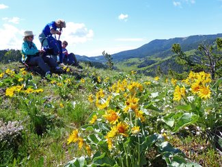
Two different days, two trips to the Highwoods, but slightly different routes. Since it rained and hailed, the Crown Butte hike had to be postponed but ladies wanted to hike anyway--so the Highwoods were a perfect choice.
On Saturday, we stuck to the trail and enjoyed the flowers along the way. On Sunday, we ventured off trail, hiked a peak and followed the ridgeline until we regained the trail adding about a half-mile to the three-mile day. On Saturday, we got out just in time to catch a large hail storm that pelted Gail's car and kept us from driving very fast. We also saw a huge coyote feeding on a road-killed deer on the side of the road. At first, we thought it might be a wolf it was so big, but a picture proved the nose and ears to be that of a coyote after all. The wildflowers were really showing their faces: sugar bowls, clematis/Virgin's bower, chickweed, larkspur, spring beauties, arrow-leaf balsamroot, Jacob's ladder, Canada violet, blue violet, yellow violet, yellowstone draba, pasque flower, shooting stars, holly/Oregon grape, service berries/saskatoons, strawberries, penstemon, bluebells, biscuitroot, golden pea, prairie smoke/old man whiskers. I am sure there were even more that I don't remember. And the green was everywhere with a bit of snow still dotting the tops of the peaks. We only ran into one motorcycle and he was on a trail below us, so that was nice too. What a nice way to get spring hiking under way. Who went: Saturday: Mary N, Maria, Bonnie, Katie; Sunday: Cathy, Linda, Brenda, Mary S, Catherine, Katie |
Mount Helena, April 22, 2017: Climbing Mount Helena and Shopping Out of Town
|
Cathy Kuntz led a group of four gals up Mount Helena: Christi Kenter, Jean Jones and Anita Gazzero, followed by lunch at Karmadillo's and then some shopping at Macy's and the walking mall on Last Chance Gulch. This is an excellent beginning season hike to test your legs. Enjoy Christi's photos below.
|
|
York Hike, April 13, 2017: Rare Rose, Kelseya, Blooms along Limestone Cliffs Fascinate Gals
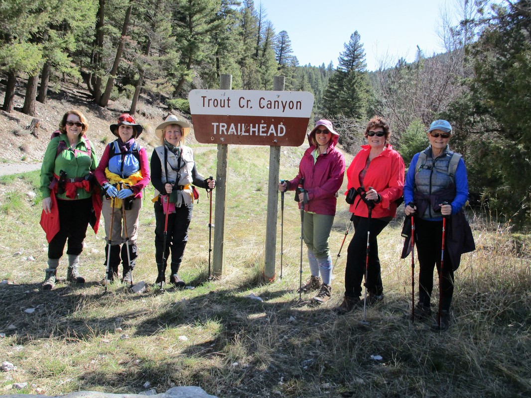
|
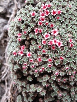
Seven gals made a four-mile up and back hike along Trout Creek to view the rare rose, Kelseya, that only blooms in Montana and select places in Wyoming and Idaho. The flower clings in mats to limestone cliffs and can be seen in the Big Belts and the Gates of the Mountains area as well as the Beartooth highway.
Read more here The gals found the flowers by a picnic table, and after a short bushwhack, they observed some patches in bloom, while others were not. After observing the flowers and enjoying the limestone canyon and cliffs along Trout Creek, the gals stopped at the York Bar for burgers. Who went: Bonnie, Cathy, Sue, Jo Ann, Anita, Gail, Carol |
Wagner Basin, April 8, 2017: Bluebird Day Brings Wind, Views, Ticks; Night of Grizzlies Revisited
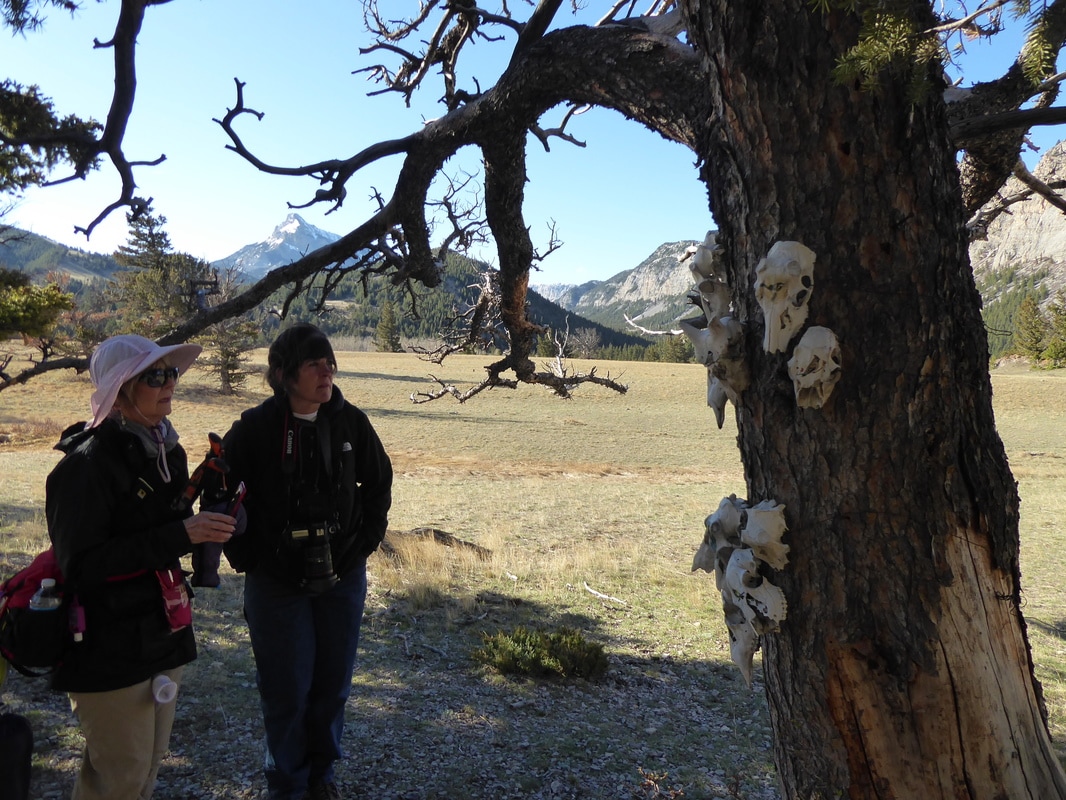 Skull Tree Skull Tree
In typical spring fashion, we brought a few ticks down the mountain with us; but other than that itchy annoyance, the day was fantastic. We welcomed Rancher Rosanna from Augusta, who put us to shame, climbing an extra 300 feet to the rock ledge above us and Mimi, who has hiked with MWA and Wayne's Wednesday Walks, but never with the GiG.
We started out by walking the scree by the pictograph cave and then across the meadow to the Skull Tree, which has pretty painted skulls, mostly with birds on them. Mary M and Ellen's niece from Dillon, Megan Royce, paints the skulls. Mary and Ellen's cabin is right at the parking area of Wagner Basin and we sure missed having them along to do some interpretation and give us background from when they were kids, playing in these mountains. All of us did very well for our first real hike of the season; we all moved up the ridge fairly quickly gaining 1,300 feet and 1.5 miles in one and a half hours. No one whined or wanted to turn around. The wind belted us while the ticks got us when we had to cross the streams, dropping when we brushed up against the willows and small aspen trees. The bushwhacking was for sure the place where those little critters clung to our clothes. Luckily, we had Rosanna along. She could spot a tick from 100 feet, or so it seemed to us as she expertly plucked--and then killed with her finger nails--the seven ticks she found on our clothing. Aside from ticks, we saw several herds of bighorn sheep, including rams with full curls and ewes with their lambs. We also saw white-tailed deer and columbian ground squirrels--and heard them chirping as they poked their heads from their den holes. The flowers were really showing too, especially the magenta douglasia that covered the upper alpine area. We also saw Wyoming kitten tails, cinquefoil/potentilla, rock cress, yellowstone draba, and phlox. But the prettiest thing might have been the majestic views of Castle Reef, the Sun River Valley, Mount Allen and Sawtooth Mountain. We walked the edge of a high saddle ridge that ran along a sheer rock wall. On top of this place were krummholtz, kinnickkinnik, and trees leaning to the east, deformed from the wind, which always blows along the Rocky Mountain Front. We made a circle around and headed back down the draw, walking on a solid stone draw that had a spring running in it. When we got back down to the meadow area, we happened upon two hikers, Dave Shea and his wife, the legendary Glacier Park Ranger from Night of the Grizzlies. We visited with him for a few minutes and then headed to Augusta for lunch at the Buckhorn Bar, which was very noisy, due to people in town for basketball tourneys. Kuntz even ran into a fellow East Middle School teacher who was reffing the games. After a gorgeous drive among the buttes with the Rocky Mountain Front as a backdrop, we got back to Great Falls by 4:30. What a lovely day. Good thing we didn't let an afternoon rain storm prediction scare us! Who went: Rosanna, Mimi, Cathy, Maria, Sue and Katie |
Essex, West Glacier March 11-13, 2017: Dangers Lurk as Gals Head to Izaak Walton on Icy Roads, Climb Trains at Marias Pass

The GiG’s adventure to Essex and Glacier began and ended with dangerous situations, from icy roads to climbing over and under trains.
It all started on Saturday morning with a hairy drive. The roads, thankfully, were good until Browning, but that’s when the fun began. With cold and mixed precipitation predicted all weekends, we caught the worst of the driving between the Two-Medicine Bridge in East Glacier until Marias Pass, about 40 miles. A big thanks to our drivers Kathy M and Bonnie J. In Browning, the temps read three degrees. At Marias Pass on the west side of the mountains, it was 26. At this point, the snow and black-ice-covered roads turned to slush. But since the ice was gone, we stuck to our original plan to drive into West Glacier for the day for a hike along McDonald Creek. The weather held with a few hints of blue sky and absolutely no wind as we crossed two bridges and marveled at the ice formations along the river on our 4.5-mile hike. We stopped for pictures at McDonald Creek Falls and Sacred Dancing Waters as we got a good look at why so many people have slipped off the rocks to their deaths in this beautiful spot, some never to be found as their bodies got deposited into the very deep Lake McDonald. Read more in the book Death in Glacier National Park: Stories of Accidents and Foolhardiness. Then we took off our yaktrax and headed back to Essex for an early supper and check in at the Izaak Walton Inn, an old historic railroad lodge built in 1939 as a bunkhouse for railyard workers. Read more here. After dinner, a few hit the hot tub, and then five of the gals headed out for a moonlit (and headlamp-lit) walk along the Starlit Trail, which snakes around the cabins and cabooses across the railroad overpass. The next morning it was up for a yummy breakfast at the lodge restaurant and then, despite the rain, we hit the trails. We were in two separate groups with one following the Pileated Trail, while others taking the entire outside loop of Essex Creek to Towering Pines to Pileated, going to the bridge and waterfall. We had “hikers” lunches, so we ate in the downstairs lounge and enjoyed a respite from the wet. Normally, we would have been eating on the trail, but with the rain, no one wanted to stay out for all day. Then after lunch, Gail and Sue took another snowshoe hike, some stayed at the lodge, but Kathy, Katie, Roni and Deb tried out skiing, Roni and Deb for the first time. We followed the Essex Creek Road, gaining about 600 feet and connected with the Towering Pines to view the bridge and waterfall, for some a second time. The newbies couldn’t believe how quickly we covered ground on skis as compared to snowshoes. After this damp day, with slushy snow and rain, we had to dry out our clothes and take warm showers. Dinner at the Izaak Walton was very good again, with several praising the bacon-wrapped filet mignon, the golden beet salad and the beef bourguignon. And as an added bonus, the toy train that runs around the restaurant on a high ledge has been fixed, so the waiter kindly turned it on so we could enjoy it for awhile, even though it is a bit noisy. Then Cathy and Kathy organized a game night, with Bonnie providing the game: Apples to Apples. Lots of laughs highlighted this game of cards, but no one lost quarters tonight except to the jukebox that mostly had songs that no one had heard of. The next day we had to say goodbye to the Izaak Walton after a Katie, Roni, Deb, Bonnie and Maria took one last ski. We made a donation to the Glacier Conservancy and headed to Marias Pass for a short two-mile hike to Three Bear Lake. We knew we were on the east side of the mountains again as the temperature dropped a bit and the wind was howling. Although the hike is short, we had to break trail the whole way as only skiers had been on the trail. At the lake, we saw our first pussy willows of the year. They were just starting to bud. Then when we returned, we found a train blocking our way. It was waiting for another train to pass but had its engine off. We figured the other train was going to be awhile since it was stopped completely. So we threw caution to the wind, threw our snowshoes and poles under the train and climbed over or under being careful that another train wasn’t coming on the other tracks. Whew! We all made it, but we encountered the other train coming as we left, which was a bit scary. With our dangerous parts of the trip behind us, we then ended our trip in East Glacier for a bite to eat at the Two-Med Grill. We saw Laurie and talked to her about her PCT trip and what she has planned for this summer. When we left, Bonnie’s car decided to travel though Choteau to enjoy the views of the Rocky Mountain Front and possibly see the snow geese at Freezeout Lake. We saw a few geese in the ponds, but the lake was still frozen over. We arrived home around four. What a trip! |
Jefferson Creek, Jan. 11, 2017: Nice Day for First Snowshoe along Jefferson Creek
Two GIG girls headed to Jefferson Creek at 8:30am Saturday morn. The wind was whipping in Great Falls, and in the Jefferson Creek parking lot. As we headed onto the trail at 10:00 the wind disappeared. It was a beautiful calm snowshoe with the snow clouds floating above us letting the sunshine through each passing. Kuntzie & Maria visited about everything from past, present, to future as we broke trail through the snow blown road.
We observed the creek peeking through mounds of snow and ice periodically. Once we heard the crash of broken ice making its way down the creek allowing the water to rush a little faster. Upon our return to the car, we came across two Fat Boy bikers and their dogs. This was Maria's FIRST snowshoe experience, you would have thought her a pro. Completing our 4 mile snowshoe, we headed to Bob's Bar in Neihart enjoying a Huckleberry Liquor and corned beef sandwiches. We returned on clear roads to Great Falls around 2:30. Attending Kuntzie and Maria |
|
Seeley in the Snow, Jan. 27-29, 2017: We Made it to Morrell Falls Frozen Water Formations

Mary did it! She pulled it off! With help of her husband Mark who got the sleds up and running and guided us to the trail, she arranged everything perfectly--even the weather cooperated-- for us to finally get to Morrell Falls to see the aqua crystals formed over this impressive cascade.
It all started on Friday with four gals heading from Great Falls and one from Helena to meet Mary at her cabin in Seeley Lake around 11:30 a.m. After eating lunch, Mary led us on a wonderful three-mile hike by the Ranger station, which wanders the north shore of Seeley. The lake was frozen with the red willows rising from the icy shores. After our hike, we headed to the cabin for snacks and drinks while Anita and Sue cooked a wonderful taco dinner with all of the trimmings. Everyone was too tired for games, so we went to bed early in anticipation of our big hike the next day. The next morning it was up early for our main event: Morrell Falls. We awoke to a very frosty two degrees, so we dressed in extra layers. Luckily, the predictions said the weather would warm to 20 degrees. Katie and Jaye cooked a pancake breakfast with embedded eggs and berry compote. Mark, Mary’s husband, arrived from Missoula to start the snowmobiles and guide us to the road leading to the trailhead. Gail, Jaye and Mary were our fearless drivers. Susan was going to be a driver, but she broke her ankle and couldn’t attend; luckily, Gail was game and said she would give it a go. We were hoping Syd from Condon could join us, but she wasn’t able to either. The ride took about 45 minutes and included crossing the highway. The drivers discovered that the sleds did not turn on pavement so were a bit worried about making all of the way across before traffic came. They had to take a diagonal path to make it. The ride to the trailhead was splendid with the sun coming out and shining on the Swan range, particularly highlighting Pyramid Peak. When we arrived at the trailhead, a bit cold from the ride, we encountered two others also hoping to snowshoe to the falls. However, they rented snowmobiles and didn’t have time to complete the hike before the sleds were due back. While we were gearing up, Jaye’s pole broke; the day before, one of her snowshoe straps had split, but a little duct tape can fix most anything. Then, after about a half hour of slogging around looking for the trailhead, we finally found the right path and got on trial. It took us about two and a half hours to reach the falls, and boy, were they worth it: cascades of aqua ice, gleaming in the sun with the water breaking through here and there. The snow in the Morrell Creek formed ice mounds reflecting in the clear water. Since it took us a bit longer than expected to reach the falls, we only stopped for about 15-20 minutes to eat a quick lunch and head back out. On the way back, we really marveled at the footbridge as we saw that snowmobiles had gone over it, despite its narrow width and large holes in the sides of the snow covering. It seemed a bit iffy to cross on foot, let alone on a sled. We also saw some strange tracks in the snow that looked like a snowmobile but without the runners. We wondered what had made the track. Speaking of tracks, we saw many from small critters and large alike (elk, deer, squirrels, rabbits, possibly moose). We arrived back at the sleds right at 3 p.m., the appointed meeting time with Mary’s husband who came back to help us start the two sleds that had pull-cord starters. We were very grateful that he did as we may not have had the arm-strength to get them going. It was around 4 p.m. when we pulled back into Mary’s driveway, tired and hungry, so we got out the snacks and leftovers and some wine to hold us over until our big dinner at the Double Arrow. We messaged Syd, who said she would be able to come to dinner, a nice surprise that we would be able to catch up with her after all. After a nice meal, we headed back home and did play some games, all of them dice games, courtesy of our planner extraordinaire Mary! We were all grateful Susan didn’t make it as some others had a chance to take home some quarters this time: Sue, Katie and Mary all won a round. The next day, we had a nice breakfast bake, cooked by Gail, along with pineapple with leftover berries and donut holes. Then it was clean up and packing time. Since we all had so much gear and overnight items plus one more person for the ride back, Mary volunteered to take some of our “stuff” in her car. That left us to pile just our snowshoeing equipment and backpacks into Sue’s. Our day would include a stop in Lincoln to tour Sculpture in the Wild, a sculpture garden created by internationally known artists and a three-mile hike along Flesher Pass. In Lincoln we met the three gals coming from Great Falls at 11 a.m. at the gas station, only to find that the gas pumps were all out of order due to a computer malfunction, and Sue needed gas. We assured her she could get to Simms, since there were pumps there. We really enjoyed the sculptures (Read more about them here), followed by lunch at Lambkins (we first tried Three Maries, but despite a bit “open” sign on it and hours listed as 10:30-3:30, the place was closed). The sweet-potato tater tots were delish! Gail filled us in on the origin of the place along with the man who started it all. Then off to Flesher for what seemed like a spring day, with temps in the 40s and granular April-like snow. We arrived home around 5 p.m., tired but happy for a fun weekend with the gals. Mary really did it! Who went: (stayed over) Mary, Sue, Anita, Jaye, Gail, Katie; (Flesher pass/Sculpture) Bonnie, Brenda, June Official site of Sculpture in the Wild |
Mary's Coconut Cake Recipe
Coconut Cake
While you are mixing the cake, toast (325') the remaining ½ c or so of coconut...be careful, it will burn very easily. Check every 3-5 min and move around in pan. This is important; otherwise you will be making another trip to the market. Grease two 9" cake pans; line bottom with parchment paper and grease again. Dust with flour. Bake according to box directions, checking to make sure you don't over bake; set time for at least 10 min less. Cake should begin to pull away from edges. Cool in pans 10-15 min; then turn out and let cool completely. I cover at this point with a light cloth, to keep moist. Drizzle: 1/2 c culinary coconut milk and 2 Tbl. powdered sugar; mix and set aside. Icing
of crumb, go slow, distribute evenly. I try to end up with a top layer .... on top! Press remaining toasted coconut into icing and pat it to make it stay. It helps to set it on a cookie sheet during this process; it's messy. Refrigerate cake. |
Jefferson Creek, Jan. 18, 2017: Glorious, Glittery Hike along Jefferson Creek with Snow Rolls
Finally! Finally! We had a nice weather: it wasn't below zero, nor cloudy. The sun was shining (but the wind tossed the car a bit) as we headed out of Great Falls for a quick four-mile snowshoe along Jefferson Creek. The roads weren't even very bad except the last two miles or so out of Neihart.
We noticed that the trail was well used, despite the weather we had had the last few weeks, with both snowshoe and ski tracks. We did run into one skier along the way. Unfortunately, there is no designated trail for dual use, so the snowshoe tracks obliterated the ski grooves. We thought a sign pointing out for snowshoers to stay to one side while skiers to the other would help educate recreators not to snowshoe on the ski tracks. On our mostly flat, fairly easy snowshoe, we took many stops to take pictures of the wonderful ice formations in the creek and to analyze all of the wildlife tracks too (and some dog tracks). We saw mouse, chipmunk, squirrel, rabbit, elk, deer, maybe moose, various birds and some little critter tracks we didn't recognize. The easy grade helped Camille, who had recent knee surgery and Doris, who had been traveling for many weeks and was just coming from flat elevation. But what caught our attention most was the "snow rollers," which looked like giant icy cinnamon rolls. After our hike, we had lunch at Bob's bar in Neihart. When we returned home the wind was howling just like when we left and the temperatures about 10 degrees colder than in Neihart. We were sure glad we decided to get out to enjoy a nice day outdoors. We were amazed that we got back to Great Falls so soon, before 3 p.m. Who went: Randi, Doris, Camille, Katie |
King's Hill to Silver Crest, Jan. 15, 2017: Fun Day Trying a New Trail in the King's Hill Area

We decided to try something different from our usual snowshoe hikes in the Porphyry area. We have been to the top of Porphyry and back down. We have climbed to the top and over the other side to then follow the cat track back. We have gone part way up and then cut down to the Powerline on the O'Brien Creek trail, looping back to the cars. But this time, we followed the Powerline trail but didn't follow the Powerline up the hill to the highway. Instead, we continued across the field until we hit the cat track for snowmobiles and followed it out to the Silver Crest parking lot.
To do this hike, we left a car at Silver Crest on the way up to the top of King's Hill Pass. The hike is about five miles with uphill at the beginning; but then it is downhill all of the way, unlike the Powerline, which requires some steep climbing right at the end of the hike. We did like this new trail; however, if there are quite a few snowmobiles, the fumes could be obnoxious. We were passed by only five and that was a bit stinky. And most of the trail was broken, thanks to the gals who had gone two days before on Friday. On a side note, we were passed closely by one snowmobile, with a young rider. When we got to the parking lot, the father apologized for his son getting so close. He explained his son was only four years old and just learning how to drive a sled. We were a bit shocked at how young he was to be on a sled by himself. After our hike, we headed to Bob's Bar in Neihart to have sweet potato fries and huckleberry creams. Who went: Cathy, Anita, Bonnie and Katie |
|
Porphyry Powerline Loop, Jan. 13, 2017: Breaking Trail Was Order of Day in Powdery Snow

It was tough; it was really tough, at least until we hit the cat track for the last mile of the day.
The day started off with three of us leaving 4Bs at 8:30 a.m.; we got on trail before 10 a.m. at temperatures hovering around zero but to sunny skies. We found that the trail had not been broken. A skier had been on the trail a few days back, but the tracks were now covered with snow. Then when we left the O'Brien Creek trail, no one had been on this section at all. The snow was very powdery but with no base, so we often broke through the thin crust. June and Katie traded off breaking trail with the snow to our thighs at times. Both Katie and Gail broke through and fell in all the way, while June managed to stay upright the entire day. The whole way challenged us mentally as we were trying to keep from sinking all the way down with each step, trying to step one snowshoe in front of the other to prevent falling. By the time we hit the cat track at the base of the Powerline, we were grateful for the hard-packed snow, even as we faced the steep uphill climb to get back to our cars. We saw two snowmobile at the end of our day, but otherwise, it was a gloriously calm, quiet day under cloudless sunny skies. We enjoyed seeing all of the tracks in the snow: snowshoe hare, squirrel, deer, elk and a cat or two around the bunny tracks. Unfortunately, besides a chipmunk and some ravens, we didn't see any critters. We ended the day at Bob's bar for some hot cocoa topped with whipping cream, where we quizzed Tony on how to get to arch that he had in some pictures posted on his photo wall. He shared that to get to the arch, we would head toward Hughesville, turn right toward Barker and then take trail 739 for about two miles. This sounds like a great summer hike; or maybe we will try it this winter. Who went: Gail, June, Katie |
Silver Crest, Jan. 7, 2017: First Hike of Year to Silver Crest and Memorial Falls on Sunny Day

This winter, it seems we just can't catch a break in the weather. It has been below zero and blowing hard. With already three snowshoe hikes cancelled, we were eager to get out for some sun and exercise.
So seven of us headed up to Silver Crest to hike the new trail and then on to Memorial Falls. The day started out at 8:30, a very frosty -3 degrees in the 4B's parking lot, with the temps reading 6 above in Neihart. So we hoped the predictions were right that it would be warmer at King's Hill than in Great Falls. The prediction proved true. It was 11 degrees when we hit the trail at 10:15 a.m. We happened to meet up with fellow GiG member Camille and her husband Mike who also were going to travel the new trail, timing to see how long it would take. They went the loop starting from the left while we took the right. Luckily, the trail was already broken. Kuntzie had been on it the week before with a group and Katie two weeks ago, so the going was pretty smooth. However, the lack of snow (some are saying the least amount ever recorded), kept us watching our feet for branches, small trees, rocks and other obstacles sticking out or just barely covered on the trail. Other than a few whoopsie-daisies due to the objects, it was a glorious day, cold but with enough sun to keep us warm. We made the loop in good time, under two hours for the three miles with a 20-minute snack break at the warming hut. Then it was on to Memorial Falls to see the frozen beauty. The road department has been plowing the parking lot this year, so we didn't have to hike the highway from the Jefferson Creek pull out, thankfully. After admiring the pretty, icy waterfall and the crystallized creek bank, we headed to Bob's Bar in Neihart for lunch, which included huckleberry cream drinks all around and sweet potato fries. Who went: Cathy, Sue, Randi, Roni, Gail, Mary S, Katie |