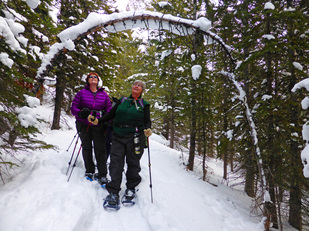
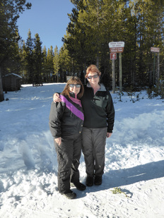
North Fork Waldron Creek Teton Pass, Dec. 27, 2015:
Moon, Antelope, Rocky-Mountain-Front Views Delight on Drive
It was the best of times; it was the worst of times on the drive to Teton Pass Skl Resort for our hike along the North Fork of Waldron Creek out of Choteau. The best of times included seeing a herd of about 100 antelope glinting in the sunrise and the moon setting behind the pink-tinged mountains of the Front.
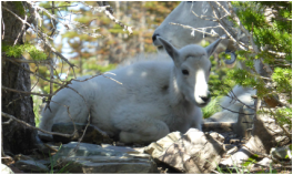
The worst of times happened when some of the gals started hyperventilating when they realized that we were headed in the direction of Mount Wright, the hike that did some of them in last summer. Just seeing the burned trees on the hills reminded them of how hot they got with no shade trees on an 80-degree day hiking the very uphill trail to the top of an almost 10,000 foot peak. The snow seemed to sizzle as the gals described getting under cars for shade and jumping in the Teton River to cool down. Surprisingly, the paved part of the road was quite clear but the gravel wasn't well sanded and was snowpacked and icy, making for a slow trip to the top. But as soon as we parked at the ski hill, all was forgotten of icy roads and Mount Wright as we realized there was no wind, temperature about 20 degrees, so the day was beautiful for our snowshoe hike. And it was perfect day for welcoming our newest member, Sue H., to snowshoeing. The trail heads straight up the ski hill before you turn 300 feet up, the blue diamond marking the place for back country skiers to head into the trees away from the alpine ski resort. Luckily, someone had broken trail, so the walking was pretty easy and our trail-finding skills weren't challenged at all. although this trail does have some ups and downs and some obstacles along the way: fallen trees, stumps sticking out. And we saw some bear grass through the few still-bare spots. We saw many animal tracks, from a mountain lion that had climbed a snow-covered branch that arched over where the bunnies were playing to elk to snowshoe hares to mice to squirrels to weasels or pine martens. We even saw some tracks that looked like moose or else a very large elk. The snow was so deep that it was a bit hard to tell on the larger ungulate tracks with no other signs. And it appeared the illegal wolverine traps had been removed from the chains, although the bait cage and tree camo were still there. When we hit the road along Waldron Creek, we headed toward the bowl for about a mile, retraced our steps and then continued out until we hit the road, then followed the road back to the ski resort, where we had a nice lunch. The lodge was crowded, which was a good thing. It's nice to have this small mom-and-pop resort operating in our backyard. Who went: Mary N, Susan, Gail, Sue H, Cathy, Brenda, Chrissie, Katie Time: Left at 8 a.m., returned 4 p.m. |
|
Silvercrest Dec. 23: Another Fun Day in the Little Belts
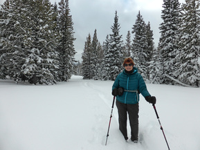
The car thermometer read one degree as Gail and Katie piled out of the car. We had frozen fingers by the time we were done fastening our snowshoes, but with about 18 inches of fresh powder to break through and sun shining, we knew we would warm up fast. And indeed we did.
Only about one quarter of a mile of trail had been broken, so the rest of the three miles were a bit slow going, sinking in knee-deep and sometimes deeper snow. Even longer snow shoes and added tails didn't keep us afloat today as the snow was so powdery, and no one had set a base yet. So we sure got our exercise for the day with only a three-mile hike. We had planned to take the new trail, but it would have been too big of a slog as we sunk in up to our hips, so we did the established trail with a quick jaunt to the overlook first. We got on trail around 10 and got back home around 2:30 after a stop at Bob's for sweet potato fries and sandwiches: notice that the fries come first. All in all, it was a gorgeous day. Who went: Gail and Katie |
|
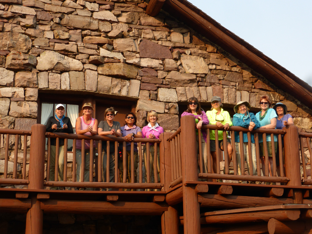
Silvercrest, Dec. 13, 2015: New Trail on Silvercrest Provides Longer Snowshoe
The snow was deep; the snow was fluffy; the sky was snowy and then sunny; and the new trail was fun! That about sums up our day at Silvercrest on the new five-mile loop, of which we covered three miles.
We owe a special thanks to Gerry and Camille for their work on clearing and plotting out this new trail and marking it well with pink ribbons. Besides one wrong turn and one wrong guess, the trail was easy to follow as the pink stood out well on the trees and there were plenty of ribbons. We did get some good exercise as we had to break trail; and since the snow was still rather skimpy, the deadfall provided an obstacle course, which gave the newbies a chance to get to know their snowshoes better. At first, we were the only ones in the parking lot and on the trail, but then we ran into a pair of skiers and then two snowshoers, one of whom we recognized as a former employee of GFPS tech department. We were disappointed at the end of the day when we saw numerous cars of families, all getting Christmas trees, which they aren't supposed to do in the Silvercrest area. They were trampling down the ski trail, even when we requested they not walk on the ski tracks. We started the day at 8 a.m. and got back to Great Falls at 1:30 p.m., in plenty of time to change and clean up for our holiday get-together. It was so fun visiting with everyone, and all of the gals enjoyed the Mile, Mile and a Half movie about hiking the JMT (John Muir Trail) section of the PCT (Pacific Crest Trail). We had 21 gals at the party, but not everyone stayed for the movie. A special thanks to Gail for telling us about this wonderful show. And a special thanks to all of the gals from Katie for the wonderful gift of a certificate to Big Horn. Katie plans to purchase a Thule car topper, so that we can store our gear, packs, snowshoes/skis and travel more comfortably in her new Traverse. |
|
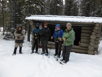
Porphyry Peak Loop, Dec. 5, 2015: Porphyry Was Picture-Perfect for a Snowshoe Hike
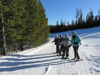
The hike to the top of Porphyry peak (pronounced "por fer ee"; rymes with referee) and the loop around it is not one to sneeze at with 1100 feet of elevation gain and almost six miles of trail, but all nine gals, even Cathy--who was our newbie--handled the snowshoe well. No one took the chicken-out options at mile two or three.
We did have nice fluffy snow despite the lack of it, and the going was fairly good, aided by Katie, her husband Tom, Gordon and Jasmine breaking the trail earlier in the week. And after seeing how many obstacles were on this trail, Jasmine had come back and cut many of the logs and moved them aside, which was especially helpful not to have obstacles since the snow wasn't enough to cover them. The climb up Porphyry always gets your heart going and today was no exception. It was a windy day,but the only time we really felt it was up on top where we ate lunch on the picnic tables under the look-out tower. Unfortunately, Katie's camera battery died, but luckily Gail took over as trip photographer! See her pictures at right. Then it was pretty much downhill all of the way until we had to re-climb a bit to get back to the ski resort. This section of the trail is a rather new one, without many people knowing about it. It is not well marked with diamonds, so watch for cut logs to keep on the trail. The trail is basically a loop: park at King's Hill; climb Porphyry peak, then go down the other side until you hit the snowmobile trail. Turn right and follow the snowmobile track until you see the cross country trail sign and then cut uphill until you come upon the Golden Goose ski run and reconnect to your tracks. Then it is a short distance back to your car at King's Hill pull-out where the snowmobilers park. The hike took us five hours to complete. After our five-hour, six-mile hike, we decided to try the new Cougar Canyon Lodge that replaced the Cub's Den in Monarch for supper. Although the food was fine, we could tell that the place will need to hire more help as our server was also the bartender, so the service could be improved. And we did get to catch the end of the Grizzly game with their loss to North Dakota State Bison. We started the day at 8 a.m. and returned home around 5:30. Who went: June, Gail, Mary, Anita, Jenn, Brenda, Susan, Cathy, Katie |
|
Silvercrest, Dec. 1, 2015: Silvercrest crystals sparkle the day; cat tracks put a scare on it
Hoarfrost crystals were everywhere as Katie and Gail trekked around the B and D loops of Silvercrest, breaking trail the whole way. Since slogging through the snow tired us out, taking pictures of the shining gems gave us many breaks as we strove for the perfect shot of the hexagonal-shaped ice that clung to the tree branches. But the lighting and shadows proved difficult for good compositions, so we kept trying and trying, taking way too many pictures. Besides the hoarfrost crystals, we saw many tracks: rabbits, mice, squirrels, birds and cats! Yes, we saw mountain lion tracks following the bunnies and elk. We had planned to go four to five miles, but three was plenty with the difficult conditions of the trail. The snow was deep but without a base, so we kept hitting rocks, small trees and even dirt with our poles and snowshoes, throwing us off balance at times. We even had to step over some fallen trees that due to lack of snow weren't covered yet. Despite the less-than-ideal conditions, the snow was fluffy powder that glistened in the sun. And the weather was perfect, no wind with sun, not to mention that we had Silvercrest to ourselves. We had given Tom, Katie's husband, a ride to the top so he could ski. We didn't know how long we would be out, but by a coincidence, Tom arrived back at the same time as we did. After our three and a half hours on the trail, we headed to Bob's Bar in Neihart for a sandwich and sweet potato fries! |
|
Rainbow to Ryan Dam, Nov. 15, 2015: Day of Chaos and Mayhem Sees Several Gals Reach Personal Bests

With names like Chaos and Mayhem, the trails along the south shore of the Missouri sounded like too much to handle. But if you are hiking, rather than biking, then the walk is fairly tame, if long.
One sign warns of "dangerous cliffs," and these cliffs do contain quite the drop-offs; but when hiking, it is easy to stay away from the edges. These trails are much preferred over the higher old road, even though they wind in and out of the river cuts and coulees because you see the river the whole way, creating gorgeous landscape views. And much of the land is untouched; and if it weren't for the power lines and dams, it would look much the same as Lewis and Clark found it. The day started at 8:45, under a blue sky with a breeze to our back.We admired the new generating station with its powerful turbines, creating clean energy. However, the new Rainbow Dam station does divert most of the river for a quarter-mile stretch, leaving the main channel as well as Crooked Falls mostly dry. When one looks at the rock ledge of Crooked Falls, it is hard to imaging water pouring over the entire ridge as it used to do. After Crooked Falls, one mile in, our first stop was Whitmore Ravine, where we stopped to read the interpretive sign about the destruction of the habitat caused by local farmers and Malmstom air force base's storm drains and other run off water. The silt from the run-off is basically damming up the Missouri. From here, we walked another three miles to Cochrane Dam, at which point we stopped for a snack just before 11 a.m. We sat on an overhang overlooking the dam and the trickle of water flowing over at this time of year. This dam and Morony are the two of five dams in this area that do not have waterfalls associated with them. Cochrane also isn't a major electric-generating dam. Cochrane was named for a hydroelectical engineer for Montana Power Company. The dam was the last one built on this stretch of the Missouri, completed in 1958. After our snack, the clouds started rolling in, and the wind picked up a bit. Another couple miles down the trail, we came to Ryan Dam and the Great Falls of the Missouri for which the town is named. This dam is much more scenic, forming a semi-circle above the Falls.It is also the largest of the five dams. It was first named Volta, but then renamed for John Ryan, the head of both Anaconda Co and Montana Power. In addition, people can drive to the north-shore side to visit the tailrace Island, which is open May-September for picnics and other events. It has a nice covered picnic area and a kitchen. It is fun to look down on the people visiting the island from the high perch you have when hiking on the south shore. More here. More information on all of the dams and when they were built is on the right-hand sidebar, except it hasn't been updated to include the new Rainbow Dam output of 62 megawatts, making it number-one in electrical production with Ryan Dam a close second at 60.. After taking pictures of the dam and island, we settled into a coulee to get out of the wind for lunch. We marveled at all of the wood in Ryan Dam, so unlike the cement structures of the others. After lunch, we took the easier way home, abandoning Mayhem and Chaos, listed at the most difficulty ways, to stay on an old road, now turned trail. It was still a lot of ups and downs, with more ups on the way home. We realized just how much the Missouri drops with all of the waterfalls along this stretch. the Missouri River drops 551 feet in just over 22 river miles from the Upper Portage of Lewis and Clark, located near the Ayrshire Dairy, south of Great Falls, to the Lower Portage one mile downstream from the mouth of Belt Creek, past Ryan Dam, In comparison, The Mississippi drops only 400 feet in 1,200 river miles from St. Louis to the Gulf of Mexico, so yes, we did face uphill. On our return trip, we were up higher and didn't have much for views of the river until we hit Crooked Falls. By this time, everyone was getting a bit tired and took a break before we headed up the last hill to the parking lot. The gals with fit bits reported 32,000 steps and over 13 miles. Along the way, we scared up a herd of mule deer and in another coulee, saw a buck chasing a doe. He was very intent on her and ignored us for the most part. We also saw geese, mallards a hawk and seagulls as well as one rabbit. We also saw some flowers blooming, a rarity for this time of year: groundsel, harebell, salsify and dandelions. Who went: Gail, Susan, Sue O., Nancy C., Cathy, Kathy D., Anita, Michelle, Katie |
Crown Butte, Nov. 7, 2015: Windy, Sunny, Muddy, Snowy Day Provides Views Galore
Yes, it was windy; yes, it was sunny; yes, it was snowy, sometimes over our boots, and at the end of the day, it was muddy! But the views from Crown Butte are hard to beat. With the Rocky Mountain Front staring us in the face with its snow-capped peaks to the buttes that meld into the mountains, to the plains that reveal small towns and cities, the scenery showed off in 360-degree vistas.
We did have some challenges with the snow. In some places, it was six inches deep, going over our boots. In other places, it was slick and icy, covering the trail, so we had to hike to the side to stay safe, not to mention that there is no real trail after you reach the top of the butte. The snow melting in the afternoon made for a muddy descent over wet slippery rocks. Luckily, no one fell, and thank goodness for poles. The hike is a gradual incline until the last 100 feet or so, which seems straight up and then through a narrow crevice in the Shonkinite "crown" of the butte. At this point, we tossed our poles over the rocks and then climbed using our hands to lift ourselves over the crest. Once on top, you realize that the butte isn't as flat as it appears from down below; instead, it is a series of ups and downs forming deep gullies and ravines, in which you can get turned around. The grasses have never been plowed or grazed so they are very clumpy (blue bunch wheatgrass, wild rye, fescue, blue gramma). Between stepping over rocks, on top of bunch grass and high-stepping through the snow, we had some great leg exercise in the four miles that we traveled. We enjoyed the spires of the cooled lava, dotted with lime-green lichen, as we hiked a bit around the rim, but we didn't dare get too close to the edge as the wind was blowing us off our feet. The also wind prevented us from having a nice lunch break, but we did grab a quick bite on a rocky area that had the snowed cleared from it. Despite seeing many tracks, we didn't see the mule deer herd that usually pops up out of the ravine, but then we didn't hike all of the way to the head of the ravine either. They were probably hunkered down in protection from the gale-force gusts. We started the day at 8:30 a.m., got on trail around 9:45, and arrived back in Great Falls at 2:15 p.m., so it was a short, but stunning, day for us. The road, as always, was bad with many deep ruts, forcing us to ride off road so as not to high-center at times. Plus the mud at the end of the day was a little squirrelly as our car squished back and forth a bit. And then the cross winds tossed the car home. |
Who went: Mary N, Susan, Cathy and Katie
|
|
|
Apgar Lookout, Oct. 24, 2015: Logistics and Larch Work Out; Both Are Beautiful!
Coordination--That's what it took to get 11 gals from from five different locations to hook up for a gorgeous fall hike among the larch, and yes, the western larch, also known as tamaracks, put on a glorious golden hue to color our day.
It all started at 5:30 a.m. when the gals from Great Falls headed out for the trip to West Glacier. Despite missing the Valier cut off and travelling 10 minutes out of the way, we made good time and met Laura and Laverne from Alberta, Canada, in East Glacier Park just five minutes past our appointed time; after a quick stop at the Two Medicine Grill for some drinks, we messaged the gals from Kalispell, Essex and Eureka to say we were on our way, 55 minutes from West Glacier.
Despite some slow construction zones, we arrived at West Glacier within our 9-9:15 a.m. meet time, and all except one gal were already there, so we headed to the trailhead and started our hike at 9:35. (The other gal had cancelled and told one of the others).
The day was gorgeous from the start with a soft mist hanging low along the trunks of the golden larch and bright green young lodge pole pines, which were rejuvenating the area after the 2003 Roberts Fire. As we climbed, the views of the larch looked like waves of yellow among the lime greens of the firs and pines and the sienna browns of frozen ferns.
We saw moose tracks on the trail and looked down on ponds hoping to spy one, but no luck. However, we did see a deer at the lookout tower.
A few of the gals were wondering if they were in shape for the uphill, but all 11 did make it and in pretty good time although we did rest quite a bit. We arrived in under three hours and spent 40 minutes on top, enjoying the far-reaching, panorama views with our lunch. The vistas didn't disappoint: we saw deep into Glacier: the Garden Wall, Mount Gould, Clements, Reynolds, Heaven's Peak, Stanton and Cannon to name a few. Of course, Lake McDonald provided the best foreground to the mountains, with its deep blue surface and its shores painted golden with larch. And an amazing thing is that we didn't have any wind, so the 45-degree weather almost felt balmy. And another amazing thing is that we had Glacier to ourselves! Between the views and the peaceful solitude, we left the top reluctantly at 1:18 p.m.
The walk down and back to the cars took two hours. On our return, we came across four other parties on their way up, and we all said how lucky we were to have had the time at top without anyone else around.
For flowers, we were surprised to find a few survivors: pearly everlasting, harebells, and goldenrod. However, with all of the seeded fireweed, we imagine the hills are alive in pink earlier in the year.
At the parking area, we said our goodbyes: Jackie and Madelon heading back to Eureka, Tracy to Kalsipell, Marta to Essex, Laura and Laverne to Canada, and Cathy, Kathy, Katie, Mary and Gail to dinner at the Lighthouse in Valier and then on to Great Falls. We arrived home at 8:30 p.m., a half hour sooner than we expected.
A side note on Valier: the bartender-owner of the Lighthouse was a wood carver and had made a unique cowboy chess set as well as several other figurines. He showed us pictures of some of the statues he had commissioned around the state. His work was on display in a glass case between the restaurant and bar.
Who went: Laura and Laverne (Canada); Jackie and Madelon (Eureka); Tracy (Kalispell). Marta (Essex), Cathy, Kathy D, Gail, Mary and Katie (Great Falls).
No Name Lake, Two Medicine, Oct 11, 2015: Tumbleweed Stampedes, Surf's Up Whitecaps Highlight the Day
|
Battling 85-mile-an-hour winds on the drive up, Susan did an awesome job navigating around herds of tumbleweeds, crossing the road, flooring the gas only to find she could only go 55 against head winds on the Valier cut-off, and holding the wheel steady on the crosswind-gusts as we turned toward Browning.
We never thought we would be so eager to get to a town, but when we pulled into the Browning Town Pump, we were all ready for a break from the hairy driving. It was a challenge getting out of the doors, one at a time, holding the door so the wind wouldn't whip it off. Despite the wind, the weather was very sunny. From there on into Two Medicine, the winds weren't so terrible; however, we faced a wall of clouds against the mountains, which produced some rain and a bit of sleet. Along the way, we were treated to the sight of stampeding herds of buffalo that looked just like we imaged they would when they free-roamed the plains. The wind and weather must have been disturbing them. The other animals we encountered were all huddled together in corners of fences, their rears toward the oncoming wind. In addition to these scenic animals, the mountains had a dusting of white from the night before. And we saw many, many rainbows, so the trip to get to Glacier was quite eventful. The drive took us an extra 45 minutes due to the winds, so we were late meeting up with our West-side friends Joan and Marta, who had to get back early, so we started the hike, all bundled up against the spitting-sleet wind, but they quickly had to outpace us to meet their time constraints of getting back to the cars by 4:00 p.m. (We finished an hour later at 5:05.) Yes, we were bundled up, but after we got into the trees, we stripped layers as the hiking warmed us quickly. The ground cover was quite a display with rosebushes and huckleberries in red, spiraea in yellow and orange, golden cottonwoods and aspen as well as lime green mountain maple, all contrasting with bright green beargrass. Besides the gorgeous fall colors, the views were spectacular, especially of Siinopah and Pompelly's Pillar all the way until we reached the emerald-colored No Name Lake. The lake had what appeared to be a pair of golden eye ducks on it, the male sleeping with his head under his wing. Besides the ducks, we didn't see any other wildlife; however, we did see elk, moose, sheep sign and tracks as well as bear scat. The whole day, threatening clouds swirled overhead as winds whipped the water into whitecaps on Two Medicine Lake as well as No Name. In addition, the gusts were so fierce over Two Medicine that they actually blew spray into the air. Interestingly, we heard was seemed to be two gunshots toward the direction of Two Med lake about three miles into our hike. When we asked some other hikers, they thought it was falling rock; however, no shale or other rocks falling or tumbling sounds were heard, so we didn't think that could be the explanation. It made us nervous to go on for a minute. After we ended our hike, we decided to hit the Two Medicine Grill, as we were all famished and didn't want to wait until Valier or Dupuyer to eat. The waitress was a bit cranky and very slow to clear a table and take our order, but the cook was fast and apologized to us for the delay. Katie had to order some triple berry and blackberry pie-for-strength to go. Then it was time to head for home. We all felt a bit hypothermic, so we turned the car heat up full blast as we headed into Browning, where we took a short stop to stretch our legs after a long hike. We ended our day at 9 p.m. Susan was so happy that the winds had died down significantly for the drive home. What a great "goodbye to Glacier" end-of-season hike! |
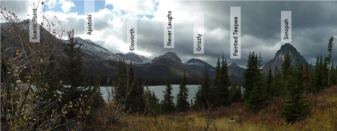
Click to Enlarge Map of Mountain Names
|
Polebridge, Quartz Lake Loop, Covey Meadows and Hidden Lake, Sept 25-27
Autumn colored our way through three hikes in three days in North Fork Country (Polebridge, Bowman and Kintla Lakes)

Yellow, orange, red and green eye candy--That is what we were treated to on our trip to stay at the North Fork Hostel in Polebridge for two nights and three days filled with hikes, laughs and good food.
It all started on Friday morning when five gals left at 7 a.m. and wound up at the Polebridge Mercantile for a quick lunch around 1 p.m. with a quick stop at the Home Ranch Bottoms to make sure they would hold dinner for the gals who had to work and wouldn't make it to Polebridge until 8 p.m. that night.
After purchasing huckleberry bear claws for breakfast, the next morning, we drove a block to the North Fork Hostel, to greet our host Oliver, who was just sneaking out for a hike.We too decided to head out for a hike on the shore of Kintla lake, so we quickly ditched our overnight belongings, leaving just our hiking gear on the car. We used Oliver's very cool and funky cart to save us from multiple loads back and forth because, of course, we over packed.
The ride along the south boundary of the park had been very pretty with yellow cottonwoods and aspen, but some were already fading to brown or had dropped most of their leaves while the road into Polebridge was just starting to light up with light green western larch and lemon-colored aspen; but the two-track lane into Kintla was alive in color from reds to oranges to hot lime. We had a nice hike along both shores of the lake, but the real treat was meeting Lyle Ruterbories. the 95-year-old park ranger who still works the Kintla station. He told us how he had had to use bear spray the day before and also told us how he got his Blackfeet name Gray Eagle. Watch him tell his story here.
We made it back to the hostel around 5:30 p.m., just in time to decide for sure that we wanted to stay upstairs in the mixed dorm area, which accommodates about 13. Luckily, Oliver let us have our pick of the top floor, so we had enough beds for all of us to avoid the top bunks. But there is no way to avoid going out to the outhouses in the middle of the night nor climbing up and down stairs that are more like a ladder, which proved a challenge on day three after a long hike the day before.
Oliver told us we were the only people staying that night, so we made ourselves at home. Some of the gals were a bit shocked that we were definitely off the grid for a few days: no cell phone service, no electricity for curling irons or blow driers and only enough hot water for four gals to take three-minute showers. Oliver relies on solar and propane power, so the lights were like lanterns with mantels and had to be lit with a match, so most of us went around wearing our headlamps..
Anyway, we settled in and then headed out to the BBQ restaurant, Home Ranch Bottoms, to meet that four gals who were coming after a full day of work. This is the only restaurant in Polebridge open this time of year. It was very crowded and the owners, a husband and wife team, had no other help. He was serving and taking orders while she prepared the food. The food was good, the gals preferring the pulled pork to the brisket; however, they did run out of food and one gal had to substitute her order. But the desserts made up for the delays and the mix ups: homemade huckleberry peach pie with to-die-for crust and homemade huck ice cream with whole fresh huckleberries in it. We ate here both nights, and on the second night, we ran into a black bear on the road home.
When we arrived back at the hostel, it was past 9 p.m., so most headed to get prepared for bed while a few stayed up visiting to a glass of wine, but morning would come early, with 5:30 a.m. wake-up calls to get on the road by 7 a.m.
In the morning, we hurriedly prepared oatmeal, scarfed down a banana or two and our bear claws from the Merc along with instant coffee before heading out the door for the eight-mile, half hour ride to Bowman lake; and yes, it did take that long on the very rutted road. (Interestingly, the road to Kintla is usually the worst of the roads in the area, but the road crews had just graded, graveled and oiled the road the week before, according to Lyle, so it was excellent.)
We ended up getting on trail for the Quartz Lake Loop, a 13-mile hike with 2400 feet of elevation gain, at 8:15 a.m. All of us started up the trail, but at about a mile and half when it started turning uphill, three gals decided to have an easier day and hike the other side of the lake, which is flat instead of doing so much up and downhill. So we said goodbye as the other six stated the initial 1500 foot gain to the top of Cerulean ridge before dropping into the beautiful Quartz lake, with views of Vulture Peak for lunch. Then this group went on to Middle and Lower Quartz lake before tackling the 1,000 foot Quartz ridge and then a steep drop off back to Bowman Lake. Although the day was mostly cloudy, we felt a sprinkle or two and ended the day with sun shining through the clouds, playing with shadows across the lake. We finished the hike at 5:15 p.m. just in time to catch up with the other three who had hiked about 12 miles themselves. All day long we feasted our eyes on the fall colors. As for animals, we only saw birds, especially female spruce grouse, also called fool's hens or Franklin's grouse. Again we ate at Home Ranch Bottoms, getting in late and tired.
We were disappointed when we heard they had run out of pie, but we settled for the fresh huck ice cream.
Again, a few had some wine before hitting the beds, but no one played the games of Catch Phrase or Pictionary that we had hauled along. The next morning, we planned to eat pastries and breakfast sandwiches with fresh coffee and latte's at the Merc before packing and saying goodbye to Oliver and the North Fork Hostel. But before we left, Oliver gave us a tour of his grounds, including his greenhouse. Then it was out the door for one last hike in the Polebridge area: to Covey Meadows, a short, but gorgeous, less-than-two mile warm up before our drive up Logan Pass on Going to the Sun Road. This hike's trail is cut through a grove of lodge pole pines that have sprung up since the 1988 Red Bench fire that destroyed many buildings at the historic ranger station in addition to killing one firefighter and injuring 19 others. These pines provide a distinct wall on both sides of the path, unlike other Glacier trails except Hidden Meadow in the same area. On this hike we saw much wolf scat, which went along with Oliver telling us he has been hearing wolves at night.
After we warmed up our legs on this hike, we headed up Logan Pass, stopping for a short looksee in Apgar for snacks and a few souvenirs that were all marked down for end of season. When we reached the pass, we hiked to the Hidden Lake Overlook, as four of the gals had never done it; however, the goats and sheep were nowhere to be seen, which was very unusual, until two women with spotting scopes said they were tracking two wolves. Then Gail and Bonnie, who had stayed behind, said they had watched a coyote, so we had an answer to why the goats weren't around.
,
It was sad to leave the park but interesting to see the results of the fire on our way down the pass. A quick stop in Browning and we found our way home by 7 p.m. We all agreed it was one of the best trips ever: seven gals got to see Polebridge for the first time, four saw Kintla for the first time and four hiked Hidden Lake trail for the first time. And the colors and company could not be beaten! When we arrived home, we were treated with a super moon eclipse and red moon. We can't wait until the next trip. See you on the trail soon.
Who went: Mary S, Mary N, Bonnie J, Kathy M, Gail, Susan, Catherine, Sara, Katie
Highline and Granite Park Chalet, Aug. 13-15, 2015: Despite smoke, health issues, heartaches, 10 Giggers hike Highline to Granite Park Chalet; head to Swiftcurrent valley on Day Two
From family health issues to blistered feet to the death of a friend and wildfires burning all around, including three in Glacier, four of the gals almost had to miss our trip which we had to plan nine months in advance with no chance of cancellations. But in the end, all 10 made the three-day trip that included an eight- to 10-mile hike to the chalet with optional Grinnell Glacier Overlook, followed by a seven-mile hike over the stunning Swiftcurrent pass into the Many Glacier valley, followed by a one-mile hike to Fishercap Lake and Wilbur Falls before heading home.
The day started at 5 a.m. from Great Falls, a quick stop in Browning on the way to catch the shuttle in St. Mary. We had been told that the shuttle wasn't running until 9 a.m. due to the fires, but we were pleasantly surprised that we could catch the 8 a.m. shuttle, getting us an early start on what promised to be a very hot day for hiking (in the 80s). We took this as a good sign that our trip was going to be good despite personal hardships. On the way to Logan Pass, we were amazed to see what the Reynolds' Creek fire had done to the east side of Going to the Sun road, blackening the better portion from the Rising Sun campground until beyond the upper St. Mary Falls turn out. The Baring Creek/Sunrift Gorge area seemed to have burned the hottest with all trees and soil blackened with no mosaic pattern to the burn. The burn has opened up the vistas of the mountains on the south side of the road, and a few hardy dusty green plants were already pushing their leaves through the blackened soil. The ride was interesting in that manner. We got on trail by 9:15, posing at the HIghline Trail sign for a quick photo opp. The first part of the day was easy, mostly flat, hiking, with the mountain shading us from the hot sun as we hiked the narrow, steep, but not-too-scary trail, but then in the afternoon, the combination of sun and smoke took its toll. When we stopped at Haystack Pass around noon for lunch, some of us were already feeling it. As we crested Haystack pass and crossed the Continental Divide onto the west side of the park, the smoke activity picked up. We could see the fingers of smoke coming our way from the Thompson fire in the Nyack area as well as the fires from Lincoln, Libby and the North Fork of the Flathead. The valley soon filled with smoke and the nice clear blue sky we had enjoyed at Logan Pass disappeared into the haze. Along the way, we saw several herds of sheep and a group of goats. Some of the sheep were quite close and seemed curious, while the goats were mostly sleeping on rocky ledges high up. Although we saw no bears on this part of the trail, we did see their tell-tale purple-hued scat, warning us they were near and eating the same huckleberries we were enjoying. By the time we reached the turn off for the Grinnell Glacier Overlook, which is only one mile from the Granite Park Chalet, three of the gals were all in and decided to continue to the Chalet and save the overlook for another time. The rest braved the steep almost-one-mile incline; one had to turn back as it turned out to be too much; but in the end six made it to the beautiful view down onto Grinnell Glacier and what is called Upper Grinnell Lake, formed from the melt from the glacier. It took us one hour and 20 minutes to ascend and 45 minutes to descend, putting us at the Chalet by 6 p.m. We found a young crew at the Chalet, who had changed the rules from previous years. Instead of finding water already hauled from the source, the new rules said you had to haul your own. The chalet was also out of bottled water, which forced us to hike a third of a mile downhill and back up again on our tired legs as all of us were very thirsty from a long climb. We also needed water to boil for our freeze-dried meals, all of which tasted good because we were hungry. Before we were finished eating, the chalet team announced that the traditional "friendship" program wasn't going to be held this night due to a historical presentation about the Night of the Grizzlies because it was the anniversary, Aug. 13. David Shea, the ranger who shot the killer grizzlies, gave a presentation about what was learned from the tragedy and pointed out where the garbage dump was located that attracted the bears in the first place, coupled with people feeding the bears on purpose. Read More here. Instead of listening to the talk inside the chalet, some stayed outside and enjoyed evening sunset and also the fires blowing up due to the heat and winds of the day. The night never cooled down, a surprise for being so high up and in the mountains. We left the windows and doors open all night trying to cool down. Of course, this being the anniversary of the Night of the Grizzlies, we gals were frightened when we had to get up in the night to use the bathroom, but we all survived and some of us even enjoyed the meteor shower. |
After a quick breakfast, we hauled more water and packed our things and hit the trail by 9:15 a.m. for the second morning in a row. We had our uphill right out of the chute, gaining the top of the pass where we faced our decision about whether or not to hike to the top of Swiftcurrent mountain to the lookout tower. Most of the gals were still too tired to attempt the steep climb and extra three miles. Even those inclined to do it decided against as the smoke was ruining the views, so we passed on the climb and continued over the pass, stopping to view the overlook of Swiftcurrent Glacier, Swiftcurrent Falls and Grinnell Mountain.
As we descended, many of us were a bit worried about the condition of the trail as earlier the trail reports said four section of the trail had washed out and to WATCH YOUR STEP! Luckily, the trail was in fairly good shape with only two very narrow, but not-too-scary, sections. However, just past Devil's Elbow on the descent, one gal fell and really cut up her elbow and bruised her palm on her opposite hand. It required first aid and picking out dirt and rocks from the bleeding wound and then bandaging. When we finally reached flatland and the Swiftcurrent River, we were happy for the relief and the cool water to soak our shirts and bandannas too cool down. Not long after, we met up with our other GiG group, the gals hiking to Bullhead lake and who had shuttled our cars from St. Mary for us! What a blessing they were. As we approached Bullhead lake, we caught a glimpse of a mama and baby moose resting just off the trail behind some willows. Their twitching ears gave them away. Then when we stopped at Bullhead lake just before 2 p.m for lunch, we came across another mama moose and baby that were way too close to us and caught in the middle of our group. We spread apart a bit more to give them room as they ran across the trail down to the lake for a drink, making for many great photo opps.About a quarter mile past the moose incident, we came across a ranger who told us to halt as a mother grizzly and her twin cubs were 10 yards ahead. He as clapping and talking and trying to get them to shoo down toward the river and lake, but he said he could hear them still in the willows. Then some hikes came from the other directions shouted "bear!" The ranger called out to ask if they were seeing a bear and they said they did. He told them there were also two cubs and to stay where they were. He then hiked up to them and clapped to chase the grizzlies away. After a wait of about half an hour, he led us down the trail and then took the others the opposite way. As we continued to Red Rock Falls, we made lots of noise. By the time we hit Red Rock Falls, 2.4 miles from the parking lot, most of the gals were tired and wanted a shower, so we didn't stop long at the falls but long enough to see that the falls were lower than any of us ever remembered, even when visiting in the fall. The water wasn't even going over most of the rocks, just trickling down the center area. At 4:15, we arrived at Swiftcurrent motor inn. However, our rooms weren't ready so we had to wait in the lobby for half an hour for the cleaning crew to finish. We got cold drinks at the camp store, then rushed to our rooms for a shower as soon as they were ready. We then met up at 6 p.m. for dinner at the Interlaken Lounge at the May Glacier Hotel, followed by a presentation on aquatic life by a Parks Canada Interpreter, mostly on the bullhead trout, westlope cutthroat salmon, the leopard frog and the tiger salamanders. That night we were happy for comfy beds at the newly redone Pinetop Motel and no top bunks to deal with. It rained with thunder and lightning disturbing our sleep a bit, but we hoped the water was helping the fire situation. The next morning, we ate breakfast at the Swiftcurrent cafe, but before Katie and Chrissie decided to look for moose in Fishercap lake, but no luck. We surmised the wind was so strong that they were all hunkered down in the willows. After breakfast, we all took the loop trail, first to Wilbur Falls and then to Fishercap. Again, we didn't see any wildlife but we did get to put our ponchos on to avoid the drizzly day. We had one last treat on the way home: We saw a black bear eating berries on a sideslope, which completed our animal sightings for the trip. We arrive back in Great Falls around noon. |
Dawson-Pitamakan, Aug. 8, 2015: The Biggie for Distance, Height, Views Doesn't Disappoint
Wowzer! We made it on one of the toughest, but most beautiful, day hikes in Glacier National Park: Dawson Pass to Pitamakan Pass. It was a day of seeing sheep, eating hucks and whortleberries, seeing sheep and coming across some interesting hikers along with a bear scare along the last mile of the hike.
It all started with shuttling the car to the campground and then a trip up Two Medicine Lake on the 9 a.m. boat, which landed at 9:30 on the far shore. We then took the quick mile hike to the connecting trail to Dawson Pass. This being a Saturday, we did have the ranger-led hike of about 15 (going to Dawson pass and back) following behind us, along with a young couple, who also intended to hike the whole loop trail. We started up the 3.4 gruelingly steep miles up to Dawson Pass just before 10 and arrived at the pass at 12:45. Along the way, we were treated to gorgeous wildflowers as we ascended (most of the lower level flowers were gone) along with about a dozen sheep as we got into the alpine area just below the pass. The flowers most prevalent were blue explorer's gentian, seed-head anemones, sulphur buckwheat and fireweed. And at each stop to catch our breath, we scooped up a few huckleberries and grouse whortleberries (mini hucks) as they were fully ripe. About a half mile from the pass, the ranger-led group caught and passed us. We were quite surprised as the group had many 70+ hikers. We felt a bit peeved as we thought we were pretty fair hikers. Anyway, as we topped the pass, the views amazed us as we faced massive Mount Stimson, one of six 10,000 feet plus mountains in the park, flanked by Mount Helen to the left and Flinsch to the right. We also saw the remnants of Lupfer glacier on the side of Mount Philips along with Pumpelly and Blackfoot glaciers in the far distance. As we looked down in the Nyack country, faraway lakes and glacially carved valleys dizzied us. We had lunch at the pass and then continued uphill for another half mile until we started around the flank of Rising Wolf, where we would spend the next four miles hiking a goat trail while being treated to some of the best views in the park. Along the way, we met the young couple who had passed us on the trail. They said the trail was too steep for them so they decided to turn around, so we wondered if we were crazy for continuing along the narrow trail, but we did. We also met a man with one leg hiking the trail, along with five other parties who had hiked from the other direction, going up Pitamakan pass first. Some were backpacking between Old Man and No Name Lakes. Before Pitamakan pass, we hiked along a ridgeline that provided views on both sides of the mountains. We saw many lakes and as we turned a corner and started descending the pass, the turquoise of Pitamakan lake came into view. We now had a different direction and all new sights as we continued down the trail along the side of Rising Wolf and through the valley leading to Pray Lake and the Two Medicine campground. Again, we feasted on huckleberries. |
As we neared the campground, a few things happened. Two young gals passed us as they were completing the loop too. Then we met a barefoot hiker coming up. We couldn’t believe he was hiking this rocky trail with no footgear whatsoever. He said it was easy to get used to, that his feet never got cut by the rocks as a person’s feet get more malleable as she continues to hike barefoot. None of us wanted to try it as our feet were sore with boots on.
Then we came upon the two gals who had hiked past us. They told us a mama black bear and her cub had just crossed the trail. The rangers were down below us on the campground road and used a bull horn to communicate with us as they could see the bears’ progression. Once the bears were a safe distance away, they told us to proceed. We made it back to the car by 7:30, which was around the estimated time of arrival. Starved and worried that the restaurants would close, we quickly changed into comfy shoes and went directly to the lodge where we hoped for a nice dinner with a glass of wine or even champagne. However, it turns out that it was Indian Days in Heart Butte so the reservation was dry. We enjoyed our dinner anyway, followed by a walk-through of the gift shop. Then we headed to Brownies and Jacobson’s cottages where we stayed the night, followed with breakfast at the Whistlestop and home by noon the next day. What an epic adventure for everyone. We crossed another hike off the bucket list. Who went: Mary N, Roni, Kathy M and Katie Link to Katie's pictures Kathy's pictures |
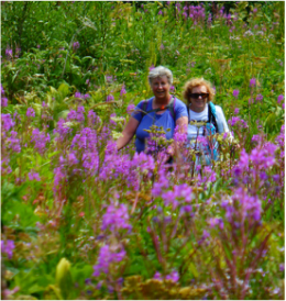
Firebrand Pass, July 23, 2015: Firebrand Pass among Fireweed during the Reynold Creek Fire in St. Mary
Our hike originally planned for the day, Piegan Pass, was out due to the trail closures of the St. Mary Fire at Reynold's Creek, so we headed to Firebrand Pass, a fitting hike for the wildfire that was raging out of control at the time, just one valley over. Firebrand Pass is located at the southeast corner of the park, a section that has no gate. We just parked at mile marker 203 on HIghway 2, six miles from East Glacier and walked in through a small gap in the fence just over the train tracks.
But not before Katie had us start on the wrong trail, causing a 45-minute delay getting on trail and adding a mile and a half to a 10-mile hike, not to mention even more bushwacking! We were on the snowshoe trail at Lubec lake, so we did get to see the old homestead from the life of Clara Miller, written about in the book Dream Chasers of the West, When we did get on trail, thanks to Chrissie's map, we found fireweed galore, which followed us all of the way up the trail, going from regular fireweed to the stunted alpine version. The other flowers were out in droves too with the paintbrush, yampah, and angelica particularly abundant and the silky and silver-leaf phacelias dominating at the high elevations. (see list for everything we saw). The trail wasn't very worn, producing much bushwacking through waist-high grasses and flowering bushes. The fireweed, cow parsnip and false hellebore were often head-high. These conditions made it very easy to stumble due to now being able to see the trail, which held rocks and raised tree roots to trip us up. In addition, the cliff side was disguised due to the vegetation, and one gal did fall down the cliff partway from stepping off the side of the hidden trail. But a cut hand was all she sustained for injuries, thankfully. Also along the way, we gained a bit of strength from the huckleberries that were just getting ripe. A few grouse whortleberries (mini hucks) were also ripening. The trail was full of elderberry bushes without berries as well as mountain ash with green berries. Although the flowers and foliage were beautiful, we couldn't enjoy them much as we neared the top as we did face the famous Firebrand Pass wind. The gusts increased once we hit the shale above the sheltered saddle, where we ate lunch, and sent us to our seats when we reached the top of the pass as it pushed us down. The traverse down the scree slope was a bit hairy with the gusts reaching around the 60-mile-an-hour range and hitting us from behind and the side at times, again, throwing some of us to the ground on the trail. But the views on top of the mountains, with 8888 dominating the horizon, were worth it. It's too bad we couldn't have enjoyed them a bit more. We met some through-hikers from Colorado hiking from Two Medicine who said they had a very difficult time coming across the pass with their large backpacks that caught the wind. They had been out for four days and hadn't heard about the fire in St. Mary. In fact, they were very surprised to hear about it. We told them to be sure to check in with the ranger station so that the authorities know that they got our safely. We also met a young couple day as well as a CDT (Continental Divide Trail) hiker who was returning to Marias Pass after being turned back by rangers due to the fire. It was the second time he had hiked the CDT, he said. We arrived back at the cars at 5:05 and headed to Serrano's. After a half hour wait, we ordered food as we sucked down tons of water and ate baskets of chips as we waited for our food. We hit the road and arrive back in Great Falls at 9:30. Who went: Chrissie, Sue M, Gail, Susan W, Bonnie, Colette, Katie and Christine, a college exchange student from Austria Link to all of Katie's pictures. |
Flowers We Saw
Alpine fireweed Beardtongue/fuzzy tongue penstemon Cow parsnip Cushion buckwheat False hellebore (corn plant) Fireweed Fern-leaf lousewort Goldenrod Groundsel Indian paintbrush Lyall's angelica Monkey flower (yellow) Mountain dandelion Parrot's beak (lousewort) Pearly everlasting Pine drops Rattlesnake plantain orchid Richardson's (white) geranium Showy fleabane daisy Self heal Silky phacelia Silver-leaf phacelia Snow cinquefoil/potentilla Sticky geranium (pink) Stonecrop Sulphur buckwheat Western tobacco root (valerian) Wall flower (mustard) Yampah Yarrow Berries We Saw Buffalo berry Elderberry (bush only) Grouse Whortleberries (mini hucks) Huckleberries Mountain Ash Red twinberry Service berry (Saskatoon) Other Creeping foxtail Raynold's Sedge Sitka Alder )cones) |
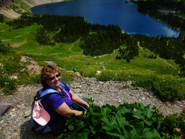
Hidden Lake, July 18, 2015: On Top of the Pass: Another Gorgeous Day in Glacier
After a passport snafu prevented us from going to Waterton, four gals ventured up to the top of Logan Pass for hike to Hidden Lake. The crowds, thankfully, were light, which might have been due to the morning rainy weather and socked-in clouds that we could see from the ridge line were blanketing the Flathead Valley area.
We left town at 5:30 a..m. and enjoyed a beautiful drive with the majestic Rocky Mountain Front following us to Browning. Toni was our driver and she had never driven Going to the Sun road, but she was up for it in her little red new car! Luckily, we didn't hit road construction or have any issues along the way, so she had smooth sailing to the top of Logan Pass. On the way down, we were treated to her sunroof views. At 9:30, we hit the Hidden Lake trail and enjoyed the many flowers: the magenta paintbrush, purple beardtongue/fuzzy tongue penstemon, yellow groundsel and pink spiraea. were particularly plentiful. But there may have been even more goats! We saw so many mamas with babies and some singles as well as yearlings both at the overlook, along the trail and down at the lake.. At the Hidden Lake Overlook, we also enjoyed watching some playful hoary marmots as they scampered among the rocks and ate the greenery. After viewing the valley from the Overlook, we wandered a bit from the crowd to enjoy some views while we ate lunch. Then we started the steep ascent to the lake. The trail has many stair-steps that weren't kind to old knees, but we couldn't beat the view as we trekked into the valley with Bearhat, Clements, and Reynolds mountains looming around us while the sparkling waterfalls and deep teal blue lake beckoned us to keep going down. We noticed that many people were speaking foreign languages, showing how popular Logan Pass is as a tourist destination. And we marveled at how quickly the 20-30-year olds managed to get to the lake. At the bottom of the valley, we relaxed and ate the rest of our food. Susan and Katie did a bit of bushwacking to reach a rocky point that juts out into the lake that Susan had seen from above at the overlook. While off trail both Katie and Susan were surprised by goats that wouldn't yield, causing them to be much too close for comfort. they also thought they were all alone in this remote area of the lake shore, but found a family with a three-year-old girl who had done the bushwack too and had gone even farther around the lake, making them realize the effort of climbing up rocks, over tree trunks and through bushes wasn't much after all. After Katie and Susan got back, the group headed back up the mountain, again facing the stair-step rocks. We actually climbed up faster than we descended, making it in just over an hour. But then we had to go back down to the visitor center area. We arrived at the car at 4:30 and then drove over the pass to the west side, stopping for dinner at the Belton Chalet. Toni was hungry for a burger but the closest they had was meatloaf. Were we surprised to see the "elegant" meatloaf adorned with edible flowers that actually tasted wonderful, if a bit spicy. We were informed that they were baby marigolds. And as we drove away, we saw a gal from the restaurant in the flower garden picking buds. We all agreed that the specialty breads (an appetizer) with the herbed butter and goat cheese were the best. We had three orders! On the way home, we had one more goat surprise: in the cut before the goat lick, about 30 goats were grazing. What an amazing day. Who went: Susan, Gail, Toni, Katie |
Mountain Goat Study Begins at Logan Pass--Collared Goats
Date: September 16, 2013 Contact: Denise Germann, 406 888-5838 Contact: Jennifer Lutman, 406 888-7895 WEST GLACIER, MONT. – Glacier National Park, in partnership with the University of Montana, has begun a three-year research study on how mountain goats are affected by roads, people and trails in the Logan Pass area. Currently, six mountain goats have been successfully collared by National Park Service staff, University of Montana researchers, and Montana Fish, Wildlife & Parks personnel with GPS or VHF radio devices. Collaring efforts will continue through the fall as weather permits. It is anticipated approximately 20-25 goats will be collared of the estimated 1,500 goats in the park. Data collected from collared goats will provide information on the animal's use of Logan Pass and adjacent areas, as well as movement on the landscape throughout the year. Collars will remain on the goats for three years at which point a mechanism will release allowing the collar to fall to the ground. The collar will then be retrieved by researchers. The use of the release mechanism means that goats will only be handled once. The study also incorporates observational, temporary marking, and visitor messaging techniques. Researchers will spend time observing and recording human-goat interactions. Informational signs about human-goat interactions will be placed in the Logan Pass area. A few goats that will not be able to be collared may be temporarily marked to enable a researcher to visually distinguish between individual goats. Research on bighorn sheep will be conducted simultaneously, with observational, temporary marking, and visitor messaging techniques. No collars will be placed on bighorn sheep, as individual sheep are easier to identify due to unique horn variations. The research is a critical component of the current Going-to-the-Sun Road Corridor Management planning effort, as human-wildlife interactions within the corridor are an identified issue of concern. Interactions between humans and goats are increasing in the Logan Pass area, creating potential unhealthy and unsafe conditions. Glacier National Park Superintendent Jeff Mow said, "Mountain goats are an icon of Glacier National Park and the information gathered from this study will play a valuable role in future management decisions. Ensuring the safety of both mountain goats and staff conducting research is our top priority with this project." |
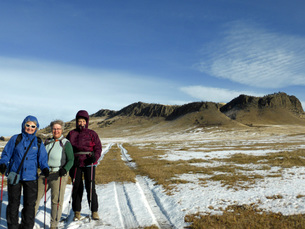
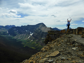
Grand View Traverse, Snowy Mountains, July 7, 2015: Flowers, Ice Cave, Grand Views Dominate Day
Five gals from the GiG joined five gals from the Canadian hiking group for a fabulous 13-mile day in the Snowy mountains.
The day started at 5:30 a.m. meet up at 4Bs, driving tot Eddie's Corner for a quick break, and then getting on trail at 8:30 a.m. The hike up the 2500 feet of elevation at the beginning of the day over four miles got our heart rates going and made some of us wonder if we could finish 13 miles when the first few felt daunting, but everyone made it the whole way without too much difficulty. From the first few steps to the last, we were treated to hosts of flowers (see list at right). The larkspur, lady slippers, white Richardson's geraniums and bluebells really stood out. However, the Pipsissewa (otherwise, known as the Prince's Pine) did elude us all day. Besides a brief break out to a scree field, the first part of the hike is in the trees until we reached the top of the ridge, that has 360 degree views and on a good day, one can see nine mountain ranges, including the Rockies in Canada and the Wind River range in Canada. Today, the broad ridge walk, while pretty, didn't produce the usual stunning views, due to the smoke coming from the 113 wildfires in Saskatchewan. But we still enjoyed what we could see, especially the glances we had of Crystal lake. The Ice Caves didn't disappoint, as the formations were stunning, if a few had fallen, either due to warm weather or vandalism. We explored the cave for about 45 minutes, taking pictures of the icy stalagmites and stalactites. We only saw four young men right after we left the ice caves. Otherwise, we had the trail to ourselves, with no one on the Grandview Traverse side. After the caves, the hike follows the broad ridge, going up and down, revealing more views of the surrounding island ranges and the plains. The ridge then gives way to switchbacks as you descend at a more gentler angle than the climb. About halfway down is the Grand View pinnacle, where we all posed for pictures overlooking Crystal Lake on a bit of a precarious ledge. The last four miles is a bit of a slog going down the rest of the mountain and swinging to the east side of the lake and then back again. By the last mile that has some uphill, we couldn't wait to spy the cars; however, the brush had overgrown the trail, so our leaders overshot it by a half mile, so Mary and June walked even more than the 12 miles. We arrived back at the cars at 7 p.m.--what a welcome sight-- and headed to Eddie's corner for dinner as we were all tired and hungry. We got home around 10:30, so we didn't leave any daylight on the table.What a wonderful day with friends and meeting new friends. Who went: Gig--Mary, Susan, June, Gail, Colette, Katie; Mountainview: Linda, Lorna, Laural, Laverne, Laura |
Flowers We Saw
Alumroot Anica Bastard toadflax Bistort Bluebells Blue flax Canada violet Chickweed Cinquefoil/potentilla Cliff anemone Columbia clematis Columbine Coralroot Cous biscuitroot Cow parsnip Cut-leaf daisy Diamond Saxifrage False Solomon seal Fleabane daisy Forget-me-nots Goldenrod Green gentian Groundsel Harebells Hawkweed Indian paintbrush Lady slipper Larkspur Meadow rue Milk vetch Mountain avens (dryad) Northern bedstraw Richardson’s geranium (white) Rock cress Rock jasmine Rosy pussytoes Sandwort Shining penstemon Shooting star Short-styled purple onion Showy death camas Shrubby cinquefoil Sticky geranium (pink) Stonecrop (sedum) Strawberry Sulfur paintbrush Tall buttercup Twin flower Western bistort Wild prairie rose Wintergreen Wood nymph Woods pussy toes |
Mount Wright, July 1, 2015: Heat causes some to get sick, but Bonnie--and others-- make it to top!
She thought about it for years: making it to the top of Mount Wright after stopping short some 20 years ago, but 2015 saw Bonnie J summiting this time! Despite highs in the mid-eighties, seven gals made it all of the way, while everyone of the others made it to the top saddle, a mere quarter mile from the top. All enjoyed fabulous views, some of the best in the nation that reach into Waterton Park in Canada toward the north and into Wyoming in the south.
The day started with nine of the GiG meeting the Mountain View hiking group from Alberta at the Stage Stop Inn in Choteau at 6:30 (The Canadians had come the night before). Forty-five minutes later, we arrived at the trailhead on what promised to be a hot day, so an early start was in order. Even with temps in the 50s, the sun felt warm as we headed uphill, taking numerous breaks until we hit the first saddle, where we took an extended lunch break (we arrived at 11:10).Some of the gals thought they might want to just stay at this first saddle as it was already a lot of uphill. However, Katie encouraged them to try to reach the next saddle as the views were much better there. So everyone started uphill again. One group was much faster and wanted to summit. They went on ahead while the others slowly made their way to the upper saddle. One other party was on the trail that day, having passed us going up and now we met them on their way down. They told us there was a nice breeze on top, which we couldn't wait to feel. Everyone made it to the upper saddle and were amazed at the views, while the others had gone ahead to the top. The group at the saddle thought it best to start down slowly as some were getting tired, one had a bad knee and some were running out of water. The second group caught up with the others just past the saddle, and many were feeling heat fatigue as the hottest part of the day was upon them. It was a slow trip down with the some of the Canadian gals offering salt and food to the others. But everyone did make it, even though it was a bit scary how hot some were. The creeks at the end and the Teton river cooled everyone down. And we didn't have to use the Spot Messenger. We were all grateful that Mount Wright didn't turn into Mount Wrong. We said goodbye to our Canadian friends who were headed back, while the GiG two cars aimed toward Choteau. The gals in one car decided to get some ice cream and head for home as they were tired and not feeling too well. The other car stopped for dinner at the Log Cabin. Link to Katie's pics |
|
Kayaking the Missouri, June 25, 2015: Nice day as nine gals paddle, some for first time
|
Mary S led the GiG on a day of kayaking on the Missouri River out of Cascade. She had much help with seasoned kayakers Mary N, Nancy C, Gail, Sue O and Sue M.
Who went: Catherine, Brianna, Anita, Sue O, Sue M, Nancy C, Mary N, Gail, Mary S |
|
Lost Lake, June 16, 2015: Evening Hike to Lost Lake with Phacelia, Mosquitoes
|
We had a gorgeous summer evening hike of about two miles exploring the boulders and unique geography of the Shonkin sag. The flowers were really out, even though the soil is mostly a gravely sand made from the disintegrated Shonkinite. We saw threadleaf phacelia, silky phacilia as well as
The color of the water is bright algae green, but i doesn' keep the birds away. We saw curlew, killdeer and avocets along with one hawk. Thank goodness we didn't see any snakes. We left from Great Falls College - MSU at 5 and returned home around 9:30. Who went: Gail, Kathy, Jenn, Bonnie, Jo Ann and Katie |
|
Upper Two Medicine Lake, June 14, 2015: Eleven-Mile School's Out Hike Brings on More Car Trouble
|
Unfortunately, our mechanic Mary S wasn't along on this trip, or we may have made it home without assistance, but that's a story for later on in the blog.
Our day started at 5:30 a.m. as we headed to the Two Medicine valley. After dropping Mary N's car at the head of the lake, we hopped into two cars and proceeded to the trail head along Pray Lake. We hit the trail at 8:45. The flowers were spectacular, from glacier lilies to speedwell to early coralroot. The flowers in most abundance were mountain ash, western tobacco root (valerian), buckwheat (sulfur was very pretty), chickweed and cous biscuitroot. We headed up the north shore of the lake and took the spur to Upper Two Medicine Lake. What a gorgeous site to behold as the valley opened up to reveal Lone Walker, the shard of Pumpelly's Pillar and the back side of Rockwell. During our rest periods, Katie told the stories of Rising Wolf (Hugh Monroe), Lone Walker and Sinopah (fox kit woman). After enjoying a half hour lunch at the lake, we hit the trail again, stopping at Twin Falls on our way back to the main lake trail. Then we dropped Brenda off at the boat dock to catch a ride to rest her twisted knee. The rest of us continued on around the south shore of the lake, enjoying even more flowers and scenery of Sinopah, Painted Teepee, Never Laughs, Apistoki and Scenic Point Mountains. One group, went a bit faster and they shuttled the cars when they reached the camp store, while Mary headed to Seeley lake. The second group finished at 4:45, at which time we hit the road to dinner at Serrano's, pie for strength at the Two Med Grill and fudge at the Mercantile. We were shocked to get a party of 11 into Serrano's without a wait. But the real drama started after dinner. On the way to Browning, Gail's check-engine light sprang on. The car seemed to drive okay, but the light was very concerning, so we stopped in Browning at the Town Pump. When we restarted the car, it lurched backward and somehow we thought we might have been driving in four-wheel drive low at highway speeds, although that didn't make much sense. When we put it in two-wheel drive, it lurched again, prompting a call to AAA. However, a helpful local, who had had a bit too much to drink, kept bugging us for money, giving us an uneasy feeling. We were all relieved when the tow truck came. Meanwhile, we called ahead to Catherine in the lead car to come back to Browning to pick up as many of the gals as could fit in her van as the wrecker could only take two with him. So with Brenda in the far back lying on top of all the gear and Katie sitting between the back bucket seats on two cases of Corona beer, we headed toward Conrad, leaving Kathy M and Gail to handle AAA and the wrecker. Katie called her husband to meet the gals in Conrad, so we could drive more safely back to Great Falls. We prayed we wouldn't get pulled over as we imagined how we would explain the no seat belts, the gal lying in the far back and the cases of Corona. We made it back to town just after 10, which wasn't much past our expected arrival time of 9:30, while Gail and Kathy were an hour later. Who went: Anita, Gail, Toni, Brenda, Susan, Mary N, Katie, Kathy M, Catherine, Sara, Sue, Nancy Follow up: It turns out the check engine light wasn't the transmission after all: just something wrong with the temperature control and cost under $50 to fix! A lot better than a $2,000 transmission fix that Gail expected. Katie's pix Kathy's pix |
|
Whitewater and McDonald Creek, May 30, 2015: Wet and Wild Day Includes Changing Tire in a Downpour
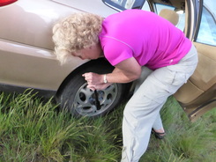
The day started and ended in rain, buckets of rain, but in between downpours, we had sunny skies--that's how our day hiking along McDonald Creek, followed by rafting the Middle Fork of the Flathead, went.
As we left Great Falls at 5:25 a.m., the cloudy skies turned to rain from Conrad on, making us think the weather prediction of occasional showers might be wrong. However, when we crossed Marias Pass, all was well. The clouds were high in the sky, which was perfect for our hike along McDonald Creek. We arrived in West Glacier at 8:30 and met with Madelon and Jackie from Eureka, the only two of our expected four who met us. Perhaps, the cloudy weather scared them away. Our hike was a bit humid but otherwise uneventful weather-wise. The creek was high, producing big rushing water over the cascades, including McDonald Falls and Sacred Dancing Waters, where we ate a hurried lunch. A few of the gals went a quarter mile more bushwhacking up the trail to view yet more cascades. The clouds covered the tops of the mountains, but the hike was still gorgeous. We saw a few flowers: some fading trilium, pussy toes, alumroot, penstemon, woods forget-me-nots, anica, foam flowers, yellow violet, Canada violet, bunchberry (dogwood), meadow rue, fairy bells, strawberries. For animals, we saw a bald eagle, golden eye ducks, a few harlequin, squirrels, and goats. We also saw tent caterpillars. We had a debate on whether they were tent caterpillars or web worms. We looked up the difference and tent caterpillars come out in the spring and build woven tents in the fork of a branch, while fall web worms come out in the fall and build more loose webs on the ends of branches. Click this link for more information At the end of the hike, we said goodbye to Jackie and Madelon and headed for the second part of the fun: whitewater rafting with Glacier Raft. Our guides Peter and James did a good job of handling us “older women” and didn’t get too mad at us when we couldn’t paddle in sync or told them corny teacher jokes. We had several gals who had never been whitewater rafting before. Was Kuntz ever disappointed when she discovered that the guides weren’t the only ones with paddles: that yes, she had to help! Others wanted to sit IN the raft, not on the outer edges. In the end, we all made it through Bone Crusher, Jaws, Eye of the Needle, Washboard and all of the seven named rapids on the river. And only the front few got wet until the weather took a turn for the worse about three-quarters of the way through, when rain came down. But just as we ended our float, the sun poked its head out for the first time that day to make our barbecue perfect. James and Peter started us out with lemonade, water, a veggie tray and chips and salsa, followed by the main course of steak, chicken and veggie burgers along with bean and pasta salads. But the finale was just what women want: cheesecake with strawberries on top. The one glitch at the take-out spot was no bathrooms: the gals had to try to find a place, but it was difficult with traffic and houses on one side and the “guy” guides near the water on the other preparing dinner. Some have tales to tell and we think James and Peter might too. We felt certain they were laughing after we left about our potty adventures. But the guides also had a glitch in their day: They may be cautious if they take a bunch of school teachers out again. When one guide tried to explain the history of the area, some of the gals knew more than he did. Mary, in particular, corrected him on the name origin of Marias Pass: She knew that Captain Meriwether Lewis named it in honor of Miss Maria Wood, cousin of Captain Clark. As we said goodbye to Glacier Raft and piled into the cars, we still had one last treat of the day: Goats at the goat lick area, but we also had a car mishap: Mary got a flat tire just out of Valier and the rain started coming down in buckets at the same time. It reminded some of another Glacier trip with car troubles in pouring rain. But Mary was our hero; she got out and changed the tire. She was almost done when a gentleman stopped and helped lift the tire back into the trunk. However, the ordeal didn’t end there as the “donut” tire was practically flat too, so we limped into Conrad to find air. Unfortunately the air compressors at the two gas stations weren’t working, but Mary used her own compressor that she had in her car to fill it up enough to get back to Great Falls, although slowly, with Kuntz’s car following behind just in case. After many a giggle on the way home due to over-tiredness, we arrived in Great Falls just before 11 p.m. It truly was Mary's day: She drove, she changed a tire, she used her electric generator to pump a tire, she knew the history of the name "Marias Pass" better than the Glacier guide, and she kept her sense of humor! Side note: it was also a day of turnarounds: Katie missed the trailhead cue, so had both cars turn around and then turnaround again as we were going in the right direction to begin with. Then driving home, we saw the goats, so turned around to go look at them and then back again to face homeward. Then Kuntz missed the Valier turn off, so we turned around again! Another side note: Story about the woman who survived going over McDonald Falls. |
Video of rushing McDonald Falls |
Rogers Pass, May 26, 2015: Threatening Skies Don't Ruin Evening--Chocolate Lilies Everywhere!
|
One clap of thunder as we exited the car didn't stop the girls from climbing to the top in a sprinkling of rain that gave way to bright sun about a half mile up the trail.
The flowers dotted the hills in zones, moving from glacier lilies, our mascot, near the bottom of the trail to bright-blue forget-me-nots at the top, but perhaps the highlight of the flowers was spotting the chocolate lily, about 20 of them to be precise. We saw over 40 varieties of flowers, wtih the culminating carpet on the top of the pass as spectacular as it comes: blankets of forget-me-not, yellowstone draba, cous biscuit root, douglasia, lyall's rock cress and rock jasmine covered the rock in a garden of blooms that stretched over the pass. Flowers weren't the only beauty as the clouds put on a colored show over the buttes visible on the rolling plains. We did pick up a few ticks. Katie found one and Kathy two on the trail, a necessary evil when you are going off trail to take pictures. Then Katie picked off another when she stripped and combed her hair that evening. Yuck! We left the DOB at 4:45 and arrived home by 10:15. Beautiful drive along the buttes with a wonderful sunset. Who went: Sue O, Nancy, Gail, Cathy, Kathy, Katie |
FLOWERS WE SAW
|
Windy Point, May 21, 2015: No Snow this Time on Second Try for Windy Point Pass
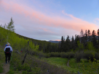
We raced out of work and then raced to the trail head, over very pot-holed roads, to get a quick start on our evening hike to the top of Windy Point Pass.
We arrived at the campground around 6 p.m. (left GF at 4:50) and after we geared up, we hit the trail around 6:20. The flowers along the trail didn't disappoint as we saw over 20 varieties (see sidebar). We used the trailhead at the end of the campground, which was closed when we visited last month and found ourselves in a spring snow storm. Using this trail head, threw Katie off a few times in the directions since it is not usually the way she and her husband travel up to Windy Mountain. But we made it. But not without the 10 stream crossings or Briggs and Thain Creeks, which got our feet wet this time, unlike the April hike when the waters were lower. Plus the first stream crossing on this side, which was the one that was deepest and widest, is avoided by using the other trail head. Besides flowers, we also spied a cow elk, who spooked up the trail ahead of us as we disturbed her drink at the stream. We arrive at the top of the pass around 8 p.m. and enjoyed a very quick dinner/snack and headed back down the trail. The 2.5-mile hike down only took us one hour as it was mostly downhill. We did make it out by dark and arrived back in Great Falls around 10:30, taking a bit longer to get out of our wet and muddy boots and taking a bit more precaution driving at night along the narrow, bumpy road. We saw many people had parked their trailers and tents to stake out camping spots prior to the Memorial Day weekend all along Thain Creek. The green right now is so beautiful but with the early spring this year, many of the wildflowers were already starting to die out and go to seed. The HIghwoods are a good place to hike early before the cattle over run the trails in July and August. Who went: Susan, Catherine, Chrissy, Colette, Doris, Katie |
Flowers We Saw
Arnica Arrow-leaf Balsamroot Bluebells Chickweed Cous biscuitroot Crazy weed Fairy Bells False Solomon Seal Golden pea Hawthorn Larkspur Lupine Oregon or holly grape Prairie Smoke (Old Man Whiskers) Pussy Toes Service berry Shooting star Spring beauty Stoneseed Wild Lily of the Valley Violet (blue and Canada white) See Katie's Wildflower site for pictures of each of the above |
Whitmore Ravine Flower Walk, May 7, 2015
H. Wayne Phillips educates gals on the pea/bean family of flowers
|
We had a lovely time with botanist H. Wayne Phillips who helped us identify many plants of the pea family along the River's Edge Trail. We had a special treat to see the gumbo evening primrose, behind the railings at Crooked Falls overlook.
Who went: Click for Katie's pictures |
|
Grinnell Lake in Many Glacier, May 2 2015
A Tale of Three Bonnies and the Attack of the Spruce Grouse
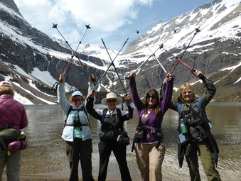
We have three Jessicas, three Marys, three Kathys, but we have never had more than one Bonnie on a hike until this one. Two Bonnies from Great Falls, joined one from Kalispell for our hike to three lakes: Swiftcurrent, Josephine and Grinnell lakes in the Many Glacier Valley. Eleven GiG gals hit the road at 6 a.m., meeting up with two from the Kalispell-based Glacier Gals group at the Essex station.
We then traveled together to the picnic area just beyond the Many Glacier Hotel to start our hike at 9:30 a.m. All along the trail, we saw sign of moose: droppings and tracks. We also so wolf and bear scat. All around lake Josephine on the flanks of Grinnell Point, we saw dozens and dozens of sheep and goats. The sheep were all rams, lying down and some grazing. On this side of the lake, we saw our first wildflowers as well: hosts of glacier lilies and spring beauties with Indian Paintbrush and fern-leaved wild parsley just stating to come out. A sprinkling of yellow violets added to the color.
We stopped for lunch/snack at 11 a.m at the Oastler boat dock shelter, enjoying the views of lake Jospehine and watching more sheep and goats on the side of the mountains.
After lunch we headed back up the trail to tackle the last mile to Grinnell Lake.
At the Cataract creek crossing, we headed up first to the Hidden Falls overlook, which didn't disappoint. Right now, the snow melt is cascading the falls and filing creeks with crystal-clear water.
The stream crossing, though not too difficult, was, of course, very cold. Chrissie hurt her foot a bit and Cathy almost fell, but the current wasn't too bad if you had poles to help. A few gals didn't bring water shoes or sandals so they had to hike in wet books from then on. A few hiked the third of a mile in sandals/Keens to avoid taking off the boots once more for the return trip. The last part into the lake was snow covered, but the beach was bare.
The lake was a jewel, nestled below the bowl formed by Mount Gould, Angel Wing and the backside of the Garden Wall. We had another break for snacks and pictures before deciding we had better head on out. It was so tempting just to sit down and relax all day, enjoying the views and sounds of nature. We didn't see any wildlife on the mountains here, though.
For the return trip, we took the south east trail around the other side of Lake Josephine. This side has much downfall across the trail, so we got our exercise going over, under and around all of the trees. We hoped we didn't get ticks in the process, but no one reported any on this trip.
But we did face another menace: the dreaded spruce grouse, protecting its nest, which we didn't see. However, the grouse ran after us and then flew in a tree. While we were looking at his beauty and taking pictures, he flew down to the trail and started attacking our ankles by pecking and flapping his wings, so we skedaddled on down the trail so as not to upset him too much. We were amazed at how a bird would take on a group of 13 humans, who could have easily stomped on him at any time. All along the trail, we saw much moose droppings so we kept hoping one would show him or herself in the swampy areas near the foot of the lake, but no luck yet.
This trail swings around the end of the lake and crosses Cataract Creek again, but this time we had a bridge, so no need to get our feet wet. Not long after we crossed, we spied a moose by the Swiftcurrent boat dock, which we would have to hike around. He was a young bull just regrowing his horns. We kept a close eye on him as we approached, but while we were out of eye sight, he slipped away somewhere. We made lots of noise as we came around the dock, nonetheless.
As we neared the end of our hike, most of the gals were glad to see the benches along the side of the trail, indicating we were almost back to the cars. Some wished to drop down onto a bench to enjoy the view but wondered if they would be able to get back up.
We reached the cars at just after 3 p.m. and we decided not to try for Serrano's and instead head to Dupuyer for dinner at Buffalo Joe's and some shopping at the Cache.We said goodbye to our new friends from Kalispell, Bonnie and Holly, who may have met up with the other Kalispell bunch at Serrano's We arrived back in Great Falls at 8:30 after a very full day.
On a side note, besides one man who raced out ahead of us at the beginning of the trail, we didn't see another soul. Having Glacier to yourselves is pretty precious.
Who went: Bonnie J, Bonnie W, Bonnie S, Holly, Sue, Chrissie, Cathy, Kathy M, Deb, Doris, Jo Ann, Jenn, Katie
Lake Josephine, Swift Current Lake April 25, 2015
Goats, Sheep, Grouse, Golden Eye--Oh My, the Animals Are Out!
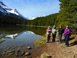
"We know to make noise to keep the grizzlies away; we know how to use bear spray if a grizzly attacks, but what do we do if one is just standing on the trail?" We got this question from two German gals who were hiking ahead of us but returned to warn about the grizzly. "We saw a grizzly at the bridge. Should we just go on past him?" Good question, we all thought--should we go on? This happened at the far end of Josephine Lake.
Well, we decided all seven of us would stick together and stick to our original plans, but two of us took out our bear spray and removed the safety, just in case. Needless to say, we did not see the grizzly again. Our day started at 6:30, when we left the district offices. We arrived at Many Glacier at 9:30 a.m. and hit the trail five minutes later. The trip around Swift Current lake was gorgeous, with not much wind, so the reflections in the water were spectacular. Signs of moose were everywhere: fresh hoof prints and droppings, so we kept a good watch. When we arrived at Lake Josephine, we were treated to dozens of goats and sheep along the west flank of Grinnell Point. We watched them for a few minutes before moving on to the end of the lake, where we ran into the German gals that we had met at the beginning of the trail and lent a can of bear spray. They told us the tale of the grizzly, which made us think a moment before deciding to continue. At the end of the lake, we came across much wolf scat dotting the trail as well as a spruce grouse, which flew and then posed for us in a tree. We had lunch at the boat dock at the Oastler shelter before heading up the trail toward Grinnell Lake. The German gals had intended to try the Glacier Overlook, but we told them-- and they soon found out-- that the angle of the snow was too steep to attempt so they headed to Grinnell lake along with us. When we came to Cataract Creek crossing, however, we decided instead to go to Hidden Falls and call it a day as the clouds were moving in and the snow on the far side of the creek at a steep angle. The German gals did go all the way to the lake, crossing the creek with bare feet and walking in the snow with no poles to keep them from slipping. We all wished for younger days as we watched how agile they were. The trail from the shelter to the lake was about half snow covered, giving our legs a workout. On the return trip, we traveled a loop, opting for the east side of Lake Josephine, resulting in a loop hike around the lake. On this side of the lake, we saw even more moose sign and tracks and faced many fallen trees. We got good at going under, over and around fallen logs, giving our legs a further workout. On the way, we heard loud noises, which we recognized as rams butting heads, but the trees hid our view of across the lake. We arrived back at the car around 3:30 p.m., only to meet back up with the gals from Germany, who returned our bear spray. They reported being attacked by two spruce grouse, which prevented them from traveling the east side of the lake the way we did. However, retracing their steps produced another sight for them: a cow moose in the lake! In addition, they had seen the rams clashing their horns together on the side of the lake. These two gals were so grateful that we had lent them bear spray. Otherwise, they s aid theywould not have ventured forth and seen everything that they did: sheep, grizzly, moose, goats, various birds. After the hike, they were headed to Canada to find a camping spot. After loading our gear, we headed back via St. Mary for the scenic route--what a treat (and when we passed the Many Glacier Hotel, sheep were all over the road, licking our car; we had to drive slowly to push them out of the way after shooting tons of photos). On the way home, we did hit a bit of rain and even a few snowflakes. We ate at Buffalo Joe's in Dupuyer and shopped at the Cache, purchasing local honey, some books and grandbaby items. The construction wasn't too bad going into Bynum, but the clouds obscured our views of the Rocky Mountain Front. We arrived back in Great Falls at 7:30. What a gorgeous day. Tick count: one so far Who went: Gail, Mary N, Susan, Toni and Katie |
|
Windy Pass, April 18, 2015
Scattered showers turn to blizzardy conditions; hike views and flowers
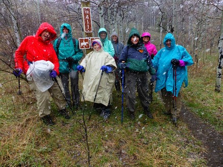
On a day predicting scattered showers, nine of the GiG headed to the Highwoods to climb Windy Mountain. The weather had other ideas.
After a false start with a bad turn that turned into a gorgeous drive toward Widow Coulee, the gals got their only views of the day on the drive to Thain Creek Campground. The campground is still closed, preventing a pre-hike potty stop at the outhouses, so we headed back to the trail head to begin our hike.
When we started on the trail, around 9 a.m. the clouds were high; but not a mile into the hike, the graupel started to come down, necessitating that we get out the ponchos and other rain gear.
The nine stream crossing didn't prove too difficult as the creek wasn't very high. Most of the gals managed to keep their feet dry by jumping rock to rock or walking on logs that crossed the creek. However, on our return, we noticed the snow had brought up the creek levels, hiding some of our rocks that we had used to cross on the way up. By now, the snow was really coming down and starting to stick to the trail.
A gal passed us by early into the hike, and then we saw a teacher running with his two dogs at the top of the pass. He was doing the Windy Peak Loop, a trail of around eight miles.
After we gained the pass, we attempted to go up the peak; however, it was snowing so hard that it was hard to see the trail. Plus, there were no views and the wind was coming up. So we saved the peak climb for another day and headed back down, completing about a five-mile day.
On the way down, some parts of the trail were very slippery mud, causing us to hike just to the side of the trail to get a purchase in the vegetation.
We were able to kick the snow off a few flowers on our hike: pasque flower, Cous biscuit root, spring beauties and kitten's tails.
We were back before 1 p.m. And although the day cleared in Great Falls, the clouds hung over the mountains all day--so much for Katie's prediction that Saturday was the better day of the weekend.
Who went: Kathy D,, Mary S, Catherine, June, Mary N, Doris, Toni, Katie
Link to all of Katie's pics
Mary's Cabin, Seeley Lake, March 27-29, 2015
Waterfalls, Rain, Games and Beaver Creek Hike Keep Gals Occupied

Food was in no shortage on a trip that has some weather interruptions, but the camaraderie made up for one drizzly day of playing games, shopping, and giggling.
It all started on Friday at noon with six of the GiG driving to Seeley Lake in two cars (Mary, Ellen and Randi arrived earlier and traveled on their own). Both cars stopped at the Hi-Country Beef Jerky and gift store just outside Lincoln, but we stitll arrived in Seeley before 4 p.m. As soon as we arrived, we called dibs on sleeping arrangements (two bunk beds, one queen and two doubles in the loft), and then quickly headed for a half-hour drive to Holland lake, so we could get our hike to the falls in before dark.
The hike didn't disappoint, showing off the first two wildflower sightings of the year for the GiG: early buttercup and blue-eyed Marys. We all thought the second one most appropriate since Mary was hosting us at her cabin. But the wildflowers were just the beginning. The snow-topped mountains, the ice patterns on the water and the beautiful falls and butterflies rounded out the experience. On the downside, the ticks were out: both Katie and Randi found ticks crawling on them; in fact, Randi found two.
That evening, Mary treated everyone to her yummy chicken bean soup/stew, while the rest of the GiG provided corn bread, rolls, crackers and cheese and wine with brownies for dessert. The gals all felt tired and headed to bed quite early, skipping games for now.
The next morning, Mary played hostess again, preparing a full brunch of sticky pull-apart buns, an egg/cheese/bread casserole and bacon. The GiG provided juice and fruit to round out the full-fare meal. Yum. However, this excellent start to the day didn't influence the weather, as it rained off and on. So Mary taught everyone a game called LRC (Left, Right, Center), as we waited to see if the wet weather would clear.
Susan won twice and Ellen once, taking home a haul of $13.50 and $6.75 respectively. It appeared the rain let up, so the gals decided to drive up the road for the hike to Beaver Creek, not leaving behind their ponchos just in case. However, along the way, the drizzle turned into full-blown sleet, so we all turned around and shopped around the town of Seeley instead. Several gals picked up projects at the quilting store while others bought tee-shirts and other items from the various gift stores.
Then it was back to the cabin for more fun and games; this time we played Catch Phrase, which brought a lot of smiles when some of us drew blanks on how to describe words.
Then before we knew it, it was time for dinner at the Double Arrow. What a feast we had from pork chops to Shanghai stir fry to elk-burger sliders.. After dinner, we visited Mary's other house, to see how beautiful it was and also see the water damage. What a sad tale.
Sunday morning brought another brunch feast with scrambled eggs with bacon and pancakes. We also had strawberries, oranges and apples and leftover sticky buns and corn bread. After our bellies were full, we packed up, helped Mary clean a bit and headed out to try Beaver Creek hike a second time. This time the weather held, providing blue skies and wispy clouds over snow-capped peaks of the Mission and the Swan mountain ranges. We hhiked from 9:45 a.m.-Noon.
One of the things we noticed was the abundance of deer. Every time we drove or headed outside, deer covered the fields and hillsides. Luckily, we didn't come close to hitting any but we did slow down to around 40 mph to be prepared if any jumped out in front of us.
After our hike, we headed back to Mary's cabin to pick up the other cars, do a final load of everything and a brief lunch. We arrived back in Great Falls just after 3 p.m., at which point Kathy Dunn found a tick. Then Katie found one in her hair after she got home. Yuck!
We owe a big thanks to Mary for opening her cabin to us and scouting out all of the hikes. Every part of the weekend was fabulous.
Link to Katie's pics
Who went: Jeanne, Randi, Ellen, Mary, Susan, Kathy D, Gail, Catherine, Katie
Tick count: 5
Mount Helena March 15th, 2015
A hike up Mount Helena on Pi Day, 3-14-15 at exactly 9:26 a.m. (3.1415926) brings a day of hiking mixed with history lessons
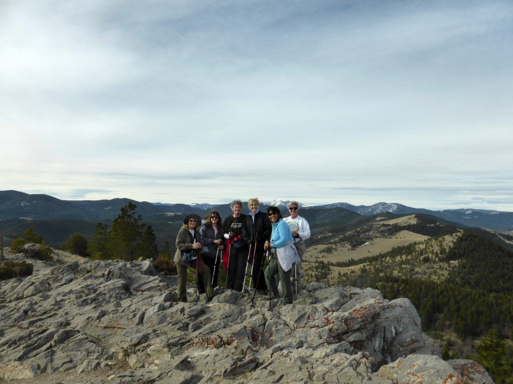
It was Pi Day, so what a great day/time to get out to enjoy mother nature. With high winds predicted in Great Falls and not much snow for skiing or snowshoeing, the GiG headed to Helena for a climb up the mountain of the same name, to get in shape for summer hiking and climbing.
The day held blue skies and nothing more than a slight breeze on top but otherwise shirt-sleeve weather. We started the hike up the Prospect Shafts trail, enjoying the views all of the way up. We took the short side trail to read about the Helena musician and teacher who took children up the mountainside to plant a grove of pine trees that still exist today. Read more.
Also along the Prospect Shafts trail are lime kilns from Helena's early days. The quicklime produced by the kilns was used in construction, particularly to make a strong type of mortar. Read more.
Our history lesson continued as we encountered the dug-out pits, used for military training exercises during WWII to train combat troops for battles in the alps and other mountainous areas. These troops were called the 1st Special Service Force, also known as the Devil's Brigade. Read More Perhaps, this is where the cave area on the mountain, Devil's Kitchen, gets its name.
After the climb of 1100 feet (we took the Hogback trail connected to the Prospect Shafts trail), we made it to the top to enjoy 360-degree views and a snack; then we headed back down the mountain via the 1906 trail, stopping along the way for side trips up to the limestone caves to view the bat guano and holes in the side of the mountain. This area is very steep so we were glad to have our poles to help us stay steady and keep from slipping.
Our history lesson wouldn't be complete without a trip up Reeder's Alley, the quaint brick townhouses that sit at the base of Mount Helena along a steep winding alleyway for lunch. We at Karmadillo's, an order-at-the counter southwest-Mexican eatery. We had the choice of eating in our out and we choose out, since the weather was so beautiful. Katie was disappointed to see that the Stonehouse, a fancy Helena-tradition restaurant was now occupied by offices.
Read more about Reader's Alley. the Stonehouse and other former businesses that inhabited Reeder's alley--this site includes a great video to learn more about the history of the area and buildings.
After lunch, we strolled down Last Chance Gulch, shopping at the various stores and getting some sweets at the Big Dipper Ice Cream and the Parrot candy store.
Who went: Kathy D, Cathy, Catherine, Mary N, Susan, Katie
Times: left at 7:30 a.m., done hiking by noon, home by 4 p.m
Link to Katie's pictures
More information on hikes in the Helena area
Map of hiking trails on Mount Helena (it's best to use IE --otherwise, you have to enable the Silverlight plug-in in Chrome)
pdf map of Mt. Helena
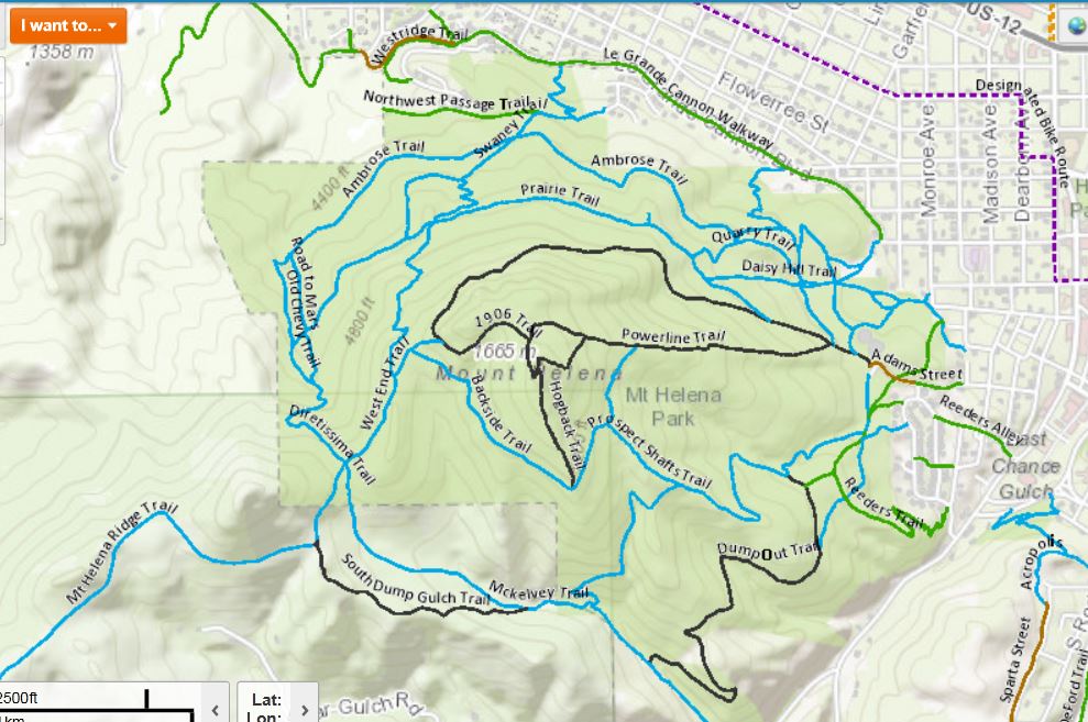
Lubec Lake and Ole Creek, March 1, 2015
Double the fun in one day: Essex and Two Medicine
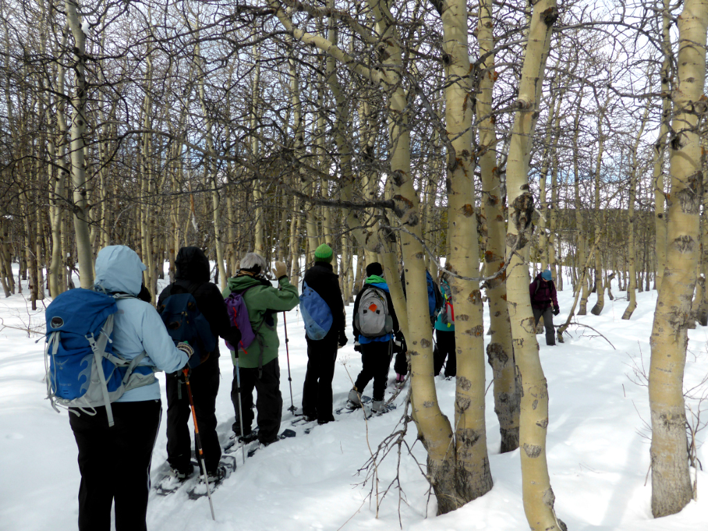
On a gorgeous first of March, four gals headed to Glacier for a tour of Lubec lake with MWA, followed by a hike up Ole Creek with two gals from the westside group (Glacier Gals Hikers and Kayakers), a first time that the groups had a joint venture.
We left town at 7:15 a.m. and enjoyed spectacular views of the Rocky Mountain Front as we decided to drive the Choteau route to be closer to the mountains. Although the weather was cool to start and very windy in Two Med, the temperatures warmed to 32 degrees with no wind at Essex. We met the MWA group at the Two-Med Grill, got some snacks and pie for strength as we waited for the last few people from Choteau to arrive, but they never did.
The Lubec Lake hike was more of a stroll with Donna, Jo and a ranger explaining about the homestead and railroad history of the area. (Read Dream Chasers of the West to learn more). Over 20 people attended the hike, and we enjoyed seeing coyote, snowshoe hare, deer, elk and moose tracks. Some of us saw a moose run scared up into the hills from the lake bottoms. The rest of us saw the sign of her. We enjoyed seeing the old homestead buildings or what was left of them, the pussy willows in bloom as well as the beaver lodge and birds' nests.
The GiG gals had to leave the hike a bit early (due to the late start) to meet up with the Westside Gals, who were waiting patiently at the Izaak Walton for us (we were 25 minutes late). Marta and Jackie seemed like long lost friends even though we were meeting them for the first time. The hike up Ole Creek on the South Boundary trail was lovely, and Jackie liked her first experience snowshoeing. Marta filled us in on her plans to set up some "meet-up" backpack trips into the Park this summer. We were amazed to learn that Jackie had traveled all of the way from Eureka on her own to join us. The GiG gals traveled about as far, but we had each other to talk to on the drive.
Most of the gals were a bit tired after the uphill of Ole Creek, which didn't have much snow. In fact, we took off our snowshoes at one point as there wasn't any snow at all in places. We came across four skiers who had skied the notch in St. Nick and were skiing on bare ground.
The day ended with a total of about 6 miles of snowshoeing. We heard from those on Lubec Lake hike that the Izaak Walton had run out of food the night before, so instead of taking our chances and eating there, we decided to hit the road for the Lighthouse out of Valier. Unfortunately, when we got there, a large party was taking up the whole dining room, and the bartender said they weren't seating anyone else for the night. So we decided to hit the road again and go into Conrad, when we spied Froggies, which was open. The food was better than expected, with the fish and chips being very crispy, served with hand-cut fries and chips.
We arrived back in Great Falls at just after 8 p.m.
Who went--Lubec Lake only: Jo Ann, Sara, Anita, Brianna, Bonnie W
Lubec Lake and Ole Creek: Katie, Susan, Bonnie, Jeanne and Westsiders Jackie and Marta
Link to Katie's pictures
Link to Bonnie's pictures
Flesher Pass, Feb 15, 2015
The GiG Pulled Over Again; Sparse, Crusty Snow With No Wind
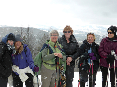
The day started at 7:30 a.m., as the GiG took off from the District Offices on a rainy day.
We headed past Vaughn and approached the other small towns on our way toward Rogers Pass, when all of a sudden we saw lights flashing out the rear window; we realized Katie's new car must have started a trend, as Mary N was the one pulled over in a speed trap, but she came away a bit better than Katie did as she got off with a warning.
Even the though the day started a bit rough with rain and an almost-ticket, it turned out beautifully. The snow wasn't the best--very crusty--but the wind was nowhere to be found, thank goodness. To have a still day and views on the Continental Divide trail is always a treat.
We were surprised to see all of the destruction at the trail head. A logging crew had been in and clear cut many trees, leaving a lot of debris to walk over. There were many beetle-kill trees on the trail, some fallen and others not far behind, so we realized it was probably a good thing to clear some of the dead out.
At our lunch spot, we enjoyed the views into the Helena valley on one side of the divide and into the Swan valley on the other.
Even though the snow seemed spotty, especially around trees, we did see that it was deep along the trail as someone had post-holed for a few miles. We marveled at the person's strength as each step sunk down to waist level.
On our return, a snow storm whipped up right as we were ending our four-mile trip, a perfect time to head home before the wind got us. The snow was graupel (gropple), soft hail balls, that rolled into bunches along the ground.
On the drive home, we enjoyed views of the snowy buttes. We arrived home around 2:30, an early day with no place to stop for refreshments.
|
|
Below is the route from Stemple to Flesher if anyone wants to ski this great traverse or hike it in the summer.It is one section of the CDT (Continental Divide Trail)
|
Showdown Learn-to-Ski Day, Feb. 7, 2014
Wet Weather, a Birthday and a Speeding Ticket Mark the Day
|
At 7 a.m., eight gals crammed into Katie's new Chevy Traverse for its maiden voyage with the GiG for a trek up to Showdown ski hill for some lessons. On its first trip out of town, the car got a ticket--actually, Katie didn't pay attention to the speed limit in Neihart and ended up getting pinched for going 50 in a 35 mph zone! Not a great way to start the day..
The day was a bit warm with strong winds, producing very wet conditions and clumpy snow, but that didn't deter the girls! Everyone rented equipment (except our expert Gail, who had her own) and made the best of the day.We even got a $5 discount on our expected $35 equipment rental/lesson, so we couldn't complain. Gail also has her own locker in the lodge, so we had a nice place to store our valuables, as we stashed our lunch and extra clothes downstairs at the lodge. In addition, the wet conditions called for goggles. Gail had the inside scoop that we could borrow some from lost and found. So off she went and produced five pair. What a nice bonus. We were all geared up a half hour early, so Gail gave everyone a mini lesson to get our legs prepared. Already we were getting a little wet though. To our surprise, we ended up with a male instructor when we were told someone named Anna would probably be our guide.He was probably just as surprised to get a group of women over the age of 50, with the exception of one. Most of us had our trials on the slopes, from the instructor making us all "fall" and then get up on our own without the aid of poles, to crashing into trees wells, to boots that didn't fit right. Thank goodness Gail was there to help with extra tutelage as our instructor became a bit impatient with gals of a certain age who weren't quite as agile and strong as they used to be. But overall, we all had a grand time. On top of that, we learned it was Mary's birthday, which called for a toast at our lunch table. After eating our lunch, some of the gals headed back up for one or two more runs and were surprised that it was easier the second time down the Golden Goose. By then, we were all wet and some of us getting quite cold. On the way home, we took a side detour through Silver Crest so those who weren't familiar with it could see it. We arrived back in Great Falls around 4:15, some of us thinking we would try skiing again and others probably not. Who went: Kathy D, Kathy M, Gail, Roni, Jenn, Bonnie, Mary, Katie Link to Katie's pictures |
|
Home Gulch, Rocky Mountain Front, Jan. 31, 2015
Snowy day with icy trails; No views of Sawtooth Mountain
The drive into Augusta revealed stunning views of the mountains along the Front, particularly Sawtooth Mountain, Steamboat and Haystack Butte before we hit Deva's house for her delicious soup and all of the goodies everyone brought, for example, Catherine and Ed's cardamom bread, Kathy M's wheat bread and Katie's halfway cookies. Who went: Kathy M, Katie, Susan, Gail, Anita, Michelle, Sara. Amy and Catherine traveled with others. Link to Kathy's pictures |
|
Blacktail Gulch, Jan. 10, 2015
Gals see elk, pronghorns, coyote, deer, sheep on hike along Front
|
The day stated at 7:45, as we headed to Augusta to meet our hike leaders Deva and Len on a partly sunny day. The hike was an MWA winter wilderness walk in an area just slated for protection with the recent passage of the Rocky Mountain Front Heritage Act
The roads were a bit icy with some drifting on curves, but Gail and Susan handled the driving well. After a bathroom break at the Buckhorn bar, we dropped our food for the after-hike get-together at Deva's and then met the rest of the group at Len's. It was another hour's drive to reach the Blacktail Gulch trailhead via the Sun Canyon road. Gail and Susan earned brownie points for their driving on the super slick and snowy gravel two-lane county road. One rancher even stopped us to warn about the icy conditions we would face. Along the way, we stopped twice to pull out our cameras and binoculars to view the 100+ elk littering the flats of the Sun Canyon game range.We also saw a herd of sheep right off the road near Wagner Basin, always a good place to view bighorns. It was a great day for animals. We must have seen over 1,000 mule deer in pastures and plains on the drive in and back as well as seeing herds of antelope, and a coyote just staring at us from the side of the road. When we reached our destination, we had to park along the side of the road as the parking lot wasn't plowed.Seventeen hikers trekked just over six miles up the canyon on a sunny and practically windless day, a rarity along the Rocky Mountain Front. And the temps rose to over 40 degrees as the sun poked its head from behind the clouds before disappearing in preparation for the next predicted storm. Many animals had tracked up the area with deer and rabbit the most obvious. We also saw much evidence of pine beetle, including the "blue" pitch (coming from pitch tubes the trees produce to try to stop the beetles) and trees with obvious holes and woodpecker damage (slabs of bark around a tree are an indication). The flickers and downies move in after beetle damage. More info from Colorado State University Extension Service: Signs and Symptoms of MPB Attack
|
The drive into Augusta revealed stunning views of the mountains along the Front, particularly Sawtooth Mountain, Steamboat and Haystack Butte before we hit Deva's house for her delicious soup and all of the goodies everyone brought, for example, Catherine and Ed's cardamom bread, Kathy M's wheat bread and Katie's halfway cookies. Who went: Kathy M, Katie, Susan, Gail, Anita, Michelle, Sara. Amy and Catherine traveled with others. Link to Kathy's pictures |