Silver Crest, Dec. 16, 2019: Gail Solves Snafu with Brand New Snowshoes

The 7 of us left 4 B's parking lot at 8:30 and headed up highway 89 towards Kings Hill Winter Recreation Park just beyond Newhart with Susie M. and Susan C. as our drivers.
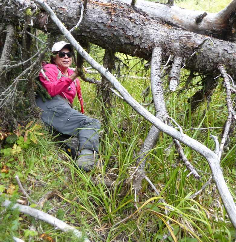
The roads were essentially clear most of the way and with very little traffic. We arrived around 9:40 am in the parking lot and began to don our snow shoes and other gear when Maria mentioned that she needed assistance with her brand new MSR snow shoes. She just wasn't able to adjust the straps effectively to allow for comfort when walking. Some of our ladies with MSR experience, stepped in to assist but without success. There were a few frustrating moments struggling with her equipment when Maria said " I've got enough problems right now!". In the midst of this.. Susan C. found a black plastic piece of something un known to anyone around.. We decided to leave the plastic piece at the car in case we would need it later. As we headed across the parking lot to the head of the trail, Brenda, began to fiddle with her new snow shoes and seemingly had trouble with the fit of them, too!!
Gail, in her wisdom, came to the rescue and determined that both pairs of snow shoes still had some of the packaging materials attached to them which interfered with appropriate fit!! Tis explains the mysterious black piece that Susan C. found near her car!! AH HA!! Once that was settled, we headed up our trail with Gail in the lead and Susie M and Susan W. as sweep. Now the adventure would begin!!
And what a beautiful day to snow shoe. The temps were actually perfect with wind from the south at 10 miles per hour. Once we travelled into the trees , the temp stabilized to 32 degrees which turned out to be very comfortable. With blue skies, we headed toward the hut on the Chaser trail where we met Fin and his wife. The were wonderful to take a few pictures of our group and explained that they were involved in the support of trail maintenance at Silvercrest and are acquainted with Katie and Tom!!
After a brief 15 minute rest break, we moved on and headed up the hill into the wide open field (not well marked) in search of the final loop of Springboard trail. It took us a total of 2 hours to complete all 3 loops and return to the parking lot!! We headed down the road to Bob's Bar for a late lunch- and had a nice visit with the soon to be new owner, Janice. (gave her a copy of the Silvercrest Trail map)
We arrived back in Great Falls around 2:30 pm ! Attendees: Sue M., Susan W., Susan C., Viki, Maria, Brenda, and Gail.
Jefferson Cr. & Memorial Falls, Dec. 7, 8 2018: Sunny, Cold, Sets Up Tony's Last Day at Bob's
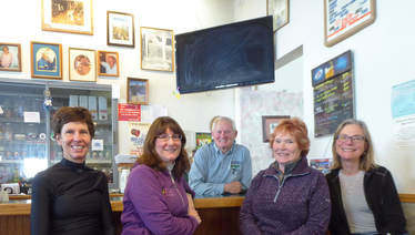
How many meals have we eaten at Bob's Bar and Restaurant in Neihart? Who served them to us and suggested a huckleberry cream drink to go with our Reubens and sweet potato fries? It was our friend Tony, a guy who has been quietly bemused by our sometimes crazy winter outings in the Little Belt Mountains. So this day was no different; we started it with a fun day of snowshoeing three miles along Jefferson Creek, followed by a quick trip to lower and upper Memorial Falls, followed by a late lunch at Bob's, for Tony's last day of cooking and serving food. After 36 years, he deserves a vacation, trips to see his children and just some rest; still, it was hard to say goodbye. The day started at 8:30 a.m., seeing us on trail around 10, after a quick trip to the Inconvenience Store to drop off some plastic and paper sacks and using the facilities. At the trailhead, we had a few false starts. It was so cold, that most of us decided on third or fourth layer, a heavier jacket, bigger gloves and even another pair of pants. Despite the cold, the day was gorgeous, not much wind, blue skies and sun. However, we didn't get too many pictures on the way going as we were too cold to get out our cameras. The few times Gail and Katie pulled out their cameras, the shutters and zoom made weird noises and were a bit slow to focus. Nora tried to use her phone but the battery died immediately due to the cold. We trekked to the bridge and decided to keep going until we hit the Pack-It-In, Pack-It-Out sign, making a full three miles. On the return to the cars, we finally started to warm a bit, so we stopped a bit more for pictures as the crystals along the creek were amazingly large and sparkly. Then it was off for a trip to see Memorial Falls all frozen in winter wonderland glory, just a quarter mile down the road. And it was gorgeous. The entire walk along the creek leading to the falls was magical. We had to watch our step along the frozen spring section as the ice was quite slippery. After enjoying the main waterfall, we decided to follow the well-worn trail to the upper falls. Again, the icy crystals were so pretty. The falls wasn't frozen over the way the lower falls were, probably owing to the sun shining directly through the trees. The lower falls is in the canyon, not receiving much light, if any at all. At 12:30, we finished our hike and headed to Bob's, to catch Tony on his last day. Sure enough, he was there but hanging out in the back. Instead of him giving us our familiar menus, a woman came over and did so. We inquired if she were the new owner and she replied she was. We found out her name is Janice and she plans to keep the same menu except run specials. She didnt' want to mess with tradition. Most of the gals were happy that the Reuben and sweet potato fries would be sticking around. Janice is from Texas but was raised in Indiana and the Chicago area. She said her boys have graduated from high school and she always wanted to run a motel, so now she is. And she is interested in joining our group. Katie gave her the info.Service was a bit slow, and Tony pretty much kept to the back until we dragged him out, gave him a card, promised to get him and buy him lunch when we are in town and asked for a last photo with him behind the bar and we in front. .He was smiling. Who went: Nora, Gail, Sara, Katie A second trip to Memorial Falls and Jefferson Creek went out on Saturday as well. Who went: Mary N, Kuntzie, Sue, Christi, Viki |
Susan C's Recipe
Lime Jello Salad Prepare 3 ounce Lime Jello as directed on the package. Mix 1 cup shredded green cabbage, 1 cup drained chopped fresh pineapple, 1 cup almond slices, and 1 pomegranate. Pour jello into mold. Add vegetable, fruit, nut mixture. Let it set for 4 hours. |
Silver Crest, Dec. 4, 2018: Perfect Day of Snowshoeing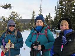
Gail, Viki, Susan C, and Jo Ann left Great Falls at 8:30 a.m. for snowshoeing at Silver Crest. Thank you, Gail, for driving. We were pleased that the road was mostly bare and dry, the parking lot was plowed and the trail was mostly broken. Gail led and Jo Ann was the sweep until the warming hut. After our stop at the warming hut for a snack and a drink, Jo Ann and Susan broke trail, three or four inches, on the slight uphill climb.
There was no wind. We all commented about the fast moving clouds. A couple times when we stopped for a photo of the snow glistering on the trees, a cloud moved over and spoiled our shot. But, in a moment the sun was out again. It was peaceful trekking through the trees, roundtrip about two miles. On the way back to Great Falls, we stopped at Bob’s Bar for lunch, but the restaurant was closed. So, we continued to Monarch and stopped for lunch at Cougar Canyon. We all had great burgers and excellent service. The bartender told us that Bob’s closes on Monday and Tuesday each week. The bartender overheard us discussing bear spray and asked if we carried it when snowshoeing. He told us that recently mountain lions have killed deer in the yard of a few resident’s in the area. Apparently, the lion population is increasing with no predators. We arrived back in Great Falls about 2:30 p.m. A perfect day in the mountains. |
Sunrift, Baring Falls, Sun Point, Nov. 30, 2018: Sixteen Gals Meet for Hike in St. Mary Valley
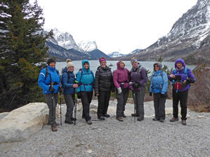
Eight from Canada, six from Great Falls, one from Eureka and one from Rudyard--16 hiking-crazy gals met for an almost-December hike in Glacier National Park.
The drive in (GF group left at 6:30 a.m.) was gorgeous with alpine glow over the Rocky Mountain Front, a herd of over 60 elk in Two Dog Flats (where they usually hang out morn and eves), and two bald eagles in old snags along St. Mary Lake. It was a bit chilly with an initial headwind, but we bundled up and headed out at about 10 a.m. after a quick group picture at the Rising Sun sign. The lack of snow kept the hiking very easy, most of which was on the road anyway. The pavement did affect our hips and knees by the end of the hike, but what a hike it was. The snow-capped mountains stood out despite the rather gray day. We also enjoyed the reds and oranges of the willows and red Osier dogwood in stark contrast against the burn of the Reynolds Creek fire from a few years ago. And the ice crystals forming on the weeping walls and waterfalls were gorgeous. Our "hike" took us first to the world famous Wild Goose Island overlook, for some the first time they had this normally popular, swarming-with-people place all to themselves. We snapped hundreds of photos before venturing on to the next point of interest: Sunrift Gorge, a very narrow slot canyon with Baring Creek running through it. Along the way, we saw coyote and wolf scat along with a lone moose's footprints in the little bit of snow remaining on the side of the road. We took our pictures at the gorge, which had ice crystals and icicles forming along the canyon walls, and headed down the rather steep path to Baring Falls for our lunch. On the trail we saw evidence of digging, probably a bear, but we didn't see tracks. Baring Falls was ice free, a bit of a surprise. We enjoyed eating at this peaceful place, again all to ourselves. Then we continued down the trail to Sun Point. We were hoping that the sun would peek out of the clouds by the time we arrived but it kept hidden. Still, this viewpoint is stunning: Divide Mountain in one direction and Fusillade and Citadel in the other. It was too cloudy to see Florence falls. Also, the spotting guide had been taken down for the winter, so a few of the mountains we couldn't identify as no one had brought a map. Then it was back up to the road from the Sun Point area, a four-mile walk back to the cars bypassing Wild Goose Island once again. The wind was at our backs now, making us all feel a bit too warm. We really sped back to the cars, covering the four miles in just over an hour. We didn't see any other wildlife other than the elk and eagles that we saw on the way in (except Madelon saw a badger on her way home), but the mountain views were pretty. The sun started shining as we got out of the valley area making them all the more beautiful against a blue sky. It was now time to say goodbye to Madelon as she headed back to Eureka and the eight Canadian gals. The rest headed to Browning, where we then said goodbye to Ann as she went to Rudyard. The GF gals stopped in Valier for a quick bite at the Panther Cafe before heading to GF, the others already arrived at their homes. GF gals got back at 7:30, an hour earlier than expected. Who went: Maria, Randi, Susan, Gail, June, Katie (GF); Madelon (Eureka); Ann (Rudyard); Carol, Pat, Kathy, LaVern, Laura, Linda, Sharon, Loural. |
Silver Crest, Nov. 18, 2018: Breaking Trail on Short Course Perfect for Newest GiG Members
The wind was howling on the drive into the Little Belts at 8 a.m., creating ground blizzards over the already icy road. We wondered what the day would be like as we made our way up Kings Hill Pass for a day of snowshoeing.
hen we reached Silver Crest, we found the parking lot hadn't been plowed, so Camille and Gail, our drivers, had to make sure not to stop the cars as they squirreled their way though the deep snow or else they might not have been able to start again. Luckily, in the main lot area, enough cars had come through before us to pack the snow a bit. By the time we used the facilities, geared up and got on trail just before 10 a.m., we realized the wind wasn't really blowing at all and the sun was starting to come out. However, we were all a bit chilled. But we warmed up quickly as we tromped through a few new inches of powder, all except Doris who had a bit of trouble with her hands and feet. Camillie had hand warmers that helped. At first, the going was easy as the trail had been broken on the first half of the hike, the part leading to the warming hut. And even though it was early in the season, we only encountered one fallen tree that was still exposed, so we didn't really have much for obstacles: a rock here and there. We enjoyed seeing all of the rabbit, elk and deer tracks, but we were surprised with all of the bunny tracks that we didn't see any that belonged to cats, one of their main predators. Our newer members didn't have any trouble handling the terrain or the distance. Both Carolyn (on her third snowshoe) and Viki (on her first) opted for the longer hike. The sun did come out by the time we left the warming hut after a drink and a snack, just in time for our slight uphill climb. When we hit the main trail, Gail and Doris headed back to the cars while the rest of us (7) decided to tack on another 3/4 of mile to do the full outside circuit. This part wasn't broken at all, so Camille, Brenda, Bonnie and Katie took turns packing down the knee-deep fresh snow. Doris and Gail also had to break trail on their last third of a mile. Because the snow hadn't been broken yet, we had to do a bit of trail-finding, searching for red diamonds from tree to tree. We had a few places with a moment of confusion, but nothing too drastic. It maybe took us 30 seconds to find the net diamond and pick up the trail again. We got back to the cars after 2 hours and 40 minutes of hiking and headed to Bob's Bar in Neihart for lunch. (It was 12:40). At the restaurant, we talked to Tony who told us the sale of Bob's did go through to the couple from Texas but that he didn't' have to sell his house as part of the deal. We were all happy to hear that and promised we would visit him when we pass through to say "hi." It's sad to see him go after 36 years, but we were also glad he was able to sell. He is taking his first vacation to see his daughter for Christmas. His last day will be Dec.7, with a party Dec. 8 when he will hand off the keys to the new owners. We got back to town around 3 p.m., an hour and a half earlier than expected. Who went: Carolyn, Viki, Brenda, Camille, Gail, Doris, Bonnie, Jean, Katie |
|
Hidden Falls, Oct. 30, 2018: Surprise Animal Blocks Trail; Eight Miles Turn into 10
This day frightened many of us for many reasons: lots of bear scat on the trail; a ranger's posting about a trail closure due to bears and what looked like a dead bear on the trail blocking our way, causing us to backtrack and go on an alternate trail.
It all started out at 6 a.m. from Great Falls with a stop to meet Ann, a newbie to the group, on her maiden voyage with us in Browning as she was coming from Rudyard. She was 20 minutes late, but not without cause: she faced 35 mph construction and an oncoming car hitting a deer, which sent "particles" hurling into her car. She called 911, checked with the other driver to make sure he was okay, inspected her car for damage and then headed to meet us. Then Susan C got in the car with Ann to get to know her and give her some company as we took the gorgeous drive into Many Glacier. The saw a moose while the other car didn't. And it was gorgeous with blue skies but clouds outlining the mountains of Glacier, especially accenting Chief Mountain. As we drove in the Many Glacier valley, however, the clouds hung over us and the temperatures plummeted into the 20-degree range. So when we got to the picnic area, we had to bundle up before donning our packs for a fun day of hiking. Right away, we saw quite a bit of bear scat, some with mountain ash berries, some with grasses and some with hair, indicating the varied diet during the phase of hyperphagia that the bears enter before hibernation. The bear poo unnerved several gals; however, the trail was wet from the snow the night before, and we weren't seeing any grizzly tracks. Besides, Katie tried to calm everyone: bears haven't attached groups larger than five, she explained. Her words didn't take the edge off, but everyone made lots of noise and kept talking. We rounded Swiftcurrent lake and started the west side of Josephine when Maria and Anita saw some goats high on the mountain side. We all squinted to see them, but those two had the eagle eyes. Maria said it was due to her prior hunting. Then at the head of the lake with Katie leading, she stopped short after the first board walk and bridge crossing: she saw something dark brown and fuzzy lying in the trail. It didn't appear to be moving. At first, Katie thought it was a sleeping or dead bear and backed off. Then both she and Ann thought they saw a hoofed leg sticking in the air, indicating a dead moose. At this point, Katie did get afraid, afraid a bear might be around eating on the carcass. She got out her camera and zoomed way in. Then the foot went down and the head arose with twitching ears. It was a mama moose and she was alive. We were relieved it wasn't a carcass but we couldn't get around her on the trail as the willows were thick on both sides. So we tried to haze her by clicking our sticks and shouting. She wouldn't move. Perhaps she was injured or, more likely, conditioned to humans, given how crowded Many Glacier has been these past few years. Katie watched along with many others a mama moose with baby play in the shore of Fishercap lake. They came out right in front of people with no care. Our group has walked within 10 paces of other moose and even scared a bull moose out of the water when we didn't see him. He just stood up and looked at us. It is still scary to see a big animal so close. Anyway, we determined she wasn't going to move off the trail. At first, we thought we could bushwack around her but then we thought again: What if she has a young one hiding in the willows and charges us. So the only real thing we could do was backtrack and go around the other side of Lake Josephine, which we did. We retraced our steps to Swiftcurrent lake amid a bit of graupel, took the cut across and bridge to the other side and arrived at Oaster shelter at 1 p.m. to eat our late lunch. By then, we were really running late as we added 2.4 miles to our expected day. During lunch, the snow really started coming down; we had to get out more layers to keep warm. We also visited the outhouse, which someone had left ajar, so it was a bit unnerving to open the door to enter as we wondered if any critters would be inside making a nest: luckily not. But this incident reminded Maria of kindergarten days in a one-room school with an outhouse for a bathroom. She was so terrified of using it, she got a kidney infection and then had to have someone go with her. She noticed that the boys didn't have to go into the outhouse to go urinate so she asked her mom one night how she could "get one of them penises." Well, her mother was a bit annoyed at her comment and wondered what they were teaching in kindergarten! We all got a laugh out of that tale. After lunch, we made it to Hidden Falls, the turquoise color as gorgeous as expected, bubbling though a carved canyon, but decided to pass on going to Grinnell lake due to the late hour; not many were too anxious to put on water shoes to cross the creek in such cold weather either, and the farther we went, the more snow was on the trail. So we headed back. We didn't have any more scares for the day, but we saw lots more bear scat. And we saw that the paving has begun on the nature trail around Swiftcurrent Lake. The Glacier Conservancy has many projects to create more handicapped accessible trails and this one is done from the boat house to the Many Glacier hotel. The pavement was tough on tired legs, but we recognize what a nice thing it will be to have. Right now, the only handicapped trails are very short. This will be 2.7 miles when complete. Interestingly, we tried to take the upper trail that ends at the parking lot but instead hit a new road with heavy equipment and lots of torn up dirt. We didn't know if the equipment was for the paving or for work on the boat house or other projects. So we went to the lower trail instead of hunting around for the upper one. As we completed the circle around the lakes, we took in the view from the Many Glacier Hotel/Lodge, climbing the stairs on tired legs to the viewpoint. Storm clouds still swirled, but this area had mostly sun. We saw a few trucks by the worker dorm with tons of wood piled up for the winter. We also saw an open door on the lodge, indicating that the lodge was still getting more of a facelift. Then we continued the last .8 mile around the foot of the lake back to the picnic area and our cars. Karen's knee started acting up but she made it back. We hoped she would be okay since she was driving, but she seemed fine once off her feet. We had more foiled plans come on our way home. First, we said goodbye to Ann in Browning as she would drive through Cutbank to get to Rudyard. Then we continued on intending to eat at Buffalo Joe's since Karen hadn't been there yet. However, it was closed on Tuesdays! So then, Katie had a bright idea to try the Rose Room in Pendroy, even though she knew they require reservations. And yes, they did unless it was just two people, so we turned around and continued into Choteau to the log cabin. There, one waitress got on her coat and left after seating us. The other gal looked very stressed and didn't get to us right away. We felt bad for us. It did take us an hour and a half, further putting us behind schedule. But we did get our meal and some of us got pie for strength. The waitress told us all about how the owner home makes desserts daily and has inventive creations. We made it home by 9 p.m., a great end to the Glacier hiking season. Who went: Ann, Susan C, Anita, Maria, Karen, Katie |
|
Apgar Lookout, Oct. 24, 2018: Golden Larch, Hazy Day Provide Fall Colors on Apgar Lookout
Three gals marched up the mountain to Apgar Lookout on a cool fall day, accompanied by Katie's husband Tom and his friend Gordon. Katie thought they would leave the gals in the dust, but instead, the guys hung back and let the gals lead the way.
We did have some eye candy on the way up: the larch were golden, starting to turn orange, but still glowed despite the haze.We could see a few smoke pillars from slash burning and suspected that the summer fires hadn't quite quit simmering based on the smell and smog in the air, emanating from the Swan Valley and over McDonald Lake. Even so, we enjoyed the views from on top of Mount Stanton, Vaught, Brown and Cannon. And it was fun to look down on the town of West Glacier: the houses, the Flathead river running through it and the golf course that Gordon told us his family created, owned and operated for 20 years. The weather was cool but not cold, and the sun started to come out on our way down, warming us up quickly, with no wind to speak of. We made it up the mountain in just under two hours and down in one hour and a half. (On trail at 9:45, on top at 11:35 and down at 2:15 after a nice break on top for lunch). We ran into a deer on the trail, but no other animals and only saw some old bear scat. On the way in, we came across a man standing next to a grader, who looked like he was getting ready to do some road work. On the way home, the grader had created a berm right in the center of the road. Katie had quite a time steering around it without getting into the brush on the sides that would have scratched the car. Driving on the berm itself scraped the bottom of the car and was so soft, it made the car a bit squirrelly. Then, as we saw some rather large rocks in the road, the grader came straight at us.Katie had to back up, while the operator took several attempts to get into the trees at the side of the road so that we could pass, almost knocking a few trees over in the process. Luckily, we did make it around the grader and back onto a smoother dirt road.It's always an adventure! We left Great Falls at 6 a.m. and got home around 7:30 pm after dinner at Buffalo Joe's in Dupuyer and a quick look-around thet Dupuyer Cache. Interestingly, we saw a sign on a book shelf that said "Tom Kotynski country" with his hiking guide on the shelf. Who went: Camille, Susan C and Katie |
|
Scalplock and Rock City, Oct. 20-21, 2018: Golden Glow of Larch Leads Way to Top of Scalplock Mountain, Stay in Essex Followed by Rock City the Next Day
Five gals from Mountain View, Alberta, joined 8 from Great Falls and one from Eureka for a magical march up to the top of Scalplock Mountain. The day started at 6 a.m. with arrival at the trailhead just before 9 a.m. and getting on trail by 9:15.
It was a bit chilly, hovering around 30 degrees, when we started out but we quickly shed our layers as we started the climb of the 20 switchbacks. To make it fair for everyone to have a chance in or near the front, as that is a common complaint of those who always get stuck in the back, we switched the leader every switchback. However, a few got shorted with only a few steps before the trail doubled back again. We made quite a few stops to glance at the views of the Middle Fork of the Flathead River surrounded by larch in full "bloom," as we wound our way up the trail. We were surprised that we really didn't see any bear scat, or other scat for that matter, along the trail. We just saw the road apples left from the mule train that would have carried the lookout's belongings, gear and remainder of food down after a long summer watching and spotting this year's fires. Near the top, Susan C thought she saw some old moose droppings, but that was it. However, on the way down, we were treated to three bald eagles catching the thermals and playing in the wind, such a majestic sight. Some of us struggled with the intensity of the uphill; after all, this hike has over 3,000 feet of gain, making it just barely, but still in the very strenuous category for our hiking group.Some of us struggled on the downhill even more, wishing for younger knees. But at the end of the hike, the Americans were all looking forward to a nice soak at the Izaak Walton's hot tub, as six of us were staying the night. At the top, we were happy to rest and have lunch, either at the picnic table, or on the side of the mountain enjoying the views into the Great Bear Wilderness with its majestic Great Northern Mountain with Stanton Glacier on its flank or St. Nick (St. Nicholas) on the Glacier Park side. We stayed about 45 minutes before starting our descent, with one group of Roni, Nona, Deb, Madelon and Josy going in a fast group and the rest of us stopping for more pictures of the glowing larch and taking a more leisurely trip down. When the second group made it down at 4:30, the others said Katie's husband had dropped by on his way back from climbing Ousel Peak. He too couldn't resist a hike seeing the golden colors this time of year. Then it was off to Izaak Walton and saying goodbye to the Canadians who were headed home, Madelon who left right away before the others got down and to Deb and Roni who went into Kalispell for the night to say happy birthday to one of Deb's daughters. The rest of us drove the one mile to Izaak Walton for a fine dinner. But we had two surprises: Katie's overnight bag was in Deb's car, so she was without her toothbrush, toiletries, clean clothes and pajamas (the rest of the gals came through with clean shirt and leggings and the Inn had toothbrushes). The second surprise was that the hut tub wasn't working. So some of the gals could instantly feel their muscles seizing up even more without a good soak. But we all survived. Some of the gals headed downstairs to see what was on TV or play some games. Kuntzie found a copy of the Wizard of Oz and put it into the DVD players. Several stayed to watch it. The next morning, we wanted to eat at the Snowslip Inn; its website said it was open from 8 am.-10 p.m. every day of the year. However, when we arrived at 8:20, it was closed, despite the OPEN sign on the door. So we headed back and had breakfast at the Izaak Walton. After breakfast, all but Kuntzie took a mile and a half walk around the grounds, looking at the cabins and cabooses and hiking up the icy and snowy Essex Creek trail. It looked quite a bit different from in the winter, and no trail signs were up yet. We also saw Gumbie with his dog Jake. He said "hi" and hoped to see us come winter time too. He was showing the winter help staff, newly hired, the trails and how to ride the fat-tire bikes that the Inn rents. After stretching our legs (at 10:45), we packed up, Deb and Roni came to meet us and pick some of us up, and we then drove to Valier with a quick stop at Rock City, a place only two of the eight had visited before. Most were amazed at the hoodoo formations and the beauty of the Two Med river where it and Birch Creek and the Marias converge. We arrived home before 4 pm, in time for Kuntzie to stump for Tester. Who went: Susan C., Susan W., Josy, Roni, Deb, Anita, Katie, Madelon, Kuntzie; Canadians: Laura, Joan, Carol, Nona, Dina |
Rock City, Oct. 20, 2018: Sunny Day for Hiking Among the Hoodoos
|
Three gals headed for a sunny day among the hoodoos as they wandered around Rock City amazed at the unusual rock formations. After peaking in and out of the sentinels and other fun stone sculptures, we followed the trail down to the bank of the Two Medicine River, right before it merges with the Marias. Then we hiked along the upper rim to a high point where Birch Creek comes in. We were amazed at the overhang and wondered if it were wise to stand in some of the places where we just were.
After we hiked around for about a mile and a half, we headed into the town of Valier, where Doris gave a brief history of some of the older parts of town followed by a quick visit to Lake Francis. Then it was lunch at the Panther Cafe and home. Who went: Doris, Viki, Randi |
|
Crown Butte, Sept. 15, 2018: Mary S. Finally Climbs Crown Butte
The GiG has climbed Crown Butte four times: 2012, 2013, 2014, 2015, but Mary S has never been able to make it. Plus we had at least three other trips planned, but the weather and gumbo roads prevented us from going.
So it almost seemed like a miracle when it didn't rain, the roads were good and we made it to the parking lot without incident We did have a few cows blocking the road (and a dead one to drive around), which Mary expertly navigated. The weather was nice, very slight breeze, some clouds and haze from the smoldering fires. We made it to the top easily, enjoying some late flowers (showy and white asters, blazing star/gay feather, Canadian goldenrod. The fall colors were just starting, and currants plentiful. Along the trail, we saw much bear scat with berries. We also saw one live and one dead mouse and a snake at the very end of the day. The snake coiled and made some noise, making us think it might be a rattler; but then we saw a pointed tail and knew it was just a bull snake, thankfully. We also saw hawks (or maybe harriers or falcons) and heard them. We even saw one try to make a meal of a magpie, but they all flew off cawing. When we neared the top, we saw an abandoned bike. We were amazed at the athleticism the person must have to be able to bike up the steep trail. And since we didn't see any other car around, we knew the person must have pedaled the 7 or more miles of dirt road. We wondered who it might be. But we didn't find out. We saw no one on the top; the bike was still there when we left. On top, we had a fun look-see around the rim, admiring the lime-green lichen, the spires of shonkinite with its black embedded augite crystals creating interesting formations on the edge of the butte. We also wondered about the cracks in the rock that almost looked like they had mortar in them. In places, the spires looked man-made. We did find the Nature Conservancy sign on an overlook facing Square Butte. We left GF at 10 a.m. and returned by 4 p.m. after a stop at the Mennonite deli. Read more about Crown Butte here. Visit Montana Virtual field trip with geology (won't work on most mobile devices) Who went: Karen, Mary S, Katie |
Info from Nature Conservancy
Crown Butte rises 900 feet above the foothill prairies just east of Montana’s Rocky Mountain Front. Fortified by tall columns of igneous rock and never cultivated or heavily grazed, the butte serves as an outstanding example of undisturbed native grassland. Looking west towards the Front Range of the Rockies, wading through the robust native grasses atop the butte, the visitor feels transported in time to an era long before the first wagon train moved west across the prairie. GeologyCrown Butte is a geological formation called a laccolith. It was formed by intrusions of molten rock, called dikes, which flowed between layers of shale and sandstone that were laid down as marine deposits nearly 80 million years ago. The weak overlying layers bulged upward as the molten rock (magma) intruded, creating the lens-like body of the laccolith. Some of the dikes are visible to the west of Crown Butte, and the soft underlying layers of shale and sandstone are seen at the mouth of the canyon to the south. After the magma cooled, it formed the resultant rock called shonkinite. Shonkinite is a distinctive rock that contains the glossy black mineral augite, which appears as small stubby crystals. Upon cooling, the rock contracted, causing vertical fractures that formed the towers and columns. While this weather-resistant rock still protects the underlying sedimentary rocks, the surrounding layers have eroded, exposing the butte. Laccoliths are rare formations, particularly ones with exposed dikes. Crown Butte is one of the finest examples of a laccolith in central Montana and most likely the world. WildlifeAlthough the most striking features of Crown Butte are the rising columns of rock and the wild grasses, the preserve also provides a rich habitat for wildlife. Mule deer are often seen browsing on the summit or along the north slopes of the butte. The loud chants and trills of the rock wren can be heard from every outcrop on the butte. American kestrels, Cooper’s hawks, great horned owls, and prairie falcons hunt the butte, as do golden eagles. The rocky remains of an “eagle catch” are found on the southeast corner of Crown Butte. Here, within the circle of stones which form the “catch,” native people would hide under branches that they had laid across the top. By placing meat or other bait on the branches they lured eagles to the “catch.” Once the eagles were lured, the natives reached up through the cover of branches and grabbed the legs of the great birds. The eagle’s feathers, considered to be sacred, were then used in clothing, head-dresses and ceremonies. Vegetation Crown Butte offers an exceptional opportunity to encounter an undisturbed grassland ecosystem. The four main grassland habitat types are grouped according to dominant plant species. They are: 1) bluebunch wheatgrass/blue grama (on west-facing slopes and on the crest of small knolls); 2) rough fescue/bluebunch wheatgrass (on slightly more moist sites); 3) rough fescue/Idaho fescue (the most productive climax plant community on the butte); 4) Idaho fescue/bluebunch wheatgrass (found less frequently, usually on west-facing slopes, and includes needle-and-thread grass and thread-leaf sedge). |
Ptarmigan Tunnel, Sept. 14, 2018: Gail Crossed Ptarmigan Tunnel off Her Bucket List
We were off to make a dream come true for Gail: achieve the hike to Ptarmigan Tunnel. For some reason, in all of the years of GiG, she had never done this hike. The weather looked good, and the Park Service had just reopened the trail after more than a month of closures due to bears.
The day started off at 5:15 a.m. and took us through fog, lot of it, slowing us down as we drove around Duck Lake, amaking us worried that we would have a bad day of hiking despite the "mostly sunny" predictions. As we started the trail, we noticed the path to the Many Glacier Hotel was closed with a Danger-Due-to-Bears sign. We realized that the bears must have moved over just slightly; all day long we saw piles of bear scat on the trail, full of currants and berries. We did have fog for the first part of the hike; however, we had beautiful glimpses of snow-dusted Mount Wilbur, Gould and Grinnell, that got hit with the white stuff the night before. The trail had a few puddles to prove that the weather had come and gone, too. But what really impressed and wowed us were the fall colors: reds of the huckleberries and fireweed, salmons of the spiraea, oranges of the currents, yellows of the silverberry, aspen and thimbleberry. The brightness almost hurt our eyes. And we couldn't stop taking photos, which probably cost a half an hour of time, but who cares? Another surprise was that some of the trees around Ptarmigan Falls must have fallen down as we could get a full view of this before-hidden cascade. As we took the turn toward Ptarmigan Lake, the trail took an uphill slant, but we kept moving and pretty quickly. The wind started coming up as well, chilling us. Just before we got to the lake, we heard a large animal walking around and hitting rocks in the creek below us; however, the willows and other brush was too thick for us to see. We imagined it was a moose due to the willows. A little later we heard what sounded like gunshots and some rocks falling from the mountainside to our right. From past experience, we knew that bighorn sheep were in the cliffs butting heads, but alas, we couldn't see them even though we looked and listen for a bit. We wondered if what we heard before was sheep crossing the creek before heading up the hillside. At the lake, we took a very short break, grabbing a quick lunch and putting on more layers. Then we had to remind Gail about Susan's advice: do not look up. At this point, it is easy to get discouraged, look up at the switchbacks through the scree and give up. But we weren't going to let that happen. We were going to make it no matter how long it took, so slowly, slowly we did just that. It took about 50 minutes from the lake to the tunnel. We took a few pictures at the overlook and in front of the tunnel before heading through it. And the views! Wow, we had fantastic sights into Lake Elizabeth and the Belly River country. Most of the hikers we met going down as we headed up said they were unable to see the lake due to fog and clouds, but by the time we got there, the clouds had lifted. We commented that sometimes there is a benefit for taking your time. Then we went a bit further down the trail so that we could see Old Sun Glacier, one of the few that isn't melting rapidly and in some years actually grows a bit. It sits higher than the others at 8,200 feet and has a mostly northern exposure, further protecting it. Read more We admired the striated rock and the lime-green lichen clinging to it, before heading back through the tunnel to descend. On our descent, the colors were still popping, even a bit more, since the sun had poked its head out of the clouds. The underbrush on the side of Grinnell Point really stood out. At the parking lot, we saw three huge, silver-backed grizzlies above the trail--luckily they were quite far off. Several people had spotting scopes to get an up-close look at them. We had a nice early dinner (4:40) at the Swiftcurrent Inn before heading back home. On the way, we saw one black bear and four more grizzlies. We arrived in Great Falls around 9:15 Who went: Gail and Katie |
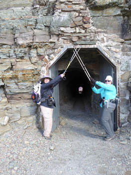
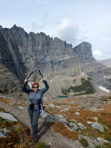
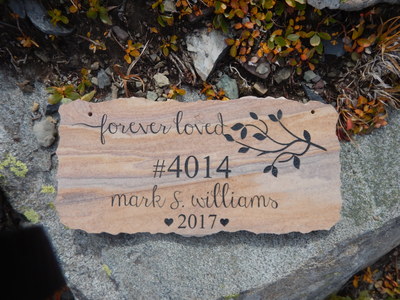
Piegan Pass, Sept. 11, 2018: Pretty Rock Turns into Surprise Find on Piegan Pass
This day held a surprise along the way, which would unfold once the gals attained the top of the Piegan Pass.
Three gals, all of whom had never taken this path before, decided to give this nine-mile hike with just under 2,000 feet of gain, a try, planning for a slow pace if necessary. Two others had really wanted to do this hike, but weren't able to make it. They sure missed a nice one. With all three of us having never done this hike before, we decided to play it safe and start really early as the days are rather short in September. We left Great Falls at 5:30 a.m. and got on trail at just before 9 a.m. We had no trouble parking in the small lot at Siyeh Bend as we were the first ones there. At this time of day, it was quite chilly. In fact, it was so chilly that normally on-fire Susan even put on a jacket, much to the other two gals' amazement. But in not time, we were shedding layers as the uphill starts out right away. The hike itself was beautiful. Preston Park and other sections of the trail still had flowers, mostly asters, pearly everlasting and Indian paintbrush, sticking out among the fall colors of the underbrush. The berries really shined too: elderberries, black twinberries, mountain ash. In general, we had the park to ourselves, seeing only about 20 people on the trail and most of them were heading to Siyeh Pass, so we lost them at the fork. We did come across some hikers at the top of the pass who had come up from the Many Glacier side, having done the hike the hard way with 4,000 feet of gain and only 2,000 feet of loss. We ate lunch at the top of the pass and didn't see any of the pesky marmots that can harass hungry hikers. On top, June went off trail exploring a bit when she found what looked like a very pretty, but very uniform-in-shape, rock. When she picked it up and turned it over, she saw it was a small stone plaque that had a name, number and date on it. We weren't sure where it had come from and surmised maybe it was on top of the mountain and had come done in a rock slide. It read: "Forever Loved, #4014 Mark S. Williams, 2017." It appeared someone may have scattered ashes or just wanted a remembrance of a loved one placed on the pass for some reason, perhaps it was one of his favorite hikes. We wondered what the #4014 meant. Gail did some sleuthing and found a reference to a Mark Williams dying in 2017 with reference to the same number, but still the number is a mystery for its meaning. We left the rock plaque where we found it. See photo slideshow below and this link. We didn't see much for animals, except one sheep that was lying down both coming and going. We surprised ourselves by finishing the hike at 3:30, about an hour earlier than expected, but the weather had been perfect, not too hot, enabling us to really make good time. On the way home, we stopped at a couple places to eat but they were all closed, so we just headed home. We arrived back in Great Falls at 7:30 p.m.. Who went: June, Gail, Susan W. |
|
Firebrand Pass, Sept. 8, 2018: Fall Colors, Wind Blew Us, Canadians Away
Bright red fireweed, hot orange mountain ash, snow berries, saskatoons/service berries and a few hucks--These provided a wonderful understory as we sauntered through thigh-high brush and gorgeous aspen groves before we broke out into the alpine section of the Firebrand Pass hike with our Canadian sister group, the WoW (Women of Wonder).
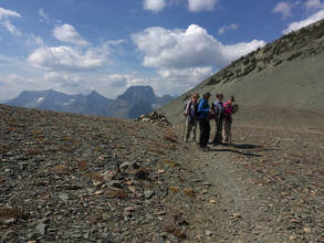
The day started and ended with a train blocking our way, making us wait to get over the tracks to the trailhead for this little-used southern-part-of the-park hike. Even though it is not very popular, about 20 cars were parked at the end of the day. Most of the activity was probably due to the west-side fires shutting down all of the trails, forcing everyone to the south and east side. Six Americans (five from Great Falls and one from Eureka joined seven gals from Alberta, Canada. We got on trail at 9:30 a.m. behind six other parties who got an earlier start. As we made our way on the flatter part of the path, we marveled at the fall colors: the oranges, yellows, lime green and red ground cover really popped in the sun. We knew autumn had started when we saw the false hellebore drooping and brown from an early frost and August snow. Contrasting with the fall colors, we also were happy to see blue sky instead of the smoke we have been used to for over a month. With predictions of 48 miles-per-hour winds, we were surprised that we didn't even feel a breeze--yet. When we hit the alpine section, we felt a breeze and knew the scree section could be challenging if a big gust came where the drop offs were at a dangerous angle; but luckily, the wind kept mostly to our backs and didn't present any issues. However, on top of the pass, the wind was gale-force. We had a hard time keeping on our feet. After enjoying the views of Mount Despair, Peak 8888, Summit and Little Dog and taking a few pictures, we scooted down the side of the pass behind some trees and bushes to get out of the wind before eating our lunch. Then we headed down and retraced our steps, leaving the side trip to Lena Lake for another day. On the way back, we came across several parties just getting started, including a tour of about 30 people, including some Asians who didn't appear to be properly dressed for such a trip. Interestingly, we didn't see any animals: none of the usual bighorn sheep or marmots showed their faces, but it could have been the wind. A few of us did hear the whistle pigs (marmots) calling to one another. Some thought they heard pika too. However, we did find a green shieldback Katydid, sometimes called a Mormon cricket. We arrived back at our cars around 4 p.m. and headed to East Glacier for a meal at Serrano's but not before getting in a little shopping at Glacier Park Lodge gift store, the pottery shop and the Old Goat Traders. After dinner, we drove home arriving back in Great Falls at 8:15 p.m. Who went: Americans: Madelon, Susan C, Anita, Mary S, Beth, Katie; Canadians: Laura, Marilee, LaVern, Dina, Joan, Shellee, Lorna |
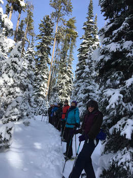
O'Brien Creek, Sept. 1, 2018: Obstacle Course: Bushwhacking, Stream Crossings, Deadfall
es, we hiked the O'Brien ski trail, not knowing what to expect without the cover of snow. We did get a surprise or two along the way in the form of bushwhacking through willows, rock-hopping at stream crossings, climbing over and under deadfall and slogging through mucky springs.
We left Great Falls at 7:15 a.m. and got on trail at 8:45 a.m. after dropping a car in Neihart and a bathroom stop at Silver Crest. At the top of Kings Hill Pass, we were surprised to see all of the rigs with trailers, but then we remembered it was the start of bow season. Frustrating us, the hunters had parked sideways, blocking all of the spots, so we had to park across the highway. The hike starts straightforward enough, following the cat track of the snow machines to the edge of the Golden Goose ski run. Then it takes a turn from Showdown and continues through the lodgepole pines until it hits the open area of O'Brien Park: so far so good. The trail was very easy to follow without many obstacles until this point. And the blue diamonds were plentiful as well, clearly marking the way. During this part of the hike, we followed a bow hunter, dressed in camouflage. We figured he was really thrilled to have us yakking and laughing, scaring all of the elk away. After we crossed the service road by O'Brien Park, the going started to get rough. At this point, the trail follows a drainage with many rocks in it, real ankle twisters. To avoid the rocks, we often found ourselves in tall brush which disguised holes left by elk hooves and burrowing animals. We saw many piles of elk droppings and matted areas where the herds had slept. This drainage then ends where it enters O'Brien Creek, the start of our bushwhacking portion of the adventure. The rest of the day we were searching for the few blue diamonds (some of which were new and of a royal blue color instead of the traditional aqua and much harder to see, we found), in hopes that they would aid us in finding a way out of the marshy mess of willows. Several times we tried to go higher on the sidehills to avoid the muck. However, there were many springs oozing out, which created a bog too. Our boots sunk down. At times, it was easier to step on the willow branches to help stay atop of mud. Another obstacle we found when we went high on the hillsides was deadfall: hundreds of trees littered the forest floor. The going was very slow at these places. We also faced about 15 stream crossings; a few of us fell in at various times as we used downed logs and rocks to avoid wading. We all brought water shoes/sandals, but we never did change. Some of us probably would do so next time. The trail was pretty despite the obstacles with deep greens along the creek, with even a few late blooming flowers: purple showy asters and harebells, deep orange paintbrush, fringed grass of Parnassus, yellow and pink monkey flowers, Shasta daisies, to name a few. We were also fascinated with all of the green-lichened rocks that had tumbled down the mountains, producing enormous talus fields. In several places, the steep rock walls created beautiful canyon. And we came across the old homestead, that is fast disappearing--in the snow, only a few logs are apparent; however, we saw some old kitchen items including a washbasin. Despite the pluses, we all said we weren't eager to hike O'Brien Creek again any time soon. We were happy we did do it, but it wasn't the easiest trail to follow in summer. It is a much better ski (but most felt trying to snowshoe this route would be over the top--a very long day indeed) The trip took us six hours to cover 8.5 miles, a long time due to all of the difficulties along the trail along with route finding. Then four of us walked the extra mile to Bob's bar while the others shuttled to get the two cars at the top of Kings Hill. After a late lunch (3-4 p.m) at Bob's, we arrived home at 5:15 p.m. On a side note, Tony at Bob's Bar said he has an offer on his business. If he does sell, the new owners will take over by Christmas. And he wants us to stop by his house after he leaves. However, he may have to move as the new owners are from Texas and as of yet can't find a house that is acceptable. They may want to buy his house as part of the deal. We were all saddened by this news. Who went: Karen, Anita, Susan C, Katie, Gail, Jeanne, Susan W, Sara, Catherine |
Lake O'Hara, Yoho, Aug. 12-16, 2018: Yoho Camping with Smoke, Steep Trails, Scary Ledges
It took four gals three days of calling with over 800 phone calls each day to get us our four days of hiking, five days of fun, but also smoke, in Canada’s Lake O’Hara in Yoho National Park. We were able to get 12 spots, three short of our hoped-for 15. (Thanks to Jo Ann, Gail, Susan, Mary for all your persistence)
So 12 of us took off Aug. 12 and returned Aug. 16 for an adventure in the Canadian Rockies. Day One It all started at 6:45 a.m. as we crowded 12 of us and our 50 pounds each of gear into two vans, with Catherine and Deb driving. Thank goodness for these vans, which were full, luggage even at our feet. Our first night would be spent in Canmore, a seven-hour drive, with a quick hike to the Grassi lakes, two emerald green gems with a wonderful waterfall along the way. We did the loop hike and followed the easy road-like trail to the top and then the steeper rock-stepped trail with railing back to the parking lot. This hike was a great leg warmer for our future harder hikes to come in Yoho. We had a nice dinner at Wood, a sports bar type restaurant, and then a few stopped to get some libations and fresh food (we weren’t allowed to take fresh fruit or much alcohol over the border) for our first day in camp. Then we had Roni’s homemade Scotcheroos for dessert. Our rooms at the Silver Creek Lodge were very nice: two bedrooms, two baths with a somewhat uncomfortable pull-out sofa to sleep six each (expensive at almost $500 per room per night). One of the baths had a weird shower that dropped a steady, hard stream directly from the ceiling, and one of the rooms had a non-functioning air conditioning, which was difficult to manage since the smoke was too thick outside to open the windows. But we survived the one night. Day Two It was up early for our drive to the shuttle stop, which would take us into the Lake O’Hara campground, our base camp for the next four days. The shuttle for which we had tickets was the 10:30 a.m. one. We arrived at the parking lot at 9:45, just time to purchase our park pass, unload and then park the cars and visit the pit toilet before boarding our shuttle. The Lake O’Hara Lodge bus and shuttle to the Elizabeth Parker Hut came before the campground one, but we were ready. The driver gave us each a green plastic token that we had to keep for our return trip. And despite prior years, the driver did not weigh or even pay too much attention to our bags that we had carefully checked to make sure we weren’t overweight. After a very bumpy bus ride, we arrived at the campground and had a few of our gals claim our sites while the others unloaded and watched over the gear. The ranger gave us a talk about leave no trace, how to use the wash basins to catch our grey water and put it down the toilet and about using only biodegradable camp soap to wash. She also explained about putting all food items, toiletries or anything smelly into the bear-proof lockers and then placing the rest of our items, including poles, boots and packs, inside our tents. Anything else could be placed inside the storage area by the lockers. Then the ranger told us about a closet that housed extras: extra sleeping bags, pads, emergency blankets, tarps, etc. These are items donated or left behind by other campers for all to use. These would come in handy later for us. The day was gorgeous, without smoke, since it had rained the night before. We also thought we were a bit north of the fires and hoped the north wind would keep the smoke blowing to our south. After we set up our tents, we took a hike to Linda Lake and the Morning Glory Lakes, a hike Katie had never been on, but which on the map looked fairly flat with just a few hundred feet of elevation gain. The hike was beautiful, wandering through what we called a gnome forest with gorgeous green underbrush, ferns, mushroom (especially red-capped russula) and many lichens. Then Linda lake was very pretty with the surrounding mountains and lovely meadows, full of paintbrush, showy asters, arnica, fringed grass of Parnassus, and western/seedhead anemone, aka hippy on a stick. Then we continued to the Morning Glory lakes, but this section was steeper and longer than expected and not as pretty. It did, however, take us on a loop hike instead of an up and back. At the end, it passed by the Elizabeth Parker Hut, a backcountry hut run by the Alpine Club of Canada, the sister club of the U.S’s Sierra Club. Then in another quarter mile, we hit the road and stopped at the Le Relais shelter for fudge bars and sodas before heading back to the campground to fire up our JetBoils to make our supper of dehydrated meals. After dinner, four of us (Karen, Susan, Roni, Katie) took a two-mile stroll around the lake, visiting the Seven Veil Waterfall, admiring the cabins (Katie’s favorite is number 6) and getting gorgeous photos of the orange-pink alpine glow on the mountains and their reflections in Lake O’Hara as the sun set. At the camp, we talked to some of the other people to hear their hiking tales; Katie met two Italians, both from northern Italy, one from a town near her relatives. Everyone was very friendly. Then we faced a very cold night that got down to 35 degrees. Our breath was visible as we got up to watch for the Persied meteor shower, but no one saw even one shooting star, unfortunately. Several got cold, so we visited the closet with the “extras,” using two sleeping bags and two mats. Catherine needed two extra bags plus an emergency blanket. Katie’s new mat went flat so she used one of the mats (but it wasn’t comfy so she slept on top of her clothes); Jeanne used a second matt to keep warm. Day Three Today was a big hike day for both groups: those doing part of the alpine circuit and those who planned to hike to the lake and maybe meet up with the alpine circuit group to tackle the Yukness ledges. Katie was leading the alpine group, while Gail led the lake hikers. The alpine group had to make its way up the insanely steep Wiwaxy Gap, which travels 1600 feet in just over a mile. Some of us realized that we weren’t in shape for the task, saying, “I’m done with uphill.” “I didn’t sign up for this.” “This is harder than anything I have ever done.” “Oh gosh, I don’t think I can make it.” Toward the top, we were taking 30 steps and then resting for 30 seconds, and some were eating one Honey Stinger every 30 minutes for more energy. Susan encouraged everyone by saying, “We got this, Girls.” We all did make it, the views were spectacular, but this ended hopes of doing more of the alpine circuit as it had taken us over three hours to do one mile. Sidenote: the purple saw wort flowers were almost dead, an unusual flower we do not have in Montana. Those doing the high trail also faced some “scary” sections on the Huber Ledges as we descended. Several of the ledges were narrow with steep drop offs, so Kuntzie, Roni and Katie led showing where to place feet and hands and checking out best routes for the others. By the time we reached Lake Oesa, most had had enough, so Katie made the decision that we would not do the Yukness Ledges part of the trail and instead call it a day and head back along the Lake Oesa trail. We had hoped to meet the other group at Lake Oesa, but we didn’t see them. At one point, Katie thought she spied them sitting at the lake as we looked down from above, but once we got to the lake, they weren’t there. We wondered if they had made it to the lake. On our way back to the campground, we didn’t’ see the other group, but we did enjoy Victoria Falls, Victoria Lake, Yukness lake and Lefroy lake. However, the smoke really set in. We could no longer see the surrounding mountains, and a haze set in over the lake. We arrived in camp after a stop for ice cream and cokes at Le Relais by 4:30. As we were preparing dinner around 5:30, we started to get a bit concerned about our other group since they weren’t back, and we hadn’t seen them on the trail, so Katie started asking incoming hikers if they had seen three gals on the trail. No one coming from Lake Oesa had but two couples were pretty sure they had seen our gals on the Yukness Ledges. They said they were moving slowly but all was well and that the gals were having a great time. We weren’t convinced that the three were Gail, Karen and Jeanne, but we were encouraged a bit. Then the ranger came with the last shuttle of the day at 6:15. Katie and Kuntzie thought we better tell her about our gals not being back yet. The ranger told us that she has seen our gals and that they had done the ledges! She was surprised that they weren’t in camp yet. We were so happy and amazed that they had gone on this tough route. Then Katie and Susan thought the gals had probably stopped at Le Relais for ice cream, so they started down the road to meet them, which they did. The gals had stopped to soak their feet in the lake. They looked great and had stories to tell about the ledges, being a bit scared but glad to have done them. We all hugged them as they entered camp, so happy they were safe and so proud that they had done the Yukness ledges when the rest of us hadn’t. Gail said they almost ran out of water but that they met a hiker “Jean Pierre,” and he had given them iodine pills just in case. Jeanne said that she now knew what scrambling and bouldering meant. After they fixed their food, Roni got out the rest of her Scotcheroos and some cookie bars! What a treat these homemade desserts were. A few of us played the dice game “Greedy,” a variation of Farkle or 10,000. Katie said goodbye to her Italian friends as they only had one day in the park (they got in on a cancellation). That night, several of us went to the Le Relais shelter to hear a talk about bats; however, it was a bit elementary and relied on audience participation. No one was cold this night as the smoke has warmed the air. We noticed when we got back that the clientele had changed from mostly older hikers to young families. We were in for a “no sleep” night with screaming kids and crying babies. The kids were really running around the camp too. And when we asked the parents about their hikes, they explained that they had gone off-trail climbing Mount Schaffer and Wiwaxy, class three and four scrambling that required roping the children while the babies were strapped to the parents’ backs. We were a bit horrified by the description. Funny exchange during the hike as we made our way along the ledges: “Watch out for the rock.” “Which rock?” “The green one.” “They’re all green.” Sidenote: Susan accidentally dumped her meal on the ground; several of us shared our meal. Day Four By now, Katie knew that no one would be up for another alpine hike (the original plan was to get up very early and try for the Oderay Overlook); the smoke would hinder the view anyway, so we planned to hike together to Lake McArthur, the most beautiful lake in the park. We still got up a bit early in hopes that the cool evening had damped down the fire a bit. But the smoke was still thick. We were happy to get out early anyway as we beat the other hikers to the lake and had it to ourselves for a while. But it was too bad that we couldn't really see the glaciers or the gorgeous sky blue of the lake. s we had lunch, everyone was bugging Brenda to try more things: she sampled an apple, mango and a few other items that had not passed her lips before as she is our meat-potatoes-pasta gal. Along the way, we saw many, many western/seedhead anemones, many that were pulled up with roots exposed along the trail. We wondered if kids had picked them or if an animal had been munching the roots and pulling them up. This hike has a couple of challenges that require using hands to get through the rocks, which everyone handled like experts both coming and going. The surprise on the trail was a pika that came out from a rock right by several of the gals feet. And he didn’t disappear under rocks like pika usually do; he/she stayed visible running along the rocks and stopping so we could get good pictures. Maybe this was the culprit making a meal of western anemone roots? We added speedwell to the list of flowers we saw. Anyway, we arrived a Le Relais for another fudge bar/ice cream snack at 2:30. Then it was back to camp for a rousing game of Greedy (Kuntzie came from behind, then Roni passed her and then finally Catherine nailed the win with five ones/aces—Wow! Our laughing caught the attention of other campers, who commented they hoped they would be having as much fun as we when they get to “our age.” Hah! We had a quiet evening of visiting and coming up with “trail names” for those on this adventure and for the others in our group. (See our website for our names). Katie gave out information on what we had to do to be ready for tomorrow morning’s 9:30 shuttle as we prepared to leave our Yoho trip. Then a few of us headed to Le Relais one for time for the night program, which was on the artists of the Canadian Rockies. However, even though the gal was enthusiastic and knowledgeable, the projector didn’t work so we couldn’t’ see well and many of us were tired. The program ran over on time, so we lost interest. Too bad as her presentation had such potential. It did spur some of us to do further research on these artists once we returned home. Day Five We got up around 6:30 a.m., took down our tents, put away our borrowed gear and had breakfast, putting our bags “in line” at the shuttle stop by 9 a.m. as requested by the rangers. We said our goodbyes to Lake O’Hara with several of us taking one last half-mile walk down to the lake (Katie, Susan, Roni, Deb). We knew we would have a long 8.5 hours of driving. Susan and later Katie talked to the author from the night before, who told us about her favorite restaurants in Canmore in case we wanted to eat lunch there. After arriving back at the parking lot, we sent the drivers to bring the cars around, packed them up, used the facilities and were on the road by 10:30 a.m. We decided to eat in Canmore after a brief look at Lake Louise as several had never seen it (a mistake as we couldn’t even see anything due to traffic and smoke. We drove in to be turned around by security and pointed back to the highway as all lots were full.) The author-recommended restaurant Blake turned out to be a wonderful stop, with excellent and interesting food (or were we just sick of dehydrated food so anything tasted good?) Then it was back home with a few stops for gas/breaks and snacks in Shelby. No one was hungry in Lethbridge, so we just scooted on home, making it in by 8:30, a full 10 hours (which included a long lunch) of travel time. Some of the silliest things we brought: make up, eyelash curler, gin, rum, wine coolers, melatonin, sleeping pills, foundation, mascara, ear plugs, mattress pad that had a hole in it, lipstick, battery charger, way too much food Good deeds we did: gave out two maps to those who had none; gave coffee packets to others, gave dessert to family who had kids, left emergency blankets for the “extra” closet, talked to others about how scary/not scary Wiwaxy was; found a man’s missing glasses Who went (by tent): Susan, Katie, Catherine; Sue, Kuntzie, Mary N; Jeanne, Gail, Karen; Brenda, Deb, Roni |
Mount Robson, July 29-Aug. 5: WoW, GiG Team up for First Ever Backpack
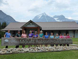
WoW—The Women of Wonder were sure wonderful on the trip to Mount Robson, a provincial park just outside Jasper and just barely in British Columbia. Mary S and Katie headed to Mountain View, Alberta, to stay with Laura, who co-leads the Canadian hiking group WoW. It took us about four hours of driving to arrive at her place to stay the night before our big adventure started.
That evening, we repacked our packs, questioning every single thing that we were taking, trying to get our weight under 30 pounds. Katie, Mary and Laura managed to do so (26, 27 and 29), but most of the others were carrying between 30 and 40 pounds. Some of the crazy things we felt were essential at the beginning of the trip but would probably should have left behind: camp chairs, glasses cleaner, full tubes of lotion and sunscreen, mirrors, glow sticks, sewing kits, hammers, mirrors, hairspray, swimsuits, umbrellas, just to name a few! Laura cooked us a wonderful shrimp penne dinner too, while Barry, her husband, supplied Katie and Mary with some Canadian spending money. Then it was up early the next morning to take our last shower before our six days without a bath. We left at 6:45 a.m. for the 10-hour drive to the Visitor Center and camp ground for our first night of roughing it. It had been a day of trying our patience—waiting in line for a park pass; waiting in line to use bathrooms at Lake Louise, waiting in line for construction until we finally arrived at Mount Robson provincial park. But the drive was drop-dead gorgeous along the icefields parkway even though the Columbia icefield had receded so much; the aqua-blue lakes, the jagged peaks. We were in awe. We also saw a bear and an elk (the rangers were set up on either side of the road slowing people so no one would hit him, we surmised). After we arrived, we had to stop at the VC (we arrived at 3:30, which was actually 4:30 our time) to pick up our permits (again, we had to wait) and have our mandatory orientation about pack-it-in, pack-it-out protocol as well as other rules of the park. Then we headed to the campground to try out our tents for night number one and enjoy a dehydrated meal for supper. The next day, we were on trail by 8:30 a.m. after a quick breakfast of oatmeal and nuts plus the last of our fresh food, such as bananas and yogurt from our coolers. Some of us also picked a few handfuls of wild Saskatoons/service berries as well as thimble berries to complement our meal. The trail was a temperate rain forest with ferns, fungi and moss galore. We saw the white fringed grass of Parnassus, the bright red pyramid of devil’s club berries, pink pipsissewa/prince’s pine, crimson, poisonous bane berry, wood nymph, hare bells, twisted stalk, false Solomon seal, mountain dryads/avens (but yellow, not white), and showy death camas as we followed the milky waters of Robson River to Kinney Lake (4 k up the trail). Harlequin ducks reside in this lake although we didn’t see any. It reminded us of the hike along McDonald Creek in West Glacier in the spring, the water rushing so hard, due to the rapid melting of the surrounding glaciers in the August heat. The heat affected some of us, slowing us down; one gal took a tumble too, but she was okay. We were surprised at the traffic on the trail: day hikers, runners, bikers, and people walking dogs. We were very tired and hot by the time we pulled into our camping place at Whitehorn at 4:30 p.m., in the Valley of a Thousand Water Falls. Unfortunately, many camp sites had already been claimed, so we didn’t find spots close to one other. Then we walked to the stream and disinfected our water and prepared our meals of dehydrated lasagna, turkey with dressing, and stroganoff. Some gals brought dessert: apple and berry crisp and shared. The picnic shelter was quite nice, providing tables and a cover for us as it spit rain a precursor of a very raining night. We also had a wash station and bear lockers for our food and toiletries. By morning, Katie and Mary were pretty soaked, especially Katie who only had a three-quarter sleeping pad, so her feet end of the sleeping bag was sopping. But there wasn’t time to dry anything as we had to set out hiking. Everyone used her garbage bag to pack the wet items before putting the items back into our packs, hoping we would have time—and good weather—to hang our wet items before dark set in. We were up by 5 a.m. but we weren’t on trail until 9:15, partly due to some sleeping in and partly due to wet gear. Tuesday was our tough day: 1700 feet of gain over a few kilometers, but the gorgeous “thousand” falls, in particular White falls and Emperor Falls, gave us some eye candy to help with the uphill battle. Joan, especially as she had an injury from Muddy Creek Falls hike, toughed it out over ankle-twisting rocks on the glacial moraine. This area gave us our first look at the glaciers feeding Berg Lake as they calved into the water below. The sound was like thunder or gun shots before the ice and snow came tumbling down. One time, we saw what we thought was a waterfall, but it was really a calving that fell in a narrow crevice making it appear as a stream.We knew for certain it wasn't a waterfall when after a few minutes, it disappeared. It was hard to tell ice from water since the water was white with glacial till. Some of us had our gear strapped to our packs to help dry; however, about half way through our hike, the rain came again. When we arrived at Berg Lake campground, we quickly set up our tents in the drizzle (the late arrivers had all out rain) before heading to the shelter to put out gear to dry. The shelter even had a drying rack that could be lowered via a pulley system and then raised to the rafters. Katie and Mary had a dilemma with two solutions. Plan A—dry out their sleeping bags and mats Plan B—sleep in tents with some of the gals who had three-person tents. Luckily, their items dried out sufficiently to try another night in the rain in their own tent. Flowers we saw on day two were yellow saxifrage, yellow/red columbine, pink pyrola (wintergreen), and many fungi. The lakes and ponds throughout our backpack so far were pure white with glacial till or flour. Thursday was our lay-in day—no tents to pack up, no heavy backpacks. We had time to continue to dry things in the shelter as well as drop some of our gear and go light on our packs as we hiked to Adolphus lake in Jasper (we saw the border line between the two parks and provinces) and then on the Snowbird pass route to get an up-close look at Robson Glacier and the bergs in its lake. We stopped at the sign indicating the toe of the glacier in 1911, a sign now about a half mile from the toe due to the glacier melting 52 feet a year, which saddened us, but also made us realize how lucky we were to be in such a special place. The day was drizzly again, but it was not cold, so the temp was perfect for hiking. We had no issue with putting on rain gear and heading out to see more sights. Some gals climbed a small knoll to gain a view into the lake and see the icebergs from above. We were also able to see about four more glaciers, all coming right down to ground level, flowing down the mountains like rivers. The alpine fireweed, sweetvetch, yellow saxifrage and mountain avens/dryads were everywhere in this area. Fringed grass of Parnassus and pink pyrola too. After our evening meal, we realized that Joan’s ankle was really sore. WE had to decide: should Joan take the helicopter out or should we divide her gear and have her just carry and empty backpack? With her advice, we decided the latter and decided that we would get on trail even earlier so she could go at a very slow pace to keep from injuring her foot even more. After that, we had fun playing some card and dice games, thanks to Loural for bringing them. For some, it was hard to sleep that night with the glaciers making their calving noises. On Friday, we were all up around 5 a.m. and tried to take Joan’s gear but she kept hiding items from us, but Lorna outed her and kept and eye. It was so hard for her to let us help her; she was the strongest of us all in this decision; she didn’t’ realize how much we wanted to help and how little effort this help took on our part. This day was the worst day yet for rain, the trail turning into a river on the steep downhill section. We had to watch our step over slippery roots and mud; but fortunately, the rocks weren’t slippery. In fact, we stepped on them on purpose to keep our grip. In the rain, the orange of the iron oxide in the rocks really stood out in striped patterns. Since it was Friday, we heard the helicopters flying in and out (they come M/F), taking in people who had paid $250 for the ride in and $200 for the ride out. We found out this information from the German Ranger gals, who was quite friendly and happy to answer our questions about the park. We did a good deed today: a hiking party of young women stopped us and asked if we had any extra toilet paper as they were out. One of our gals handed them almost a full roll. They were so happy when she said they could keep the whole thing since we were on our way out. We helped even more people today. Mary had a map and helped several people with directions and mileage to various places. We really moved down the trail on this day, arriving at Whitehorn by just after 1 p.m. Joan was able to walk at a good clip without all of the extra weight; however, she was limping. We had another issue too: Due to the rain, Mary’s feet got wet and as a result, her core got cold. We had to use hand warmers to get her body temperature back to normal. After our usual routine of water filtering and heating water for dinner, we had time to dry out our soaked gear. Then we relaxed and played games (one dice game was fun: Greedy). We did notice that some of our items that we hung out had slugs on them as well as our tents. The rain had brought them and the mosquitoes out to torture us. Down at the river, someone had set up “rock” lounge chairs, fashioned from slabs of rock and embedded into the river stones. They were actually quite comfortable. The next and last day, we booked it out, Joan doing well on her now very sore ankle, the rest of us still helping to carry her gear. The rain had stopped, and the crowds were back on this stretch, even more so as it was a Saturday of a long weekend. We arrived at the visitor center around 2 p.m. to have a nice lunch and ice cream cones before we split up for the long drive home We reminisced on what “simple pleasures: we missed while backpacking: Chinese food, pillows,hamburgers. When we were a few hours from home, we learned one of the cars had lost keys and had to go back to Jasper to rent a car to drive home. We were all so sorry that we didn’t have service to get this message so that we could have picked them up. We didn't know any other details from the text, which said it was a LOOOONG story. We arrived home at midnight, losing an hour when we crossed into Alberta from BC. Mary and Katie overnighted at Larua's and then made it to Great Falls around 2 p.m. the next day. Our favorites: waterfalls, glaciers, mountains, trees, bridges, rocks, making it the whole way, calving, the cute German ranger, camaraderie, fungi, resilience, working together to solve issues, moss. What we could have lived without: slugs, mud, so much rain/wet, the weight of backpack, flies/mosquitoes, toboggan falls trail being closed, Surprises: how big and how many glaciers, Robson lake had more glaciers than Berg lake, how we got used to the pack, how good we felt on day five, the call of the varied thrush sounded like a whistle, more flowers than expected, how many trees had fallen down, how many people were on the trail |
Siyeh Bend to Sunrift Gorge, Aug. 4, 2018: Panoramic Views Aren't Diminished Due to Reynolds Creek Fire
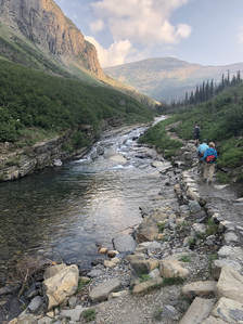
|
Ptarmigan Tunnel, July 22, 2018: Bear Blocks Gals on Ptarmigan Tunnel Trail
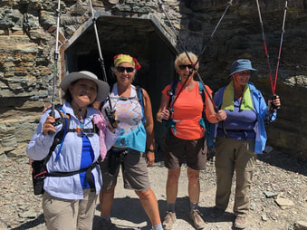
An incident with a bear ruled the day as the gals had to get their bear spray out and scoot 20 paces off the trail to let it by. One foolish and lucky man followed it just a few feet away, taking pictures the whole time.
We left Great Falls at 5 a.m. and arrived back home around 9:30.
Who went: Josy, Catherine, Mary S and Susan W
We left Great Falls at 5 a.m. and arrived back home around 9:30.
Who went: Josy, Catherine, Mary S and Susan W
Muddy Creek Falls & Our Lake, July 23, 2018: Waterton Women Meet GiG for Two Hikes
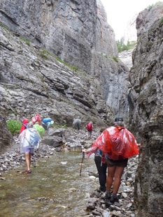
A fall, a lost hiker and an overheated hiker didn't deter the GiG (Girls in Glacier) and the WoW (Women of Wonder) hikers from having great adventures first to Muddy Creek Falls and then the next day to Our Lake.
This was a wonderful two-day trip with our Canadian sister hiking group, the WoW (Women of Wonder). Our first excursion was to Muddy Creek Falls, an obstacle course that follows Muddy Creek into a limestone slot canyon that ends in a gorgeous cascade.It truly is a hidden wonder. The Wow group from Canada crossed the border at 7 a.m., the earliest it opens (one group had to backtrack as they tried Del Bonita which didn’t open until 8!) and met the American GiG group at the Rock Shop in Bynum at 9:15. After bathroom breaks, it was quarter to 10 before we left. The it was a bumpy 18 miles and 40 minutes to the trailhead from there, which includes a gate and two-track road the last few miles. We had to park a half mile away from the main trailhead/parking area as the spring floods had created crevasses in the road. We weren’t sure why the road was roped, off but once we started walking, we realized why. The day, although in the 60s temperature-wise, was hot nonetheless with the sun bearing down in the exposed first part of the trail. Our first incident happened when Jeanne overheated. We poured water on her and Loural offered Gatorade. Susan C agreed to stay with her as she cooled down and return to the cars. We really didn’t like leaving her and felt she would be fine once she got in the shade. Then the rest of the group continued following the stream, with lots of crossings and some bushwhacking up the social trails. We were getting in our rock-hopping skills when Josy heard something, and rightly suspected that Susan and Jeanne had followed us after Jeanne cooled down. Josy went back to guide them to us. It took us a bit longer to go three miles than normal with the route finding and creek crossings. Then the rain started, necessitating a change into ponchos and worrying a few about thunderstorms when we were wading in water. The brightly colored ponchos really made a splash against the limestone cliffs. Luckily, the thunderstorms kept a distance and never really developed where we were. And then the canyon narrowed, and we saw the falls. Everyone was amazed at how gorgeous they were, coming over the top of the cliff with a wedged stone forming a semi roof over our heads. We enjoyed taking many pictures and cooling our feet in the pool at the base of the cascade. After a snack/lunch on the rocks, we headed back with the rain drops now a drizzle. On the return trip, we had two more incidents—maybe it was the far-off thunder foreboding trouble. First, Joan slipped on a rock as she was crossing the creek. She took a good tumble but seemed okay except a few bruises that would develop and soreness on an ankle. However, she was soaked and her boots full of water. So the gals helped her take her boots off and pour the water out, changed her socks and put plastic bags over her socks to keep them dry as her boots were very wet, and she was set to go again. Meanwhile, some hikers had gotten far ahead as we attended to Joan. In fact, Roni missed the turn to the cars, bypassing them and continued down the road. However, no one saw that she had done this. So when we all arrived back at the cars, the slower group assumed Roni was with the faster group and the faster group assumed Roni had taken a potty break off the trail and was with the slower group. No one could really remember the last time we saw her. After we thought of possible scenarios and game up with a search strategy, she was probably gone for over half an hour. So we all got a bit panicked at this point. Thinking she may have bypassed the cars, Susan C drove ahead two miles, honking her horn. When she returned without Roni, we lost a bit of hope. The WoW ladies called for a prayer circle, and we readily joined in. We somewhat organized a search, but Katie realized we need more preparation for a situation like this: the cars started honking horns and some, led by Josy, took off with whistles to search the last half mile of trail or so and to explore splits in the creek to see if she followed the wrong one. Deb, Josy and Susan had cell service. After about an hour with no sign of her, Katie said to call 911. It was now past 5:30 and she wanted to make sure the search team, if needed, had daylight for an aerial search. We all thought Roni might have fallen like Joan did and hit her head. Deb called 911. We had to explain that we were in wilderness even though, yes, we were on a remote road. It was hard to explain that we couldn’t just flag people down for help, that we had seen no one all day and didn’t expect to see anyone on this particular “road.” Then a confusion of mixed messages and several more calls to 911 ensured before she was found—safe! To make a long story short, we found Roni, or she found us. Susan C picked her up on the road. After a while, Roni realized something was wrong and turned around. Katie started crying with relief when she saw Roni in Susan’s car; Deb too. We were all so thankful that nothing had happened and that she had been safe all the time and never in any danger. So many things can run through one's mind when worried. It was now nearing 7 p.m. and we headed to town, tired and hungry. We quickly checked in at the Stagestop Inn and went to dinner at the Log Cabin Café. By now it was almost 9 p.m., so off to bed with a few opting to soak in the hot tub to relax after a good hike but a stressful day. Three of the GiG stayed overnight with all of the Canadians, while four GiG headed back to GF. Many lessons were learned on this wake-up-call of a trip, that will require some research, training at a later date, but we had another adventure the next day. Our Lake The next day it was up early to beat the heat. After a quick breakfast at 6 a.m., we met the GiG gals who were traveling from GF at 6:45 a.m. who met up with the three who stayed over plus the 8 Canadians, making for 15 again. However, Joan was still feeling a bit sore from her fall at Muddy Creek, so she decided to stay to read a book and heal. She needed to make sure she was okay for the big backpack at Mount Robson in a week. After a quick bathroom break, we headed out at 7 a.m., getting on trail around 8:30. The trail was shaded most of the way, and we saw several orchids: lady slippers and Alaskan rein orchid. We were fairly fast going uphill, reaching the lake around 11. Many of the gals were awed by the views: the lake, the remaining snow and the surrounding mountains. Unfortunately, no goats or sheep were out this day. We followed the trail around the lake to the head to eat our lunch around 11:30. The wind was much better to our back. Partway around the trail, we saw Wayne’s Wednesday Walkers, which included Katie’s husband and Camille from our group, but they never encircled the lake, so we didn’t get to talk to them. On the way back, we flew down the hill in about one hour 45 minutes. I guess the ice cream was calling in Choteau. So, we picked up Joan at the Stage Stop inn and stopped in for ice cream; unfortunately, they were out of huckleberry. We said our goodbyes to the Canadians and arrived back in Great Falls around 5 p.m. Who went, Muddy Creek: Roni, Deb, Katie, Josy, Jeanne, Susan C, Joanne (GiG), Lorna, Laura, LaVern, Loural, Sherry, Joan, Dina, Sue Ellen (WoW); Our Lake: Lorna, Laura, LaVern, Loural, Sherry, Joan, Dina, Sue Ellen (WoW); Roni, Deb, Katie, Josy, Susan C, Susan W, Linda (GiG) |
Laura's Sweet & Salty Recipe
Ingredients
Instructions
Notes I put wax or parchment paper on my table for easy clean-up. I remember making this every Christmas to take to neighbors and friends. |
Poia Lake, July 12, 2018: GiG and WoW Survive Insanity Six Times (Three Up; Three Down)
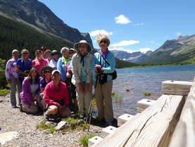
“Insanely steep”—that’s how one hiking book author (Erik Molvar) described the Sherburne cutoff trail that the Girls in Glacier and the Women of Wonder traveled on the way to Poia Lake in Many Glacier.
The trail climbs 1,000 feet in just over a mile, so it is steep; and in three places, it is very steep, but we all made it and safely, just taking a few more breather breaks than normal.
Our day began with six gals from the GiG joining seven from the WOW on our 8.5-mile trek to the gorgeous alpine Poia Lake on the Red Gap Pass trail. If we hadn’t taken the Sherburne cutoff trail, the hike would have been 12.5 miles. So we hiked in honor of Doris and Terry Sherburne, two of Katie’s friends, mother and son, who passed away this year and whose family after whom the cutoff trail is named.
On this trip, we welcomed Susan C on her first hike with GiG while realizing that this was Bonnie J's last hike with us as she heads to Las Vegas.
As a side note, even on a Thursday, Many Glacier was so crowded that there was nowhere to park at the picnic area or the lodge; we had to wait for about 20 cars at the entrance gate when we arrived at 8:45. Just pure craziness in the park.
It was 10 a.m. before we started on what was heating up to be a very hot day, but we made it up the steep hill to where the cut off trail connects to the main Poia lake trail that originates at the Apikuni Falls trail. Three sections were very steep, the first one with small ball-bearing rocks that made a few gals think we should walk out the long way instead of going down the slippery, steep slope on our return.
Most of the hike is through the trees, but just before the intersection, the trail breaks out, revealing gorgeous views of the surrounding mountains and Sherburne Lake. And the meadow area had many flowers, especially orchids. Some were the following: lady slipper, spotted coralroot, early coralroot, white bog orchid, sticky geranium, nine-leaved biscuitroot, harebells, yarrow, lupine, wood nymph
A little farther and we encountered a hidden lake: Swiftcurrent Ridge Lake, a gem hidden behind trees.
Finally, after a lot more uphill, we crested the ridge and started our long descent into the lake, crossing large boulder fields that had a lot of pika droppings, but we didn’t see one. We also saw bear scat and prints as well as moose and deer prints. At one point, Katie scared a deer as she was in the lead during this section.
The lake was pretty (we didn’t arrive until 1:30 pm), surrounded by Yellow and Red Gap Mountains. Some of the ladies walked a way around the lake for better views of the surrounding cirque while the others enjoyed a longer lunch.
Then it was time for the long hike out. At the decision point where the cutoff trail meets the main trail, we all decided to take the cut-off and go slowly to save the extra 2.25 miles of hiking in the heat. And we all handled the steep downhill well, a few sliding on our backsides at times.
It was time to say goodbye to each other, the Canadians headed north and the Americans south to enjoy a meal at Buffalo Joe’s along the way.
Insanity over.
Mount Aeneas, Hemlock Lake, Seeley, July 8-10, 2018: GiG Conquers Two Hikes, Canoe Trail, Enjoys Sunset Cruises |
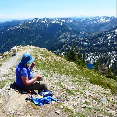
Thanks, again, Mary N for inviting us to your cabin! Wow, we had another fabulous adventure or two or three.
It all started with a hike up Mount Aeneas in the Jewel Basin area. We met Madelon at the turn by Echo Lake and continued on. Somehow, we missed Syd, unfortunately, but we did catch up with her later in our trip. This hike is gorgeous, although a few struggled with the elevation gain. However, once we reached the saddle with the views, it was all worth it. And getting the last third of a mile up to the summit was even more rewarding with 25 mountain goats greeting us as well as 360-degree views. Everyone made it to the very top even though the saddle is still outstanding. We were on top between 1 and 1:30 pm after a 10:45 a.m. start. I should note that on the way to the top, a mama mountain goat was challenging people on the trail. The gals had to be cautious as they climbed to the top. WE have great pictures with Kuntzie and the goat facing off. On the way down (we left the top- just after 2 p.m.), we had intended to take a large loop past Black and Picnic Lakes. However, there was too much snow, so we headed down the same way but took a different loop the last half of the trip. On this loop, we did encounter snow but on a low angle. But we still had a little scare when Susan got a charley horse and fell. She ended up being okay with no damage to her repaired ankle, thank goodness. On this section were tons of glacier lilies and spring beauties coming through the snowmelt. We only saw one other party on this route as well. Hordes were starting to come up the other trail, so it was nice to have the walk to ourselves. We reached the car around 4:15, said goodbye to Madelon as she headed back to Eureka and got to the Laughing Horse Lodge right on time for our 5 p.m. reservation. Our dinner was wonderful as usual at this “unusual” place. Kate, the chef, sat with us for while and wanted to know which hike we had done and told us a bit about the specials. Then it was off to Mary’s house for an evening boat ride and then a rousing game of Left, Right, Center and a few dice games that Mary explained to us. Surprisingly, Susan wasn’t the big winner this time. Since it was going to be in the 90s the next day, we decided to skip a long hike and canoe instead, so we could get a late start on the day. We rented canoes and paddled the Clearwater river Canoe trail, seeing lily pads, frogs, turtles and a loon family along the way. It was very relaxing. Then we had a delightful 1.5 mile walk back to our cars. The trail had many flowers on it: penstemon, yarrow, bunch berry, hare bells and even some late blooming blue camas. Then we continued to the Condon Mercantile for lunch and to look around this newly-rebuilt and much-improved after-the-fire store. The Deli had some delish sandwiches, which most of the gals ordered. However, Kuntzie ordered a pizza. She thought she ordered a personal pan size but they brought her a huge pizza, saying they thought she ordered the biggest size. After this awesome trip, several went back to freshen up at Mary’s cabin while a few walked around town and did a bit of shopping, or should we say, Kuntz did some shopping. It’s always fun trying to predict what she might buy. While we were in town, whom did we run into but Syd! She found us among the shops and came back to Mary’s with Katie while some decided to go to the Chicken Coop for a drink and a try at Shake-a-Day (no winners). Back at the cabin, the gals had prepared all sorts of awesome appetizers, which we enjoyed on the porch. After eating them, we decided we really didn’t need to go to dinner as we were full. Instead, we took an evening boat ride with captain Mary until the sun set. The evening was so lovely it was hard to go inside. Then that night we played Catch Phrase. We had fun laughing when certain words stumped all of us. The next day at breakfast, Kuntzie showed us her new mug, that has a holster and mini flask attached to it, perfect for making her Irish coffee or slipping another libation into her hot drink. Then we tidied up for Mary before heading out for a hike to Hemlock lake in the Mission Mountains. Again, who caught us, this time on the trail? Syd! She came up behind Mary and really gave her a start. After about three and a half miles of walking through young trees that have sprouted since the 2003 burn, we arrived at the gorgeous Hemlock lake, but again, a few of us were flagging due to the heat. This eight-mile hike is Mary’s favorite in the area. It was so great that she shared it with us, a pretty cirque with views of the both the Swan and Mission Range, which still have much snow on the peaks. The only bad thing about this hike is the road into it. It is rough with many branches that can scratch your car. Then it was time to say goodbye after eating a few leftovers and stopping for Ice Cream in Seeley. We arrived home around 6:30 p.m. Who went: Susan, Josy, Deb, Roni, Jeanne, Mary, Kuntzie, Katie with Syd joining us for Hemlock and the boat ride and Madelon for Mount Aeneas. |
|
St. Mary Waterfalls, July 7, 2018: GiG Visits Three Falls on Combined Trip with Canadians
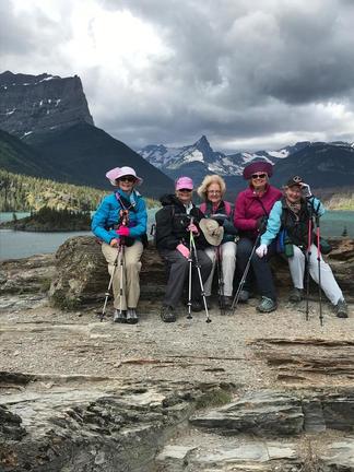
Five of us began our drive from Great Falls around 6:30 am, arriving in Browning for a quick refueling stop and “refreshing” break. We had quite a discussion about the new gas station scam going on at the pumps!! With that in hand, Sue prepaid for gas “ínside” as a precaution which means that the driver must guesstimate “how much” to buy in advance- not such an easy task!!! We headed up Duck Lake Road to the east side of the park and were pleasantly surprised to enter Glacier without having to wait too long in line. We arrived at the Sunpoint parking lot right on time and found 2 carloads of Canadian hikers had just arrived!
We donned our gear, including ponchos for impending rainy skies, then the 16 of us headed down the trail to Sunpoint. We briefly enjoyed the panoramic views of Lake St. Mary (quite windy) before heading down the trail, under a canopy of trees, along the lake towards Baring Falls. Although there had been bears on the trail the previous week, the ranger reported that there had been no recent sightings of bear!! Yeah! We stopped on the footbridge just before the falls came into view for a group picture. The Baring Falls continue to be a site to behold as one never tires of seeing it spill down over the rocky ridge for at least 25 feet. We continued our journey along the lake toward St Mary Falls enjoying glimpses of Virginia Falls from a distance. At one point, Kuntz stopped and pointed to a big black “thing” standing at the end of the lake along the shore remarking “ Is that a moose??”. None of us had binoculars so couldn’t really tell for sure. On the way back along the lake , the big black thing was gone!! It must have been a moose!! We enjoyed a number of Wild Flowers along the way including: Mariposa Lily, Arnica, Wood’s rose, Indian Paint Brush, Glacier Lily, and Beargrass , to name a few. As St. Mary’s falls came into view, we were impressed with the beauty of the aqua green water pooling down below the falls and downstream of the bridge. Not too far before arriving at St, Mary Falls, Sue took a tumble ,having tripped over a tree root, but was able to land in such a way as to protect her finger that is healing in a splint!! Thanks to the ladies that supported her with wet wipes and bandaids. We took a short break on the new bridge to enjoy the majesty of St Mary’s falls cascading down so powerfully. We headed up the trail to Virginia falls stopping briefly at the flat rocks that overlook the stream. Sue, Laura and Lavern recounted our first introduction of GIG and the Canadians . Laura and Lavern approached Sue at that very spot a few years ago and struck up a conversation ending in an introduction to Katie, our leader and the GIG. And… the rest is history of our collaborative hiking quests!! We headed up the trail, enjoying un named cascading falls long the way until we reached Virginia Falls- a sight to see with its powerful 50 foot drop and sprays of water at the base like pouring rain- ponchos required unless one desires a shower!! We headed back down the trail to the flat rocks to enjoy some lunch together and a candy bar treat from the Canadians-delish!! We completed our hike back to the Sunpoint parking lot in the rain( around 3 pm) , said our goodbyes to the Canadians and headed out to Two Dog Flats Restaurant at Rising Sun camp area, for a late lunch. During lunch there was a bear carousing outside the window near our table- it was a young bear cub that employees were corralling and moving away from the campground, across the road towards the lake. During our meal, we enjoyed the panoramic views of the peaks viewed from our table but alas, without Katie to assist, just couldn’t name those peaks! After more shopping, we headed home for Great Falls!! . Who attended: Sue Michels, Sooz (Sue Oleary), Kuntz, Karen Spencer, Anita Gazerro. |
|
Bullhead Lake, June 2018: Glacial Till Shows Gray on Cloudy Day Not Usual Milky Aqua
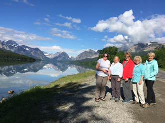
Even though the day started out rainy, it didn't end that way. Our drive from Great Falls (6 a.m.) had us in showers for about one hour, but by the time we hit the trail at 9:30, the sun had come out.On our drive in, we spied a bear just off the road. He was quite small and probably a black bear but it was hard to see through the tall bushes to get a good look.
Our hike to Bullhead Lake was a day to die for: gorgeous views on the way in and all along, cool weather and threatening clouds but no rain and not too much wind. We also didn't see that many hikers on the trail. Those we did see told us to watch for two small bears as well as moose. We did see their tracks but we never did see any as we were hiking. We visited Fishercap Lake, Red Rocks Lake, Red Rock Falls (Katie, Mary and Karen scrambled up the rocks to look down on the cascades), Bullhead lake and finally Wilbur Falls. We ended our hike around 2:30 pm and headed to the Many Glacier Hotel/Lodge to look around and have a late lunch/early dinner. On the way, we saw another bear, this time a grizzly rototilling a side hill above the turn to the lodge. He was huge, with a large hump and golden face and back. At the lodge, we wanted to see the new double helix staircase that was rebuilt after having been taken out to accommodate a gift store upstairs (gifts and a coffee/snack shop are now downstairs, taking up part of the old auditorium space).It is gorgeous and almost identical to the original, the only thing is the railings are closer together to meet code (no kids can slip through or get their heads caught). We did a bit of shopping and then headed out to the deck to enjoy the view, at which time we spotted a moose across Swiftcurrent Lake. After watching her eat some willows, we went into the Iinterlaken Lounge to eat. Interestingly, a wedding party was there as well, bride in her gown and all. As we walked around the lodge, we noticed that the side-by-side of glaciers comparing what they looked like in the early to mid 20th Century to the 1990s that adorned the hallway leading from the lobby to the dining room were missing.No one at the desk knew what happened to them, so Katie filled out a form requesting information, leaving her email. Before the end of the day, she received a message that said the pictures were a fire hazard as people stopped in the hallway, that they were being stored and would be brought back next year but would be placed in the lobby area. After a delightful lunch, we headed home (seeing two foxes along the way, one trotting right next to the road), but not before stopping in Valier for ice cream and a stretch break in Browning. We arrived home by 8 p.m. One calamity on trail: Denise fell on ball-bearing type rocks, but she wasn't injured too badly; just a bit of a bruise on her elbow. Who went: Gail, Mary S, Denise, Linda, Karen, Katie |
|
Porphyry Peak, July 24, 2018: After-Work Hike Leads to After Dark Adventure
|
After getting a later-than-expected start (around 5 p.m.) due to waiting for a no-show, seven of the GiG headed to the Little Belts for an evening adventure. When we arrived at the top of Kings Hill Pass, parked and started walking, we had to reroute from the trail to the dirt road due to construction in the campground.
Without snow, the road is easy to see and follow. Apparently, the forest service was taking down dead trees and had closed the campground. Instead of continuing up the road, we decided to go up the gut of the ski hill. Going this way, gave Mary S the workout she wanted. She had a full backpack with about 30 pounds to get in shape going uphill as she was getting ready for a backpack trip. The climb was a good one, but everyone made it easily. At the top, we stopped at the picnic tables to have dinner and enjoy the views of the mountains. A few of us climbed up the lookout tower to get even better views. Unfortunately, the lookout wasn't in the tower at the time. Then we went down the road that curves around the side of the peak. After, we jumped int o the cars and were going to stop at Bob's Bar, but it was closing at 9 p.m and it was almost 9 when we got there. Then we continued on to Monarch and stopped at Cougar Canyon but it too was closed. So we arrived home at just after 10 p.m. Who went: Kuntzie ,Gail, Sue Julie, Josy, Mary S, Susan W, |
|
Hiawatha Bike and Blackfoot Float, June 17-19, 2018: Rain, Overboard, Crash, Lots of Laughs on Hiawatha Bike Ride, Blackfoot Float
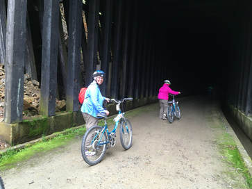
Where do I begin on this one? Two women overboard? Biking in the dark on an almost two-mile long tunnel? A bike crash? Rain? Hot springs?
It was a wet weekend, a very wet weekend or to be more precise, a Sunday and two weekdays, which started after having breakfast with our hubbies for Father’s Day (leave time 10:30 a.m.) before heading out for a rainy drive to Missoula to pick up Susan, who was on her way from two days in Hamilton with her husband. We were glad we decided to forgo hiking Rogers pass for the milder and less wet Kim Williams trail in Missoula. Missoula was just a bit overcast, so the three-mile hike along the Clark Fork River was pleasant. We all remarked at how fresh and wonderful the breeze felt as we enjoyed the river walk. We didn’t have time to hike up Mount Sentinel, so we had to save that for another day. Now that we had Susan, we had 11 of our ladies with one more (June) after we got to Quinn’s Hot springs in Paradise, Montana, where we would sty the night. We arrived at just after 4 p.m., giving us time to check in, get settled, and then head to dinner at the Harwood House. As the person with the reservation, Katie had to sign that we wouldn’t lose any towels (had to check them out and back in with the desk), lose any keys or “play chicken” in the highway, realizing that the speed limit was 70 mph. Fees were $40 for a “lost” or “stolen” towel and $10 for keys. Katie and June both remembered the look of the old hot springs, bar and Harwood House restaurant, having lived in Western Montana (June in Plains and Katie in Alberton and Superior) in the late 70s and early 80s. It was pretty shabby back then, but everything is quite nice now with new cabins, even across the highway along the river (these cabins are pricier with the river view but also right next to the RR tracks). Our meal at the Harwood House was quite good, just as Mary N told us it would be. The soups everyone particularly commented on. Then those who wanted to soak, headed for the pools, while others relaxed on the edge and enjoyed a pleasant evening that only produced a few sprinkles before an early bedtime before our big ride. We knew that the next day would probably bring showers, however, with a 70 percent chance predicted. The next day, some of us had an 8 a.m. breakfast at the Harwood House (the earliest they open with no place else for miles to have a bite) while others ate in their rooms before we hit the road at 9 a.m. for Lookout Pass and our Hiawatha Bike Trail ride. We gained an hour going into Idaho, which is on Pacific time, so we arrived at 9:30 a.m. to pick up our lunches (our lunches came in a nice Hiawatha Trail souvenir day pack), passes, shuttle tickets, bikes and helmets. I must say it was a bit disorganized: they didn’t have the right number of lunches ready, they left off lettuce on a veggie sandwich instead of a turkey one (had to be remade due to Bonnie’s lettuce allergy), gave us 11 instead of 12 bikes (luckily, we counted before we left) and then didn’t put a headlamp on the last bike (which we didn’t discover until we got to the trailhead). Again, luckily, one of the trail marshals had an extra light as those tunnels are dark. A funny side note: many of us hadn’t ridden bikes in a while, so we were asking how to change gears, etc. on the bikes. Susan asked so many questions, that the trail marshal finally said, “I think you are a good candidate for walking your bike. At least through the tunnels.” Ha ha! P. S. Susan had no issues with her bike. It was 10:15 a.m. before we really started as we all rode around a bit getting used to the bikes. (Another side note: they only have a one-stall toilet for both sexes, so it takes a while for a group). Then we faced the first obstacle right off the bat: the looooong tunnel. June led us into the tunnel walking our bikes so that our eyes could get adjusted before we headed out. This was a very good idea as we had heard from Anita about her crashing and two of the Canadians also said they crashed in the tunnel. We made sure to take our sunglasses off and turn on both our headlamps and the bike headlights. Our first hour and a half was glorious, cloudy but a nice 60-degree temperature. We leisurely pedaled and stopped at each interpretive sign to read about the history. Unfortunately, the trail crew had places large rocks to slow riders before each of the interpretive signs, and Catherine hit one as she attempted to go between two rather narrowly spaced boulders. Luckily, she wasn't hurt. But we told her she would have a souvenir bruise of her trip. Along the way, we enjoyed the views into the snowy mountains, the tunnels and each trestle to its fullest, marveling at how high each was, how beautiful the firs trees’ new growth was as we gazed down on trees over 100 feet tall from trestles that were over 200 feet high. Amazing. And we had fun with all the tunnels as well. The trail has 10 tunnels (one—the long one—we went through twice) and seven trestles. At our third trestle, we sat along the edge of raised railroad ties and ate our lunch, which was 11:45 (12:45 our time). Then the rain came at the half-way mark just a half mile from lunch. Luckily, it was right at the bathroom, so we took a break and those who didn’t have rain gear on, quickly put it on. Then our pace quickened a bit as the spitting turned to a steady drizzle. In fact, the last two miles, Kuntzie, who was in the lead, started hoofing it. Some struggled to keep up, but the trail was turning muddy, putting a “Hiawatha Stripe” down our back from the mud kicked up by the rear tire. And due to the rush, we made the 1:15 bus; otherwise, we would have had another hour and a half wait in the rain for the next shuttle. We hardly saw another soul on the trail; probably no one wanted to bike on a rainy Monday (70% chance of rain). At the end, we saw a few more headed up and a few groups passed us trying to make the early shuttle too. The shuttle left us off before the long tunnel again, so we had to go through it second time. This time it was a bit eerie with a weird atmosphere that gave Linda a sudden headache and made others struggle to see. The rain had made the inside air extremely muggy and foggy, but we all made it out without crashing. Kuntzie, the speed demon, slowed way down too at this point, facing a bit of uphill as well as the mugginess. It was 3:30 p.m. before we loaded all the bikes up and got back to Lookout Pass to turn the equipment back in, and head to Wallace, Idaho, for some shopping and dinner. We had to skip hiking the Polaski trail due to the weather and the lateness of the hour—there is always next time! We were going to eat at one restaurant that Katie remembered as being good, but the locals said “Not anymore” when asked if it was good, so we took their recommendation of the City Limits Pub and Brewery. Boy, did it have an interesting menu. Two gals had the homemade raviolis (fresh that morning), one with sage brown butter sauce and one with marinara and both said they were amazing. They served a lot of food, for sure. Then back to plains on a rainy evening to soak or just relax. The next day, it was breakfast and check out by 9:30 for our raft trip, but not before saying goodbye to Susan and June, who passed on going down the river. Katie called to double check that the float down the Alberton Gorge was still on due to rain (might have raised the river too high to navigate safely) and due to predicted afternoon thunderstorms. Tiffany said we were still on. However, she didn’t’ tell us the whole story. We arrived in Missoula at 10:45 and stopped at a coffee shop/sandwich shop to pick up lunch and then walked the one block to the raft company. We all paid and then started to gear up. It wasn’t until we had our gear and had paid that we found out we were not going down the Alberton Gorge after all but instead going down the Blackfoot. Some of us were very disappointed, more in the fact that the raft company had not told us. We should have been able to decide whether we still wanted to go or not since the Gorge wasn’t an option. However, we accepted it as the guides had already-- at this point-- hitched up the rafts and were expecting a trip. The drive to the put in was a full 45 minutes and it drizzled a bit at times on the drive, but the day actually looked pretty good, better than predicted. It had taken us almost an hour to put on wetsuits and get ready. We were in two rafts: Katie, Kathy, Kuntzie, Mary and Susan with two guides and Bonnie, Linda, Jeanne, Gail and Catherine in another with one guide. Bonnie was unable to paddle due to a shoulder injury. In hindsight, we should have had Bonnie in the raft with two guides to balance the paddling. Everything went pretty well to get started; we all put on our own gear without much instruction other than to put on our lifejackets tightly. So we got into the rafts and took off, the first boat waiting for the second to get on the water. We didn’t get any instruction as to how to hold the paddles, how to work together, what the commands were, etc., which those of us who had gone on guided trips thought a bit odd. However, Katie thought that the Blackfoot was such an easy river that maybe it wasn’t needed. Indeed, the guides briefly covered safety, explaining how to put your feet in front of you if you fall overboard and how to keep yourself upright and push up and over if you happen upon a “strainer,” a jam of logs and debris that can suck a swimmer under and catch her feet. But the guides said, “This won’t happen today.” Famous last words, that appeased Kuntzie since she doesn’t swim, and she was nervous, very unusual for Kuntzie. So a mile or two into the ride as we were admiring the herons, the mergansers (including the ducklings), the osprey and the high cliffs and wildflowers, the gals in the lead boat looked back after a small rapid (all were mostly Class I with some low Class IIs), and were shocked to see that it appeared Bonnie had fallen in. Then we saw Bonnie in the boat but another person floating toward us, with feet first, just as instructed. We at first thought it was Linda as we strained to see who was on the boat and then realized it was Gail. But we saw that Bonnie was soaked. We were confused but surmised that maybe she had gotten wet trying to rescue Gail. Cathy said, “Gail is a goner,” as we felt a sinking feeling in our gut watching her float along. Katie said, "Shouldn’t we paddle backward to try to get her?" and the guides finally said yes, but the other raft paddled forward and caught up to Gail first. However, the gals struggled to pull her into the raft. In fact, her life jacket pulled almost all of the way off, covering her face. It had not been tight enough. Now Kuntz said, “There is a headless life jacket,” as we couldn’t see Gail’s head anymore. Finally, the guide on the second raft was able to pull her in (He told the gals to "move aside" and grabbed her with ease), but we saw her just lying in the bottom of the raft, leading us to believe the cold water had brought on a heart incident since Gail has heart problems. Later we learned this was not the case. It was just that the life jacket had wedged itself around her chest and neck and the others had a hard time getting it off to put it back on right. After what seemed an eternity, the guides and the gals in the second raft signaled that all was okay. It was now that the main guide on the first raft admitted that the guide in the second raft was brand new and that this was his first time leading a boat down this river and that he was supposed to be following the first craft’s line. In fact, our guide was only in his second season and the other guide on our boat was a newbie too. The rest of the trip was uneventful other than Kuntzie not paddling anymore as she was holding onto the cooler’s tether rope and said she wasn't going to let go. She also said, “Why wasn’t Gail screaming? I would be!” Many of us said we would be too, but Gail is a pro and a calm head. She was cold but not injured at all and followed instructions to a tee.Her technique was textbook. Toward the end, Susan “made” the newbie on our boat take the steering oars and be our guide. She was telling him to show us points of interest and tell us river stories, but he didn’t have any being a newbie. So she said he now had a story due to some of our gals going overboard. When we got to the takeout, we heard the whole story: Raft 2 had gone over a “pourover,” a large rock with just a bit of water rushing over the top but enough to create a steep drop with backwater. It tossed both Bonnie and Gail over; however, the other gals were able to grab Bonnie right away, who was holding onto a tether on the side of the raft.The raft didn't have a rope on it so there was nothing for Gail to grad onto. Ironically, on bus trip to the put in spot, Jeanne had asked if the guides had ever gotten hung up on a large rock that was partially submerged. They said they hadn’t. On the way back in the bus, we were all laughing and joking around and making a bit of fun of the guides, Zach, John and Skyler, who really deserved a bit of teasing. In fact, I think they learned a lot from our group, and we did too. Both Bonnie and Gail were cold, especially Bonnie as she was shaking. Those two had been wet for most of the 17 miles; and at the end, we all started getting a bit chilly due to the wind coming up. And on the bus, it started to pour. We had made a day of it without rain from the sky, just the rain from the rapids. After changing at the raft company office, we headed back out to Great Falls around 5 p.m. We decided we would eat fast-food in Helena instead of stopping in Missoula before we left. And yes, we had to go through Helena instead of Lincoln as Highway 200 was closed over Rogers pass due to rivers flooding in the area. In fact, all of Augusta was flooded with other areas threatened due to the Sun River, Teton River, Missouri and many creeks overflowing. So it was Arby’s in Helena and then home. What a wet and wild weekend we had with lots of laughs to boot and everyone safe at the end. Thank goodness. Who went: Kathy M, Bonnie J, Linda, Gail, Kuntzie, Susan, Sue, Catherine, Jeanne, Mary S, June, Katie |
Rogers Pass, Sculptures, June 14, 2018: Chocolate Lilies, Canadians Welcome New Hiker
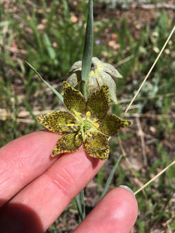
We had our first hike with Michele on a fun quick trip up Rogers Pass followed by a visit to the HI-Country Beef Jerky factory and gift store and then to the Blackfoot Pathways Sculpture Garden.
The hike to Rogers pass didn't disappoint on wildflowers on the way up, with dark blue larkspur, glacier lilies, paintbrush, bistort, arnica, phacelia and the rare chocolate lily dotting the hillsides, just to name a few. However, the alpine forget-me-nots, douglasia and pasque flowers were well past their prime. And the top of the pass was very windy, forcing us to take a quick look at the view before we headed back into the trees to have a bite of lunch. On the way down, one of our in-house scientists, Josy, showed us some moss/bryophyte that turned almost instantly green when she spat some water onto i, bringing it out of dormancy. Josy also told us that the leaves, flowers and roots of a plant often have different effects on people. For example, the Valerian root can be used as a sedative, but she explained eating the flower or leaves might not have the same effect. Once we got down, we headed to the Hi-Country Beef Jerky Country Store and factory. We enjoyed looking around at the various Montana gifts: huckleberry everything, 406 t-shirts and sampling pemican and other dried beef products. Then we toured the sculpture garden after taking a quick trip off the road a quarter mile by Leepers to see Kuntzie's cabin. She is going to sell it as both she and her sister aren't interested in maintaining it. It is right on the creek and has huge ponderosa pines surrounding it, making it very peaceful and beautiful. Then we said goodbye to our Canadian friends as they were headed over Flesher pass and on to Helena for the night before they eventual destination in Idaho for the Spinderella bikeride. But we had another adventure or two involving animals. First, a cow elk sauntered into the road right in front of us, making Katie brake rather quickly. Then instead of running away, she stood, looking at us and sniffed the air before wandering back to the same side of the road from which she came. It brought back bad memories for poor Maria who had totaled her new car hitting a deer on another GiG trip. She said an elk would have really totaled the Katie's car. Then five minutes down the road, Susan spied a young spike bull moose in the marshy area, right off the road. Katie turned around so we could all get a good look. He was magnificent. Finally, we headed home but not before we stopped at the Mennonite/Amish store/cafe in Vaughn to get a few goodies. Who went: Kuntzie, Maria, Anita, Michele, Susan, Josy, Katie |
North Fork Highwoods, June 9, 2018: Flowers Dot Ridge Overlooking Mountain Range
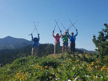
Although the arrowleaf balsamroot were fading, we still happened upon a stand or two in full yellow bloom. And we saw many other flowers: arnica, lupine, chickweed, larkspur, bistort, threadleaf phacelia, pink and white sticky geranium. The lupine were especially showing off in their purple-gorgeousness.
We hiked to the ridge and then went off trail to the top of a little knob where we could see the mountains in both directions before descending back down to the trail, going about three-miles.Along the way, we heard of Bonnie's exciting new adventures: her move to Las Vegas and new job at a charter school and her required class to be certified in Nevada.
We left GF at 6:45 a.m. and were home around 11:15 a.m.. Nice flower walk that still left us with time to hit the Farmers Market and enjoy the afternoon.
Who went: Roni, Mary, Deb, Bonnie and Katie
West Butte, June 7, 2018: Thunderstorm Speeds Hikers on Ascent/Descent of West Butte
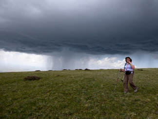
Lightning strikes, the power of thunder and gorgeous clouds reminded us of the fragility of life as we hiked to the top of West Butte in the Sweet Grass Hills.
The day started out 7 a.m. with a quick stop in Shelby and then continuing to Sunburst to pick up our sister gals hiking group of Canadians, the WoW (Women of Wonder). All told, we had seven from the U. S. and 7 from Canada, plus one guy. Then it was on to the parking spot along a gravel road. Our hike started at 9:30, with the pressure of beating a 3 p.m.-predicted thunderstorm to hustle us along. Katie’s husband Tom was our official leader, the one who had the GPS to keep us off private land and also help get us back down through the tree section, which can be a bit tricky. He was also the one who reminded us to gear up quickly and move up the mountain as quickly as we could, which most of us found easier said than done as the way is up, up, up. And this adventure was off-trial, always an experience of route finding. On the way up, we occasionally turned around to cool ourselves in the breeze and check to see how far off the clouds were. We also enjoyed the flowers: lupine, golden peas, larkspur, wild onion, crazy weed, silky phacelia, death camas, and miles of thread-leaved phacelia, more than we had ever seen before. Some of us struggled, all of us felt the steepness and one had to turn around about a third of the way up. The terrain was as follows: Meadow, grassy-tufted hillside, pine forest, talus, forest, talus and athen meadow on top. Then we had an unexpected storm, one that came in around noon, just as we were cresting the top. Luckily, we had Beth Thomas who had an app on her phone that tracks storms. She could tell us exactly where the storms were and if they were electrical and how strong. We quickly got off the top and took shelter among the trees as the lightning storm swirled around us, hugging the butte. It didn’t produce much rain and kept to the side of us, but we did get some pea-sized hail as we ate our lunch, huddled with our colorful ponchos on. When the storm subsided, we went back on top to enjoy the views a bit more before we headed down. We also took a group shot by the cairn and signed the register. Then we had to scoot as another storm cloud was forming off to the west. We started our steep descent through the talus, then through the trees and then the promised 3 p.m. storm started looming with booms out in the distance, heading our way. The leaders beat foot to the coulee to get off the mountainside, while the rest of us encouraged everyone to get down as quickly as possible. And the rain was really coming down now. If caught amid the lightning, we reminded everyone to flatten against the ground and for sure not to hold poles up. Even though the storm was a bit frightening, it was also awe-inspiring: The clouds amazing; the lightning and thunder powerful. Thankfully, we all made it down safely, one with legs jiggling and one with knees locked up but with everyone smiling. For some, the Sweet Grass Hills were on their bucket lists. For others, they now have two out of three buttes completed, with East Butte, the largest and longest hike yet to do, hopefully, next year. We said quick goodbyes as it was still raining and headed down the now-gumbo road that gave us a squirrelly ride, the Canadians back home and the U.S. gals to Shelby for dinner at Ringside Ribs, a misnomer as they serve everything from pasta to steaks to pizza to fish and chips. The gals who got the barley soup particularly liked it. And the waitress really impressed us as she memorized our order (for all 8 of us). We arrived home around 8. Who went: U.S. Katie, June, Camille, Kuntz, Brenda, Beth, Sara; Canada: Pat, Linda, Deena, Sharon, LaVerne |
Pioneer Ridge, June 2, 2018: Orchid Walk Awesome with Calypso Fairy Slipper and More
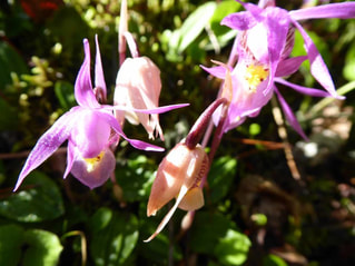
An early morning (6:30 a.m.) trip to Pioneer Ridge to see the orchids turned out perfectly: We saw the calypso fairy slipper orchids and then some: chickweed, larkspur, arrowleaf balsamroot, blue-eyed Mary, yellow violet, bluebells, woodland star, Oregon or holly grape, false Solomon seal, nine-leaved biscuitroot, sticky currant, fern-leafed desert parsley, shooting stars, groundsel, arnica,and lots of virgin's bower clematis.
The views into the Little Belts were amazing with the green almost hurting our eyes it was so bright. We arrived back home at 11:30; a.m. after our short three-mile walk. Who went: Christi, June and friend, Carolyn, Kuntzie, Karen, Susan, Denise, Sara, Catherine, Brenda, Katie |
Many Glacier, May 5, 2018: Can't Beat this Lunch View: Grinnell Point, Swiftcurrent Lake
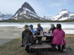
So much for 60 percent chance of rain: Not a drop of rain, just a few unsettled skies as we hiked the road into Many Glacier, ending in lunch with a view at the Many Glacier Lodge/Hotel.
We took off from the District Offices at 6 a.m. and arrived at the trail head right at 9 a.m. The road was closed at Park Boundary, so that is where we started our hike. The snow on the peaks made the walk in eye candy all of the seven miles. One of the things about walking the road instead of driving or biking is that we stopped at each interpretive sign and hiked down to the Swift Current falls. None of us had done these items before as we are always in a hurry to get to our destination. Another thing we notices was painted V’s on the side of the road, each with an embossed nail at the tip. We surmised they must mark something such as culverts, wells, piping, electrical or surveying. According to the Department of Transportation website, they are survey markers for aerial mapping*. We also saw the repeater markers for the park service radios. All along the trail, we saw moose dropping and wolf and coyote scat, so we kept hoping to see some animals. Boy, did we see animals! We saw a goat, a herd of sheep, a yearling sheep right by the lodge and a yearling moose on our way out. Our lunch was filled with a bit of trepidation. One of the Xanterra workers drove over to us from the upper lot behind the lodge. He asked if we were hiking and to be careful as he had seen a bear in the upper lot headed down to the lake by us. Needless to say, we put the cans of bear spray in the middle of the picnic table just in case he wandered our way. He did not. And we had Catherine facing one way and Susan the other to keep watch. After a half hour lunch, we decided to risk it and headed to the upper lot to get the fantastic view over the Many Glacier Valley to view Mount Gould, Grinnell, Swiftcurrent, Wilbur, the Iceberg Notch and the B7 Pillar overlook the lake before the long trek out. This is where we saw the young yearling sheep, lying down by the stairs. Thankfully, we did not see the bear up close and personal, but we would have liked to see him from distance. Not many flowers were blooming, but we did see early buttercups and alyssum. The seven miles back seemed long, especially walking on pavement, so we moved to the shoulder to take some pressure off our feet and hips, but it was still a long seven miles with our back to the beauty and the interest of the interpretive signs gone. On the way in and at the lake, we saw no one else except the Xanterra worker. However, on the way out, we saw a group of three bikers from Browning, towing a baby, a lone hiker from Quebec who didn’t really know where he was going so we told him what to expect, and two other cyclists speeding by. Katie asked on cyclist about the road going through St Mary to Browning to round out the return trip with views into this lovely area. We arrived back at the cars just before 3:30 p.m. and headed to Dupuyer to eat at Buffalo Joe’s after a brief stop in Browning to stretch our legs and get a cool drink. We also visited the Cache, where Katie and Kuntzie both contributed to the local economy. By 8 p.m. we were at the District Offices, tired after a very rewarding day. (only a few sprinkles came down) *The symbols are ‘targets’ an aerial photograph; there is no meaning to different shapes or configurations of the markings (X, V, T etc). A survey crew is dispatched to survey the location of these targets and assign coordinates to each. When the survey is completed, the spatial relationship between each of the targets is known, such as the distance between them and the difference in elevation. This information is provided to an MDOT “photogrammetrist,” an aerial mapper. The photogrammetrist loads two aerial photos into a machine called a “stereoplotter.” Each pair of photos overlap each other so that each inch of roadway is photographed from two positions to create a 3D view. (Similar to toy stereo viewmasters where two photos are inserted in the viewmaster to make a 3D picture.) When the photogrammetrist views the targets in the 3D view, he can assign the coordinates given to him by the surveyor. Once this is complete, the relationship between the ground distances and the distances on the photo are known. Who went: Josy, Susan, Mary S, Kuntzie, Catherine, Katie |
York, Kelseya Uniflora Rose, May 5, 2018: Kelseya Uniflora Blooms Amaze Gals in Limestone Canyon |
The GIG headed out at 8 a.m. to hike a portion of the Trout Creek Canyon Trail, near Vigilante Campground out of York, to see the rare Kelseya uniflora in bloom. We were not disappointed. From the beginning of the trail, we observed many mats of Kelseya growing on the limestone cliffs, some in bloom and some not. About 2.2 miles in we found the ultimate bloom close to the trail (thanks to Katie's perfect directions).
Along the trail, we stopped at each of the ten stations while Jo Ann read the description of the area from a Forest Service brochure, which discussed erosion, vegetation, limestone formations, birds and other wildlife, flooding, microclimate and caves. After a delicious lunch of 1/2 pound burgers at the York Bar, we talked the bartender into taking a group photo outside the bar. A friendly, fun place to eat. For desert, Jo Ann provided dark chocolate with cranberries and almonds. On the way home, there were a few sprinkles of rain but it did not last long. Everyone agreed it was a great day in the Montana's great outdoors. Who went: Jo Ann, Sara, Anita, Jeanne, Christi K. |
|
Mount Ascension Loop, York, April 29, 2018: A Day of Climbing and Roses: Mount Ascension Loop Provides Views while Trout Creek Beautiful Pinks
The GiG headed out at 6:30 a.m. to do two hikes: Mount Ascension Loop and then to hike along Trout Creek by the Vigilante Campground out of York to see the rare Kelseya uniflora rose in bloom. This flower only grows in a few places in Montana, Idaho and Wyoming, clinging to certain limestone rocks near water. Read more.
scension was a 4.5 mile hike with two more miles along Trout Creek after a fun lunch at the York Bar. Everyone said the burgers were great. June, Brenda and Susan headed back right after the Mount Ascension climb. Although the day threatened rain, it didn't start until the ride home, so everything turned out well. Who went: June, Susan, Brenda, Kuntzie, Gail, Denise, Bonnie, Sue, Catherine, Deb, Roni |
Two Medicine Snow Hike, April 22, 2018: Glacier Mountain Eye Candy for First Hike of 2018
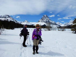
You can never go wrong with a snowy backdrop of Sinopah, Rising Wolf, Lone Walker and Painted TeePee mountains surrounding Two Medicine Lake, and that is exactly what we had: a gorgeous view and nice start to the hiking season. We welcomed Josy on her first hike with the GiG.
Four of us completed the 10-mile hike up the Two Medicine Road with a quick stop to see Trick/Running Eagle Falls. For the most part, the road was open, not requiring snowshoes; however, in the morning we faced many sections of black ice that slowed our travel and gave us a few heart attacks, thinking we might fall and break something. Mostly, though, we could step into the snow to avoid the ice. The snow was quite deep: at times, way over our heads along the side of the road where a plow had come through. To get into Trick Falls, we put on our Yaktrax. Luckily, the icy compact snow held us, so we didn't posthole at all. And the falls were beautiful, rushing through the subterranean cave portion (the top spring runoff wan't going yet). We found much different and deeper snow conditions when we arrived at the lake. At this point, we did fall through a few times, sinking to our waists, requiring some quad power to get out. Needless to say, we didn't walk around too much or get too close to the lake, instead opting for lunch on the porch of the camp store, but that wasn't without an effort to get into either. We had a huge berm of snow to step over and then down and then the railing to step over before we reached the picnic tables to enjoy our lunch. On the hike out, we came across many parties going into or just enjoying the area: split boarders climbing up and boarding down the sides of the road, bikers riding in ad then walking and some other walkers. And the black ice was gone for the most part, thankfully. We really kept a good pace (easier to do without snowshoes), getting back to the cars one and a half hours earlier than expected, so we decided to skip dinner and head straight home. We left GF at 6:30 a.m. and arrived home by 5 p.m. Who went: Susan, Josy, Sue, Katie |
Sharp-Tailed Grouse Blind, April 20, 2018: Grouse Mating Dance Brings Hawks, Coyotes a-Calling
The weather was perfect; the birds cooperated; and despite the cool morning and having to leave at 5 a.m., everyone was very satisfied with the "show" of the mating dance of the sharp-tailed grouse.
For two years, we have tried to get drawn for a permit to go to the Benton Lake blind to view this spectacle, and for two years we were disappointed. So this year, Katie put in to go on a Friday as well as Saturday and Sunday, and it worked. We did get in, but on a Friday, which prevented some of those who work from being able to join in. So seven of us were lucky enough to go.
The blind is a bit tricky to find at dark, but we made the traverse across the swampy uneven ground, lugging our cameras, blankets, extra chairs, snacks with the light of our headlamps, silent as possible so as not to disturb the grouse. As we approached the blind, we could hear the birds were already out, making their drumming and cooing noises.
As we situated ourselves, moved the chairs and then slowly opened the blind windows, we were amazed to see over 40 grouse. The ranger at the office has said not too many birds had been dancing. She wasn't sure if many had died over the long, cold winter we had or if the long winter had delayed their mating, but not many had been on the lek (the term for the dancing ground). But they did show up for us.
We saw around 32 show-off males and many choosy females. As the sun arose, so did other animals. A hawk flew overhead, causing the grouse to lie low and quiet for a while, followed by two coyotes, one of which caught a bird (we think a duck and not a grouse as he was closer to the ducks) for a tasty breakfast. At this time, most of the grouse dispersed, leaving a few sitting, very quiet, females.
We left the blind at 7:37, the time which we were allowed to leave if the birds had stopped dancing, which they had (one hour past sunrise).
We arrived back in town at 8:10, with some of us having to scoot off to work and some to breakfast.
Who went:Jo Ann, Bonnie W, Susan, June, Roni, Catherine, Katie
Neihart Mining District, April 17, 2018: Old Cars, Old Schools, Contaminated Ground Make for Lovely Hike
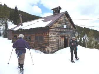
We had a great time meeting Jasmine for a guided hike to the Neihart mining district. We arrived at the Inconvenience Store at 9 a.m. and all fit into Jasmine's truck to head up Carpenter Creek Road. She had to use her pickup to "redneck plow," as she called it, a parking spot so others could get by us on the narrow road. She reversed the truck and rammed into the hill of snow several times until there was enough clearance.
Then we tackled the 1400 feet of elevation gain to arrive at the old mining town, which has several buildings still intact, including what we thought was an old school. We did go inside to find mounds and piles of rat and mouse droppings. We didn't stay too long or disturb anything for feat of hanta virus, but many interesting items still remain inside. Most of the screens on the windows were still in place too. We also had fun looking at the old work trucks, rusted a pretty color. We finished the hike around 3:30 and decided not to stop for food and headed home instead. We went 7 miles. However, Jasmine and June went a bit farther as June's glasses had fallen out of her pack, so the two of them went back to retrieve them. And, yes, they did find the glasses. Yay. Who went: June, Susan, Katie, Jasmine (our guide) |
Izaak Walton Inn Essex, March 15-18, 2018: Everyone Wins when Team Canada and Team USA Combine for Three Days of Snowshoe Fun over Long Weekend
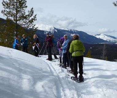
It didn’t start out well. It didn’t start out well at all. When we met at the DOB to begin our journey, the sleet was coming down in full force. As Katie met each car, she became soaked though even her ski jacket, discussing with each gal whether we should head out or not, due to the storm warning in effect. June’s husband thought we should stay home; Susan’s husband wouldn’t chime in; Katie’s husband said “you always go to the trailhead.” Mary was the last to arrive and she was the driver. Susan said to ask her since she had to face the storm. Mary said she was ready to go and we should go, so we did. And it was the best decision.
So the four of us made it to Essex, keeping in contact with our six Canadian friends who were meeting us. Their drive was one and a half hours shorter, so they had less weather to drive through. They arrived about 20 minutes ahead of us to find it wet, but not icy at Essex—very wet, with lakes for puddles that we had to navigate on our way into the Izaak Walton Inn. After a quick 15 minutes of check in, at which time the Canadians were successful in switching to slightly larger rooms, we decided to go into West Glacier despite the rain coming down and the snow predicted for later in the afternoon evening. However, we found that Going to the Sun Road was closed, which ruined our change of hiking along McDonald Creek with a possible look at the nesting harlequin ducks; we briefly discussed snowshoeing the South Boundary trail to the original entrance bridge to the park, but the rain was coming down harder. The Canadians were interested in shopping in Kalispell; we opted to head to the Inn for some snowshoeing and relaxation. Back at the Izaak Walton, we quickly unpacked and stretched our legs on a walk around the starlit trail, looking at the cabins and cabooses and then a stroll around the neighborhood marveling at how much snow the local cabins had with tunnels to their doorways and roof snow that hung from the eaves to the ground creating caves alongside the sides of the houses. Then after a late lunch and break by the fire, we put on the snowshoes and headlamps and hit the Essex Creek Trail, for a beautiful two-mile hike along the creek side. We ran into tons of moose sign: droppings and hoofprints everywhere! We even heard crashing in the trees thinking we scared a moose in the dim twilight. We heard a bull moose along with a mama, her yearling and newborn calf lived there. Alas, we didn’t get a glimpse of the actual animals, but we saw tons of snow fleas. When we arrived back around 8:30, the Canadians were just getting in from a successful shopping trip to Costco. We all had a great day. Katie then took the Canadians on a moonlit tour around the Starlight trail to see the cabooses and cabins before some decided on a soak in the hot tub. The next day, Katie, June, Susan, Mary and all six of the Canadians, Linda, Laura, LaVern, Stephanie (Linda’s daughter), Paula, Sharon took to the Essex Creek trail again, getting in a quick hike before the rest of the American’s arrived around 11. After they did, they quickly checked in, we ate lunch together and all of the Canadians and seven of the 12 Americans (Kuntzie, Katie, Susan, Mary, Sue, Sara, June) did the most spectacular hike of the trip: a climb to Garry’s lookout. The rest of the Americans, Gail, Catherine, Anita, Jeanne, Jo Ann, went on a tour around the Essex Creek Trail. The actual lookout is no more, but we also knew that Marta and her son and a waitress at the Izaak Walton had created an igloo to mark the spot of the old lookout, so our trip to the top was not just to see the views. We were not disappointed in this climb. But before the climb, we had a nasty stretch of walking the highway and climbing two berms because the plows had not hit the parking area for this trail head, located at mile-marker 168 (Forest Service Road 499—but the marker was buried). The weather held, revealing breathtaking views of Mount St. Nicholas, Threetops Mountain and big daddy Stimson as well as Loneman with its lookout perched on top. We could also see the results of the Thompson and Nyack Creek fires from two years ago. It was hard to stop taking pictures of these glorious sites. Then a few of us stepped into the igloo—and it was a BIG step down and another to get fully inside this space. Our friends the builders did an excellent job of building a nice hut. We lingered on top for perhaps forty minutes, not wanting to leave this wonderful place in the sun. Then it was down, down until we had to face the berms and highway again, this time in pretty heavy Friday afternoon traffic. All told, it took us around three and a half hours to complete this fabulous hike ( one hour 40 minutes up and one hour down). We had a bit of down time before our six p.m. dinner reservations at the lodge. We all enjoyed our dinner and our servers. One of our waitresses was the one who helped build the igloo. This day didn’t end yet as Kuntzie has a fun night of games planned for us of foosball, pool, shuffle board, and two dice games: Left Right Center and Shut the Box. We mixed it up but we did have a few instances or Team USA versus Team Canada, yet everyone was a winner when Kuntzie handed out various to prizes to each gal, recalling memories of the trail as she did so. The next morning saw us out early again (9 a.m.) for a longer morning hike (3 miles) to the waterfall. At this time Stephanie and her mother left us so Stephanie could get back to her son, but we picked up LaVern’s husband, who was on his way back from the Flathead Valley. After lunch, it was back out for some to Ole Creek to go across the hanging bridge before we had to say goodbye to the rest of our Canadian friends, who wanted to get back ahead of an impending storm. June, Susan, Katie, Sara, Anita, Sue continued up the trail a bit further, coming across a wolf or mountain-lion deer kill. We could see the deer fur and tracks running though the little trees before it was forced onto the narrow trail with steep sides. We surmised that a couple wolves may have trapped it from both sides of the trail this way. Then we decided it was time to turn around. No one wanted to see more blood and hide plus the trail was giving way as the sun heated it to slush on this narrow canyon trail, making it dangerous. Before we ended this hike, we went down to where Ole Creek meets the Middle Fork of the Flathead River. What a glorious sunny sight. While we basked in the sun admiring the snow and ice along the water’s edge, two deer came out of the bushes to drink, then a few more. They looked our way but decided we posed no threat and continued down to the water. We stayed still and hushed so as not to spook them. We didn’t want them to use up what little reserves they had from this long, deep-snow winter and not be able to outrun those nasty wolves hanging around. Then it was back again. Some of the gals who had been relaxing instead of hiking decided they did want another hike, so we went into Three Bears Lake before dinner at the Snow Slip Inn. Some of us had a half hour in between so we really got our exercise for the day, pegging in at over 25,000 steps! To get into the lake, we had more berms to cross plus the railroad tracks. Luckily, no trails were present this time, as we recalled climbing over and under trains in the past. Three Bears Lake often has a moose or two hanging around, but not this time. Still it was pretty despite the wind of the east side battering us a bit. We had become used to the calm of the last few days. The lake was surprisingly frozen solid with lots of snow on it. Katie had never seen it completely covered. We didn’t see moose tracks either, indicating that moose were not breaking though. Nor did we see evidence of browsing on the willows that surround the lake. However, we did have one find here: Katie’s husband’s car was parked for his ski through to East Glacier. She put a “love” note under the wiper for him to find when his group came back to shuttle his car. Then dinner—St. Paddy’s day dinner to be precise at the Snowslip Inn. The Izaak Walton had forced us to go elsewhere when it announced the only menu item would be a $40 meal consisting of corned beef and cabbage with leek soup and dessert. No one really wanted to spend that much, plus we had a couple vegetarians. So Katie planned for eating at the Snowslip Inn, thinking the Canadians would be headed out that direction anyway. When Katie was getting ready to make the reservation Friday evening, David—a waiter at the Izaak Walton—offered to make it for her, as he knew the owner. This saved trying to make a wi-fi phone call since Essex has no cell service. What a nice thing David did for us. Our meal was excellent, is all we can say! For $14, gals who wanted corned beef and cabbage not only received a huge helping but also got homemade green cake, which they graciously shared with the others whose meal didn’t come with it. Very delish. Conversation was around what to do about the storm warning coming in: when should we leave in the morning?We made the call to leave around 9 a.m., not too early before the plows but early enough to miss the brunt of the oncoming storm and hopefully miss most of what would hit Great Falls. After dinner, a few headed to the hot tub, a few played Left Right Center and then to bed. The drive home was better than expected overall but started out very bad. We couldn’t see the road in places, relied on the rumble strips and sighed relief when the Valier cutoff was mostly slush and no ice. We did see a few vehicles in the ditch, some that had gone screaming around us. The interstate was wet but not snowy or icy. And we all made it home safely. What a wonderful, full, long winter weekend with fun friends. Who went: GiG: Sara, Catherine, Susan, Sue, Gail, Jo Ann, Mary, Katie, June, Anita, Kuntzie, Jeanne Canadians: Laura, LaVern, Paula, Stephanie, Linda, Sharon |
King's Hill Pass to Silver Crest, Feb. 3, 2018: Finally, a Nice Day for Getting Out
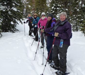
We couldn't have predicted such a nice day as we shivered in the 4B's parking lot before heading up to King's Hill pass for a snowshoe. It had been three weeks of nothing but bitter cold, wind and snow drifts so we all felt a bit cooped up and ready for some exercise in the sun, which we got--with no wind! Amazing day.
After a quick stop at Silver Crest to drop off one car, we headed to the top of pass--Kuntzie didn't have her third seat up, so Katie road in the way back on top of the gear for the short two-mile ride to the top of the pass. After gearing up, we headed uphill, the only uphill of the day. Luckily, the pass hadn't gotten very much new snow and a snowshoer had already been down the trail so we didn't have to break until the trail split at the O'Brien Creek/Silver Crest crossing. Then Sue handled all of it, breaking the whole way until we hit the flats at the bottom of the hill, where we took a snack break. We were at the bottom by 11:20 a.m., record time. After our break, Susan took over and led the way to the snowmobile trail and back to the cars. Unfortunately there were quite a few machines out, so we had to watch for travel and swallow a few fumes on this stretch. At Silver Crest, we all got to try out June's new car, a Highlander with a third seat. She drove us all to the top of the pass to get Kuntzie's car and head to Bob's for lunch. Kuntzie asked Tony if he sold the place yet, and he told her no. Although the drives were uneventful, there were a few icy patches and some deer looking to cross the highway, not too far from Maria's accident, so that was a bit scary. Right out of Great Falls, our drivers faced a bit of blowing snow. Overall, a beautiful, warm, fun day. Who went: June, Susan, Brenda, Sue, Kuntzie, Katie |
Flesher Pass, Jan. 20, 2018: Windy Pass Gives Way to Sunny Hike, Sculpture Garden Walk
The roads weren't too bad for a winter drive up two passes: Rogers and then Flesher. But the wind whipped us at the top, sending scarves flying and turning us freezing cold as we got on our gear. Some had to head out quickly as hypothermia threatened. Leaving early gave some of the gals first dibs on the one outhouse about a quarter of a mile into this hike along the Continental Divide Trails or CDT. We forwent the traditional start up the hill to the views into the Seeley/Swan valley and stuck to the road to shelter us from the howling wind. And sheltered we were from then on out, only occasionally feeling a bit of a breeze.
After everyone geared up and made it to the picnic area, we followed the freshly broken trail, which actually headed up much higher than the real trail, revealing more views. The colors were popping today: The blue skies contrasted with the fresh white snow. The lime green wolf lichen clung to the trees, making for some pretty photos. At the first view point, our newbie for the day decided she had gotten her fill of trying a new sport. She and Carolyn turned around while the rest of us went another mile down the trail. We made it to the overlook; however, the clouds blocked our view into the Seeley/Swan. When we arrived back at the pass, we found the wind just as strong as when we arrived. Hats and scarves went flying again. Then it was on to Lambkins in Lincoln for a lunch--everyone was very hungry as we didn't make it until 1:15. After lunch, we headed to Blackfoot Pathways sculpture garden to see the new constructed items from this summer among the wonderful ones from prior years. It really is a fun walkaround. Read about it here We headed home by 3:30, so that the melted snow wouldn't turn to ice on the way home. We arrived back around 5 p.m. Who went: Carolyn, Sandy, Susan, Kuntzie, Roni, Deb, Emily, Bonnie, Katie |
|
Paine Gulch, Jan. 13, 2018: Sunny Day Gives Reprieve from Below Zero Days
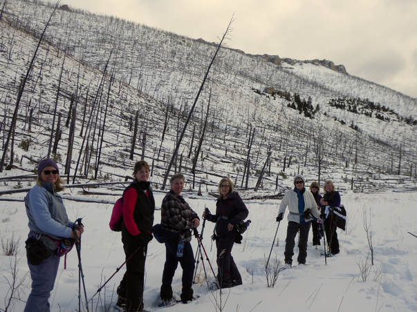
After several days of below zero temperatures, it was wonderful to get out into the sunshine and 40-degree weather. We had a fun time hiking past the old mining claim with a cabin and old school bus, up the creek bed to the wide open valley with a gorgeous ridge dotted with sandstone outcroppings. Some of us thought about hiking to the top through the burned trees, left from a fire about 15 years ago, but we saved the climb for another day.
We saw deer, coyote, rabbit, and mouse tracks along the way as well as snow fleas, which seemed way too early ahead of the spring time when they usually hatch in tree wells.
After, we ate at Cougar Canyon and enjoyed a nice meal. It has improved quite a bit from when it first opened, replacing the Cub's Den, an old standard in Monarch.
Who went: Roni, Deb, Kuntz, Sue, Susan, June, Anita, Katie
Jefferson Creek & Memorial Falls, Jan. 7, 2018: Four Snow Angel Memorials Mark Sunny Day of Snowshoeing
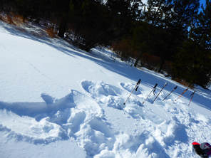
Whoever hikes Jefferson Creek next will come upon four snow angels along the trail, one for Chrissie, one for Colette, one for Dan (Sooz's husband) and one for Julie (Sue's daughter). After a tough year of losses, it is hard to hit the trail at times without remembering our dear friends and relatives who are no longer with us except in our memories. So two of us took the plunge into the snow to commemorate our loved ones. Luckily, there were quite a few others who could help us up!
We actually started the day with a quick trip up to take a look at Memorial Falls, a three-quarter mile, slightly uphill climb to see the frozen cascade with water still running behind the crystalized falls. This canyon holds usually holds inversions that chill us, and today was no exception. It also has an ice hazard from the spring that seeps from a large rock. There is no way to avoid the ice as it abuts the creek. But with careful foot placement, we picked our way without any slips this time.
Then we headed up the road less than a quarter mile to hike up Jefferson Creek. The sun was shining and the creek gorgeous with the snow covering parts of it, resembling fluffy floating marshmallows.
After about two miles of hiking, we turned around and headed to see Tony at Bob's bar for a late lunch before going back to Great Falls.
Who went: Jeanne, Sue, Susan, Sooz, Maria, Mary N, Katie, Roni
Jefferson Creek/Memorial Falls, Jan. 3, 2018: Two Gals Go On First Hike of YearJust Katie and Susan ventured out on a warm (30+ degrees) day with no wind. On the drive, we came across a host of birds, including a huge bald eagle, feeding on a deer by the side of the road. They all flew a ways off as we approached, but it was a sight to see.
Our first stop was for a quick trek without snowshoes to see the frozen Memorial Falls. The parking lot hadn't been plowed, but Susan's truck handled the deep snow well, even getting us over the berm without goosing it. On the hike, what really surprised us was the frost on the rocks. The creekbed really held an inversion, which made us a bit chilly. Then it was a short drive to the Jefferson Creek parking area, where we took a 1.5 mile hike up the road along the snowed-in camping sites. The creek held a lot of snow, but it was running and broke through the snow and ice in places, revealing sparkling crystals and gorgeous ice formations. Before we turned around, flakes started coming down, but not enough to worry about. We got back to the car and ate our lunch before driving home. Katie had to get back to town, so we didn't stop for anything to eat. |
|