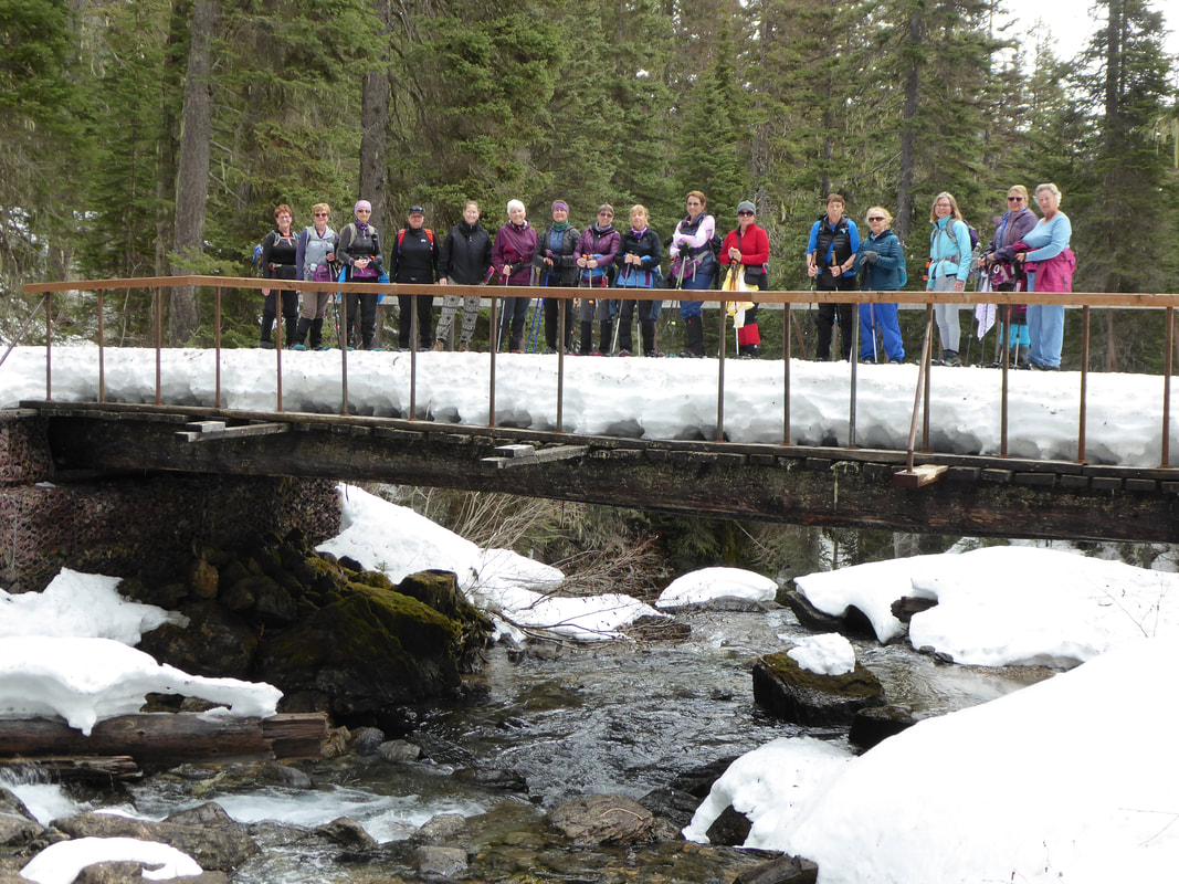
Rockwell Falls, July 27, 2019: Falls Pretty; Restaurants Scarce in Two Med Area
Our group left the DOB at 6:20 a.m. headed to the Power exit to pick up Viki and then on to Two Medicine. Thanks to Desirae for driving so all six of us could fit into one vehicle. After stopping in Browning for gas and snacks, we proceed on to Two Medicine arriving around 9:30 a.m. We were surprised to find a choice of parking spaces. In the parking lot, Gail met an adventurous lady named Judy, who we invited to hike with us. She travels the country alone in her camper and was happy to have hiking companions.
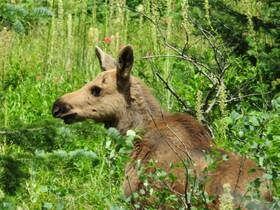
As we proceeded to the trailhead, we met an Adventures in Good Company tour group of 15 plus ladies. For the first few miles, we played “pass” with the group as they stopped with their guide or we stopped for a photo. But, they arrived at the falls first so there was no room for all of us to sit or a view to take photos. Gail then led us to a great spot up the trail, above the falls, where we ate lunch and enjoyed gorgeous views. On the way to the falls, when we stopped for a drink at the South Shore and Rockwell trail intersection, Gail and Judy heard a snort. We didn’t see the source; so, we quickly proceeded on loudly calling, “Hey Bear, Stay Bear, Bear, Bear,” as we approached blind spots in the trail. On the way back from the falls, we encountered several people stopped at the trail intersection watching a moose which was quietly feeding on vegetation just off the trail, the source of the snort we heard earlier. An obnoxious man was making weird noises to attract the moose. The moose looked up at the source of the sounds. We quickly proceeded down the trail to avoid any potential problem with an agitated moose. He was a fine specimen with a huge rack. Gail took some photos. We also stopped at Aster Falls for a photo but were out of pep so we skipped Paradise Point for another day. When we arrived at the car, the parking lot was full and cars were parked up the road. We shopped at the General Store and enjoyed ice cold, huckleberry lemonade and other cold drinks and snacks. Our first two choices of restaurants, The Two Medicine Grill or The Whistle Stop were closed. None of the restaurants in East Glacier along Highway 2 were open. So, we proceeded to the Glacier Park Lodge bar, which was crowded due to a wedding. We had to split up and sit at separate tables since a table for six was not available. The service was slow but the food was good; Susan especially enjoyed the huckleberry bread pudding. Another wonderful day in the mountains with GIG ladies. The wildflowers did not disappoint: colorful meadows primarily covered with harebell, sulphur buckwheat, and leafy aster. Lush, dense Thimbleberry bushes lined both sides of the trail in many places, but no ripe berries. Other flowers along the trail: foamflower, cow parsnip, yarrow, pearly everlasting, pipsissewa, white-flowered hawkweed, one-sided wintergreen, mariposa lily, queen’s cup aka bead lily, showy death camas, rattlesnake-plantain (leaves only), bracted honeysuckle, both yellow and orange false dandelion, arrow-leaved groundsel, lanced-leaved stonecrop, yellow columbine, bracted lousewort, yellow penstemon, pink wintergreen, huckleberry, sticky geranium, nodding onion, fireweed, meadow rue (female), red monkeyflower, red-stemmed saxifrage, cinquefoil, alder, pink spiraea, northern bedstraw, round-leaved alumroot, green false hellebore aka Indian corn lily, and more that I do not recall. It was perfect hiking weather—a sunny day, temps in the low 70’s, a slight breeze. By the time we reached the parking lot, a strong wind was blowing, as forecast. We arrived in Great Falls at 6:30 p.m. Who went: Desirae, Viki, Jeanne I, Susan C, and co-leaders, Gail and Jo Ann W. |
Suzie's Lake Five Cabin, July 22-24, 2019: Blistering Days Prompt Change in Hiking Plans
Huckleberry Lookout will have to wait for another year for the GiG as the 95+ degree days would not have been wise for 3400 feet of gain over 12 miles, so we opted for shorter, but still gorgeous hikes in the West Glacier area. We really enjoyed Suzie's cabin on Lake Five too.
Our first hike was on the way into West Glacier: Garry Lookout, a usually easy 3.6 mile hike with less than 500 feet of gain to a lovely overlook into Glacier Park, dominated by St. Nick mountain. However, the heat made it seem twice as long, but the flowers and views were worth it. The Shasta daisies, St. John's wort and the red paintbrush were particularly gorgeous. Then we went into West Glacier to stop at a gift shop. What a mess--the traffic was so bad we had a hard time making a left turn into the parking lot. Then the gift shop was so crowded with kids running all over, most of us waited in the parking lot. And again, we had a hard time getting back out onto the highway. We were glad to leave. It was just before 6 pm when we pulled into Suzie's cabin along Lake Five. It was so peaceful, except her neighbors had many relative over so the parking spots were all taken. We still managed to squeeze our vehicles in. The evening was so peaceful. Suzie had prepared a dinner of tostadas, yum! That was followed by Gail's cupcakes in honor of Susan W getting her 1,000 miles of hiking accomplished. She received a plaque that said, "If life gives you mountains, get on your boots and start hiking." We were all tired so we went to bed early, without playing any games, as we planned to get up early to beat the heat the next morning. We did get up early, but I don't think we could have gotten up early enough on a 100-degree day. Gail and Jo Ann headed to Howe Lake, a lovely three-mile hike in open meadows and burned trees with views into the Livingston range as well as Glacier Park. The others, Katie, Nora, Susan and Suzie plus George the dog went into the Jewel Basin area on the Hungry Horse Dam side to climb Doris ridge and mountain. These destinations were particularly meaningful since our hiking sister Doris was moving to Texas as we were hiking. We are so sorry to lose her but happy she will be near family. The heat again got to us, but luckily, there were several stream crossings as well as a lake so we could dip our neck coolers and hankies into the cool water. George enjoyed the cool water too. The whole way, the flowers wowed us. We were especially taken with all of the sego or mariposa lilies and the bright red paintbrush. The variety of flowers from beargrass to larkspur also gave us some eye candy. Speaking of eye candy, the views of the Flathead valley (Flathead Lake, Kaslispell, Whitefish, Columbia Falls, Whitefish Lake and the Whitefish ski hill) contrasted with the views into Glacier Park and the Great Bear wilderness. On this hike, we only came across one other party (but three cars full) and one dog. George had to be called back a few times as he wanted to get a bit too friendly with the other pooch, a labradoodle. George is an Old English Sheepdog. Gail and Jo Ann, hiked to Howe Lake in the morning, through burned out trees, new forest floor growth and wildflowers--a stark contrast of colors. It was a hot day with temperature in the mid-80s in the morning and a high of 93 degrees. Vibrant red Indian Paintbrush grew in large patches along the trail. There were also many White Spirea, a bit past prime. The Beargrass had gone to seed. A log in the shade at the lake provided seating where they ate lunch and enjoyed reflections of clouds and the mountains in the water. The Howe Lake area burned in the Howe Ridge Fire of August 11-November 3, 2018, which was ignited by a lightning strike. Several private homes and historic buildings were destroyed by the fire which burned 14,522 acres and resulted in evacuation of much of the West Glacier area including Lake McDonald Lodge and GNP campgrounds. After the hike, they enjoyed an ice cream in West Glacier and then relaxed at Suzie Taleff’s cabin on Lake Five while waiting for Katie, Suzie, Nora, and Susan W to return from their hike to Doris Ridge. Then is was back to Suzie's cabin for an early supper since Katie and Susan had to go back to Great Falls a day early. Nora had made a mushroom and artichoke lasagne while Jo Ann made a salad and Susan brought cheesy buns. Suzie had made lemonade cookies that were delicious too. Then the gals presented Suzie with a "thank you" book and card: Dream Chasers of the West, a book about some of the first settlers of the East Glacier area. Luckily, the next day wasn't supposed to be as hot. The plan for Gail and Jo Ann was to hike to the old Belton Bridge, the original entrance to the west side of Glacier. It is now a foot bridge. Nora and Suzie would do the longer Skiumah. Wednesday morning, Suzie made delicious oatmeal pancakes and fruit for Gail, Nora and Jo Ann. After breakfast, Gail and Jo Ann packed up and then hiked to the historic Belton Bridge. Two more hikes checked off Jake’s 734 list. After the hike, they decided to drive the Going to the Sun Highway, since they were so close. They made no stops since Logan Pass parking lot was full and most pullouts were full. The traffic wasn't too bad and no crazy drivers except for an unmarked Park official car stopping in the road, with no flashing lights, to talk to cyclists and one driver parked in an unauthorized spot on the side of the road. Before we read his license plate, we thought the Park official was a crazy tourist driver. The day began cloudy but the sun came out and the wind began to blow, but the views were spectacular. They stopped and braved the wind for a photo at Wild Goose Island. For lunch they had a delicious burger, salad, and fries at the Snowgoose Grill in St Mary. and arrived in Great Falls early afternoon. Who went: Susan, Gail, Jo Ann, Nora, Katie, Suzie |
Patrol Mountain with WoW, July 19, 2019: Canadian Women Wowed by Samsara, Views on Patrol Mountain
Six Americans met seven women from Canada, who had stayed over in Choteau at the Stagestop Inn, at 7 a.m. at Augusta for a hike up to see Samsara, the lookout on top of Patrol Mountain. It is Sam's 23rd year "manning" this tower.Laurie from East Glacier even came.
After Katie had a few mishaps on which campground, we finally found the trailhead and got on trail at just after 9 a.m. Thank goodness the day was cool with a breeze; however, the breeze made Katie a bit nervous as she knew the saddle could be a bit tricky to cross if the wind was too bad. One of the things Katie and Laurie hoped to see and show the Canadians was the sparrow-egg lady slipper flower, so we started looking after a half hour of hiking, since Sam said they were about three quarters of a mile down the trail. But we didn't see any. We thought maybe we were too late to see them. We continued down the trail, completing the first 2.5 miles by 10:15. At this point, we have to cross Straight Creek, so we took off our boots and put on our wading shoes or sandals to brave the very cold water. Then we stashed our water shoes behind some trees and put our boots back on. Along the trail, we saw many flowers: arnica, showy fleabane daisy, twin flower, townsendia, penstemon, sticky geranium, blanket flower and bear grass, oh, the bear grass. Just when everyone was getting very tired of uphill, we came to Honeymoon Basin, a beautiful meadow in a carved out area, a perfect place to stop for a snack, even though it was 12:15. However, Katie said we didn't want to take too long as the main point was to get to the lookout. We would finish our lunch on top, but not before Lorna pulled out her famous fudge. She had carried a pound and a half up the steep trail. We are so lucky to have our fudge lady along. The bite of sweetness was just what we needed to finish the last mile of trail. When we apporached hte saddle, the gals were so amazed at the views that they hardly noticed the wind gusts. But as we crossed the saddle to the lookout, it could have blown a few of us over, but we all made it easily and no one was afraid to cross. It took us about an hour from the basin to reach the top. Samsara was waiting for us and had even started a fire in her stove. The temperature was only 46 degrees, she said, and had been in the 30s at night. Sam told us about her life as a lookout, let us use her binoculars and try out the Osborne Fire Finder, an instrument made in the 1930s. We all signed the book and asked lots of questions, especially about lightning storms. Then another hiker, a man, came in too. He didn't stay long as he had to get to work, he said. Sam told us she receives 60-80 hikers per year, mostly in July. He was the only other hiker we saw. We stayed an hour and then Katie said we better head down as it would be around 6 p.m. before we got down. With reluctance, we headed back down the trail and across the saddle to Honeymoon Basin. At this point, Laurie, who had a long way to go to East Glacier, and who also likes to hike alone, took off and said she would really be looking for the lady slippers and would mark the trail if she found them. We had our doubts that any were still in bloom. We marveled at the views on the way down as well as how much uphill we had climbed. Some joked that we would never get to Straight Creek, as the downhill just seemed to keep going and going. Along the way, we came across a couple doing a field survey on plants. They had a tape measure and were recording things into a notebook. Finally, we arrived at Straight Creek and recrossed the stream, reclaiming our wading shoes from the bushes and faced the last 2.5 miles. On the way, we told our lead gals to keep an eye out for any sign that Laurie may have left pointing the way to the sparrow-egg lady slipper flowers, and sure enough, Laurie created a marker from stones and tree limbs: she had found them. There was a whole grove of them, all in very good shape. We all traipsed though the deep grass to snap a photo or two. This was a nice distraction and pick-me-up at the end of a very long day. We arrived at the cars at just after 6 and headed back to town while the Canadians headed for the border. We didn't see any moose on the way out, but the lupine on the ranches was gorgeous. What a wonderful day with wonderful friends. Who went: Canadians: Laura, Dina, Doreen, Lorna, Linda, Marilee, Sharon. Americans: Josy, Susan, Roni, Deb, Laurie, Katie |
Granite Park Fast Hikers, July 15-16, 2019: Highline Trail Closure Blessing in Disguise as Gals Enjoy Quiet Chalet
The Highline Trail was closed due to a recovery effort for a man believed to have committed suicide as well as many grizzlies in the area, possibly due to the body. The Park was flying helicopters to drop search crews and sending drones to haze bears and take pictures of the terrain. But we still had hope that by the time we reached the pass, the body would be recovered and the trail reopened by the time we arrived.
So we planned to drive at 4:30 a.m. to St. Mary to catch the shuttle and meet Suzie at the pass. Her husband Mick would be driving her from their cabin at Lake Five. We said if all works out, 8:15 a.m. would be the time. And all did work out, even after facing construction between Cutbank Creek and St. Mary; even after trailing a slow car; even after the shuttle driver delayed leaving 10 minutes as he checked messages on his phone.. We caught the 7:30 shuttle, by now 7:40, which dropped us off at 8:15--we did see a bear on the way up, which was a good omen on the day. Suzie followed one minute later. On the shuttle, the driver told us it was unlikely the pass would reopen that morning. A volunteer on the bus was upset at how much was being spent to find the body. Others were upset the trails were closed due to this incident. We were still hoping, so we asked other shuttle and bus drivers what they knew. Katie even tried knocking on the Viistor Center door to try to catch attention of the rangers inside, but they shook their heads. So we decided that the Highline wouldn't reopen any time soon; Mick had us all pile in his Highlander, with some of us putting backpacks on our laps and headed to the Loop. So now instead of a very long day, we would have short, but steep, hike into the Chalet. Before we reached the loop, a very sick grizzly, about two years old, was wandering, staggering off the road and then on the road. He caused a huge bear jam both directions. We waited and watched for 10 minutes and still no cars were moving. Some people got out of their cars to take pictures, prompting Beth to say loudly, "You can't fix stupid." Finally, Mick drove around the jam and down the road, only to be stopped by a Park volunteer who hollered at him for "getting to close to our bears!" We were really shocked as she ranted in his face. We think she mixed us up with people who had gotten out of their cars or else the person in the lead car. Mick held his cool and just listened to her until she settled down. Then we drove on our way. We reached the loop at 9 and got on trail at 9:15. Almost immediately, a single hiking gal approached us and asked if she could hike wtih us. We agreed, so Alexis joined us. She was surprised at how fast ladies our age walked, she said much faster than she would have done on her own. About 10 minutes down the trail we came upon Barb and Sooz. They were waiting for a few others from their party and in the meantime, talking to a man, his cousin and his son, also headed into the chalet. Sooz wasn't too wild about having to hike the steep Loop trail. We said goodbye and headed out. The flowers were gorgeous, especially paintbrush. St. John's wort, stone crop, penstemon, and bear grass. We took a ton of photos. We also enjoyed the views of Heavens Peak as well as the lookout. Just before the chalet, a curious deer and then another got a bit too close to us. Both were nursing mama does. We arrived at the chalet at 12:15, just in time for lunch. We had our tour of the kitchen, stashed our food, toured the room and listened to the rules. The staff said he could tell we were experienced in the back country since we left our packs downstairs until we emptied all food into our food container. Unfortunately, some people had been taking food into the rooms as we did have mice, even with an upstairs room. Sigh. It was now that we noticed the beauty of the Highline trail being closed--no one else was at the chalet--no one except the staff. We had the entire chalet to ourselves while we ate lunch. And no through hikers either. It was so quiet and peaceful. Staff said that they had many cancellations and expected no shows as many aren't capable of climbing the Loop trail: sad for them but a bonus for us. The entire time, it was quiet. We only had five other parties besides ourselves at the chalet. After lunch, Beth and Amber made a a water run and we emptied all unnecessary items from our packs (some switched to fanny packs) and headed up to Swiftcurrent Lookout. Bonnie and Katie headed out before Beth and Amber returned so that flatlander Bonnie could get a head start. The others said they would carry bottles up for them. Alexis wasn't up for joining us after the morning hoof up the Loop, so she stayed behind and read a book. It was now 2:30 and still no Sooz or Barb. We worried a bit. Going to the Lookout was the best decision. It was windy; it did sprinkle a bit, but if we hadn't done it this day, we would have missed the unbelievable views as the next day was foggy and cloudy. And the views were stupendous as were the flowers, especially the moss campion, sky pilot (which you don't see much in Montana), penstemon and mountain avens/dryads. We loved the 360-degree sights of the mountains and glaciers all around. Josy, Amber, Beth and Suzie caught up to us. They left around 3 but still hadn't seen Sooz and Barb. At the top, we visited with the young family who was filling in for the main lookout employee: a couple with two young sons around 6-7 years of age. They did allow us into the lookout. They boys showed us around a bit. Bucky, the regular lookout, never invited us in, so it was a treat. By now, off in the distance, real clouds were forming, we put on jackets and it looked lide a snow squall was happening near Heavens Peak, brrr. When we started our descent, we noticed a chopper coming in and landing at the chalet. Two people came up from a valley, tossed what looked like duffel bags into the chopper and then climbed in. We asked when we got down and were told that they were searchers for the suicide victim. They had a grid to cover and would be brought in each day around Haystack Butte. Dogs had traced his scent to this location. We arrived back just before 6 p.m., in time to get ready for our 6:30 kitchen time. Amber and Beth cooked --ha, I mean boiled the water for our dehydrated meals. Boy did they taste good after a 9.5 mile day with 4200 feet of gain! Katie brought caramel corn and Bonnie Dove chocolates for dessert. The Dove candies had appropriate sayings such as "Every moment matters, including this one," and "Don't stop until you're proud." After dinner, we listened to naturalist Ashley Mason discuss the geology of the park. Then we were warned about the resident marmots that were hanging around the bathrooms and not to get afraid at night. There weren't any deer wandering this year though. Both Amber and Beth got into battles with the ladders as they were staying in the upper bunks as was Josy. Beth really bruised herself--she said she had a mammogram scheduled and the technician may wonder if someone had beaten her. Thank goodlness nothing was broken. At night, mice moved between rooms, prowling for food that unwise visitors brought into the rooms, despite the warnings from staff to put all food in the bins in the kitchen area. The staff emptied traps into the bushes in the morning. If only people would follow the rules and not take any food into the rooms, no mice would be around. Since there were mice, people need to watch their packs and any other items that might have salt as the mice could chew through the items looking for tastier morsels. The next day, we left at 9 a.m. after the mule train came. We were amazed at mule Ticket, who carried two 100-pound propane tanks up. He had about 60-70 pounds on the way down. the other mules, carried 48 pound of laundry/garbage on each side, so less than half of Ticket's load.The wranglers were amazing, lifing and tying the heavy loads to the mules. What amazing animals that over the years have done so much for humankind, so willingly. We were very glad not to have to hike up to the top of Swiftcurrent mountain with full backpacks and water. Instead, we had an easy day; however, Katie threw in some sidetrips: Swiftcurrent Glacier overlook, a scramble by Red Rock Falls, Fishercap Lake and Wilbur Falls to give us 9.5 miles again. On the way down, the beargrass was amazing, reaching to our heads. And we watched two moose move across the unnamed lake between Red Rocks and Bullhead. We could see their tracks through the shallow water. We arrived at Swiftcurrent at 3 p.m. to find our car right by the restaurant, so easy to see. Thanks Gail and crew for shuttling it for us! After getting a cold drink, and for some ice cream, we headed to the Many Glacier Lodge/Hotel. Several had not been in it or seen the new double helix staircase and new gift store, so we headed there. Unfortunately, the parking lot was full. After two circles and no luck, Amber and Beth decided to follow people to their cars and block the space for us. it worked right away. Those two were a team.! So we shopped and then ate in the lounge. Our waitress was from Lituania and the bar tender so attentive. Before we left, Amber had her picture taken with the workers wearing their lederhosen. It was very tempting to drive home since we finished so early; however, we paid for our rooms already with no refunds, so we thought we might as well stay and enjoy the evening and a good shower. We stayed over at the St. Mary Lodge, Bonnie and Katie in the lodge and the other four in one of the new Tiny Houses, with a bedroom with a queen and a day bed with a trundle underneath. They also had a small kitchen and an outside bathroom. It was very nice, but $300 plus tax per night. The lodge room wasn't so nice: a concrete floor, dirty carpet in the hall and spider under the pillow. Yuck! The Lodge staff didn't seem to care much when we reported it and showed them pictures. The next day, we tried to have breakfast at Johnson's, walking up the hill to stretch our legs, but it wasn't open, even at 8 a.m., so we ate at the Park Cafe, which had been pretty bad since it switched hands, but it was better than a few years ago. The service was quick and the food good. After some shopping in the gift store and writing postcards to grandkids, we drove home, arriving around 1 p.m. Who went: Amber, Beth, Suzie, Josy, Bonnie J, Katie |
Bullhead Lake, July 15, 2019: Parking Problems, Construction, Moose Rule Day in Many
Starting earlier than usual, at 5:30 our group of hikers headed to the Power exit to pick up Viki and then on to Glacier. We were on a mission to move a vehicle from St.Mary to Swiftcurrent because part of the GIG group were hiking down Swiftcurrent pass after their stay at Granite Park Chalet.
Road construction held us up for a few minutes but the traffic moved quickly and by the time we got to the St. Mary visitor center at about 8:30 the parking lot for Logan Pass and the Visitor Center were full. Luckily we did not have to park, just pick up and move a car to Swiftcurrent. Again we encountered lots of people and it was hard to find a place to park. Cathy K managed to parallel park a large truck in between two cars that had all observers in awe. It was a bluebird day and the GIG group was at Red Rock in under an hour and everyone then headed down the trail to Bullhead Lake. Fisher Cap Lake had not produced any moose but after Red Rock a young moose was on the trail and then headed into the trees. We were able to take a few pictures and then there was a rustling in the trees and the mother moose could then be seen. We felt lucky to be able to observe the wildlife and then went our way. When we arrived at Bullhead Lake, Susan W wanted to go further so we went to the end of the lake where Swiftcurrent Pass started. After lunch at the lake we proceeded back to Swiffcurrent and then to the Many Glacier Hotel but dinner there was not in our cards as there was no place to park. A trip to The Two Sisters Restaurant for dinner yielded content hikers as we had pulled pork and Portobello sandwiches and some huckleberry pie to round things out before we arrived home. Who went: Susan W., Jo Ann W, Bonnie W., Susan C, Jean F, Gail, Viki, Cathy K and Sue M. |
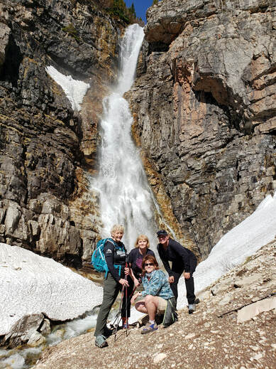
Cobalt Lake and Rockwell Falls, July 12, 2019: Two hikes, one car, dinner together for GiG
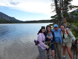
We had a great day with four of us going to Rockwell, Aster Falls and Paradise Point while four went to all of the above plus Cobalt Lake. We left Great Falls at 5:30 and got on trail at just after 9 a.m.
The flowers were amazing, especially bear grass right near Rockwell Falls. One group saw a grizzly at Paradise Point. The Rockwell Falls gals finished around 3 p.m. while the Cobalt Lake gals finished at 4:45 p.m. Susan proclaimed that we had hiked at a "Katie pace," since we hustled so we didn't finish too far behind the other group. We ate at Serrano's, which is under new management. They were out of a few things. We also learned something: if no one at the table orders a meal and instead all order a la carte, then the table doesn't get chips and salsa. We arrived home around 8:30 pm. Who went: Susan, Judy, Amber, Katie (Cobalt); Sue, Karen, Gail (Rockwell) |
Iceberg, July 11, 2019: Bear Blocks Road; Popular Iceberg Trail Not as Busy as Usual
Two cars left Great Falls at 5:30 a.m to head to Many Glacier for a 10-mile hike to Iceberg Lake.
It was easy to find a parking place amazingly, but then again, we really arrived early. We got on trail at 9:15 and were done at 3 p.m. On the way in, we saw a bear on the way in walking along the side of the road, sauntering along like he owned the pavement. We had to drive around him. We did take our hike pretty leisurely. We say many large groups of hikers, with as many as 10-15 people. It was crowded with everyone passing us but not overly crowded. It was a beautiful hike; the gradual uphill that wasn't noticeable really until we turned around and went down. We saw a mouse on the trail. Two Columbia ground squirrels ran over Susan' C's boots, startling her, causing her to scream, which startled all of us. At the lake, it was pretty crowded. We saw some people coming from Shangri-la down the steep scree to Iceberg Lake. The only icebergs were at the far end of the lake, so there was no standing on them this year. The flowers were pretty but the bear grass was all over. Amber was the water bearer, reminding everyone to drink to prevent dehydration. Cloud cover threatened to drop some water but it never rained. Ate at 'Nells restaurant at Swiftcurrent. The restaurant has changed with ordering at the counter, all pay separate. It's burgers, pizza, wraps and salad. It was okay, but Josy said the French fries were the best. We arrived home around 7p.m. Who went: Josy, Susan C, Amber, Bonnie J, Brenda, Viki, Susan W |
Mount Brown/East Butte, Sweet Grass Hills, July 9, 2019: Two Gals Get Trifecta--Summit All Three Sweet Grass Hill Buttes; One Gal's Heart Issues Scare Hikers; Belly Crawl Required to Enter Devil's Chimney Cave
It was a day of delays and emotions, and not one we would want to relive but also not one we would like to erase either.
It started at 9:10 from Chester, where we met Ann, the Canadians and Joanne, with a 35-minute delay due to a work train blocking the crossing. We got out of our cars to watch the crane lift ties from the railcars onto the tracks. A few did some stretches. Then we made our way to the Meisener Ranch to check in and get further directions. Deb, the manager, was so kind and friendly as we signed the book and told her we were a group of 19. She hoped we didnt have too many vehicles. She was pleased we were in only four. Then we went through a series of gates to arrive at the cairn, marking the place to go through the fence to start the hike. We broke into two groups, with a mix of Americans and Canadians in each. Tom, Katie's husband who was our guide, and Gordon, Tom's friend, led the first group while Katie and Josy took the second. Tom and Katie had walkie talkies for communication between the two groups. Linda, one of the Canadians, was the main reason Katie and Tom wanted to do this hike--plus some of the gals wanted to conquer all three main buttes of the Sweet Grass Hills: Gold Butte, West Butte and East Butte. We had already done all but East. And East had two peaks: one named Mount Royal, an open peak with many cellphone and TV towers on it, and one Mount Brown, the tallest. We were headed to Mount Brown. But for Linda, this butte had special meaning. For many years, she had wanted to climb the mountains she would see just over the border. We wanted to make this happen for her. The first part is on an old jeep road, which started out fine until a mile in. Ina Jean started to lag, so Katie's group couldn't keep the pace.Katie kept radioing to Tom to stop and wait. We didn't know it at the time, but this would be a precursor to serious trouble later. By the time we had covered the two miles to the entrance to the cave called Devil's Chimney, Ina Jean wan't feeling well. But we all made it into Devil's Chimney and enjoyed the 15-20 feet of belly crawl into the tight space to come out into a large open cavern with a skylight. After the cave, it was apparent that Ina Jean could not continue: she was really sweating, she had leg and foot cramps and was wearing the thin toe shoes, that Katie told her wouldn't work on the volcanic talus that we faced on the steep slopes of East Butte.Susan C stepped in with her nutritional knowledge to help re-hydrate her and give her some Gatorade after she took on some water. We all thought she must be dehydrated from the long drive. As a group, we decided she should stay and rest by the creek and the shady cottonwood trees, while the rest of us went on. Laura, the Canadians' leader, said she would stay with Ina Jean, despite Katie and Ann volunteering since it would be easy for them to return but not for Laura. It was now going on 1:30, so it was very late for a mountain climb, where wisdom says to be off the top by 2, due to electric storms. It took the rest of us over two hours to reach the summit, with Gordon pointing out a key directional error we almost made. While on top, we celebrated Linda and LaVern, who both completed summiting all three buttes and at the age of 75. For Linda, it completed her bucket list, which was bittersweet since her cancer has returned. And at the top, Tom put Linda in front, so she could reach the top first.She also was first to sign the registry, which was inside an old army ammo box. Also inside, was a silver chalice. We had fun taking pictures of Linda pretending to drink from it. Another hour and a half took us back down; it was almost 6p.m. when we reached Laura and Ina, who both seemed rested and in good spirits. However, the minute we started the uphill to climb out of the creek bottom, Ina Jean felt sick again, with sweats, shallow breaths. She was very afraid of the downhill section and was dreading it. Not to go into too much detail, but it took three hours to go two miles back to the cars. Ina was really suffering. A special thanks to Josy, Loural, Susan C and Gordon who took charge and stayed with her. She didn't like so many people around her so the rest of us would go ahead and wait. Later, we found out that Ina Jean had had four prior heart attacks. We were all shocked at this and now thought it wasn't dehydration but heart problems causing her issues. And we were right. We were all tired and thirsty by the time we arrived at the cars; it was now going on 9 p.m. Americans left first with the Canadians following. The Canadians didn't get too far down the road, and unbeknownst to the Americans, Ina Jean ended up with a full blown heart attack. She didn't want to go to Shelby, the closest hospital due to the Canadian insurance not working in American, so the Canadians called ahead to Milk River; an ambulance met them at the border--which is another story. Since it was so late, the normal crossing for the Canadians was closed. They had to go to Couts instead. Milk River determined that Ina Jean needed more care than they could give so they sent her to Lethbridge, where she was in ICU all night and into the next day. Even Lethbridge determined she needed to go to Calgary. She had water in her lungs, possibly pneumonia, water on her heart and other heart abnormalities. We were all shocked and kept up the prayers. She is still in the hospital as this is written; we hope she recovers quickly. But this incident was a good wake-up call about what very strenuous and very steep mean as far as health issues and what can be attempted if a hiker does have health problems. We arrived home around 11:30 p.m., dodging deer the whole way. We even saw a whole herd of bucks in the velvet. Plus, the bugs were so thick, they coated our windshield, making it very hard to drive.And we were starving. No restaurants or even convenience stores were open in the small towns before we hit Great Falls. But the Canadians had an even longer ordeal and longer drive than we didn't even know about until the next day. So the day had an almost tragedy, which hasn't ended yet; but it also had the high of Linda and LaVern climbing all three of the main buttes of the Sweet Grass Hills: Gold, West and East. Who went: Americans: Josy, Susan C, Amber, June, Katie, Beth, Ann, Jo Ann, Tom, Gordon; Canadians: Laura, LaVern, Lorna, Loural, Linda, Ina Jean, Dina, Sharon, Merrilee |
Flesher to Rogers Pass, July 6, 2019: Second Leg of the CDT Stuns Gals with its Beauty
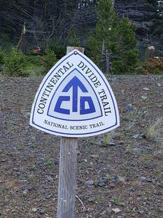
This 13.5 mile hike prove to be a premier portion of the Continental Divide Trail. The majority of the 3,000 foot elevation change occurs at the beginning and end of the hike. After shuttling vehicles, we ventured up the stairs in the east side of Flescher Pass.
The views on both sides of the divide were fabulous as clear skies were predominant, until some afternoon thunderstorms at the end of our hike. We observed the Bob Marshall Wilderness Complex, the prairie including Square Butte, and the Rocky Mountain Front. We had a comforting breeze periodically and the temperature was in the upper 70’s. Tall and abundant grass lined the trail and filled the meadows as well as a diverse assortment of colorful and unique flowers. The forested areas contained many standing and fallen dead trees covered with chartreuse colored moss. The geology was amazing with a variety of shales, sandstones and feldspar conglomerates and outcroppings of weathered rocks. We encountered hikers who ere traversing the CDT (Continental Divide Trail). They were from Germany, London, Texas, Colorado, and Wisconsin. They all had started in Mexico, but when in Colorado the late snow caused them to fly up north and work back down to Colorado. One hiker shares with us that his friend had tried to make it through Colorado, but broke his leg. All in all it was a beautiful day and we thoroughly enjoyed each other’s company and appreciated nature’s unending beauty. We got on trail at 8:15 and ended the day at 4:30. Who went: Amber Susan’s c Susan W. Camille Beth Ronni Paula Mary S.. |
Mount Wright, June 30, 2019: GiG Gals Find Steep Climb Worth the 360-Degree Views
We had the perfect day for a mountain climb: not too hot and not too much chance of thunderstorms, so 10 of us drive the Teton Canyon road to the start of our hike.
Coincidentally, we came across a group of GMS (Glacier Mountaineering Society) members climbing Washboard Reef, which Katie's husband decided to join. And Laurie from East Glacier was among the group. We got on trail at 8:40. Katie wasn't feeling well so she wasn't very foggy headed questioning so many things, even the trail, which she should know well given how many times she has done this particular hike. So she had Josie, Amber, June and Christi scrambling to double check she was on the right trail. They all earned their merit badges for the day going an extra quarter mile, some uphill. On the way up, we marveled at the wildflowers, so many different kinds and a doe who seemed unaware or afraid of us. We wondered if she was about to give birth. We has seen many deer at the ranger cabin and stables by the parking area on the way in. We hoped to see her on the way down with a newborn, but it wasn't to be. We did see deer by our cars, but we didn't spot the fawn. The hike went well except for Katie and Mary S who had trouble breathing. Everyone made it to the top, Katie struggling, with Mary staying at the second saddle. The views were spectacular, but a bit of a storm was brewing so we didn't spend too much time on top in case of lightning. The peak is over 8,800 feet with a climb of 3,400 feet in elevation. Katie got that wrong. She thought it was a 10,000 foot peak. It is the third highesst in the Bob, and they say it has the best views in all of Montana. We agree. On the way back down, Katie and Mary looked for the extra water bottles they had stashed to save some weight. Katie was way off on where they were stashed. Mary knew right where they were and didn't give up hope as we spotted them. However, someone had taken one of Mary's bottles and left behind the labels! We had seen a young gal on trail with her dog. We could only surmise she must have needed the water for herself or her pet. Luckily, Mary didn't need it. We finished our hike around 3;30. After our hike, we got our cold drinks out of the coolers and relaxed a bit, changed our shoes and headed to Choteau for dinner at the Log Cabin. We left GF at 6:30 a.m and arrived home around 7 p.m.. Who went: Mary S, Susan C, Amber, Christi, Susan W, Josy, Paula, June, Beth, Katie |
Seeley Weekend, June 24-26: LC Pass and Holland Lake Connector Trail Perfect for Seeley Overnight
Our group headed to the Alice Creek Trailhead which is outside of Lincoln and then up trail 493 to Lewis and Clark Pass. The trail was wide with a steady gradual climb past areas of burnt trees from the Alice Creek fire that started by a lighting strike in July of 2017 and burned over 29,000 acres. There were a plethora of flowers such as Silverleaf Phacelia, Fern-leaved Desert Parsley, Cut-leaved Anemone, creamy white ,reddish-pink, Blue-eyed Mary, Dogbane, Shooting Star, Rockcress , Rosy Pussytoes, Coiled Lousewort, Stickseed, Yarrow, Roundleaf Alummroot and Stonecrop.
We were within a very short distant to intersection of the Continental Divide trail but a storm blew in and with wind and rain, we quickly headed back down. We said good by to Sue as she drove back to town and the rest of us headed to Seeley Lake.
At Mary's cabin we unpacked and relaxed on the deck and then had dinner at the Chicken Coop. In the morning we drove to Holand Lake to hike the Holand Lake Corridor trail.
As we were preparing for our hike, we observed three employees from the Forest Service getting ready to head in to the Bob Marshall for five days of trail work. Each person had a seventy pound pack including axes and two of them carried large crosscut saws. We thanked them for all of their work in keeping our trails in good condition and just stood and watched in awe as they quickly headed up the trail for their fifteen mile trek for the day.
Most of our group had not been on this hike but it did not disappoint and gave us some super views and waterfalls at the end. We decided to return the same way we came in and not go all around the lake because the last part of the trail was in the woods with no views. We spotted some Mariposa Lilys, Trumpet Honeysuckle, and Thimbleberrys
In the evening we had a great dinner at the Double Arrow Lodge and then headed back to Seeley and spent the rest of the evening enjoying a fire by the lake that Anita kept stoked along with conversation that lasted until dark.
After a leisurely breakfast the next day and some shopping at the quilt shop, we were on our way home and grateful that we were able to have Mary share her cabin with us.
Who went: Gail, Mary N, Jeanne, Jo Ann, Anita, Sue (day hike)
Alice Creek to Rogers Pass, June 24, 2019: CDT (Continental Divide Trail) Wows Gals as They Hike the Ridges
It was windy; it rained; but it was still a most wonderful hike on the CDT (Continental Divide Trail) from Rogers Pass to Alice Creek. We were so lucky to have Gail and Jo Ann willing to shuttle our car on their way to hike Lewis and Clark pass.
We parked at the top of Rogers pass to hit the trail at 8 a.m. under very cloudy skies. As we headed up the trail, we were amazed at the variety of wildflowers: Indian paintbrush, prairie smoke, larkspur, arnica, virgin's bower/clematis were the main ones with the bear grass just starting. We also spied the elusive chocolate lily, although it was starting to fade. At the top of the pass and at Cadotte pass, we placed stones on the cairns in memory of Chrissie Jackson and Colette Engel, reminding ourselves how lucky we are to be alive and still able to do a hike like this one. June and Katie conferred with the GPS and maps several times as the trail is a bit unclear in spots; however, the bulldozers had widened the trail as they came in to set a barrier from the wildfires two years ago, so the trail was easier than expected to follow. In addition, we saw pink flags along the route, some with writing such as "pipe here." We saw another hiker behind us as we trekked across the ridgeline, views in all directions. We expected that he would have caught us but he must have taken a different route or turned around as we didn't see him again. Then we came upon a hiker going in the opposite direction. He was a CDT hiker, doing the route from Canada to Mexico, not the usual route. He said he didn't have too much trouble crossing the snowfields in Glacier and the Bob. He has camped at Caribou peak the night before. Along the ridges, the flowers changed. We came across sections filled with bluebells, Yellowstone draba, silky and silverleaf phacelia and forget-me-nots. Others had nothing but biscuitroot or arnica, penstomon, and stickseed. We must have counted over 50 different varieties of wildflowers. Then it started to rain. We pulled out our rain gear; Judy learned not to trust to the weather predictions, especially looking at a town's forecast when hiking in the mountains.Always bring rain gear on a GiG hike.Luckily, it didn't rain much, just a few sprinkles, but the wind was howling and was a bit cold. Gloves came out. When we finally reached the top of Green Mountain, most of us were happy to know that the rest of the way was downhill after the 3,000+ feet of gain; however, the downhill coming off Green mountain is quite steep, so our progress was slowed as we watched our step.especially with the wind gusts that were probably about 50 mph. Also, the register at the top of Green Mountain had water in it, so it was ruined and we coudln't sign it; a bit of a disappointment. After we descended, we had a short jaunt to Lewis and Clark pass. We drank in the history as we thought about the company seeing the same scenery that were were now gazing at. In this area, the burn was more obvious since it had more trees. As we took the last turn to follow Alice Creek, we came across one more hiker, this one part of a trail crew. He said about 20 people were in the campground, ready to get to work. He was surveying what needed to be done. Now the pink markers made sense. They were for the trail crew. We thanked him over and over for doing this often thankless volunteer work. When we reached the parking lot, we were relieved to see Susan's car parked and ready for us. Thanks to our fellow GiG gals for the shuttle! We ended our hike at 4 p.m. We arrive back in GF at 6 p.m. who went: Judy, Susan W, Bonnie J, Katie, June |
Upper Two Med Lake, Twin, Aster and Rockwell Falls: Attack of the Spruce Grouse and Rain Don't Spoil the Day
It was supposed to rain; it was supposed to snow; it was supposed to be cold, but four of the GiG stuck with the plans and made a go of the day (originally 19 had planned to attend).
The decision turned out to be good as we only faced a few sprinkles the entire day, mostly at the lake itself. We had a lot of putting on and taking off rain gear, but the day was mostly sunny with clouds and in the 40s-50s temp-wise, perfect hiking weather. We arrived in Two Medicine a full 45-minutes early, so we decided to the the .6-mile roundtrip walk to Running Eagle/Trick Falls. It was impressive with water roaring over the top and through the tunnel. Then it was on to a mostly-empty boat ride, with a tour from a gal who a first-timer as captain of the Sinopah. After working in West Glacier the year before, she decided not to return to Colorado and stay in Montana. She did an excellent tour. Then we hopped off the boat and began our day with a hike to Twin Falls. Two people reported seeing a moose but we didn't see it. However, the falls were impressive with tons of water spilling down the rocks. Then it was on to Upper Two Med Lake. On this stretch, the clouds started coming in, settling into the cirque. We faced a light rain at the lake and lots of wind, so we didn't stay long. On the return hike to the boat dock, no rain as soon as we got out of the cirque. The head of Sinopah kept up protected and the storm contained in the Upper Two Med valley.This stretch of the hike overlooking the lake and out of the trees in the sun was then too hot, so we were stripping layers. When we came to the horse ford turn, we saw some hikers who had accidentally gone that way, backtracking. Then we arrived at the Cobalt Lake/Rockwell Falls junction. Susan suggested we do the extra three miles to Rockwell Falls. Katie thought we might be pushing our luck on the rain, since the weather sites said it was really supposed to pour or even snow after three, but we all agreed that we were prepared if it did happen. We went to the Falls and then continued up the switchbacks until we got above the cascades for an overlook. We had a snack on the rocks before heading back down to the main lakeshore trail. Now, people were starting to figure out that rain wasn't really happening. We came across quite a few people on the trail and even had lines on both sides of the hanging bridge, something we hadn't encountered before. The park, even Two Med, is getting busy, even on a weekday with rain threatening, before Logan Pass is open. Speaking of threatening, Viki looked up and saw a bird on a low branch, saying "Look, a bird." Katie said, "Watch out!" it's a daddy spruce grouse protecting his nest; he will attack." And he did, getting Amber in particular. After we manged to get far enough away, we could hear screaming behind us; I guess he got the next set of hikers too. We took another little break at Aster Falls, looked for moose in the moose/beaver ponds but didn't see any, just a brand new beaver lodge. But on our drive out of the park, we did see a herd of sheep, so we were happy on the wildlife score. In total, we made it a 13.5-mile day instead of the planned nine. We all felt great. Then it was off to a great dinner at the Glacier Park Lodge. We had a very fun server too and quick service. We arrived home around 7:30. Who went: Viki, Susan, Amber, Katie |
Willow Creek Falls, June 14, 2019: Gals Were Surprised They Had Not Done this Hike Before
We had sunny skies with a high of 68 in the Willow Creek area on Friday, June 14. There was a slight chance (20%) that showers and thunderstorms may move through in the afternoon hours. We moved our departure time up by 30 minutes so that we can be off the trail a little earlier to avoid the possible storms. We did get sprinkled on for a couple minutes, but thankfully, no thunderstorms.
This hike was 5 miles round trip with a steady climb of around 1000 feet elevation gain to the top of the uppermost falls in the series. This was a first time trek for Jo Ann, Sara, and Susan Cooper and all were rightfully impressed and awed by the sights and sounds of the water as if fell through its series of falls. Gail and June had made the hike before but were no less thrilled than the first-timers for the volume of water that spilled over the five waterfalls. The trail varied between tree covered, open meadows and rocky, loose ledges which provided overlooks of each waterfall. Our first task was to don our water shoes and cross Willow Creek which was running full from spring runoff. A very nice gentleman came down from his cabin to visit with us as we put our boots back on and gave us an “OK” to cross his fence and use the private footbridge on the way back. Needless to say, we took him up on the offer. A mid-day meal of burgers at the Bunkhouse Bar capped a great day of wonder and camaraderie at Willow Creek. Who went: Sara, June, Jo Ann, Gail, Susan C |
Pioneer Ridge, June 13, 2019: Calypso and Other Flowers Wow on Evening Hike
We started out with eleven ladies for an evening hike and headed out to the Belt Creek Range Station near trail 734 to look for Calypso Orchids and we were not disappointed. The trail started with just a few Calypso flowers and as we proceeded along the switchback trail we were graced with many groups of the lavender and yellow beauties. There were many photos taken of all of the different flowers as each turn we spotted new varieties of plants that were awaiting us. We saw Utah Honeysuckle, a Chocolate Lily, Arrowleaf Balsamroot, Prairie Smoke, and many more. Jo Ann's expertise in plant identification was a learning experience for all of us.
The temperature was quite warm and although the hike was only three miles total, it was a good climb to the meadow. Susan lead the group to the end and then back down the forest path. Some of our experienced hikes weren't expecting the amount of up hill that they encountered. We had some new hikers that had not been on too many hikes before and did very well with the heat and altitude gain. Our group decided to stop and have a bite on the way home at Cougar Canyon and we returned home just as the sun was setting. The ladies that went were: Una, Maria .Bonnie J.,Roni, Susan C., Debra Mc., Susan W, Jo Ann W, Bonnie W., Heather, and Gail |
Sawmill Gulch, June 4, 2019: Evening Wildflower Walk Doesn't Disappoint
|
Who went: Bonnie W, Mary S, Una, Susan C, Jo Ann W
An evening wildflower walk at Sawmill Gulch did not disappoint. We saw sugar bowls, yellow bell, prairie smoke, larkspur, woodland star, valerian, bluebells, shooting star, fairy bells, Jacob's ladder, fern-leaved parsley, chickweed, and others. We walked about two miles. A lovely evening. |
Mount Ascension, June 2, 2019
Our group of five headed to Helena for a hike to Mount Ascension in the Prickly Pear Land Trust area. We had our South Hills Trail Map and made use of it because there are so many trails that are social trails and trails that intersected. If you want to use your phone for navigation there is an app that has the South Hills Trail System on it. There are over 70 miles of single-track trails and old two-track roads that are in the Helena area and are managed with the cooperation of the Prickly Pear Land Trust, the Helena National Forest and the Bureau of Land Management.
The start of our hike was from the Beattie St. Trailhead and then on to Prickly Pear, Meatloaf, Easy Rider and then on to the Mt. Ascension Loop trail and our goal of the Mount Ascension summit of 5282 feet. We encountered trail runners and hikers as and well-behaved dogs along our way as we headed down different trails such as Pail Rider to return to our car.
A stop at Basecamp to check out some gear proved fruitful with shoes, water bottles and other accessories that were enticing. We then proceeded to the Windbag for lunch, and wandered in a few shops along Last Chance Gulch and returned home.
Who went: Amber, Susan, Linda, Gail, Anita and Christi
Rogers Pass, May 30, 2019: Rain in Town Doesn’t Keep GiG from Hike
We left the DOB under ominous skies and the rain didn’t subside as we got closer and closer to the Rogers Pass trailhead on May 30. Leaders Gail and June were going through alternative activities in their minds if we were to have driven all that way and been rained out. Go on to Lincoln? Walk the Sculpture in the Wild Park? Even Mary Nichols, who had driven Highway 200 from Seeley to meet us at the trailhead, said she had been through hard rains the entire way. But as can sometimes happen, the clouds thinned, the rain clouds moved on, and just like that, we were under dry skies from the beginning to the end of the 3 mile round trip to the top of Rogers Pass.
The highlight of this hike was presenting Mary Nichols with her 500 mile award. Unbeknownst to Mary and to make sure she had truly reached the 500 miles, the group continued on with her across the top of the pass along the Continental Divide Trail to a cairn designated by Katie that would guarantee her 500 mile total. Once we had returned to the bottom, Susan Woyth presented the award, and we shared cookies and a good laugh over the extra trek to the cairn. Who went: Mary N, June, Christi, Susan W, Amber, Rose, Spardha |
Scenic Point, May 27, 2019: New Snow on Scenic Point Creates Obstacle for GiG

In Great Falls, it was foggy and rainy all day, but we escaped the gloom by heading to Two Medicine for a hike up Scenic Point. Going north apparently was just to ticket to avoid a cold dreary day as we had patches of blue in between the clouds; no rain at all.
We started at 7 a.m and hit trail at 10. The path was nice to start, then became a river due to melting snow and then finally we hit the snow. We handled it fine at first but then resorted to yaktrax as the snow became slippery the more it melted. Luckily, there was one hiker ahead of us creating a set of tracks to follow as it was hard to see the trail. At one point, Katie followed the tracks and realized she was off trail. We missed a switchback and had to backtrack. Two gal passed us and then came back down. They said they found deep snow, up to their hips, so they turned around before the top. We did too as Katie also saw a small cornice at the pass and was worried about avalanche. Plus some of the gals were starting to posthole too as the temperatures rose. When we did turn around, Susan W asked, "How am I going to get out of here" as it is harder to go down than up, especially in steep slippery snow, but it was easier than it looked and we all made it to the "river" portion of the trail with only one mishap: Josy fell into a tree well, but she quickly scrambled up to the trail without assistance. We all agreed that the effort was well worth the views: puffy clouds, some blue sky and fabulous snow-capped peaks surrounding us with the gorgeous Two Med lake below. We got off trail at 2:40 and headed to the camp store for a snack on the porch. The store had just opened for the season at noon that day, with several new employees. We found out that the store will have a few more food items this year as well as more inventory. Then it was off for another two mile hike, this time to the moose ponds on the south shore trail. We didn't see any moose and only a few flowers in the meadows--shooting stars and buttercups mostly--and lots of mud. We finished just in time to get in line for the opening of Serrano's. We found out that Serrano's did sell. We were impressed with the help--lots of it and on the ball. However, some of the food wasn't cooked all of the way and lacked some of the former quality. Still, we had worked up an appetite. And two of us brought home pie for strength from the Two Med cafe for our husbands. We arrived back in Great Falls at 8:15, early since our meal only took 45 minutes. Who went: Josy, Susan C, Susan W, Amber, June, Katie |
South Hills, May 26, 2019: Gals Check out New Trail in Helena; Weather Holds Off
The forecast was threatening with a 70% chance of wet weather but armed with our rain gear, we headed out to Helena. We had a slight problem in finding the Rodney Ridge Trail Head but Sue H. helped guide us as some of the streets were hard to find. Yes, we were using GPS but it was not too helpful.
This was a new hike for most of us and everyone enjoyed the diversity. We started out and found the trails to be very pleasant with many great paths that connected so our maps of the area were put to good use. There were social trails not listed on our maps so sometimes we were not sure if we were on the right trail but we able to make the six mile loop. There were some flowers like Arrow-leaved Balsam Root, Phlox, Shooting Stars with more plants emerging. We encountered mountain bikers that had full face helmets and safety gear which was good to see because they were riding quite fast. There were a few hikers and some trail runners also. Our group was amazed at how polite everyone was on the trail which made us feel welcome and we appreciated the large area of trails that were well maintained. We hiked to The Top Of The World and were rewarded with a spectacular view of Helena and the surrounding area. As we were ending our hike it looked like rain in the distant and by the time we stopped for lunch at the Brewhouse it was raining. We met Cathy;s daughter for an enjoyable lunch and then we made a quick stop to shop and then proceeded home. Ladies who went: Cathy, Susan, Karen, Gail, Susan C. and Sue H. |
South Hills Helena, May 19, 2019 Gals Explore New Area in Helena South Hills
On a gray day, three GiG gals headed to Helena, hoping for no rain. The predictions were for rain and wind in Great Falls all week, so we went south since the weather looked more favorable that direction.
And we were right. We didn't get rained on and no wind! Although, we were quite cold when we started, necessitating gloves and jackets.Susan never did strip down to her last layer, I think a first for her. Mary kept all five of her layers on the whole time, with Katie taking off one layer just to put it back on once we reached our ridge top snack break. We did encounter a few hikers (two with dogs) and quite a few bikers, who were a bit scary due to how fast and silently they came upon us. But everyone was respectful and polite. The hikers yielded to uphill traffic while we stepped off the trail for the bikers, so they wouldn't have to lose their momentum. We took the Don't Fence Me In trail to the Water Line to the TR to the Pinchot to the Rodney Ridge and Meadow trails, which completed a nice loop. At the far end of the Rodney Ridge trail, we continued up a spur trail to view the Top of the World view spot and then backtracked to our loop. The views were lovely even though the low clouds blocked the far mountains. We could still see snow-capped peaks as well as the surrounding hills, houses and creeks. The trail is a variety of forest, meadow and ridgelines with views. We also saw 14 flowers: fitillary, 9-leaf biscuitroot, cous biscuitroot, American vetch, fairybells/red twin berry, pasque flower, arrowleaf balsamroot, buttercup, phlox, douglasia, virgin's bower/clematis, skunkcap sumac, shooting star to name a few. A few times we were confused about the trails as there were unmarked social trails. However, with the aid of the South Hills Trail map and our cell phones, we easily found our way. The trip took us just under 3 hours to complete, and then we headed to lunch at the Brew Pub, but first we stopped at the Base Camp to purchase more maps and take a look at gear. We got back to GF just after 4 p.m. to face the howling winds. |
North Fork Highwood, May 13, 2019: Late Season Still Produces Flowers in Highwoods
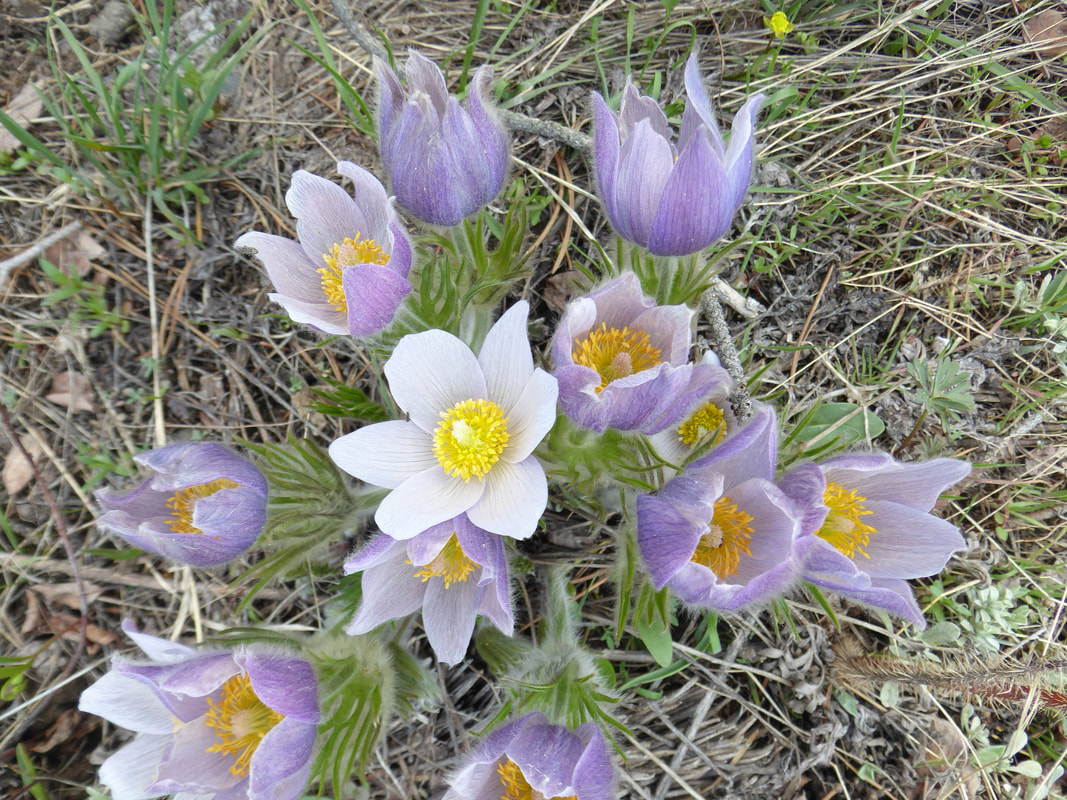 Pasque flower Pasque flower
A group of nine ladies headed out after work to the Highwoods to try the North Fork Trail for an evening hike. There were clouds looming over the Little Belts but the Highwood mountains looked inviting. It was nice to have Bonnie along on the drive because she was raised in the area and gave us some history and showed us the family ranch with all of the newborn calves that her brother now runs. She also pointed out some sketchy bridges and guided us on the dirt road.
We arrived at the parking area and then crossed a small foot bridge to the trail head. All though the hike is a short one, it is a little steep and starts in the trees and heads to a ridge where the view are super. You can see Baldy which still has some snow on the top of the mountain. After the ridge we came to a stand of trees and five of the group lead by Katie, headed to the top. The rest of the group continued along the trail to meet up with them. When we stopped we were in voice contact with them but they did not show up so our group turned around and then waited for them on the ridge. We started down the trail and very shortly the group was in view. Although the flowers are late this year, we still saw 20 different varieties, including pasque, cous biscuitroot, fritillaries/yellow bell, sugar bell, chickweed, woodland star, shooting star, golden pea with the arrowleaf balsamroot just starting. We were dismayed to fine that motorcycles had used the trail and also there were other vehicles had climbed a hill by the parking lot when motorized vehicles were to remain on the road. After a beautiful evening for a hike we returned to Great Falls at 8:30 just as a few drops of rain came down. Thanks Amber and Jeanne for driving. The ladies who went were: Amber, Rose, Judy, Jeanne, Beth, Katie, Gail, Bonnie W and Christi. |
Many Glacier Waterfalls, May 11, 2019: Snow Shortens Hikes on Warm Many Glacier Day
Two groups of the GiG headed out for a day in Many Glacier to see Apikuni and Redrock falls. Both groups found more snow than expected.
Longer Group hike 6 a.m. group Brenda Brooks Susan Woyth Viki Gallagher Judy Held Amber Pedersen Mary Somerfeld Karen Spencer Kuntzie Kuntz Highlights of our trip: Kuntzie woke up late so that gave Susan time to grab a coffee while we waited. At the turnoff Amber made the rookie mistake of not speaking up about the bathroom and wound up having to 'read a sign" on the side of the road prior to arriving in Browning. As we entered the park Susan was deeply concerned about how low the water was and expressed her dismay several times. Finding an open bathroom proved more challenging than we first thought. Pete, a lone hiker was very helpful with suggestions...there was great little loner pit toilet in a parking lot behind the Many Glacier hotel that we finally found. We made our way back to the Apikuni trailhead and began our journey. We ran into Pete again taking pictures of the pasque flowers (crocus), and he joined us to the falls. The trail was nice with minimal snow to traverse. The temperature was perfect and the wind was practically non existent (no, really!) The elevation gain was just enough to get the heart pumping! Judy decided pants were optional and did not need her under tights-- and Amber quickly learned the Lesson of the day: Snow does not mean cold! The Apikuni Falls were absolutely beautiful and it was great little jaunt to get our day started. Pete continued on above the falls and we met with the sister GIG group on our way back down. We were all so enthusiastic about our great little loner pit toilet we decided it was worth another stop on our way to the Bullhead lake trailhead. Some folks had mentioned a Mama bear and cubs on the road but we did not see anything other than an impressive pile of scat. The trailhead to Bullhead lake looked quite promising until about 500 ft. past the bridge. Much of the trail was shaded by trees and the snow had not completely melted. Probably 75% of our journey to Red Rock Falls was through the snow. We had nice deep moose tracks to helps us avoid some of the deeper post holing spots but never did find our moose guide. We had lunch at Red Rock Falls and after a brief, unsuccessful scouting trip to find the trail to Bullhead Lake we determined it was not to be. Kuntzie had already determined she was not going any further! The snow was far too deep and we did not want to risk losing Judy up to her hips again! The snow coming back was very slushy and slippery and the post holing was quite frustrating as well. Our only wildlife were some gophers and ducks with white stripes. We did earn ourselves a nice little merit badge for finding lost bear spray and sunglasses on the way out. Once we changed out of our slushy shoes we just could not miss the opportunity the stop by our great little loner pit toilet again. As we left the park and started into the reservation we all shared in the concern for just how low that darn water really was! Gas in Browning and on to dinner at Buffalo Joe's. Our sister group was already there and eating and after a small panic by the hostess we all enjoyed an wonderful meal. All in all it was a great day in the park and good times were had by all! Shorter Group HIke Our group left Great Falls at 7:00 a.m.: Gail, Maria, Anita, Jeanne, and Jo Ann. Gail drove. We stopped in Browning for gas and snacks; then, proceed on to Many Glacier. There was snow on part of the trail to Apikuni Falls. Not difficult, but on the way down we wore our Yak Traks; the snow was melting and slippery in spots. As we were going up the trail, we met the other group coming down. The Falls were beautiful and the snow-capped mountains glistened in the warm sun. Then, we proceed on to the bathroom and lunch at the Many Glacier picnic area on Swiftcurrent Lake. After lunch, we proceeded on to Red Rock Falls Trail. However, after a short time on the trail, observing other hikers post holing and falling in the snow, Gail suggested we turn around and all quickly agreed. Then, we went to the Many Glacier Hotel to check out the trails. Again, too much snow. We took photos and relaxed in the sun, enjoying the spectacular view of the snow covered mountains. The hotel was in various stages of renovation, including painting the outside. Maria and Anita took a peak inside. On our way home, we stopped at Buffalo Joes in Dupuyer. We had 6:15 p.m. reservations, but since we hiked less than planned, we arrived around 4:30 p.m. Since dinner service begins at 5 p.m., we ordered off the lunch menu. The food was fair, not as good as in past stops. We then proceeded on to Great Falls. A sunny, warm, scenic day in Glacier was enjoyed by all. Who went: Maria, Gail, Jeanne, Anita, Jo Ann |
Morony to Ryan, May 7, 2019: Evening of Hoodoos, Ticks, Rock Formations
Twelve gals headed out for an evening walk along the north shore of the Missouri at 4:15 p.m., going from the Morony Dam trailhead to the Ryan Dam trailhead. First we parked a car at Ryan and then continued to Morony. We enjoyed a slight breeze but not the winds we had expected while the storm clouds kept their distance, hanging over the Highwood Mountians, so the weather really cooperated. The river was gorgeous as were the hoodoos and the few flowers we saw: cous biscuitroot, phlox, golden peas, sumac, cushion milkvetch and American vetch. The eye of the needle and the hoodoos stood out along the bank. One thing that really surprised us was the silt that formed numerous sandbars even though the water was high.The run-off from the farms must be getting worse. We wondered how the flow of the river was being affected with the narrowing of the main channels. We didn't see any snakes although several gals collected a tick or two, especially those hiking toward the front. Sara even had one embedded, we think a first for a GiG hike. We got back around 9 p.m. Who went: Maria, Susan W, Judy, Amber, Jo Ann, Gail, Bonnie, Sara, Susan C, Rose, Kuntzie, Katie |
Trout Creek Canyon, April 27, 2019: 22 Steam Crossings Create Trout Creek Obstacle Course
There probably wasn't a dry foot after we finished our 6.5-mile hike in the Trout Creek Canyon by York, as the creek was running high. We had 22 stream crossings, some of which were tricky: see-saw logs, slippery rocks and muddy shorelines. A few of the gals wondered what they had gotten into.
But the creek wasn't the only obstacle of the day; we also had ice and snow as well as felled trees to maneuver over and ticks to pick out of our clothing and hair. The day started at 7 a.m. We arrived at the trailhead by 9 and hit the trail at 9:20 after a quick bathroom break at the Vigilante campground. Of course, no spring trip to Trout Creek would be complete without looking for the Kelseya uniflora rose. We saw some great blooming specimens above the entrance kiosk (which were too far away to see well) and also at the end of the main trail, about one-mile down the road. This spot, however, requires an off-trail, through the bushes, trek for a good viewing; several of us ventured for a close-up look of the dainty flowers; however, those who did picked up a few ticks in the process. The rest of the Kelseya mats we saw were not flowering yet. We only saw a handful of people and two bikers on the trail. When we started, we were the only vehicles in the parking lot. On the way back through the canyon, several of the gals gave up on rock hopping and simply walked through all of the crossings, preventing any falls. At the very end, we came across a solo climber working his way up one of the rock faces. He did have a rope anchored at the top. We watched as he ascended and clapped when he reached the top of the pinnacle. After our hike, we had a discussion about where to eat, the York Bar of the Grubstake. Decision was the Grubstake, so we headed past York toward the Lincoln exit in Helena for our late lunch/early dinner. We were so happy to fit in a hike with an impending blizzard on the way. We had only had a few sprinkles; we were able to drive back without much precipitation too. Although we had canceled a trip to Glacier as the weather had already turned for the worse to our north, we weren't disappointed in our canyon obstacle course. We arrived back in Great Falls around 5:30. Who went: Brenda, Susan W, Viki, Judy, Paula, Amber, Susan C,Maria, Beth, Katie |
Juniper Bay Holter Lake, April 24, 2019: Gals See Bighorns, Views, Snake
Bighorn sheep, a dead deer, pair of American kestrels, hawks and wildflowers--yes it is spring, and three GiG gals had a beautiful warm-weather hike at Holter lake.
We started at 8 a.m. and got on trail by 10. We were treated to a flower show: pasque, fritillary/yellow bells, shooting stars, phlox, douglasia, nine-leaved biscuitroot, alyssum, Wyoming kitten tails and sumac. The trail starts up going uphill to a ridge, but we went off trail to the top of a knob; we named it Rattler Peak since Katie saw a rattle snake. She heard it and then saw it coiled up under a rock, waiting to strike. As she backed away, the snake did too, retreating into its den under an overhanging rock. From then on, we were very cautious around the rocks and tapped our poles on those we had to go by on the trail. Luckily, we didn't see any others. But we did come across a deer carcass and then higher up, the a hide that we figured was from the carcass that a cat probably dragged. At the top, we had a snack, but not wanting to take off our packs or sit down for fear of ticks (we never did see one, thank goodness). We enjoyed the views over the lake, marveled at the erosion of silt into the sides of the lake and marveled at the back side of the Sleeping Giant. Then we dropped down the mountainside to the Log Gulch campground to have our lunch at the nice picnic tables there. We even had nice outhouses for our use. We talked to a ranger there, who was getting prepared for the summer season. He informed us that there were some changes to the campground, trying to alleviate some of the partying in the past. He also said some of the sites would be reservation now, so people didn't have to rely on first-come, first-served. We told him about the rattler and he knew about it. He also mentioned mountain lions, which furthered our thoughts about the carcass we saw earlier. Then we headed back uphill to return on a loop trail to the Juniper campground. Along the way, we happened upon five bighorn sheep, all females and yearlings. The day was gorgeous with clear blue skies with fluffy white puffy clouds. Who went: Amber, Susan and Katie |
Essex, April 4-7, 2019: GiG, WoW Enjoy Izaak Walton Together with Snowshoeing, Games, Soaking while Facing Post-Hole Snow Conditions, Mouse, Spiders
The GiG and WoW (Women of Wonder from the Waterton area) headed out on Thursday from their respective homes to meet at Marias Pass for snowshoeing on the Pike Creek Trail. The GiG left at 6:45 and arrived right at 9:30 but behind the Canadians. As the GiG left Browning, we received and call from an upset Mary N who had overslept her alarm and wouldn't be able to come until later in the day as she was driving from Missoula.
The trail was pretty good, with not too many postholes, until we arrived at the base of Flattop Mountain. We enjoyed breaking into the burn area, the dead trunks pretty against the snow and the views of Summit and Little Dog Mountains coming into view. All was going well until Anita fell into a tree well up to her waist. Luckily, Paula was able to dig her out quickly as one snowshoe had caught under a buried branch. After a few more sunk, we decided the snow conditions weren't good to continue, so we turned around about a mile and a half into the hike. It was still a fun trail with pretty views. Since we cut the hike short by two miles, we arrived two hours early into the Snow Slip for lunch; and since the weather looked like it would turn rainy the rest of our days, we decided it would be best to make this a long day and hike to Garry Lookout after lunch. No sense climbing the mountain if you can see anything, we figured, so we might as well go for it on a clear day. This turned out to be a good decision--the views were fantastic. The only bad thing was that the Garry Lookout snowshoe was the one Mary really wanted to do, so with no cell service, all we could do is swing into the Izaak Walton on our way and hope she had arrived. She had--she was in the parking lot. We loaded her up into Katie's car and headed down to mile marker 168, hoping the pull out was plowed. It was. We got on trail at 3 p.m. but didn't get done until 7 p.m., yet it was still light. The snow was uneven, with some sinking, which took us a bit longer. We even faced some bare spots. At the top, we didn't find an igloo as in years past. We surmised that the weather had been too cold this year; however, the waitress at the lodge later told us there just wasn't enough snow to build one. The cold wouldn't have stopped them from building it, she said. Then it was back to the lodge to check in, the Canadians at the main lodge and the GiG at the Withrow house, a block away. Some had a soak in the hot tub, showers for others. Beth and Amber arrived around 8:30 p.m. and joined us for a Get to Know You activity with the Canadians at the Withrow house. Most everyone enjoyed the game, saying they not only learned about the Canadians but also about the gals in our own group. On a side note: The Withrow house had a mouse; it skittered around several rooms, including the bedrooms where Katie and Anita were. We tried to shoo it outside, but instead it went behind the stove. We informed the front desk person, who sent over a maintenance man with two traps. Apparently, the workers had been trying to catch the mouse for some time--nice they told us. We also faced many, many spiders. Anita, being an arachnophobe, wanted them all killed, but they just kept hatching. We must have killed over 100, each night more coming out. The next day, we left the lodge at 9:30 a.m. for snowshoeing on the Izaak Walton groomed trails. We took the Essex Creek Trail, connected to the Towering Pines and ended on Pileated. Instead of snowshoes, most used yaktrax, with minimal sinking. Then after lunch, we met back up at 2 p.m. for a hike along the Ole Creek trail over the hanging bridge that spans Ole Creek--which gave the newbies a thrill--stopping for side trips along the horse fords to see the convergence of Ole Creek and Middle Fork of the Flathead River. Gorgeous. Back at the lodge, we had a lovely, albeit pricey, dinner at the lodge (the Huckleberry Bread Pudding was amazing) and then finished with a game of Left, Right, Center in the downstairs lounge for some while others soaked. Katie asked about the mouse at the front desk. They said it was caught by the foot and they took care of it. They thanked us for showing them where the mouse had gone under the stove. The next day, we said goodbye to the Canadians (it was sprinkling, so they didn't want to snowshoe before they left, and instead went grocery shopping in Browning), while GiG headed to West Glacier for hiking the Fish Creek Bike trail into the campground and possibly Rocky Point. On the way, we happened upon a rock slide. Emergency vehicles blocked the road. Luckily, there was a pullout, so we could swing around the rocks and continue. The snow was a bit uneven again, but we were able to use yaktrax instead of snowshoes with minimal sinking.When we arrived at the campground, we were greeted to nice views, wind and no other people, a first for some of us in West Glacier. We ate a quick lunch at the picnic area in the cold wind and took the campground street back to the Camas road and followed it to our cars. Along the way, Susan tried to right a sign that had turned upside down. Then we drove to Apgar, shopped and took photos across Lake McDonald, so pretty surrounded with snow-capped mountains. Then it was on to the Snowslip for a late lunch/early dinner so we could then just stay and relax at the lodge or the Withrow house, play Catch Phrase/Dominoes and not drive again. Amber and Beth watched basketball games, but Amber joined in the games. A few took a one-mile walk around the town of Essex, marveling at the names on the cabins, the very fancy and the very rustic. The next morning, it was raining and had been all night, By the time we went to breakfast at 9 a.m. the rain had turned to snow. it looked like winter again. Our drive home wasn't too bad (we left at 11) --just a few slushy patches necessitating slower speeds over Marias Pass. As soon as we got to the east side of the mountains, the weather started clearing. By the time we hit Browning, we had clear skies with clouds in the distance. On the way home, we stopped in Browning, Bynum (we hoped the shops would be open, but they weren't) and Choteau. Unfortunately, we didn't see the migration of snowgeese, even though we drove by Freezeout Lake. Two swans were in a pond, but that was it. We arrived back in GF by 2 p.m. Who went: Susan, Mary Irene, Mary N, Anita, Amber, Beth, Jeanne, Sara, Katie (Canadians: Laura, Kathy, Carol, LaVern, Joan, Sharon, Paula, Dina |
Looking Glass Highway, March 23, 2019: Mountain Views Make up for Post-holing with Joint Trip with Canadians; Susan C. Enters 100-Miler Club
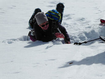
We left town at 7 a.m., meeting our sister group from Canada--the WoW (Women of Wonder/Waterton) at the East Glacier convenience store and gas station by 9:30. Then we continued to the trailhead where we met Laurie, who is from East Glacier. She had a rare day off from waitressing at the Two Med Grill. All told, we had 16 gals ready to snowshoe, with two (Desirae and Gail) taking a more leisurely pace and going four miles, while the rest of us signed up for the 7.5 miler.
The weather prediction was for a cloudy day bringing rain at night, but we had blue skies to start along with a bit of wind. As we headed out, we realized the snow wasn't very settled after our weird year of no snow through January and then tons of snow but below zero temperatures in February. With no chinooks, the snow never formed a solid base, hence those with smaller snowshoes were falling in all day. Even those with tails and larger shoes were sinking at times. Luckily, it wasn't too many postholes or we may have given up. Had we done so, however, we would have missed the absolutely stunning views of Rising Wolf Mountain (the largest land mass, but not highest, mountain in Glacier Park). The surrounding mountains, though not as commanding, were also impressive: Scenic Point, Henry, Apistoki, Lone Walker, Sinopah, Rockwell, Never Laughs, Bisonhead, Painted Teepee, Red and Spot mountains, among others. Each round of the bend brought a different perspective and new peaks into view. Along the trail, we saw many different tracks, some we thought might be wolverine, a small cat of some sort and a mountain lion. We made it just over 3.5 miles in, past the seven-mile highway marker to the wide pull out in the road. This area, Laurie calls "Rising Wolf Curve," a fitting name since this handsome red mountain dominates the skyline. Lower Two Med lake was still frozen but with areas starting to thaw. At our lunch spot, we could see the total white of Two Med Lake, not showing signs of any melt yet. As we stopped, we felt the chill and pulled on our caps and coats against the wind. But once we were back on trail, we warmed up quickly. As a side note, Katie started to pull out her water bottle and saw a Bud Light next to it. Actually, it was empty. Susan had found it on the road and decided we should pick up trash. On the way back down, we spotted bear scat and many moose droppings, more than on our way up. As the snow softened, more gals took tumbles as the snow collapsed under them. Of course, those of us with cameras had to document the fall-ins. We arrived at the cars at 3:30, while the other group finished at 1:30. They walked the Two Med road and chatted until we returned. Then it was time to say goodbye to the Canadians and Laurie while the Great Falls group headed to Choteau for dinner at the Log Cabin. We were hungry and thought about stopping in Dupuyer at Buffalo Joe's, but we called and they said they were booked for the night with a wedding and other parties. We had to put off our appetites for another 40 minutes, but that put us closer to home. We thought we might see some snowgeese and swans on the way past Freezeout lake. We did see a pond of swans near Fort Shaw but nothing else. We arrived in GF at 7:30, a great day of exercise and camaraderie. And when Katie got home and added up the miles, she discovered that we welcome Susan C to the 100-miler Club! Congrats, Susan. Who went: GF--Gail, Desirae, Joanne, Paula, Susan W, Susan C, Viki, Sara, Mary S, Amber, Katie, EG: Laurie; Canada--Laura, Dina, Paula, Joan |
Kings Hill to Silver Crest, March 16, 2019: Perfect Powder Makes for Fun Day, Quick Day
|
The Kings Hill to Silver Crest is a fun walk through hike, necessitating at least two vehicles for a car shuttle to the top while leaving one at Silver Crest, the ending point. We had one more twist in our shuttle day: We were dropping off Maria at Showdown for a morning of skiing on a memorial day for a friend of her son's.
We left Great Falls at 8 a.m. and were on trail at 9:45 after a stop at the Inconvenience Store in Neihart. We had a cramped ride with 7 gals and gear, including skis in Katie's Traverse; luckily, it was a short ride to Showdown, where we left Maria off, telling her we would return around 2 p.m. The day was beautiful with no wind as we started the climb up the Ranch Creek/O'Brien Creek back country ski trail. We did have to break trail all of the way to the bowl where the snowmobilers play, but the snow was powdery, so it wasn't bad. We all took our turns out front. When we hit the bowl and the Powerline trail, we saw a few snowmobilers, but not many, and they were staying away from the creek areas where we were as the snow wasn't stable. We saw several places where the water and thin ice were visible. Then we crossed the bowl area to get on the road. Katie pointed out where to go to hit the E-Loop on Silver Crest if we were on skis; some wanted to see the loop, so we took the quarter-mile spur trail until we met the groomed trail. We actually saw two skiers on the E-Loop, which is the first time. Usually no one is on this run. Then, when we turned around, we met a couple following our tracks. They said they were doing O'Brien Creek; we informed them that they had missed their turn quite a ways back. We told them they could backtrack, which might be quite a long way or instead head up the Powerline and back to their car at the top of Kings Hill. They could also have cut cross country to hook back up to the trail, but that might not be a good idea without a GPS. We could tell that gal wasn't into making for even a longer day, so we told them to go the Powerline for sure and save O'Brien for another day. Then we backtracked to the cat track and followed it around to the Silver Crest Parking lot. We made very good time, arriving at 12:30, which put us back at Showdown by 1 p.m., so we thought we would have a cool drink or some snacks while we waited. Then we found Maria was already waiting for us inside, so it worked out perfectly. We got back around 2:30. Who went: Susan, June, Viki, Sue, Amber, Kaite and tag-along Maria |
|
Seeley, March 8-10, 2019: GiG Gets Pinched by HiPo; Unlucky at Shake-a-Day;
But Snowshoeing Fun, Shopping, Camaraderie Prevails
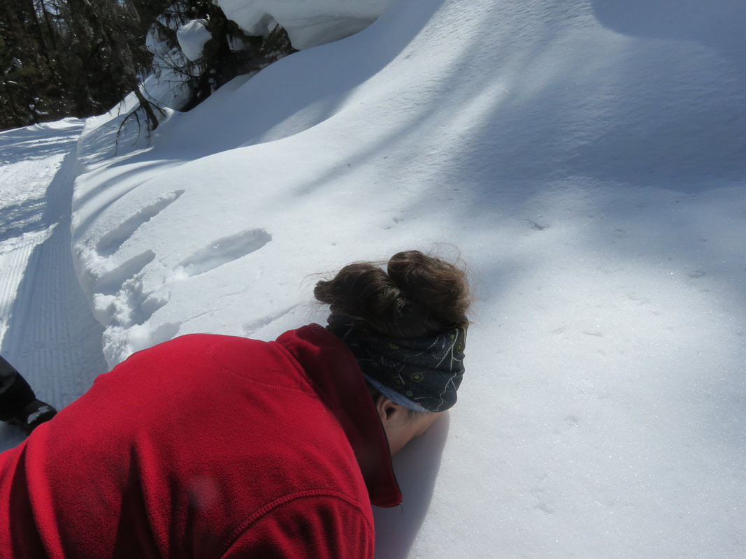
Leaving Great Falls @ 4:00 we rushed through Vaughn receiving a $55 speeding ticket from a very cute MT Highway Patrolman. Arriving in Seeley Lake at 6:30 Mary had a delicious homemade soup dinner w/coconut cake for dessert waiting for us. We headed to bed looking forward to a relaxing morning awaiting the arrival of Susan & June. Getting word from June that her husband was having heart issues sadly, Susan & June cancelled.
We then had a delicious breakfast of French Toast made by Kuntzie. (Best French toast ever!) Heading out around 11:00 we hiked four miles on the canoe trail. We had blue skies, no wind, and a narrow trail. It was gorgeous! Returning to town we stopped at the Coop for “Shake-a-Day” & a beverage. Leaving as losers we headed home having h’dorves & cocktails. After 2 hours of great gossip we sat down to a delicious salmon dinner, twice baked potato, asparagus & a salad. We then played Codename & Pip! Mary & Kuntzie were great coders & Gail is a fabulous Pip! We headed to bed around 10:30. The next morning we woke up to eggs, bacon, & toast. (dreaming of the French Toast) we had full bellies! Around 12:00 we hiked to West Fork of the Clearwater road for 4 miles which was beautifully groomed for us. We ran across several snow mobilers that were very kind & considerate. A few of us took off our snowshoes & walked to the car. We then went shopping downtown Seeley. Sue & Kuntzie helped out the economy of Seeley Lake. Then on to refreshments at the Coop. Once again we were losers @ Shake -a-Day. Skipping the quilt store we headed home for showers & h’dorves! While practicing face plants we witnessed 4 deer walking across the lake toward our house, they were very cautious. At 6:00 we went to dinner at the Double Arrow. Cosmos & wine started us off w/ salads & steaks. It was the best! After a remediate math lesson, we paid our bill. We finished the day with cinnamon whiskey Alpines & some funny old times stories. Rising Sunday morning, we had Jeanne’s Strada which was devine! After packing, we hiked one mile out to the middle of the lake. We owned the Lake, it was ours! Hiking back to the cabin we stripped the beds & split. Without a visit by the Highway Patrol we made it safe & sound to Great Falls by 4:00! |
Mary N's Recipe
TORTILLA SOUP 1 onion, chopped 2 oz Taco seasoning (dry) 1 tsp cumin 1 tsp dried oregano 3 small cans diced green chili, or to taste 3-4 Garlic cloves, pressed 2 +TBS butter 2 TBS Olive oil 1 1/2 quart chicken stock or broth 1 cup chopped bite size tomatoes 6 shredded corn tortillas (thickner and flavor) 3/4 lb queso dip (potato chip aisle) 1 lb Grilled chicken or 2 cans of Cosco chicken 1/2 tsp baking soda 1 pint heavy cream GARNISH cilantro matchbook cut corn tortillas, fried (or chips) Green onion, finely sliced Sour cream Avocado, diced 1.Sauté onion with spices, taco seasoning, and green chili. 2.Add chicken stock, corn tortillas and diced chicken, boil 15 minutes. Add tomatoes and cheese, simmer 30 minutes. (If not creamy enough, add 1/2 teaspoon baking soda, 1 pint heavy cream and simmer 30 more minutes. (I typically add 1/2 the amount of heavy cream.) (NOTE:I have made it w just broth wo heavy cream and queso) |
Memorial Falls, Jefferson Creek, March 10, 2019: Newbies Take to the Snowshoeing
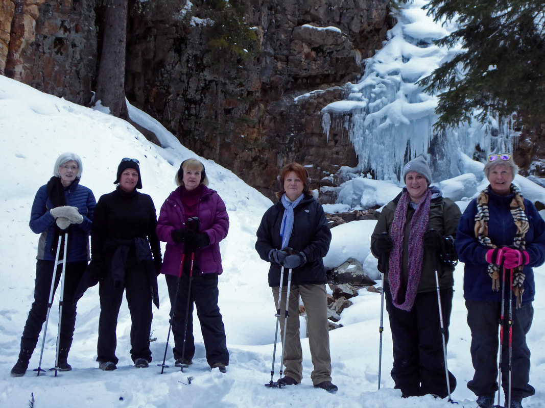
No one slept in on this spring ahead day, as two newbies and a returning gal joined four more experienced GiG members for a fun day of snowshoeing. First, we stopped at the Inconvenience Store after our 8:30 start from Great Falls for a potty break and snacks. We had fun visiting with the new manager as he showed us how he rearranged the store, putting our preferred items in unexpected places.
Then it was off to Memorial Falls. Katie made the decision to ditch the snowshoes, which turned out to be a bit of a mistake. At first, all was fine as we walked the third of a mile to the lower falls without incident, In fact, the normally icy spot was covered with snow, so we had no fear of slipping. so all was well so far and the falls very beautiful. However, when we headed to the upper falls, things got a bit deep, about a foot and a half deep to be precise. But everyone bucked it up and post-holed to the upper falls. This falls wasn't as pretty as it usually is due to too much snow covering the ice crystals and icicles. Debra felt a bit queasy on this hike--maybe it was the uphill, maybe the post-holing, but luckily, she recovered by the time we started on Jefferson Creek. We hiked three miles up and back to the Pack it In, Pack it Out Sign and had lunch on the bridge. We saw some fun snow-rollers, some thinking they looked like cinnamon rolls, others roses. But we didn't see the usual elk tracks or other signs of wildlife. The creek has some lovely snow formations in it, though, and it burbled up between the iced-over areas. The sun shone on us the entire way with little wind, so most of us were down to shirt sleeves or shells. On the return, we practically raced the last mile, so we got back almost an hour earlier than expected. After our hike, we stopped into Bob's and said hi to Janice the new owner and met two other new employees. Janice said the months were pretty good despite the bitter cold that kept many skiers at home. She also said it had really picked up this weekend with the warmer weather. We arrived back in Great Falls before 2 p.m. The newbies all made the entire way and seemed to do well. We hope to see Desirae, Debra and Amber back on the trail soon. And many had new snowshoes that they had no trouble getting used to. Who went: Susan W, Amber, Debra, Desirae, Viki, Judy and Katie |
Sluice Boxes, March 7, 2019: Frozen Belt Creek Provides Backdrop for Warm Day
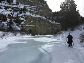
It might not have been warm in Great Falls, but it was roasting at the Sluice Boxes State Park, where Katie and Susan W decided to snowshoe. The car showed 48 degrees by the time we returned to the cars, and we were sweating, wishing we hadn't worn our Cuddle Duds.
We left town at 8:15 and got on trail by 9:15 after a quick drive to the top trail to see if the pull out was plowed, which it was. Then we headed back down to the bridge and began our hike. To snowshoe the Sluice Boxes, conditions must be perfect: enough snow and frozen creek. It can be a muddy mess or the creek not solid enough to cross, which is required, four times. The sun was out and we had fun exploring the old buildings, smelter and machinery from the old mining days as we hiked along the old railroad bed of the "Fish" train that ran between GF and Neihart, through the old town of Albright. The creek had solid crossings, although as the day wore on, and we returned, the ice had noticeably melted. We saw many animal tracks and scat, including a big cat, that appeared to be living in the grotto/cave as its tracks and scat were at the entrance. We imagined it might be sleeping in there as we passed by, a scary thought. We saw several places where it had bounded down the hills after deer and two places where an altercation had taken place, the snow packed down and tracks and evidence everywhere. The beauty of the cliffs, the creek and snow can't be overstated. We even saw several eagles soaring overhead. A flock of chickadees kept us company as we had lunch. We turned around when we came to the first ruined trestle as climbing down among the scattered boards we deemed too hard with not being able to see our footing beneath the snow. Several places were a bit iffy, especially on the return as the snow rapidly started to melt, making it hard to trudge through. Both of us felt our muscles at work in these tough snow conditions, such a change from the morning when we had had fluffy powder. Overall, we had a great day and were so happy to be back outside again after a month of below-zero weather. On a side note, we came across a back country skier, who had never been in the area before. Who went: Susan W and Katie |
Sacagawea Springs, Feb. 2, 2019: Calm-Before-the-Storm Morning Hike to Sulphur Springs
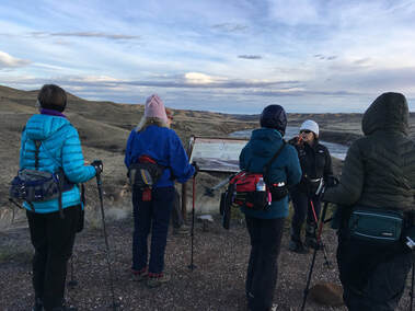
After yesterday's crazy snowshoe on the 747 trail, this lovely morning walk along the Missouri following in the Lewis and Clark expedition footsteps was a welcome stroll. Maria called it "day two of bootcamp," but it really was pleasant. With temperatures in the 40s, we shed our layers and enjoyed the warm breeze as we knew the thermometer would be dropping later in the day, bringing in below-zero weather.
The day started at 8 a.m. at Paris Gibson Square. Thirteen of us went despite not knowing how icy or muddy the trail would be.So we came prepared with snowshoes, yaktrax and old boots/shoes we didn't care too much about in case the gumbo piled onto them. Yet, we found the trail to be mostly dry. We had a few icy spots, especially in the shaded coulee areas (of course they were on the downhill/uphill sections) and a bit of mud too. But we all enjoyed the views of the Missouri River Breaks, the unbroken plains that looked almost identical to what the expedition would have seen: no power poles, no structures, just river and waving grasses. We marveled at where Belt Creek enters the Missouri as well as the rapids that can cause havoc with those floating the river, but we really enjoyed seeing the springs that supposedly healed Sacagawea after Clark's bloodletting failed to cure her from a major illness (Probably PID (pelvic inflammatory disorder caused by gonorrhea). Read more here. Most of us knelt down to touch the water, which is artificially dammed into a pool now. Beyond the pool, the water has coated all of the rocks with its minerals, giving them a gray cast with nothing else growing. The distinct sulphur smell emanated from the pool and stream, yet the water temperature isn't warm, but rather about room temperature. We all wondered how the sulphur smell bubbled up through the earth's crust and what causes it. Read more here. We also discussed how the state tried to give the old homestead area plus $10,000 for a grant writer to the Little Shell Band of the Chippewa Tribe so that they wouldn't be homeless anymore. However, they declined as they felt they didn't have the money to restore it. Read more here And more We ended the day at 11 a.m., a wonderful hike before our sub-zero days start. Who went: Susan C., Susan W, Mary S, Sara, Jeanne, Jean, June, Viki, Carolyn, Sue, Kuntzie, Maria, Katie |
747 Trail, Feb. 1, 2019: Tree Wells and Avalanche "Woofs" Make for a Scary, Long Day
"That was the hardest thing I have ever done in my life," proclaimed Maria at the end of a very long day on the 747 Trail. So the day started pretty well, with us driving to Kings Hill at 8 a.m. A quick stop at the Neihart Inconvenience Store, and then we were at the parking area by 9:30 a.m. It was warm, 34 degrees, but with a breeze; so far so good.
We knew that the climb of Porphyry Peak would be our toughest thing of the day, so we prepared ourselves. Katie had recruited her husband Tom and his friend Wayne to break trail on the backside of the mountain and show us the way (Tom had gone on Wednesday and had lost the trail, so Katie was worried. Tom said he went an extra mile; we didn't want to follow his tracks and go 7 instead of 6 miles, so he was cutting a new trail the correct way, based on an earlier GPS reading). However, they were on skis, so they started an hour later than we. We agreed to meet at the warming hut "Top Rock Cafe" on Showdown around 11:30. As we started the climb, we did have to break trail, Camille leading the whole way, so she got a good workout. Maria, Viki and Rose were unfamiliar with the climb of Porphyry so they didn't know what to expect. Maria was a bit worried with all of the up, up, up until she saw the lookout tower perched above us, at which point, she knew she could make it. About this time, Tom caught us on his way up, but Wayne was a bit back. They thought that we were farther ahead than we were, so Tom skied back down and then up again as he waited for Wayne, which allowed us to get a bit farther up the hill. Tom and Wayne caught us about a quarter mile from the hut, where we ate a snack (some had lunch, but we had to forget about hot cocoa as no worker had showed up) before heading down the 747 Trail, Tom and Wayne leading the way. side note: At the hut, the ski patrol workers were very worried that we were headed to the Mizpah Bowls. They warned of extreme avalanche danger. We assured them that we weren't heading to the bowls but to the 747 trail, with which they weren't familiar. Anyway, after Tom got on what he thought was the correct trail, he and Wayne left us and skied fast down the hillside. We followed slowly in their ski tracks, Katie using some painter's tape to mark the trail. About a half mile down the 1.5 mile section, we started falling into tree wells and sinking in around deadfall. Several fell, Susan four times. Once, Susan fell through to her waist and couldn't move her feet. Katie used her poles to loosen the snow around her and then dug her out. What happened was her foot was caught under a downed tree and under a small tree that was burried in the snow. Viki helped clear to the front of Susan and held back the little tree, while Katie freed the back of Susan's snowshoe. It was an all-out effort for Susan to regain her feet and get herself out of the hole. Viki and Rose also ended up in tree wells; luckily, they were very limber and were able to right themselves on their own. But the snow was very unstable. We started hearing very loud woofing sounds, and slabs of snow would crack and sink a few inches, throwing us off balance. Maria suggested we spread out so not so much weight was on a section of snow at a time, and Katie and Viki were packing the snow down and on purpose going down so that Susan who followed wouldn't fall again. It was very tenuous going, everyone trying not to fall again and the eerie woofing of avalanches coming down around us. It took us 2.5 hours to go a one-mile stretch with all of the postholing and time it took for those who fell to get back up. We were never so thankful to hit the cat track, but we still had 2.5 miles to go, some uphill. We also noted that we didn't come out at the trail marker, so we were slightly off trail. After a long 2.5 more miles, we did make it out by 4:15. Maria's hips were hurting, Susan's legs were really feeling it, and we all relished getting off our feet as we sat down in the car. By this time, we all thought climbing Porphyry had been a piece of cake compared to the last half of the hike. Welcome to backcountry snowshoeing! As it was getting late, we opted not to stop for a drink and bathroom break at Bob's and instead headed home with a quick stop at Armington junction to use the restrooms. It was just before 6 p.m. when we arrived back to 4B's. But Susan reminded us all that we should still go on the Sacagawea hike in the morning. Four of us took her up on it. Who went: Susan, Camille, Viki, Rose, Maria, Katie |
Mount Helena, Jan. 26, 2019: We Welcomed Rose to Mountain Climb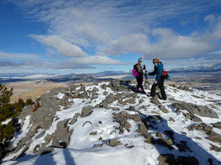
On a bluebird day with lots of wind, we welcomed Rose to the GiG. We all marveled at her matching outfit while talking about how we have hiked with mismatched mittens, mismatched gloves and even two different hiking boots. Mary S recounted how she took two different shoes on a trip to Atlanta; Katie related how her husband tried to climb Patrol Mountain in two left boots. But the real interesting tidbit happened at the end of the day--read on!
Christi led us on the Dump Out trail, one the GiG had never traveled, so we had a new experience on our climb of Mount Helena. We usually take the Prospect Shafts or Prairie trail and then take the 1906 down. We have also gone on the Hanging Draw and Powerline. The newbies to this area marveled at the fact that it is a city park, purchased by the Prickly Pear Land trust. Some of the land is BLM too. For Helenans, it is like our River's Edge Trail, well used and loved by the local strollers, bikers, hikers, dog walkers. We decided that Yaktrax or ice cleats would be better than snowshoes, given the trail was well worn and snow not very deep; it was a great choice. We battled a bit of wind, but we were mostly protected in the trees and coulees on our way up. The day was warm, in the high 30s, so the wind wasn't too cool, especially on the going up part. As we climbed, the views kept getting better and better until we reached the top with 360-degree scenery! What sights we could see, looking down on Carroll College campus, Fort Harrison, the Cathedral and Last Chance Gulch, not to mention Mount Ascension, the Elkhorn Mountains and the Sleeping Giant. After taking many pictures, we decided not to eat lunch on top due to the wind and instead head back to the picnic table, located about halfway back to the parking area. However, the table was out of the sun and not out of the wind, so we did have to bundle up, putting on extra layers. Our lunch was a very quick due to the cold, so we blew down the mountain, making it back to our cars just after 1 p.m. Then, for one car, it was a quick stop at the Park Ave. Bakery; we decided we earned a cookie for the ride home. At this point, we also ducked into the bathroom at a brewery, where Jean discovered in the mirror that she had put on two very different earrings, proving that our day truly was one of mismatched items, all expect Rose, that is. We arrived back home by 3 p.m. after our wonderful windy, but very sunny, day. |
Flesher Pass, Jan. 12, 2019: Don't Tell the Hunters: Elk Everywhere on Flesher Pass
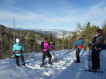
Any time you hike to a pass, you expect wind. at least in Montana, so we were pleasantly surprised when the day started out calm and sunny from the get-go. We left Great Falls at 8 a.m. and arrived at Flesher Pass around 9:30; and by the time we geared up, we hit the trail at 10 a.m. At the pass, it was a fine 23 degrees, yet down in the valley the thermometer had hovered around zero, making many of us wonder if we had brought enough warm layers. We needn't have worried.
After a quick group picture at the Flesher Pass/Continental Divide Trail sign, we headed straight uphill to our first overlook, catching a glimpse of the Mission Mountains and Scapegoat Wilderness areas. After our picture shooting, we noticed right away is that we couldn't see the trail. Why not? Elk tracks. Not just a single-file line; elk tracks all over as if a herd of 1,000 ungulates had trampled the whole area. We saw so many tracks and had to skirt around so many elk piles, we just could not believe our eyes. Almost every tree had indentation around it where elk had slept. We saw this the the entire way; for almost two miles the elk had completely trampled the area, obliterating any sign of a trail from prior snowshoers or skiers. But elk tracks weren't the only prints we saw. We also spied cat tracks among the hoof prints. So we kept an eye out in the trees and overhanging branches just in case a mountain lion decided we looked like a nice meal. Luckily, we didn't happen upon any kitties today. Without a clear trail, we took turns guestimating where we needed to be, looking for cut logs and clearings to guide our way. In this way, we also traded off trailbreaking as the snow was quite deep in places; yet in others, we found bare ground, especially under the trees. And snowshoeing over the uneven elk tracks was a bit tiresome. By the time we turned around, the snow was turning from powder and icy in spots to corn from the heat. It seemed more like spring snow than early winter. We need more snow, for sure. All day, we enjoyed gorgeous views to the southeast (with a bit of a haze indicating an inversion in the valleys still), but we never did find the overlook to the northwest on the nice rock outcropping. We did, however, make it to the wolf lichen forest, the dead trees covered in the lime-green parasites wowing our eyes. On this hike, we welcomed Judy to our group--her first snowshoe. And she liked us so much, she decided to join! On our way home, we stopped at the Amish/Mennonite Deli in Vaughn for ice cream and other goodies to take home. We arrived home by 3 p.m. Who went: Sue M., Gail, Susan W, Susan C, Mary S., Maria, Paula, Judy, Christi, Kuntzie, Carolyn, Brenda, Jean, Viki, June and Katie |
Porphyry Peak Climb, Jan. 6, 2019: First Hike of the New Year Gets Hearts Pumping
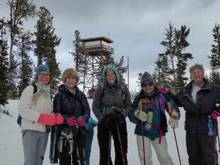
"It was a snow beaching," Susan W, aka, Happy Camper, said after she fell over into very powdery deep snow, necessitating a rescue. But that was toward the end of the hike when we were speeding down the mountain as the snowflakes started flying.
The day started at 8 a.m., and we got on trail by 9:30, slowly making our way up the mountain, breaking trail the whole way until we hit the cat track at Showdown that wound us around the back of the mountain to the base of the lookout tower. Some of us realized how much the Christmas baking was slowing us down, but we realized we could do this climb. Most of those on today's trip were also planning to go on the eclipse snowshoe adventure, so this was a good test of our endurance; plus doing it first in the daylight was a good idea. As we neared the top, we could really feel the wind picking up and see the clouds closing in overhead, leaving just a slim strip of sunshine on the surrounding mountains, which was pretty. By the time we were on top, the wind was picking up the powdery snow and blowing it in our face. Since the weather was turning, we decided to walk the short distance to the ski hill to eat our lunch in the warming hut. And warm it was. Susan W discovered that the heaters were right under the benches that ran along the outside walls, so those needing to warm up sat there. And some purchased coffee or hot chocolate as an extra warm treat to go with their lunches. Then it was back outside to the wind and blowing snow, which encouraged us to hoof it down the mountain without stopping. We made it to the cars just after 1:30, a record, I'm sure! After a brief bathroom break and drinks at Bob's Bar, we headed home. We did see Tony and teased him a bit about being back at the Bar since he had sold it before Christmas. He said he had to finalize the books on his last quarter and then he would truly be done. And he gave us his phone number and promised to take us to the stone arch on a summer hike. We arrived back in Great Falls at 3:15; a very fun day with a bit of a challenge. |