Girls in Glacier | WELCOME
Like us on Facebook
  • Home
  • About Us
  • Blog
  • Hikes
    • Hikes 2021
    • Hikes 2020
    • Hikes 2019
    • Hikes 2018
    • Hikes 2017
    • Hikes 2016
    • Hikes 2015
    • Hikes 2014
    • Hikes 2013
    • Hikes 2012
  • Flowers/Trees
  • Helpers
  • Goodbye
  • Contact

Porphyry Powerline Loop, Jan. 13, 2017

1/14/2017

0 Comments


Breaking Trail Was Order of the Day in Powdery Snow

Picture
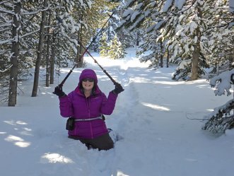
It was tough; it was really tough, at least until we hit the cat track for the last mile of the day. 

The day started off with three of us leaving 4Bs at 8:30 a.m.; we got on trail before 10 a.m. at temperatures hovering around zero but to sunny skies.  We found that the trail had not been broken. A skier had been on the trail a few days back, but the tracks were now covered with snow. Then when we left the O'Brien Creek trail, no one had been on this section at all.  The snow was very powdery but with no base, so we often broke through the thin crust.

June and Katie traded off breaking trail with the snow to our thighs at times. Both Katie and Gail broke through and fell in all the way, while June managed to stay upright the entire day. The whole way challenged us mentally as we were trying to keep from sinking all the way down with each step, trying to step one snowshoe in front of the other to prevent falling.

By the time we hit the cat track at the base of the Powerline, we were grateful for the hard-packed snow, even as we faced the steep uphill climb to get back to our cars.

We saw two snowmobile at the end of our day, but otherwise, it was a gloriously calm, quiet day under cloudless sunny skies.  We enjoyed seeing all of the tracks in the snow: snowshoe hare, squirrel, deer, elk and a cat or two around the bunny tracks. Unfortunately, besides a chipmunk and some ravens, we didn't see any critters.

We ended the day at Bob's bar for some hot cocoa topped with whipping cream, where we quizzed Tony on how to get to arch that he had in some pictures posted on his photo wall. He shared that to get to the arch, we would head toward Hughesville, turn right toward Barker and then take trail 739 for about two miles. This sounds like a great summer hike; or maybe we will try it this winter.

Who went: Gail, June, Katie


Pix
0 Comments


Leave a Reply.

    How to Download Pix
    ​How to download with iphone

    Archives

    January 2021
    December 2020
    November 2020
    October 2020
    September 2020
    August 2020
    July 2020
    June 2020
    May 2020
    March 2020
    February 2020
    January 2020
    December 2019
    November 2019
    October 2019
    September 2019
    August 2019
    July 2019
    June 2019
    May 2019
    April 2019
    March 2019
    February 2019
    January 2019
    December 2018
    November 2018
    October 2018
    September 2018
    August 2018
    July 2018
    June 2018
    May 2018
    April 2018
    March 2018
    January 2018
    December 2017
    November 2017
    October 2017
    August 2017
    July 2017
    June 2017
    May 2017
    April 2017
    March 2017
    February 2017
    January 2017
    December 2016
    November 2016
    October 2016
    August 2016
    July 2016
    June 2016
    May 2016
    April 2016
    March 2016
    February 2016
    January 2016
    December 2015
    November 2015
    October 2015
    September 2015
    August 2015
    July 2015
    June 2015
    May 2015
    April 2015
    March 2015
    February 2015
    January 2015
    December 2014
    November 2014
    October 2014
    September 2014
    August 2014
    July 2014
    June 2014
    May 2014
    April 2014
    March 2014
    February 2014
    January 2014

    RSS Feed

    Girls in Glacier and Katie Kotynski

Contact Us
Copyright 2014 Girls in Glacier
All pictures copyright of individual photographers; no use granted without permission